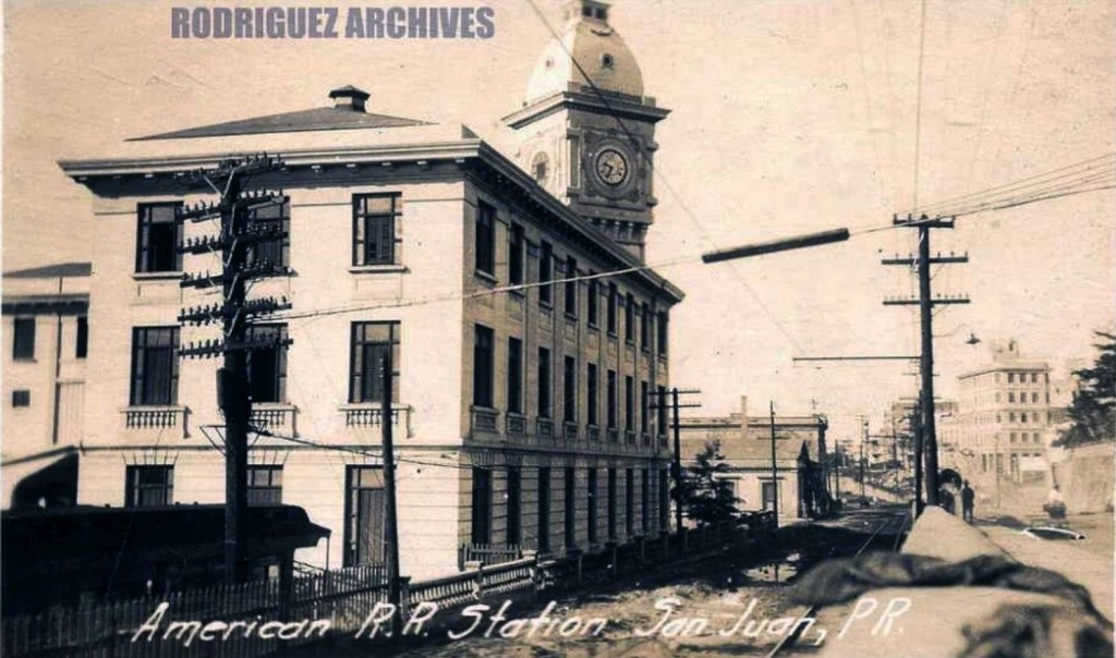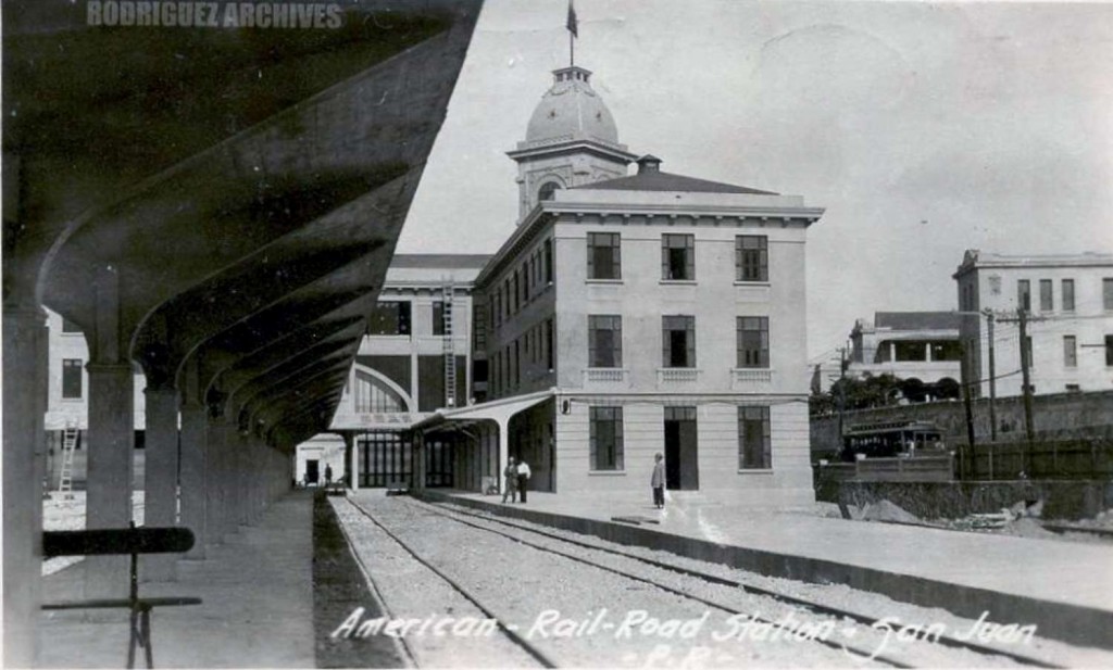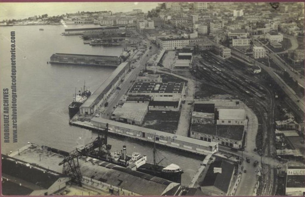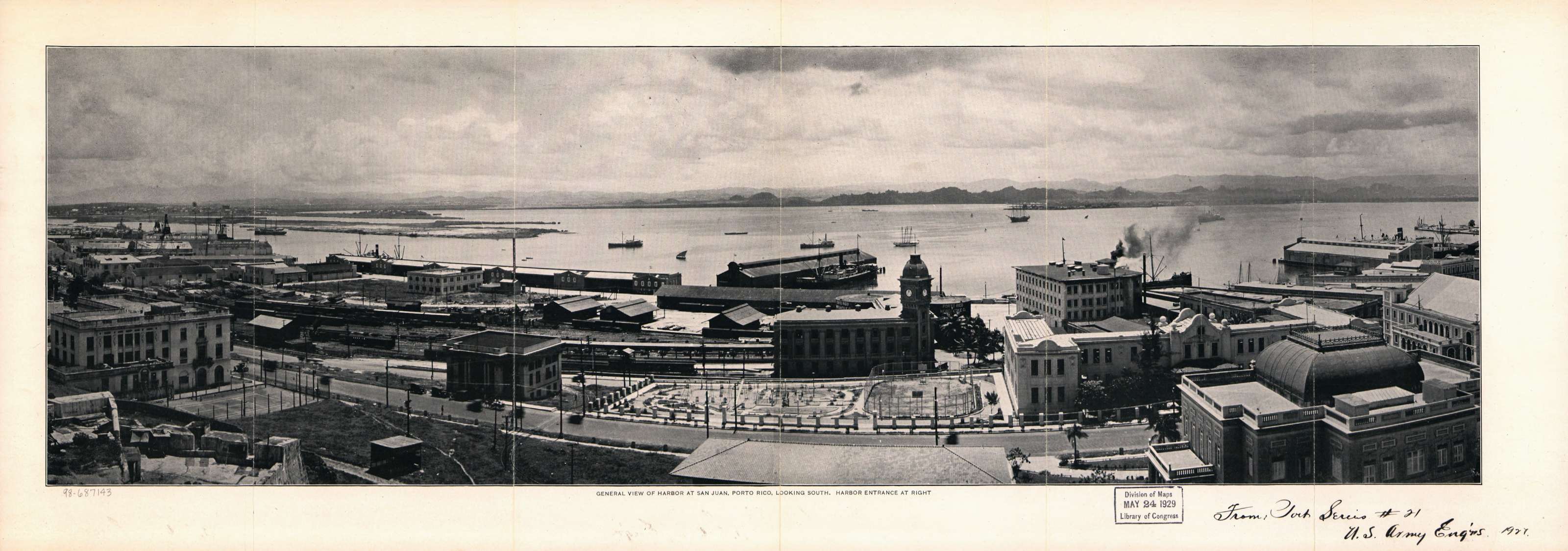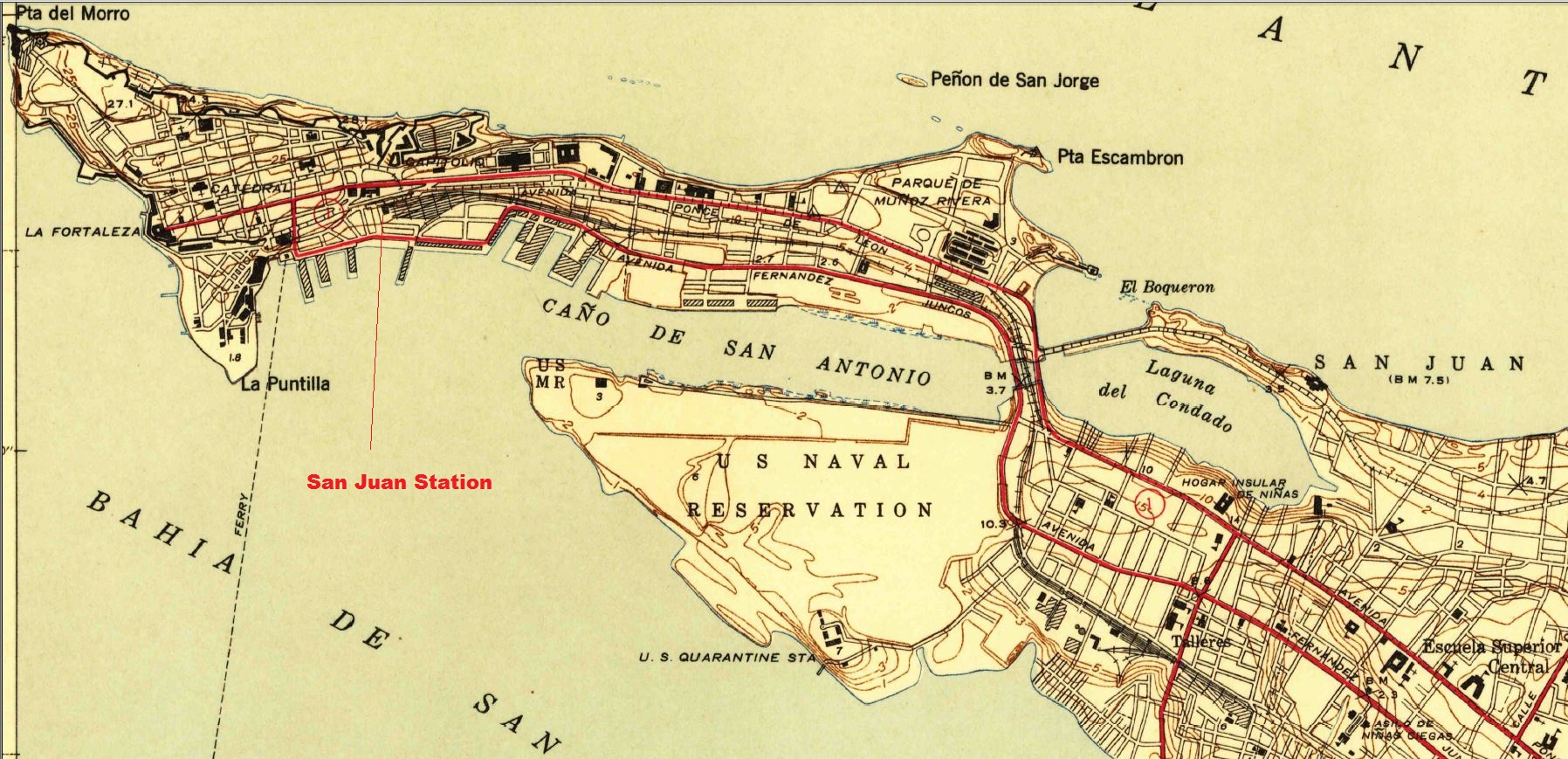
Estación de San Juan / San Juan Station


General view of harbor at San Juan, Porto Rico looking South.

United States Army Corps of Engineers. “General View of Harbor at San Juan, Porto Rico Looking South”. Web. American Memory. Lib. of Congress.  April 25, 2013.
<http://hdl.loc.gov/loc.gmd/g4974s.ct000494>

(Courtesy of the U.S. Geological Survey)
San Juan, P.R. Map. 1:30000: U.S. Geolical Survey, 1941.  Print

Los mapas topográficos histórico del USGS se pueden ver en línea y bajar
US Historical Topographic Maps can be seen and downloaded
Ver / See

Search / Busque: San Juan

Ver / See:  Map copies / Copias de mapas

Other photos / Otras fotos:

These photos are a selección from the Rodríguez Archives (José Luis and José Alfredo Rodríguez).   Please see:  Archivo Histórico y Fotográfico de Puerto Rico – Colección Rodríguez , and Archivo Histórico Y Fotográfico De Puerto Rico’s photostream .
Photos used with permission / Fotos usadas con permiso.

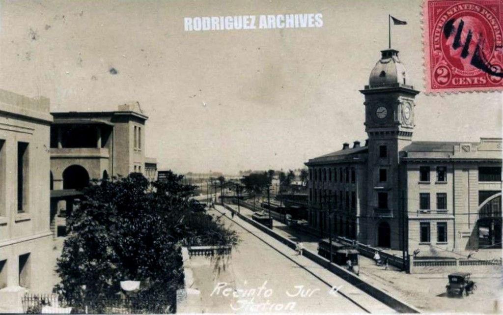
MOSCIONI (ATTRIBUTED) RPPC ~ SAN JUAN – Recinto Sur [showing Trolleys & R. R. Station] – Mailed from Aguadilla JUL 7, 1925.  https://www.flickr.com/photos/fredandrebecca/4570380522/in/photostream/.

MOSCIONI (ATTRIBUTED) RPPC ~ SAN JUAN – American R. R. Station – Unused c. 1910′s-1920′s.  https://www.flickr.com/photos/fredandrebecca/4570380800/in/photostream/ .  Trolley track on the right.  Observe la vía del tranvía a la derecha.

MOSCIONI (ATTRIBUTED) RPPC ~ SAN JUAN – American Rail-Road Station – Mailed from San Juan APR 7, 1925.  https://www.flickr.com/photos/fredandrebecca/4569743437/in/photostream/.

San Juan Station yard.  MOSCIONI (ATTRIBUTED) RPPC ~ SAN JUAN – American Rail-Road Station – Mailed from San Juan APR 7, 1925.  <https://www.flickr.com/photos/fredandrebecca/5415075816/>.

San Juan Station Model


Posted in Uncategorized | Comments Off on Estación de San Juan / San Juan Station

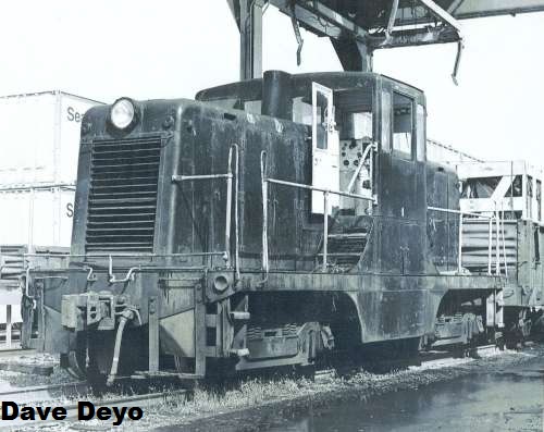
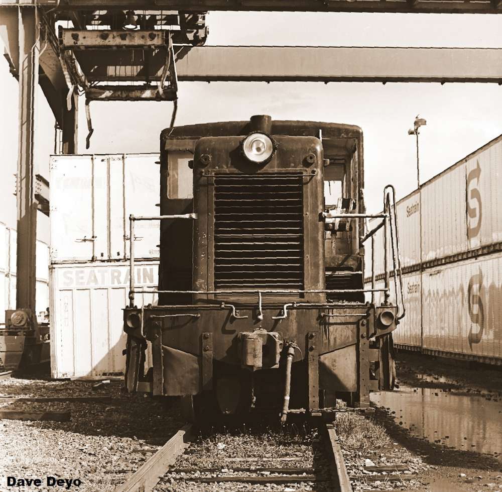
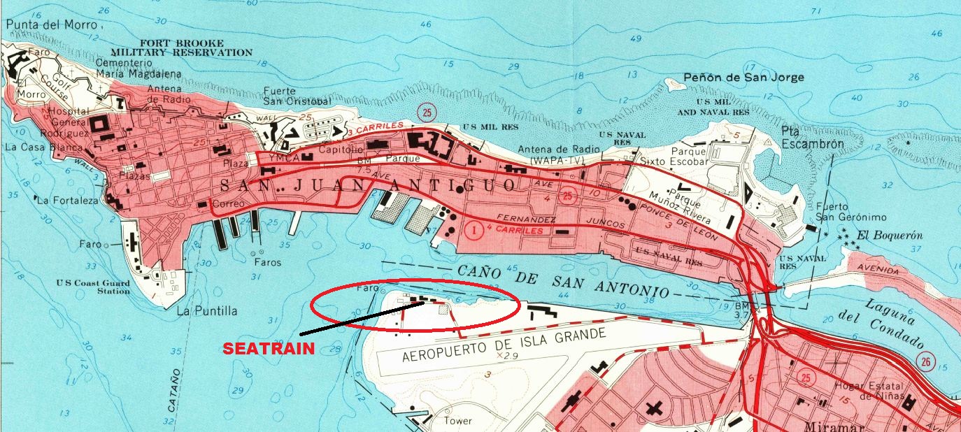
Seatrain, Isla Grande, San Juan


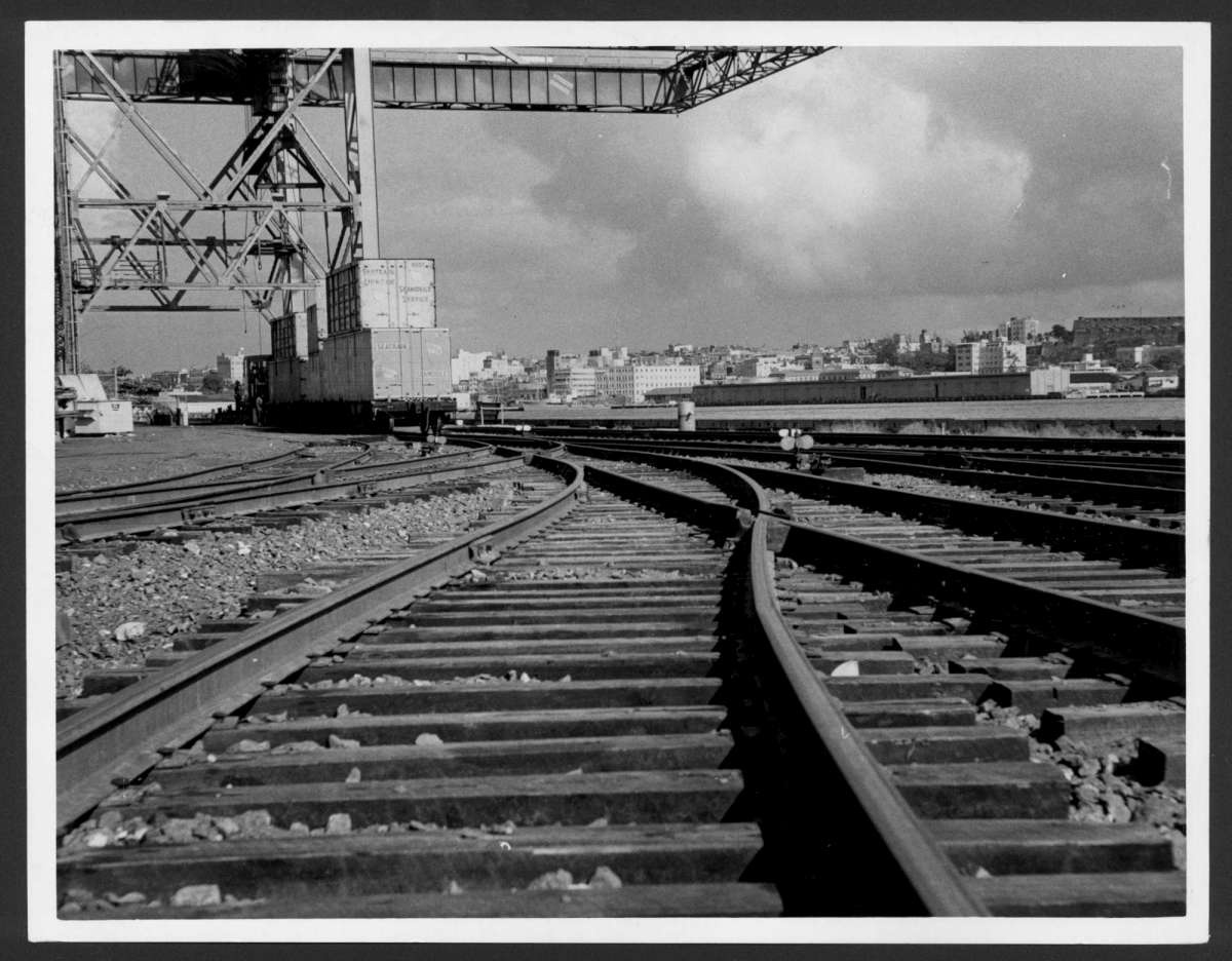
Seatrain, San Juan, Standard Gauge / 4 ft 8 ½ in gauge.

Casenave, Luis de. “Vías de Tren En Muelles de Isla Verde.” El Mundo 13 Aug. 1964: Web. 25 Apr. 2013. <http://bibliotecadigital.uprrp.edu/cdm/singleitem/collection/ELM4068/id/3838/rec/35>  Nota – Debe decir Isla Grande y no Isla Verde.  Note:  It should say Isla Grande and not Isla Verde.

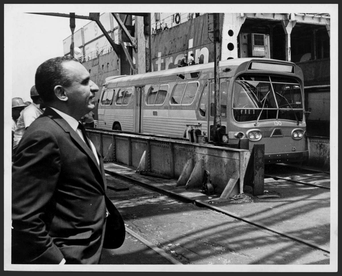
Casenave, Luis de. “Herminio Fernández Torrecillas Observando La Llegada de Nuevos Autobuses Para La Autoridad Metropolitana de Autobuses.” El Mundo 24 July 1967: Web. April 25, 2013.  <http://bibliotecadigital.uprrp.edu/cdm/singleitem/collection/ELM4068/id/1533/rec/1>

Biblioteca Digital Puertorriqueña, < http://bibliotecadigital.uprrp.edu/cdm/>

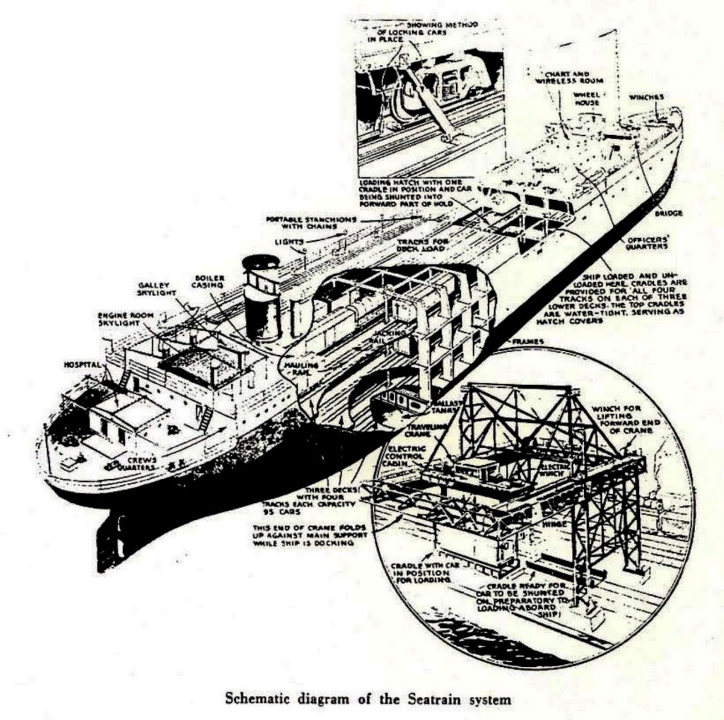
Diagram Seatrain System / Diagrama sistema de Seatrain
Transfer No. 9, page 5. Thanks to John Teichmoeller, Coordinator
Rail-Marine Information Group. http://www.trainweb.org/rmig/index.html.  Used with permission.

See / Ver:

Popular Mechanics, Oct 1947

Popular Mechanics, Dec 1958

“Seatrain Line.” Wikipedia, the free encyclopedia 18 Apr. 2014Wikipedia. Web. 25, Apr. 2014.

Seatrain ships carried railcars.  At the docks, a large crane lifted the railroad cars and placed them on rails.  A diesel engine moved the cars to tracks where their contents were moved to trucks.  Later on containers were carried on the ships and were transferred to flat cars.  I Interviewed Rafael Zambrana, of Zambrana Trucking, who had seen this operation.  He stated that the ships carried the cranes.  Photos show the that crane was located on the dock.  Perhaps both systems existed.  This operation existed during the 1960s.  I have not been able to locate aerial photos and track diagrams of the Seatrain operation.

Los barcos de Seatrain transportaban vagones ferroviarios.  En el muelle, grúas levantaban los vagones y los colocaban sobre rieles.  Locomotoras diesel movían los vagones a áreas donde su contenido era transferido a camiones.  Luego se usaron furgones que eran colocados sobre vagones plataformas.  Entrevisté a Rafael Zambrana,  de Zambrana Trucking.   El vio esta operación.  Según él, los barcos tenían grúas.  En las fotos la grúa estaba en el muelle.  Quizás se usaron ambos sistemas.  Esta operación existió para la década de 1960.  No he podido localizar fotos aéreas ni diagramas de la vía.


SeaTrain GE 44 Tonner # 9

(Courtesy of the U.S. Geological Survey)

Posted in Uncategorized | Comments Off on Seatrain, Isla Grande, San Juan

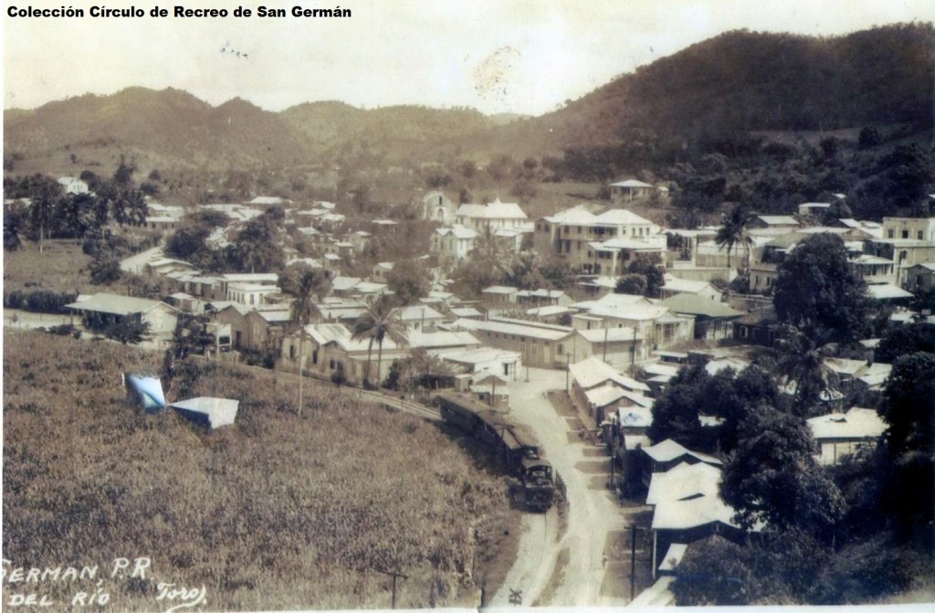
Estación Norte de San Germán / San Germán Station (North)

Museo de Arte y Casa de Estudio Alfredo Ramírez de Arellano (MARA), afilidado al Círculo de Recreo de San Germán, Dr. Arturo Marquez García, Presidente
<http://www.circuloderecreo.org/Circulo-Nueva/HistoriaFoto.htm>
Foto usada con permiso / Photo used with permission

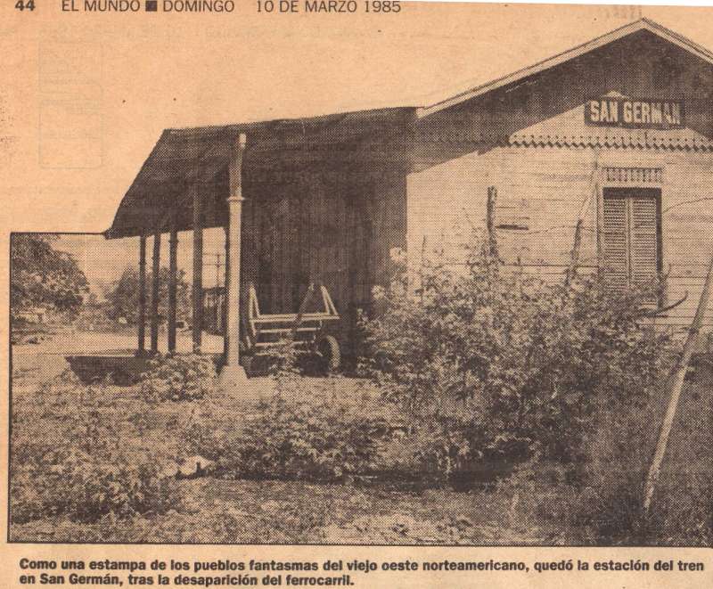
El Mundo 10 Mar. 1985: Print.
Foto es usada para estudio e investigación histórica y no para propósitos comerciales o que rebasen el “uso justo.”.  Foto puede tener derechos de autor.  Photo is used for research and historical investigation under “Fair Use” and not for commercial use. Photo may be subject to copyright.

San Germán tenía dos estaciones. Una de las estaciones, la del Norte, estaba en la vía de San Germán a Sabana Grande. El tren que operaba en este tramo se conocía como el Tren Batatero o el Tren Batata.  La otra estación estaba al sur del pueblo.  Por esta estación se pasaba para ir de San Juan a Ponce.

San Germán had two stations.  One of the stations, North Station, was on the track from San Germán to Sabana Grande. This train was known as Tren Batatero o el Tren Batata. The other station was south of the town.  Through this station trains passed when traveling from San Juan to Ponce.
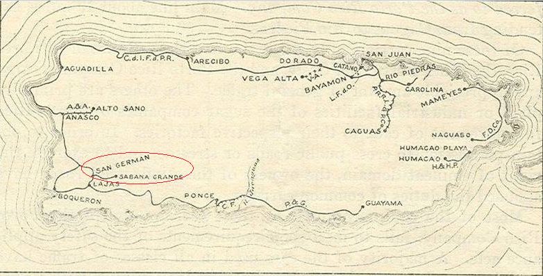
Source / Fuente:  Interstate Commerce Commission. No. 5701. In the matter of safety appliances of equipment in railroads of Porto Rico. Washington: Government printing office: 1916

(Courtesy of the U.S. Geological Survey)

Los mapas topográficos histórico del USGS se pueden ver en línea y bajar
US Historical Topographic Maps can be seen and downloaded
Ver / See

Search / Busque:  San Germán , Sabana Grande

Ver / See:  Map copies / Copias de mapas
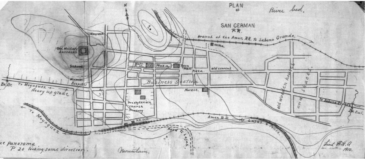
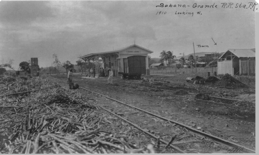
Manuscritos de William H. Armstrong, vol. 10, p. 31.
http://bibliotecadigital.uprrp.edu/cdm/singleitem/collection/william/id/2, accessed April 24, 2013.
Biblioteca Digital Puertorriqueña, <http://bibliotecadigital.uprrp.edu/cdm/>

William Armstrong fue un ingeniero militar norteamericano que llegó a la Isla con el cambio de soberanía en 1898 junto a otros militares y especialistas en cartografía, agrimensura, fotografía e ingeniería. Estos tuvieron la misión de recorrer la isla y producir un reconocimiento exhaustivo del territorio;  Armstrong estuvo encargado de preparar un mapa militar de la Isla. La colección actualmente incluye nueve volúmenes, los cuales contienen descripciones de los pueblos, mapas anotados,  fotografías, postales, croquis y planos que reflejan las condiciones de Puerto Rico del 1909 al 1912.

William Armstrong was a military engineer from the United States who came to the Island during 1898 and made an extensive study of the geography, railroads, roads,  bridges, etc., of the Island using photos, drawings, maps, etc.  The study reflects the conditions of Puerto Rico from 1909 to 1912.  It is written in English.

Source / Fuente: Biblioteca Digital Puertorriqueña, <http://bibliotecadigital.uprrp.edu/cdm/>

Note / Nota:  Existen 9 volumenes de los Manuscritos de William H. Armstrong. / There are 9 volumes the Manuscritos de William H. Armstrong.

Sabana Grande
Manuscritos de William H. Armstrong, vol. 10, p. 78.
http://bibliotecadigital.uprrp.edu/cdm/singleitem/collection/william/id/2, accessed April 24, 2013.
Biblioteca Digital Puertorriqueña, <http://bibliotecadigital.uprrp.edu/cdm/>

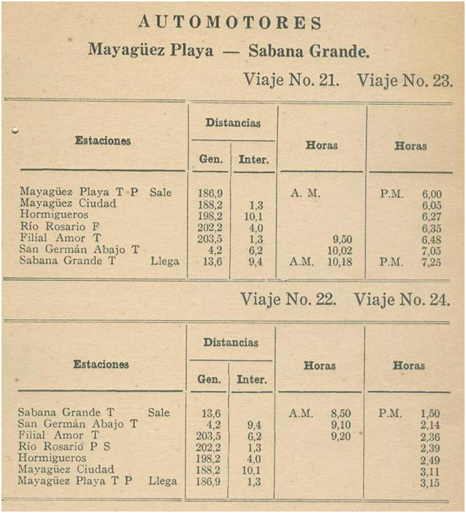
http://ferrocarrilespr.rogerseducationalpage.com/wp-content/uploads/2012/06/itinerario3.jpg
Source / fuente: American Railroad Company of Porto Rico, Manual de Explotación, 1926.

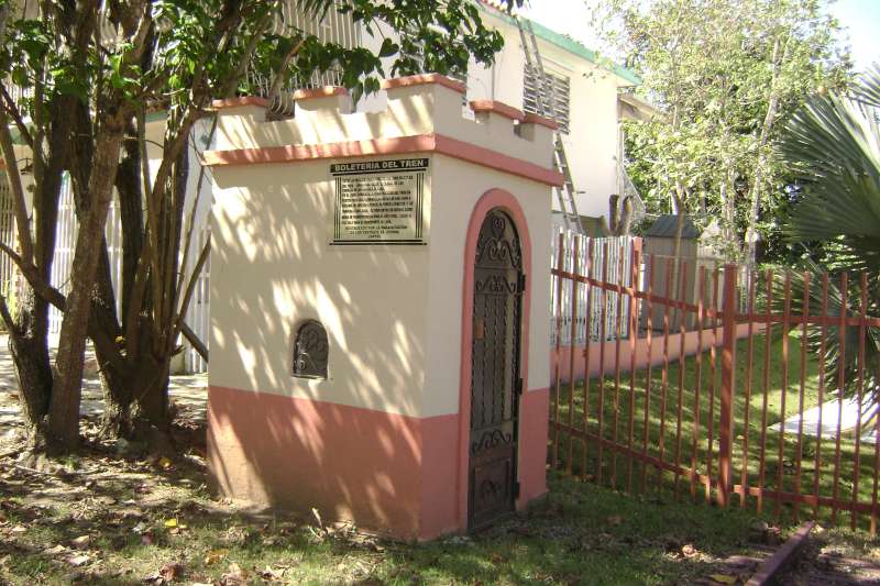
Boletería / Ticket or Waybill Office


Referencia, fuente, fotos (Photos, Reference, Source): Efraín Martel

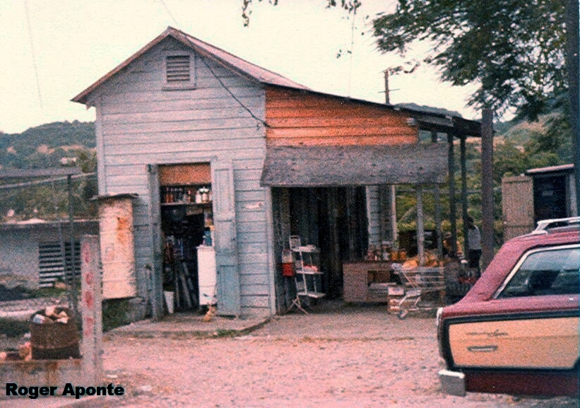
Esta estructura se encuentra en la carretera # 118 Barrio La Tea de San Germán practicamente a menos de 1,000 pies de la carretera #102.  No estamos seguros cual era su función exacta, pero pudo ser donde se recogían los conduces de los trenes o la caseta para el guardabarrera.

This above structure is located on Route 118, Barrio La Tea in San German, close to Route 102.  We are not sure of its use but maybe is was where waybills were collected or it was a gateman shanty.

Casita de perro / gate house, railroad crossing shanty, crossing gateman shanty –  Caseta para el guardabarrera.  Foto: Roger Aponte
Posted in Uncategorized | Comments Off on Estación Norte de San Germán / San Germán Station (North)

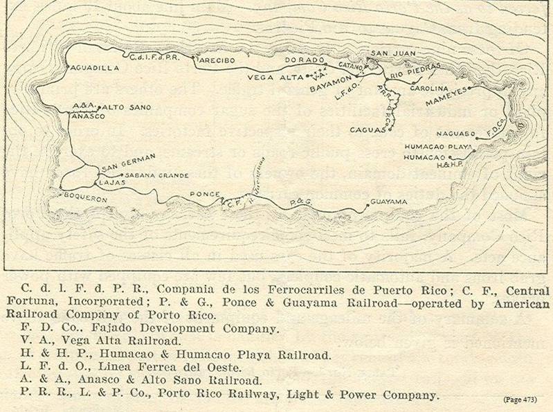
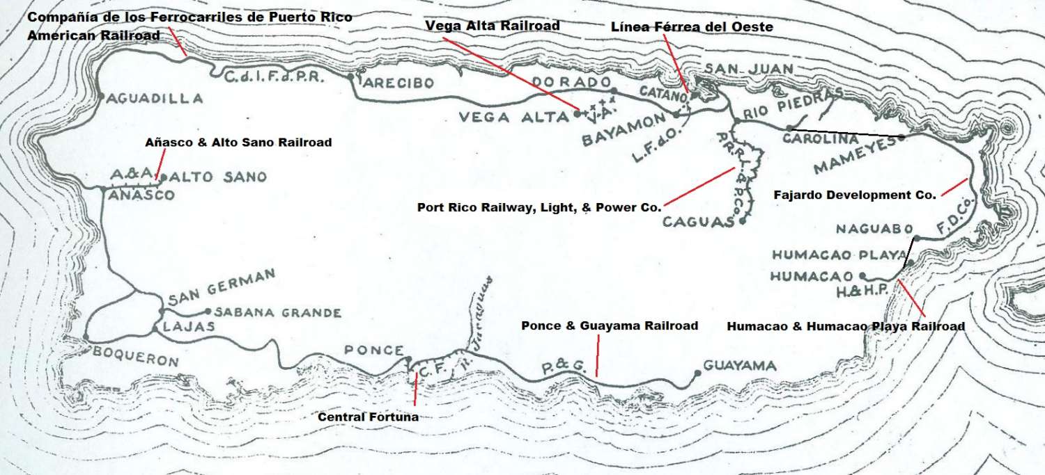
Map Railroads in Operation, 1916 / Mapa ferrocarriles en operación, 1916


Source / Fuente:  Interstate Commerce Commission. No. 5701. In the matter of safety appliances of equipment in railroads of Porto Rico. Washington: Government printing office: 1916

Eventualmente, se unieron los tramos desde Carolina a Humacao. Eventually, Carolina was united to Humacao.

Ver / See:

Railroads in Operation, 1916
Ferrocarriles en operación, 1916


Posted in Uncategorized | Comments Off on Map Railroads in Operation, 1916 / Mapa ferrocarriles en operación, 1916

Estaciones de Lajas / Lajas Stations


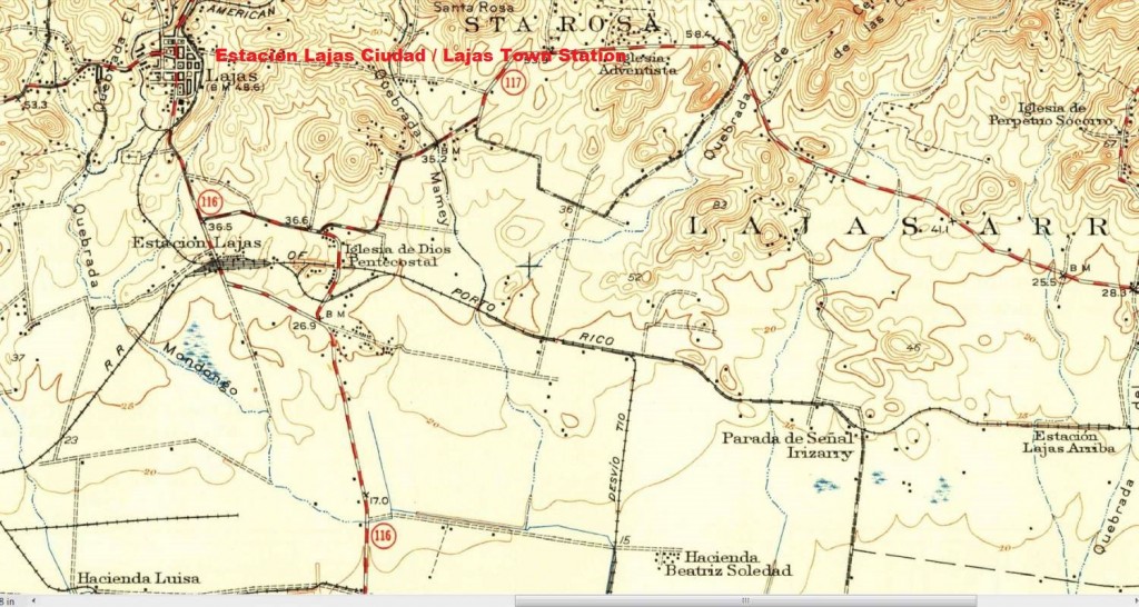
Estación Lajas Ciudad / Lajas Town Station

See Map / Ver Mapa (Courtesy of the U.S. Geological Survey)
Estación Lajas Arriba – Flag Station / Parada de Señal

Los mapas topográficos histórico del USGS se pueden ver en línea y bajar
US Historical Topographic Maps can be seen and downloaded
Ver / See

Search / Busque:  San Germán

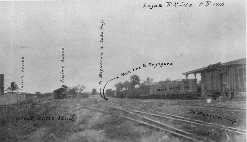
Estación Lajas, al sur de la ciudad. / Lajas Station, south of town.

Manuscritos de William H. Armstrong, vol. 10, p. 55.
<http://bibliotecadigital.uprrp.edu/cdm/singleitem/collection/william/id/2>, accessed April 26, 2013.
Biblioteca Digital Puertorriqueña, <http://bibliotecadigital.uprrp.edu/cdm/>


Courtesy of the U.S. Geological Survey

Source / Fuente:  Interstate Commerce Commission. No. 5701. In the matter of safety appliances of equipment in railroads of Porto Rico. Washington: Government printing office: 1916


Posted in Uncategorized | Comments Off on Estaciones de Lajas / Lajas Stations

Estación Santa Rita / Santa Rita Station


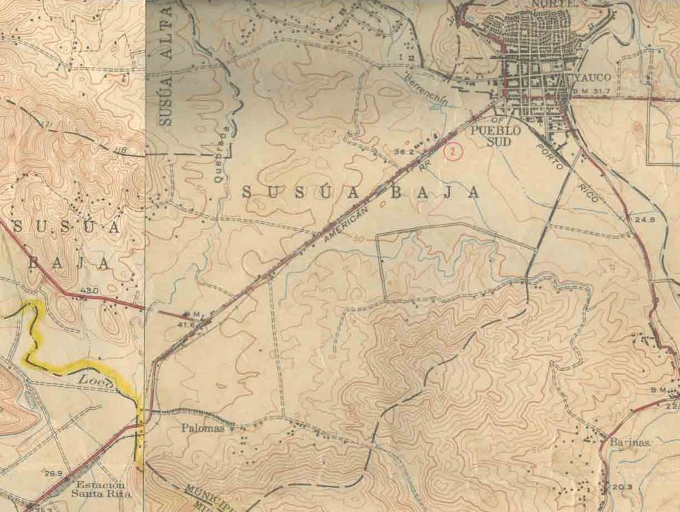
Ver mapa / See Map (Courtesy of the U.S. Geological Survey)
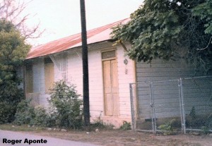
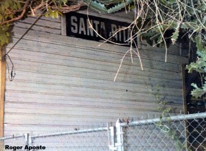
Santa Rita está al suroeste de Yauco.  /  Santa Rita is southwest of the town of Yauco.

Los mapas topográficos histórico del USGS se pueden ver en línea y bajar
US Historical Topographic Maps can be seen and downloaded
Ver / See

Search / Busque:  Yauco and Guánica

PR RR Historian:

To access Guanica during the existence of the American Railroad, one would travel to this station at Santa Rita. Guanica Centrale connected here with the ARRCo. to interchange freight and receive loaded cars of cane from their distant properties as far north as Anasco and as far east as their Fortuna Estate just beyond Ponce, as well as much colono cane. Their basic railroad system from the mill to this station was quite short and only had a few loading stations along the route, and supplied only a small portion of their cane ground.

Here passengers were faced with two options: taking an earlier horse-drawn carriage to Guanica or a later public car. However, the South Porto Rico Sugar Co. did own an unusual diesel-powered railcar, much like a large enclosed workman’s car (teresina), which can be seen in a postcard view in my collection, near this Santa Rita station. According to interviews, a small shelter existed at the mill batey where passengers disembarked. It was from this point too that passengers caught the outbound car that was timed to make connection with several of the scheduled ARRCo. passenger trains (which were frequently quite late, especially the trains coming from San Juan and being rearranged at Mayaguez). I have never found any tickets for the mill’s train, so it may have
been a complimentary service provided by the SPSCo.. Note the sugar cane car behind the station to the right. Guanica Centrale’s fleet of cars were steel flatcars (basically) with wooden bulkheads at the ends and wooden stakes with a top runner for sides. But
most of the cars that were taken to the mill were those of the American Railroad 20 ton Gregg type carrying cane from along the system.

SPRSCo. sugar haciendas were operated under a wholly-owned subsidiary called Russell & Co. and were divided into three “estates”. They also operated two separate, isolated sections of railroad, one south of Anasco and the other branching off of the ARRCo. Lajas/Boqueron loop, called the Joyuda Spur. On both lines, ARRCo. cars were employed to bring cane to Santa Rita, where Guanica Centrale locomotives picked the cane up for
the trip to Guanica. On the branches themselves, Guanica Centrale locomotives did the moving of the cars out to an ARRCo. siding, and made trips back to Guanica via the ARRCo. for servicing or storage (at the end of the zafra). One large estate privately owned
that ground much or sometimes all of their cane at Guanica, was Hacienda Dolores, property of the Valdivieso family, and located in the Penuelas valley area. Their cane was picked up by the ARRCo. from a siding at Tallaboa, where the locomotive of the
Hacienda would bring loaded, leased ARRCo. cane cars for pickup. (Hacienda Dolores was also engaged in the growth of many “frutas menores” as well as sugar cane).

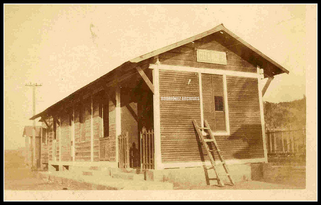
“Guanica Rail Road Station – Real Photo PC C. 1910 Closeup #1 | Flickr – Photo Sharing!” Web. 23 Apr. 2013.
<http://www.flickr.com/photos/fredandrebecca/3506407182/in/set-72157618400265012>

Archivo Histórico y Fotográfico de Puerto Rico – Colección Rodríguez , and Archivo Histórico Y Fotográfico De Puerto Rico’s photostream .
Photo used with permission / Foto usada con permiso.

Comments / Comentario:
I believe that the photos are of the same station.
Yo creo que las fotos son de la misma estación.


Posted in Uncategorized | Comments Off on Estación Santa Rita / Santa Rita Station

Links / Enlaces


pr rr historian1’s photostream

César J. Ayala, Professor, Department of Sociology-UCLA
Books, Recent Work, Selected Publications in Journals

Sociedad Ferroviaria Puertorriqueña

Centrales Azucareras de Puerto Rico

Central Angelina / Central Arcadia 2-4-0 “Porter” Type Locomotives / Class Details by Steve Llanso

Central Playa Grande 2-4-0 “Porter” Type Locomotives / Class Details by Steve Llanso

Central Cambalache / Central Consuelo 2-4-0 “Porter” Type Locomotives / Class Details by Steve Llanso

Modelismo Ferroviario / Model Railroading
Pasatiempo (hobby) de trenes en miniatura ( tren maqueta)

Model Railroad Hobbyist Magazine (Free Magazine / Revista gratis)

Trainlife (Free Magazines / Revistas gratis)

O Scale Trains Magazine Online (Free Magazine / Revista gratis)

Micro / Small Layouts for Model Railroads / Small layout Scrapbook

All Gauge Page – Fun with Model Railroading

Sugar Cane Line  (Maqueta / Model Railroad)
“SCLineE1.” Web. 30 Mar. 2013.

Videos: Maquetas de ferrocarriles de caña / Videos: Model railroads of sugar cane trains.
La Zafra
Modelleisenbahn LA ZAFRA/model railway LA ZAFRA/Chemin de fer miniature L….

Maqueta / Model Railroad
La Zafra” – On30 Cuban Sugar Railway – Scale On30 (1:48)
“Narrow Gauge Rail.” Web. 30 Mar. 2013.

“Built by Bernard Junk and Jack Trèves with the help of Detlev Horn. Special thanks to Marie-Jeanne (Bernard’s wife) for supporting the team.”

Redescubriendo a Puerto Rico: Mapas – Ferrocarriles.” Web. 30 Mar. 2013.

Tramways of Puerto Rico / Tranvías de Puerto Rico.  Copyright by Allen Morrison.

– San Juan – http://www.tramz.com/pr/sj.html – This was put online on 1 November 2008.  Esto es una página sobre los tranvías de San Juan, Caguas y Cataño.

– Mayagüez –  http://www.tramz.com/pr/my.html   –   The Tramways of Mayagüez

– Ponce – http://www.tramz.com/pr/pc.html   –   The Tramways of Ponce

Mapas Topográficos Históricos del USGS (U.S. Geological Survey)
USGS Historical Topographic Maps (Online)


Posted in Uncategorized | Comments Off on Links / Enlaces

¿Problemas con archivos PDF usando Firefox? / Problems with PDF files using Firefox?

Problems with PDF files using Firefox?
There are three ways of solving this situation:
– You can right click the link and then click on “Save Link As”, and save the file.
– You can click on the download arrow icon on the Firefox viewer and click “Open with” or “Save file”.
– Change browser.

Visualizdor de Firefox / Firefox viewer

¿Problemas con archivos PDF usando Firefox?
Existen tres formas de resolver esta situación:
– Dale un “click derecho” al enlace y después un click en “Save Link As” y guarde el archivo.
– Dale un click a la flecha de icono de “download” en el visualizador de Firefox y dale un click a “Open with” o “Save file”.
– Cambie de Navegador.

Posted in Uncategorized | Comments Off on ¿Problemas con archivos PDF usando Firefox? / Problems with PDF files using Firefox?

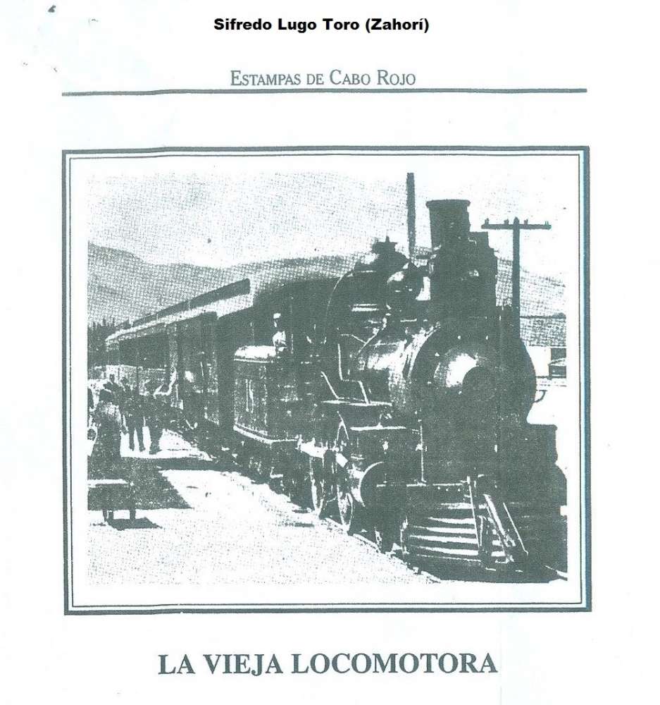
La Vieja Locomotora


La Vieja Locomotora

Lugo Toro, Sifredo. Estampas de Cabo Rojo. Edicion Especial. Print.
Referencia / Fuente (Reference / Source):  Myrna Lluch, Boquerón, P.R.
Permiso: Myrna Lluch, Boquerón, P.R.


Posted in Uncategorized | Comments Off on La Vieja Locomotora

Report on The Island of Porto Rico…..


Carroll, Henry K. “Report on The Island of Porto Rico…..“. Washington: Government Printing Office, 1899: 156 – 158.   Web. 25 Mar. 2013. <http://archive.org/stream/reportonislandof00unit#page/n9/mode/2up and http://archive.org/details/reportonislandof00unit>.

Ebook – Texto completo / Full text

Este libro tiene datos (año 1899) sobre los siguientes ferrocarriles de Puerto Rico. / This book (year 1899) has data on the following railways of Puerto Rico:

– San Juan Railroad

– The Western Railroad (Ferrocarril del Oeste)

– The Porto Rico Railroad Company (French)

– Railroad from Añasco to Alto Sano

Mas información / More information:

San Juan Railroad (Tranvía de vapor de Ubarri)

Sepúlveda Rivera, Anibal
San Juan: Historia Ilustrada de su desarrollo urbano, 1508 – 1898
(Planos / Plans)

Steam Tram of Pablo Ubarri, 76 cm / Tranvía de Rió Piedras a San Juan, 76 cm

Map 1

The Western Railroad (Ferrocarril del Oeste)

Línea Férrea del Oeste (Valdés Railroad and Ferry Line), Bayamón, Cataño, San Juan –
meter gauge / Ferrocarril de Bayamón a Cataño

Map 1

Map 2

The Porto Rico Railroad Company (French)

Ferrocarriles de Puerto Rico / American Railroad of Porto Rico
French Train / Ferrocarril Francés

Map 2

Railroad from Añasco to Alto Sano

Añasco – Alto Sano Railroad

Añasco – San Sebastián (Map / Mapa)

Map 2


Posted in Uncategorized | Comments Off on Report on The Island of Porto Rico…..