Colorizar fotos en blanco y negro / Colorize Photos

Colorize Black and White Photos
Algorithmia
http://demos.algorithmia.com/colorize-photos/

Mi hijo Juan Carlos encontró este programa.  Puedes colorear fotos en blanco y negro automáticamente. Existen otras aplicaciones.

Las fotos en blanco y negro tienen que tener una dirección en el web.  Simplemente coge la dirección de la foto y la entra en el “text box” del programa y le das al botón “Colorize It”, espera unos momentos,  y luego le das al texto “Download Colorized Image”.

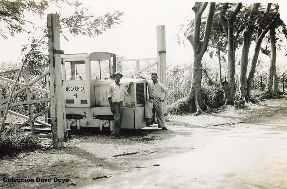
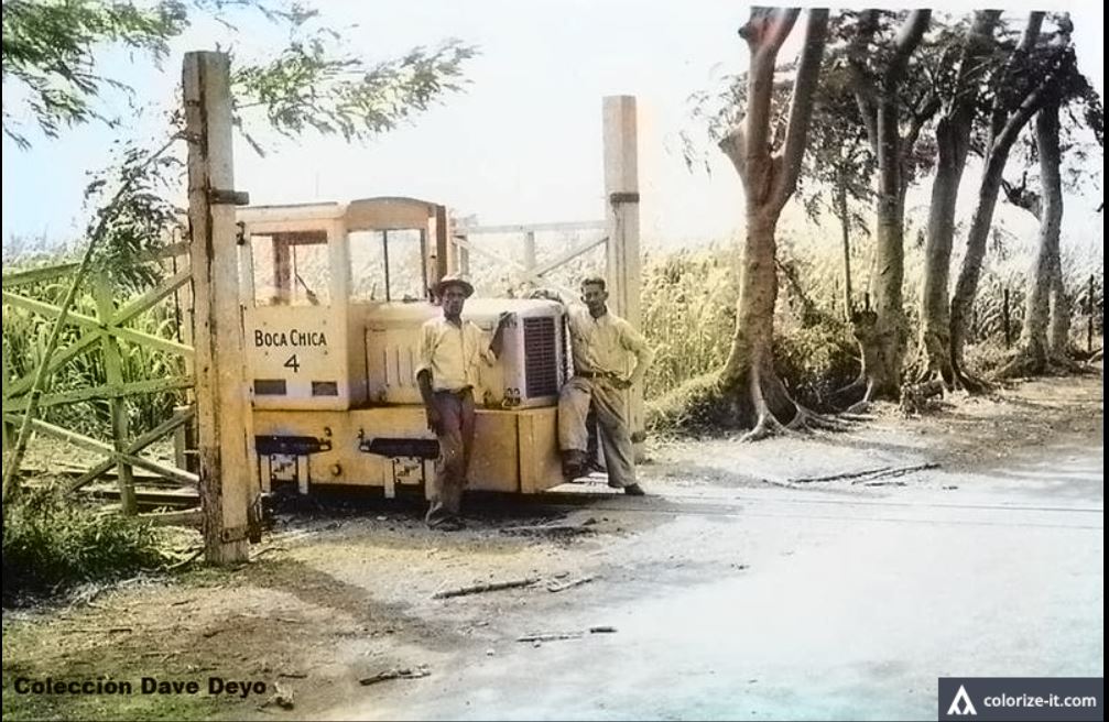
Ejemplo de foto en blanco y negro coloreada, antes y después:


La dirección que usé fue:

http://ferrocarrilespr.rogerseducationalpage.com/wp-content/uploads/2015/02/C.-Boca-Chica2.jpg

Intenten las siguiente foto de mi página:

Entren al “Text Box” la siguiente dirección del Ferrocarril de la isla de Mona:

http://ferrocarrilespr.rogerseducationalpage.com/P3railroadPRList_files/clip_image019.jpg

Dele a “Colorize -It”, espera unos momentos, y luego dele a “Download Colorized Image”.

This application colorizes black and white photos. Just enter in the text box the web address of a black and white photo, hit “Colorize It”, wait,  and then click “Download Colorized Image”.  Please visit http://demos.algorithmia.com/colorize-photos/

Referencia / Reference

“Colorize Black and White Photos.” Algorithmia, https://demos.algorithmia.com/colorize-photos/. Accessed 20 Mar. 2018.


Posted in Uncategorized | Comments Off on Colorizar fotos en blanco y negro / Colorize Photos

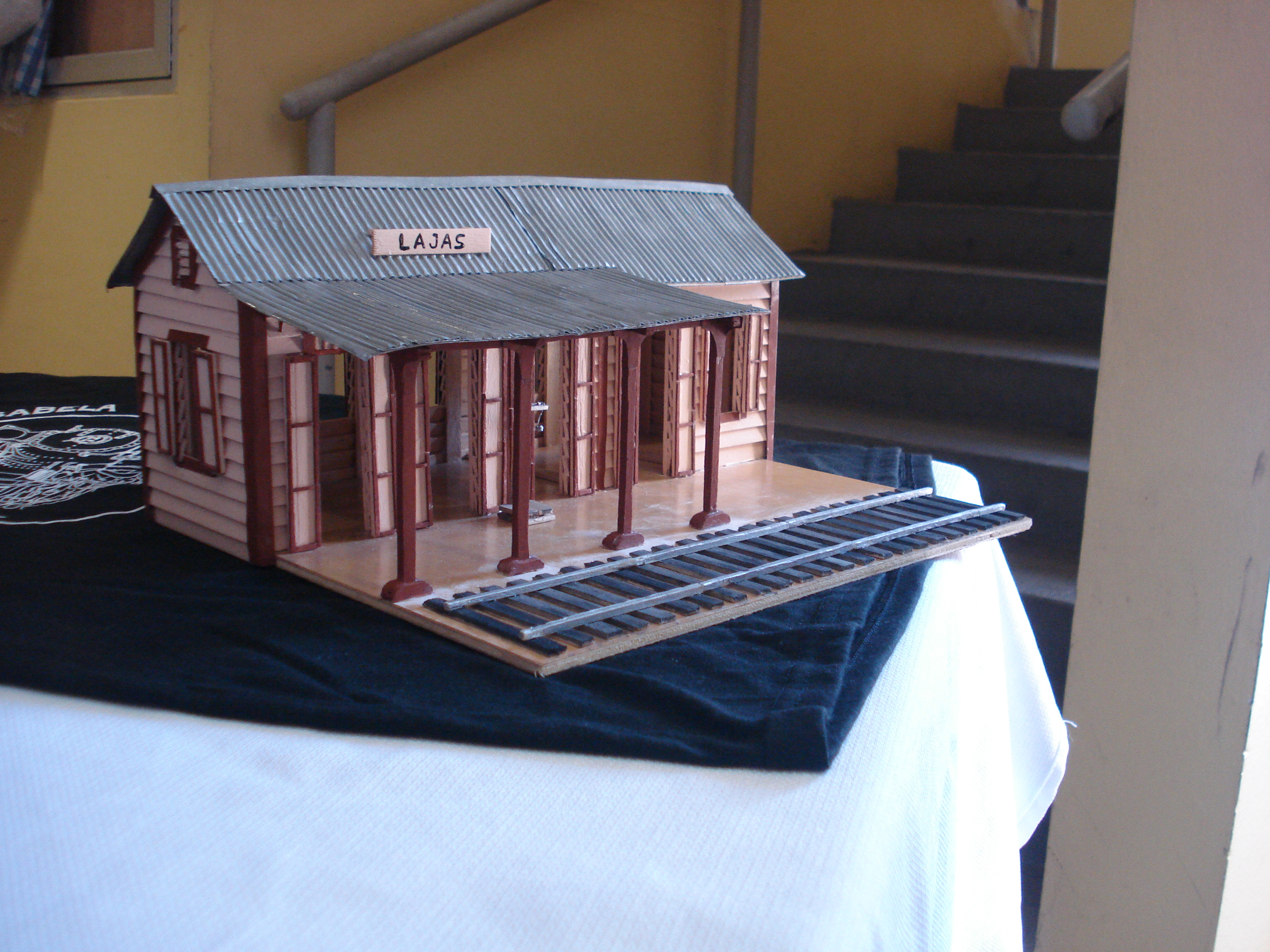
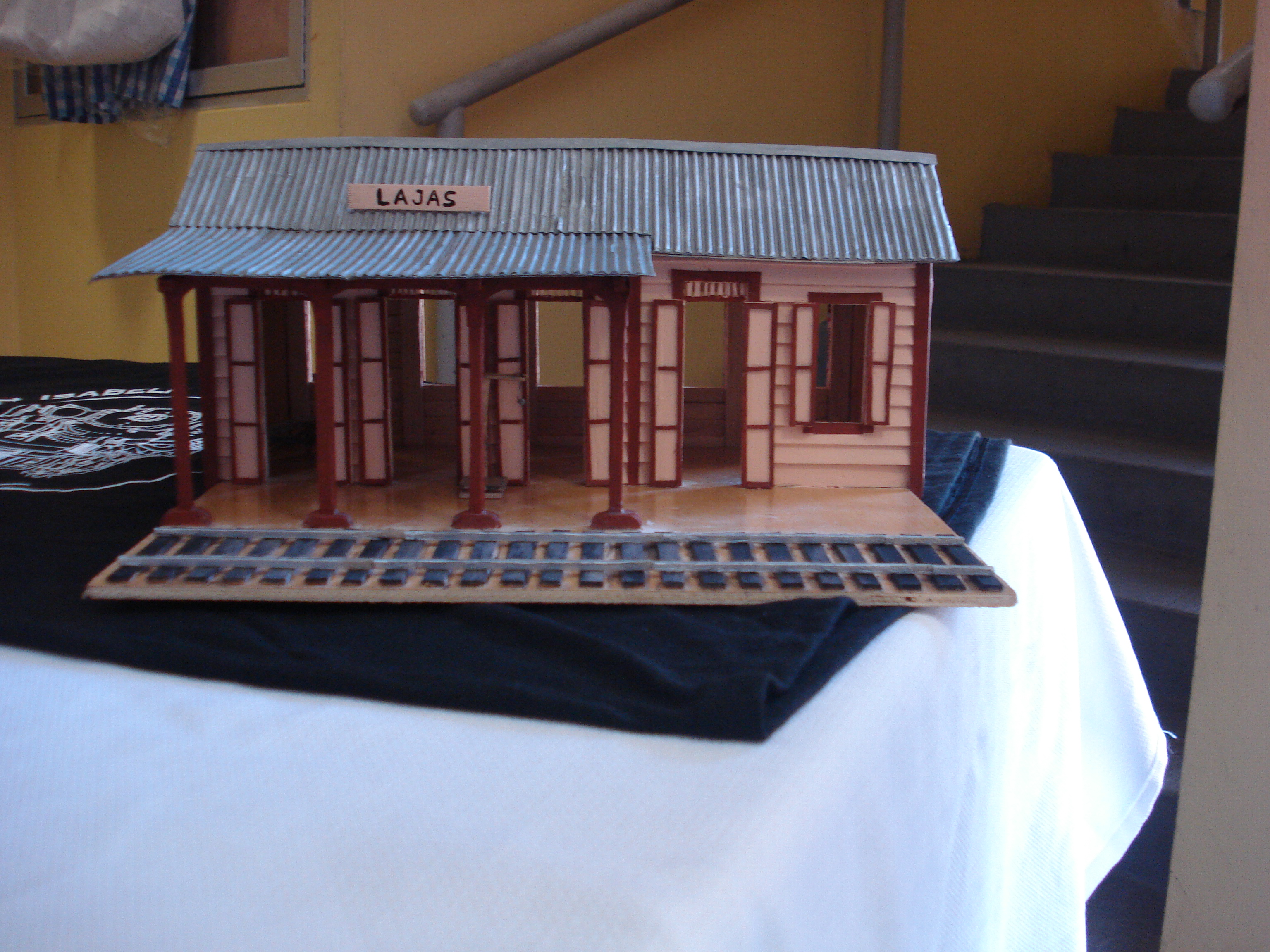
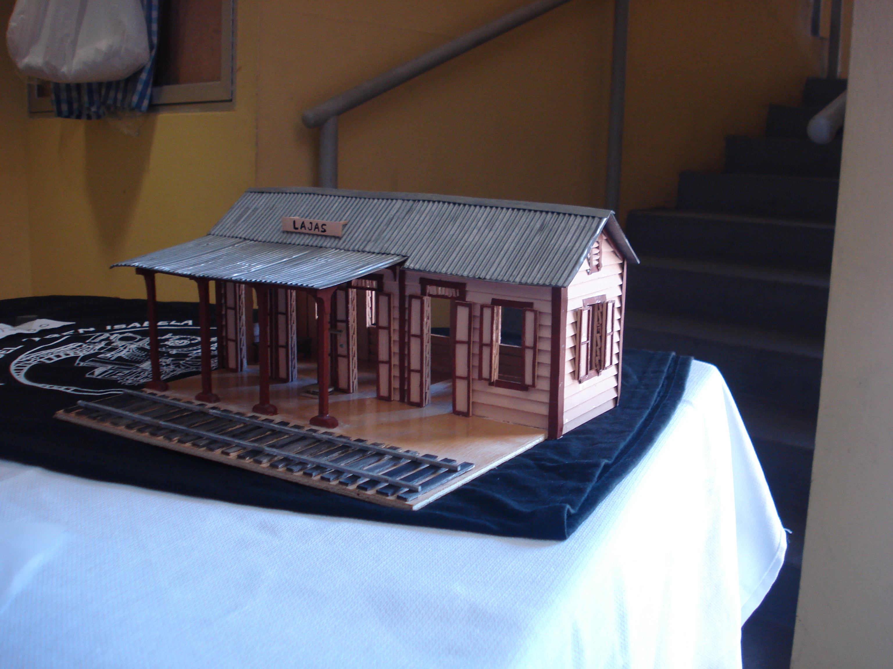
Modelo – Estación de Lajas, Pueblo (Lajas Town Station) por Isabel Avilès Martìnez

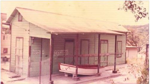
Estación de Lajas (Lajas Town Station).  Foto coleccion Sr. Alfredo Velazquez.  La foto fue publicada en la revista Surcando,  junio 2012, año II, volumen 6, página 8 (Alfredo Vargas).   Israel Roman, Presidente, Surcando La Historia, Inc., Lajas P.R.  Foto usada con permiso.

Isabel Avilès Martìnez es maestra de matematicas jubilada. Actualmente reside en Lajas. Siempre le gustò mucho hacer diferentes artesanìas en especial las artesanias de casitas de madera, canvas y mosaicos. Belkys Lugo.

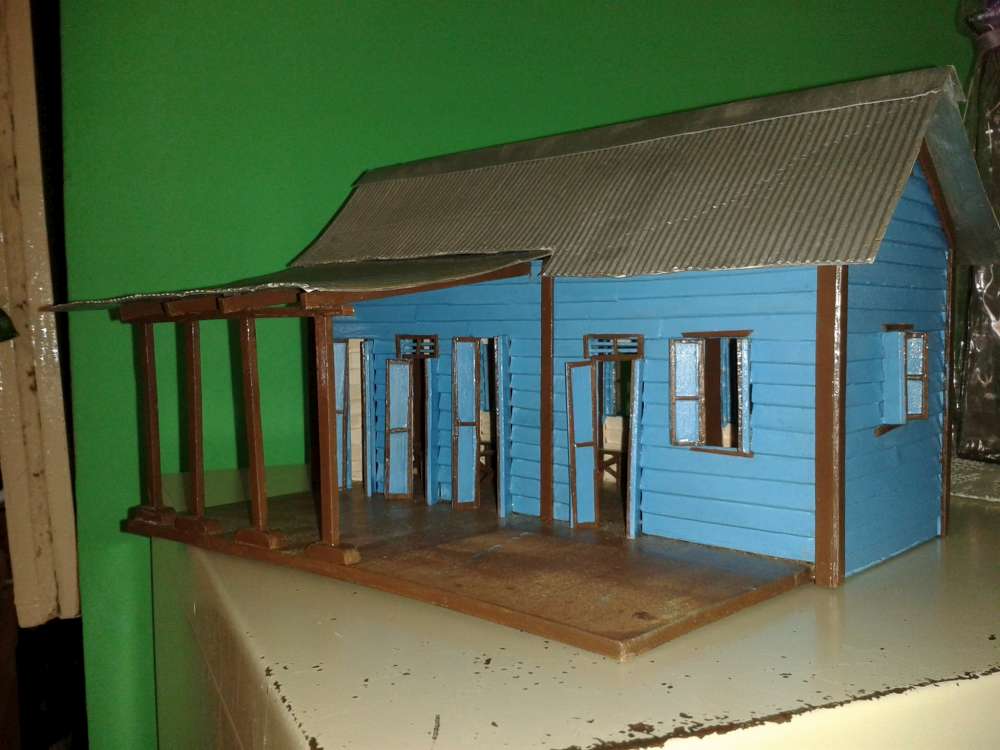
Ver / See: Modelo – Estación de Lajas, Pueblo (Lajas Town Station) por Belkys Lugo.

Belkys Lugo fue estudiante de Isabel Avilès Martìnez.  Belkys was a student of Isabel Avilès Martìnez.


Posted in Uncategorized | Comments Off on Modelo – Estación de Lajas, Pueblo (Lajas Town Station) por Isabel Avilès Martìnez

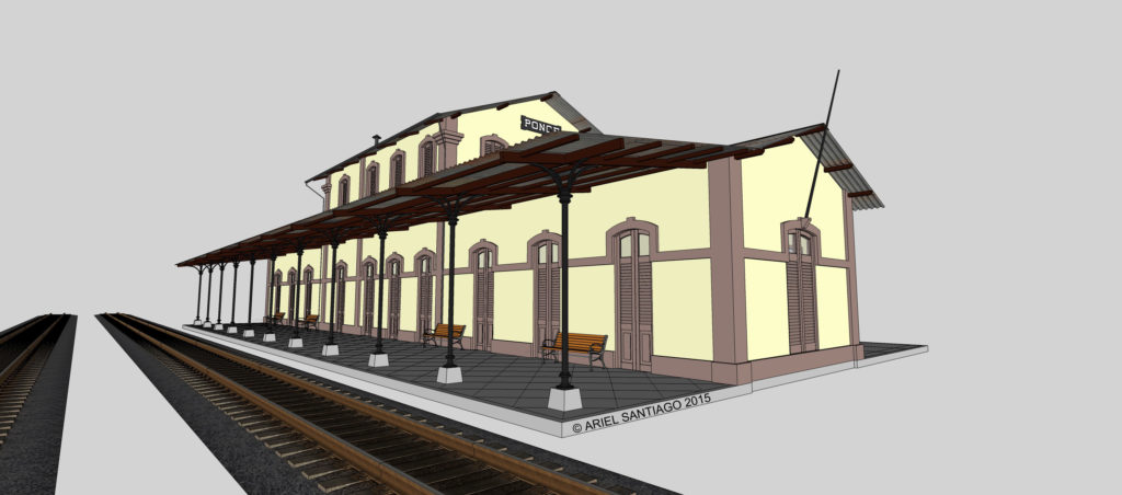
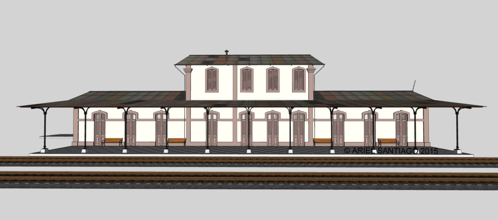
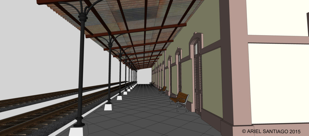
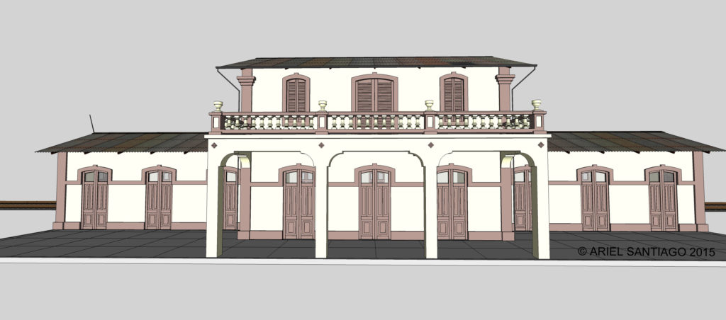
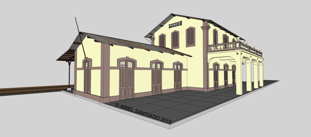
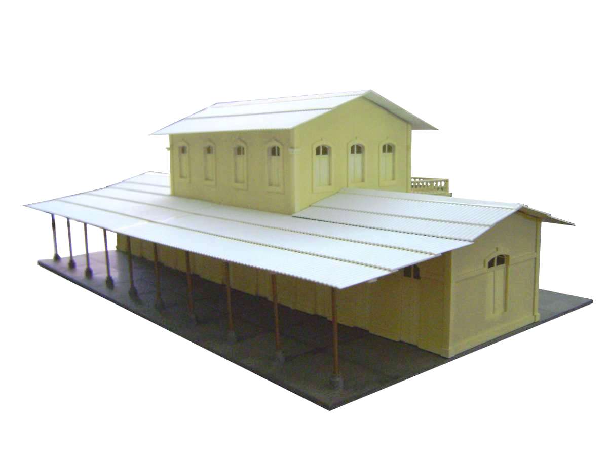
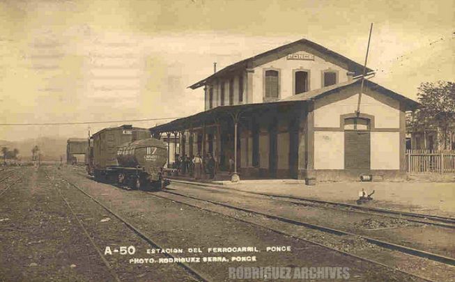
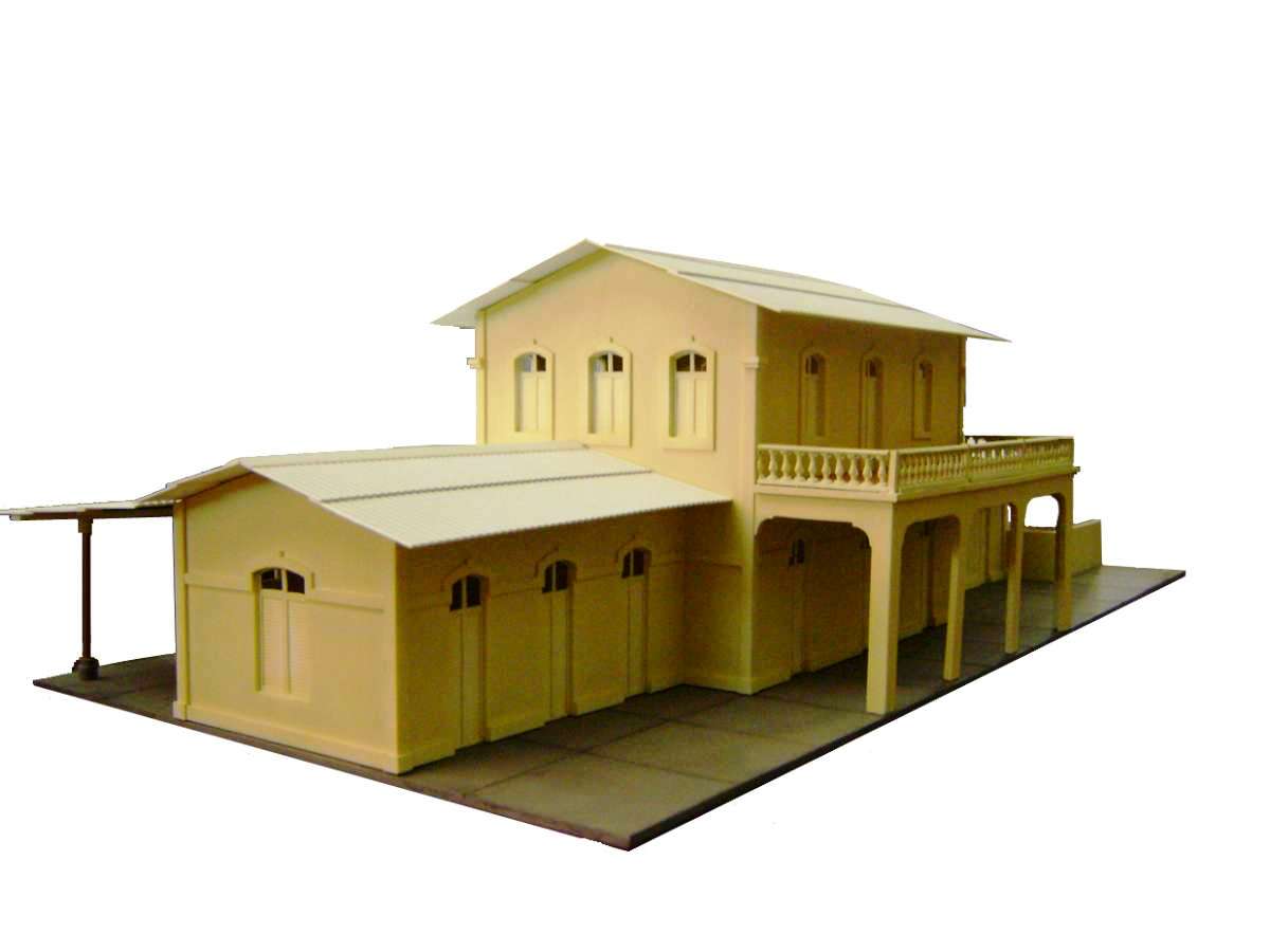
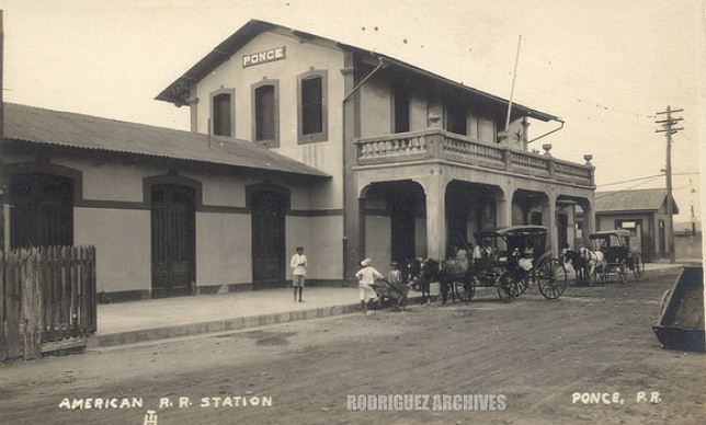
Estación de Ponce, Dibujo / Ponce Station, Drawing – Arquitecto Ariel Santiago, Bayamón, PR

Dale un click a las fotos / Click on the photos

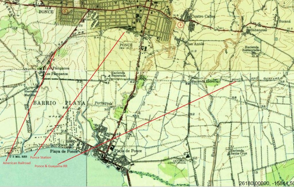
The Ponce Station was on the American Railroad and located in the town of Ponce, South of San Juan.  It also was reached by the Ponce & Guayama RR.

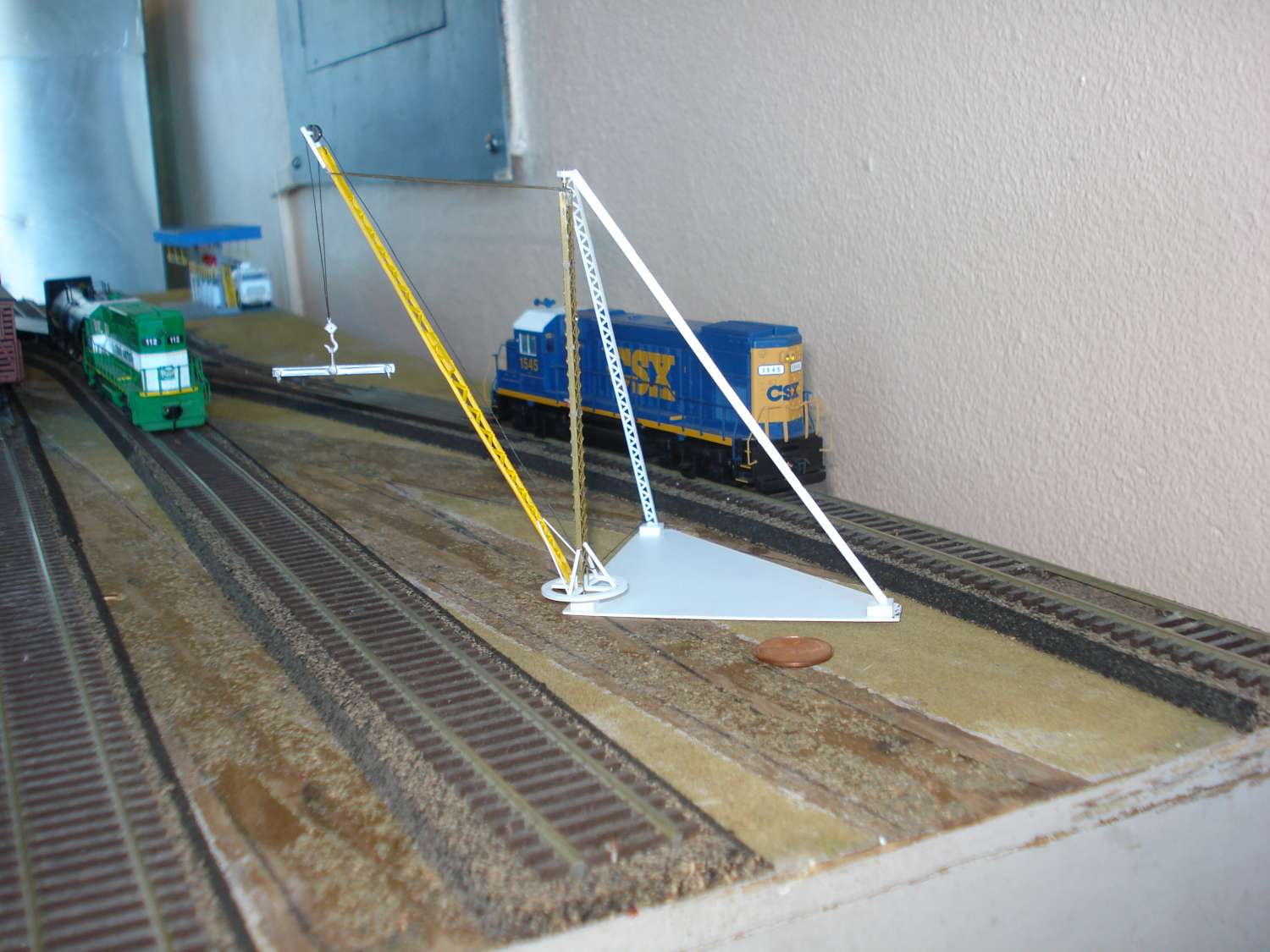
Sugar cane derrick and Ponce passenger station, scale 1:87
Grúa de caña y la estación de Ponce, escala 1:87

Train Stations.  ARCHIVO HISTORICO Y FOTOGRAFICO DE PUERTO RICO

Train Stations.  ARCHIVO HISTORICO Y FOTOGRAFICO DE PUERTO RICO

Otros modelos / Other Models  (Incluyendo artesanías / Including Crafts)


Posted in Uncategorized | Comments Off on Estación de Ponce, Dibujo / Ponce Station, Drawing – Arquitecto Ariel Santiago, Bayamón, PR

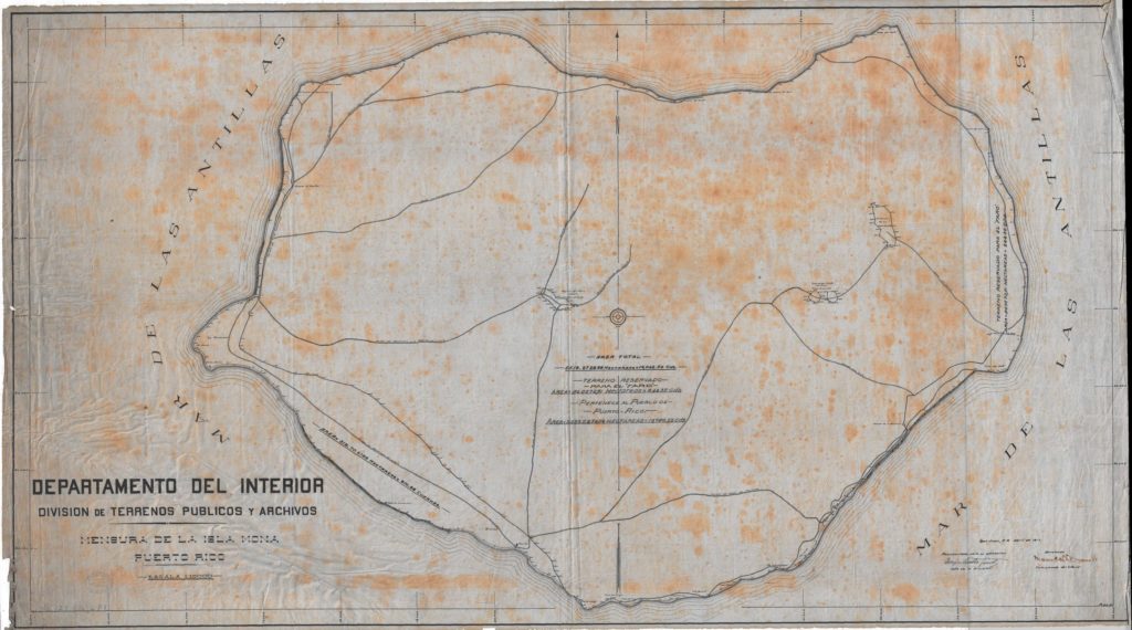
Plano de vías del tranvía / ferrocarril de la Isla de Mona / Mona Island Tram Track Plan

Dele un click a las figuras / Please click figures
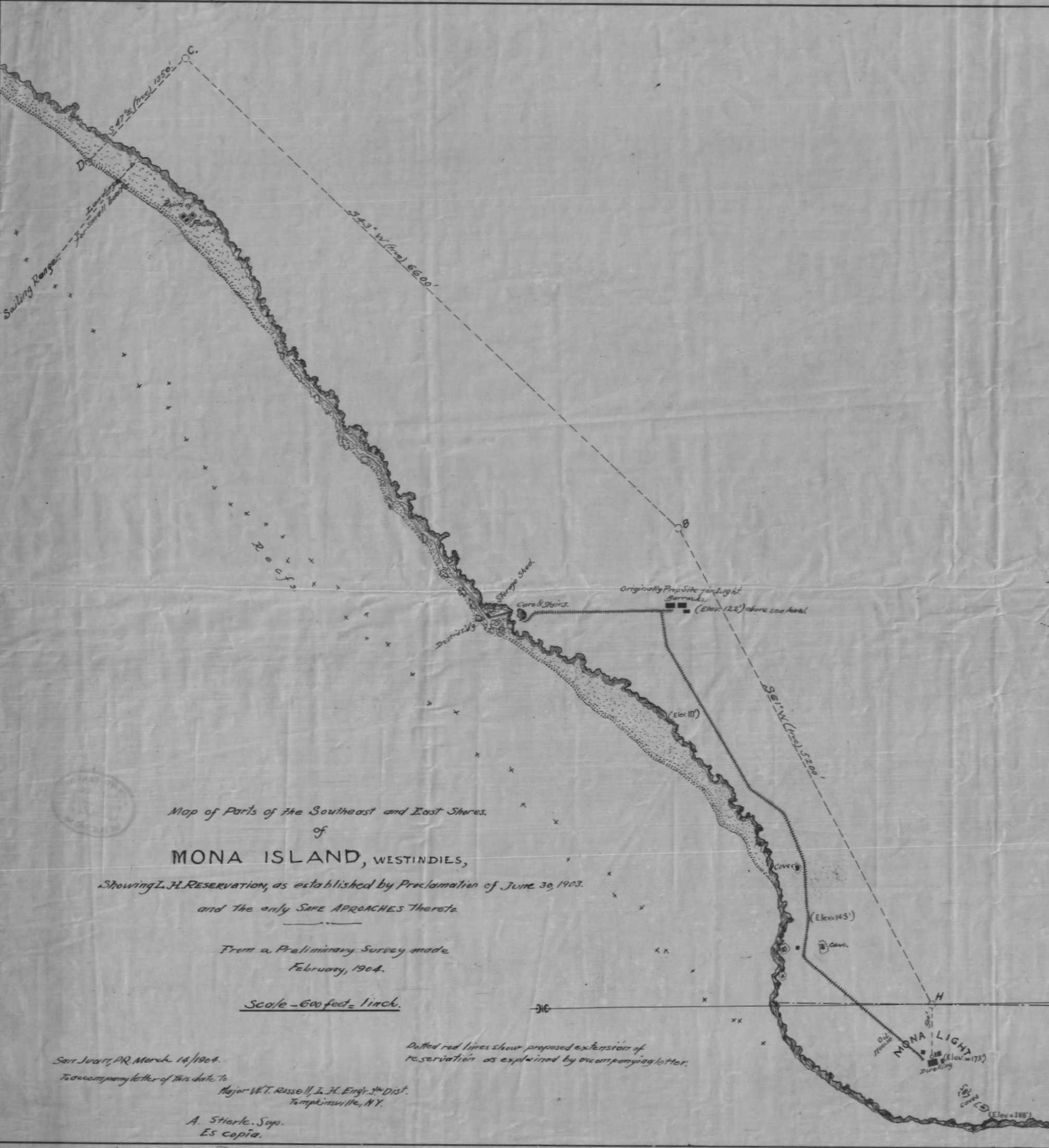
Archivo General de Puerto Rico – Mapoteca.  “Map of Parts of the Southeast and East Shores of Mona Island.  Showing Light House Reservation”. 1903. https://archivonacional.com/PL/3/1/5700.  Copia / Copy :  Isla de Mona 3.5MB.pdf


Archivo General de Puerto Rico – Mapoteca.  “Mensura de la Isla de Mona”. 1916.  https://archivonacional.com/PL/3/1/2771

La Isla de Mona tenía una operación ferroviaria. Carga desde Playa La Escalera era llevada por una vía hasta la Cueva Escalera donde se subía una escalera hasta otra vía donde se llegaba al faro. El carrito usado era halado por un burrito. Una tormenta destruyó las facilidades de Playa Escalera y se tuvo que usar las de Playa Pájaros.

Había una operación minera que también usaba vías. El área de las ruinas en Pajaros pueden ser las de esta operación.
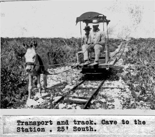
Mona Island railway.  Used for transport to the lighthouse.  Ferrocarril de la isla de Mona para el traslado hacia el faro.  Source / Fuente: U.S. Coast Guard. Tranvía de la Isla de Mona / Mona Island tram.
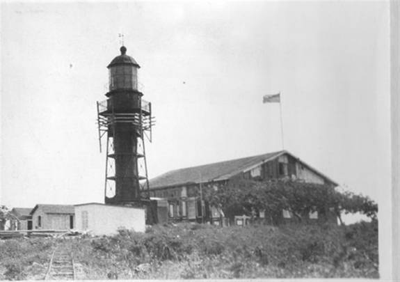
Observe la vía.  U.S. Coast Guard Photo.  Thanks to Mrs. Sandra, http://www.thelighthousepeople.com/

Mona Island had a tram operation between the shore and its lighthouse. Freight from the shore was taken to the lighthouse in two stages.  Originally, freight was taken from the Playa Escalera landing site to the Cueva Escalera cave on tracks.  From here, a stairway was taken up where another railway was taken to the lighthouse. Tram was pulled by a donkey.  A storm destroyed the above landing site and the Playa Pajaros was then used.  

There was a mining operation which also used tracks.  The site of the ruins in Playa Pájaros could be of this operation. Tranvía de la Isla de Mona / Mona Island tram.

Cueva La Escalera / Stairway Cave.  Observe las vías. Notice the tracks. Wadsworth, Frank. History of Man and Mona Island (Historical Review). 1972. History of Mona Island – UPRM Geology Department. 
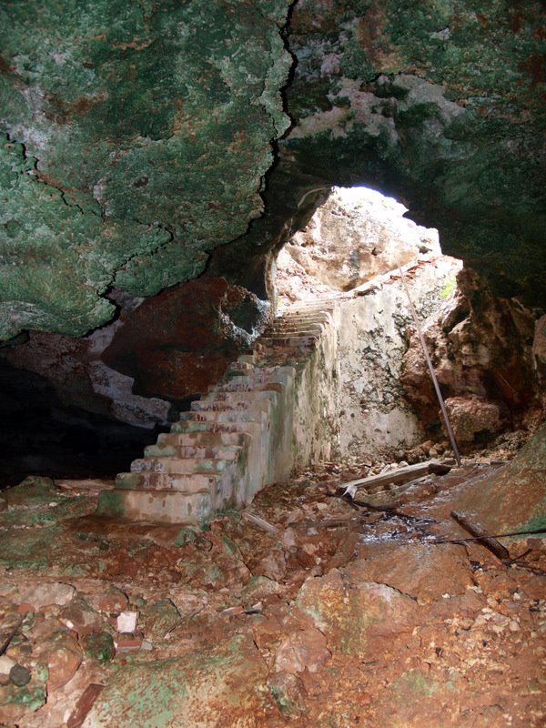
Pirata Cofresí. Cueva Escalera, Isla de Mona. Panoramio. Agosto 25, 2009.
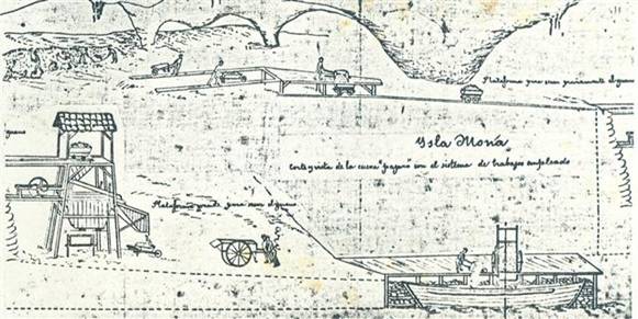
Guano mining in Cueva de Pájaros in 1883 ( Alter Vasconi y Vasconi), Isla de Mona. Also in History of the Guano Mining Industry, Isla de Mona, Puerto Rico by Edward F. Frank

Nota / Note:

No conocemos el ancho de vía del ferrocarril al faro. Tampoco conocemos los fabricantes de los equipos usados. ¿Cómo se llevó el material al área del faro para su construcción? Tenía que existir más equipo. Asumo que tenían que haber usado vagones más grande y animales como caballos y/o bueyes.

We do not know the gauge of the railway nor the manufacturers of the equipment used. How was the materials transported for the construcción of the lighthouse? There had to be more equipment. I assume that there had to be larger cars pulled by horses and /or oxen.

Recursos / Resources:

Wadsworth, Frank. History of Man and Mona Island (Historical Review). 1972. History of Mona Island – UPRM Geology DepartmentDra. Lizzette Rodriguez. Directora Departamento de Geología. 14 nov 2013.

Wadsworth, Frank H.  Mona Island – The Mining Period (1848-1927). January 28, 2016. https://frankhwadsworth.wordpress.com/2016/01/28/mona-island-the-mining-period-1848-1927/. Frank H. Wadsworth, https://frankhwadsworth.wordpress.com. Accessed 6 Apr. 2018.

Extracto:

….En el 1903 se abandonó el primer faro. Se construyó un ferrocarril desde la parte superior de la Cueva La Escalera a el faro nuevo. En 1903, una tormenta destruyó el área de desembarco en Playa La Escalera y este se movió a Playa Pájaros.

Para llegar al faro había que viajar de la Playa Pájaros al la Playa La Escalera, después subir una pendiente de 50% hasta la Cueva La Escalera, subir una escalera, y viajar por ferrocarril 6,000 pies.

En el 1925, el ferrocarril tenía 25 años y el vagón era halado por un burrito llamado Macario. En el 1927, habia una carretera para automóviles en construcción….

Summary:

…..The first site of the lighthouse had been abandoned by 1903. A narrow gauge railroad was built on the plateau from Cueva La Escalera to the new lighthouse site. In 1903 a storm destroyed the landing site at Playa La Escalera. The new landing site was moved south to Playa Pájaros.

To reach the new lighthouse, you had to travel along the beach, from Playa Pájaros to Playa La Escalera, then up a 50% slope to a cave, up a a stairway through the cave, and then travel 6,000 ft to the lighthouse on a tram…

“Map of Parts of the Southeast and East Shores of Mona Island.  Showing Light House Reservation” [plano / mapas]. 1903.  Archivo General de Puerto Rico – Mapoteca. https://archivonacional.com/PL/3/1/5700 , Isla de Mona 3.5MB.pdf

“Mensura de la Isla de Mona” [plano / mapa].  31 de diciembre de 1916. Archivo General de Puerto Rico – Mapoteca.  https://archivonacional.com/PL/3/1/2771

History of the Guano Mining Industry, Isla de Mona, Puerto Rico by Edward F. Frank

Tranvía de la Isla de Mona / Mona Island tram [May 28, 2014]

U.S. Geological Survey. Isla Mona, P.R.(209). [map]. 1944. Scale 1:20,000. Washington, D.C. and Department of Public Works, San Juan, Puerto Rico.
Visite al USGS en https://usgs.gov., The National Map: Historical Topographic Map Collection en https://nationalmap.gov/historical/ y Mapas Topográficos Históricos del USGS (U.S. Geological Survey) / USGS Historical Topographic Maps (Online) http://ferrocarrilespr.rogerseducationalpage.com/?p=2509

Rodríguez Archives. “Photograph – MONA ISLAND – Lighthouse at Mona Island circa 1900. – Vintage Photograph measures 5 x 4 inches.” Flickr, https://www.flickr.com/photos/fredandrebecca/4294009089/. Accessed 20 Mar. 2018.
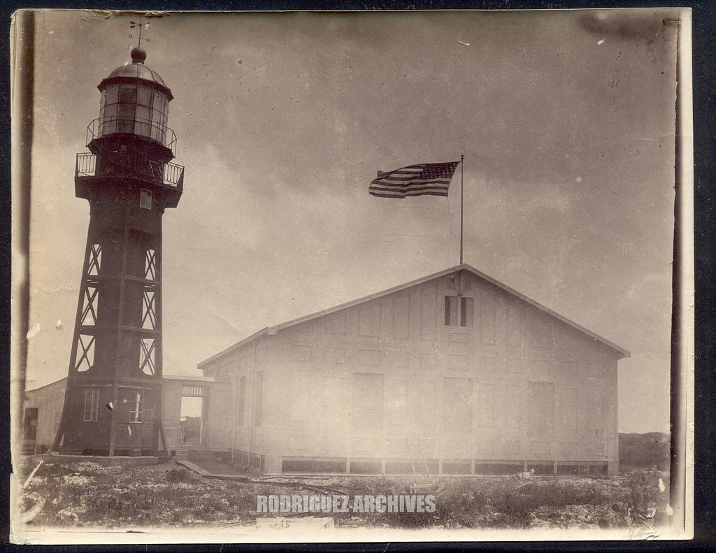
Unknown. English: Mona Island Lighthouse, in Puerto Rico. Photo Taken in 1913. 1913. http://www.unc.edu/~rowlett/lighthouse/pr.html, Wikimedia Commons, https://commons.wikimedia.org/wiki/File:Monaisland.JPG.  This looks like it is a U.S. Coast Guard photo.

“Mona Island Light.” Wikipedia, 27 Aug. 2017. Wikipedia, https://en.wikipedia.org/w/index.php?title=Mona_Island_Light&oldid=797427378.

Moreno, Christopher.  “Los rieles de la Mona”. Isla de Mona.  https://www.facebook.com/Reserva.Natural.Isla.de.Mona/posts/791519470917501. Belkys Lugo Facebook Share a Historia del ferrocarril en Puerto Rico. 10 de febrero 2015. Usado con permiso de la página Isla de Mona.
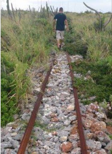
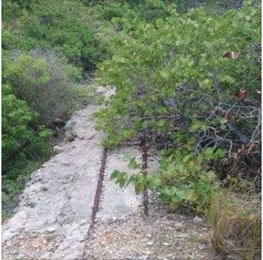
 

La vía de la izquierda es del ferrocarril al faro. Yo creo que la vía de la derecha es de la operación minera.

The track on the left belongs to the tram.  I believe the track on the right belongs to the mining operation.


Posted in Uncategorized | Comments Off on Plano de vías del tranvía / ferrocarril de la Isla de Mona / Mona Island Tram Track Plan

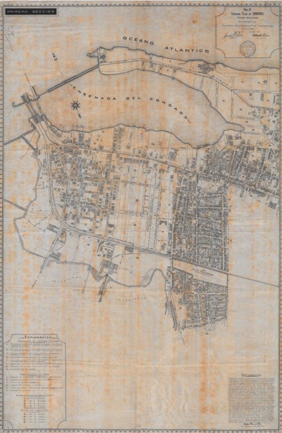
Plano General de Santurce, 1917 / General Plan of Santurce, 1917


Dale un Click a la imagen / Click on the image.

Santurce ADNPR_20170602_182524 (1)

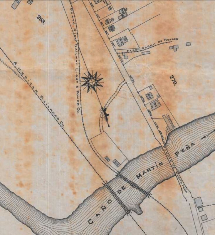
Este mapa de Santurce está compuesto de 3 partes.  Se ve la red de vías de la American Railroad, Porto Rico Railway Light & Power Co., el trolley, y muy intersante la de el Ferrocarril de Rexach, una operación poca conocida. Ver siguiente mapa.  Se ven las industrias servidas por la American Railroad, la localización de la planta eléctrica del trolley y el Parque Borinquen.

The above map of Santurce is divided in 3 parts.  We can see the railroad tracks of the American Railroad, Porto Rico Railway Light & Power Co., the trolley, and a unfamiliar railroad, Ferrocarril de Rexach. See the following map.  You can see the industries served by the American Railroad and the location of the power plant of the trolley and Borinquen Park.

Ver / See:

“General Plan of Santurce.” Mapa/Plano. 1917.  Archivo General de Puerto Rico Mapoteca. https://archivonacional.com/PL/3/1/2795

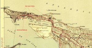
Puerto Rico c. 1946 (Mapa/Map).  Este mapa tiene la red de vías de la American Railroad. Tiene las vías del tranvía eléctrico, trolley, de San Juan a Santurce.  This map shows the American Railroad track and  trolley track between San Juan and Santurce.

El tranvía de San Juan a Rio Piedras.  Redescubriendo a Puerto Rico, https://redescubriendoapuertorico.blogspot.com/. Estudio sobre el tranvía eléctrico de San Juan. This is a study of the electric trolley of San Juan.

U.S. Geological Survey.  San Juan quadrangle, Puerto Rico [map]. Surveyed in 1939-1940.  1;30000.  7.5 Minute Series.  United States Department of the Interior, USGS, 1941. <http://nationalmap.gov/historical/> .  Este mapa tiene identificado la ruta de la American Railroad y el trolley.  The American Railroad and Trolley are identified in this map. (CLICK)

Mapa Completo / Complete map.

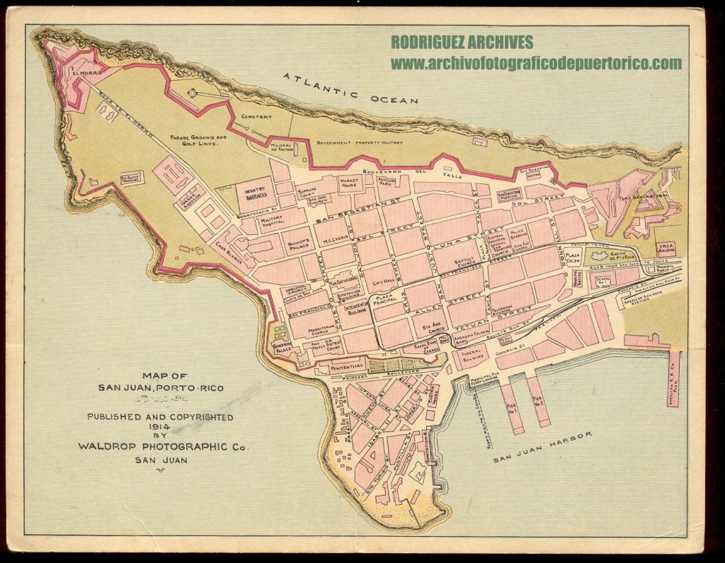
“Waldrop Photo Co. Set No. 10 MISC. ITEMS – Map of San Juan Published 1914.” ARCHIVO HISTORICO Y FOTOGRAFICO DE PUERTO RICO. https://www.flickr.com/photos/fredandrebecca/5393737595/. Rodríguez Archives (José Luis and José Alfredo Rodríguez). Ver: Archivo Histórico Y Fotográfico De Puerto Rico’s photostream. Photos used with permission / Fotos usadas con permiso. Este mapa tiene la ruta del trolley en el Viejo San Juan.  This map has the trolley track plan in Old San Juan. (CLICK)

American Railroad Company of Porto Rico – Delaware Public Archives

Barriger III, John W. American Railroad Company of Puerto Rico

Rexach Railroad / El Ferrocarril de Rexach, Santurce, PR

Porto Rico Railway, Light and Power Co.

Parque Borinquen , Biblioteca Digital Puertorriqueña

Google “Parque Borinquen, Santurce”

San Juan – Trolleys / Tranvías

The Tramways of San Juan, Puerto Rico

Posted in Uncategorized | Comments Off on Plano General de Santurce, 1917 / General Plan of Santurce, 1917

Tranvía de vapor de Ponce – Imagen parcial, 1882 / Ponce Tram – Parcial Image, 1882


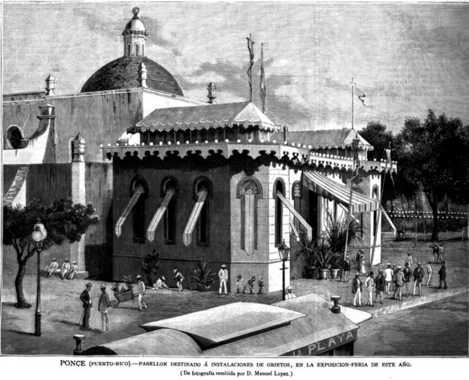
Ponce, Puerto Rico – Pabellon Destinado a instalaciones de objetos, en la exposición -feria de este año. Fotografía remitida por D. Manuel López. / Ponce Fair Pavilion, 1882. goo.gl/vsoEJu (Original from Cornell University / Digitized by Google)

Para 1880 Ponce tenia un tranvía de vapor. Daba servicio de pasajeros y de carga.  Duró unos pocos años hasta el 1883. La foto es una parcial de un vagón del tranvía de vapor de Ponce.

Collection of Allen Morrison http://www.tramz.com/pr/pc.html
(With permission to use). Ver http://ferrocarrilespr.rogerseducationalpage.com/wp-content/uploads/2012/06/pc02b.jpg.

Lo importante es que la foto fue sacada de una publicación del año 1882. Es posible que se puedan encontrar otras fotos en otras revistas.  Solamente tenemos una foto de la locomotora de frente. No sabemos como era de lado.

Tranvía de vapor de Ponce / Ponce Steam Tram
Para 1902, Ponce tenia un tranvía eléctrico.  El tranvía de vapor no pasó a ser uno eléctrico.  Eran dos operaciones apartes de diferentes compañías en diferentes épocas. El pabellon pasó a ser el Parque de Bombas, hoy día un museo. Está localizado en la Plaza de las Delicias, detrás de la catedral de Ponce.

The city of Ponce had a steam tram from 1880 until 1883.  See above photo.  The photo, Ponce Fair Pavilion, 1882, shows a parcial wagon of the steam tram of Ponce.  See links and photo above. The important thing is that this photo was taken from an 1882 publication. Its possible that other photos can be found in other publications. We only have one photo of the steam tram locomotive from the front. I do not know how it looked from the side.

In 1902 Ponce had an electric trolley.  The steam tram operation did not become an electric trolley operation.  They were two different operations by companies that operated at different times.  The pavilion became the firehouse, today a museum. It is located at Plaza las Delicias, behind the cathedral.

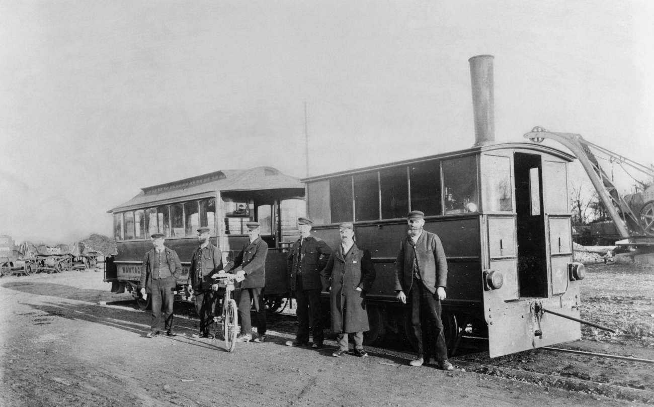
© National Railway Museum/SSPL (Science and Society Picture Library)

Hughes steam tram. La locomotora de vapor del tranvía de Ponce era similar, sin la chimenea alta, y de la misma compañía al de la foto.  Ponce steam tram was similar to the one above, but without the tall chimney. I am grateful to David Halfpenny for the information of Henry Hughes and the Falcon Works of Loughborough, England. 

El tranvía de vapor de Ponce era similar a la locomotora #4, Engine No 4, en lo siguiente página.
Ponce steam tram was similar to Engine No 4. in the following web page:
British Tramway Company Badges and Buttons
http://www.tramwaybadgesandbuttons.com/page148/page152/styled-268/page691.html

Otras fotos / Other photos:

“Wantage Tramway.” Chasewaterstuff’s Railway & Canal Blog, 18 May 2011, https://chasewaterstuff.wordpress.com/2011/05/18/the-wantage-tramway-plus-shannon/wantage-tramway/

Law, John. Oxon – Wantage Tramway Train En Route C1913. 21 Mar. 2007. Flickr, https://www.flickr.com/photos/johnmightycat/5913222339/.

Wantage Tramway by FFDP-Neko, Journals / Personal ©2016-2018 FFDP-Neko.   https://ffdp-neko.deviantart.com/journal/Wantage-Tramway-608802457

Sainsbury, Steve. “The Rail Thing: Wantage Tramway.” The Rail Thing, 8 June 2014, goo.gl/C74yab at http://railthing.blogspot.com/2014/06/wantage-tramway.html

“Hughes Steam Tram No4 Wantage Tramway by Charlie586 / Scale Models on Shapeways.” Shapeways.Com,   https://www.shapeways.com/product/8JMA6E5NX/hughes-steam-tram-no4-wantage-tramway. Para los que deseen hacer un modelo de la locomotora de vapor de Ponce. Existen otras escalas.  For those interested in making a model of the steam tram of Ponce. There are other scales: 1:76 – OO, 1:32, and 1:43.5.

Video de modelo de tranvía de vapor en YouTube (Model Videos of steam trams):

Rail 2014 – Wantage Tramway – YouTube. https://www.youtube.com/watch?v=qaSBeU3BDhQ. Accessed 12 Apr. 2018.
Ver alrededor de 1:25 / See around 1:25.

Wantage Narrow Gauge Tramway – YouTube. https://www.youtube.com/watch?v=fKMNwdDZaTo. Accessed 12 Apr. 2018.
Ver alrededor de 8:07 / See Around 8:07

Ver / See:

La Ilustración Española y Americana. v.26 1882:July-Dec.. – Full View | HathiTrust Digital Library | HathiTrust Digital Library. Page 172. https://goo.gl/vsoEJu. Carlos, Abelardo de. La Ilustración Española y Americana. 1921 1869, p. 52 v.  https://catalog.hathitrust.org/Record/000554227.  Accessed 12 Apr. 2018.

Ponce Steam Tram / Tranvia de vapor dePonce http://ferrocarrilespr.rogerseducationalpage.com/?p=1992

http://ferrocarrilespr.rogerseducationalpage.com/?p=1548

Ponce – Trolleys / Tranvías

Ponce Electric Trolley / Tranvía Eléctrico de Ponce (Data)

Posted in Uncategorized | Comments Off on Tranvía de vapor de Ponce – Imagen parcial, 1882 / Ponce Tram – Parcial Image, 1882

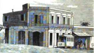
Tranvía de Mayagüez (Imagen), 1877 / Mayagüez Tram (Image), 1877


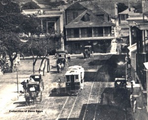
Recuerdos de Puerto Rico – Paradero del ferro-carril urbano, en la marina. Fotografía remitida por el Sr. Pedro Tolosa, ingeniero. 1877 (Original from Cornell University / Digitized by Google)

Figura interesante para 1877. Para el 1872, el primer tranvía de Mayagüez tenia dos pisos. Ver Primer tranvía de Mayagüez / First Mayagüez Tram Car. No he podido localizar una foto o dibujo de este tranvía. Mayagüez tuvo varios tranvías.

Very interesting figure.  In 1872, the first tram of Mayagüez was a two floor vehicle. See Primer tranvía de Mayagüez / First Mayagüez Tram Car.  I have not been able to locate a photo or drawing of this tram.  Mayagüez had various trams.

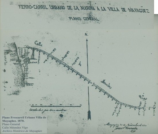
Plano de vías del tranvía de Mayagüez, 1870. Mayagüez tram track plan, 1870.

Recursos:

Tolosa, Pedro. “Recuerdos de Puerto Rico (imagen).” La Ilustración Española y Americana, vol. 21, 1877: July-Dec. pág. 276. https://babel.hathitrust.org/cgi/pt?id=coo.31924069280943;view=1up;seq=286;size=175

Carlos, Abelardo de, 1822-1884. La Ilustración Española Y Americana. Madrid: [s.n., 18691921]. https://catalog.hathitrust.org/Record/000554227

Hathitrust Digital Library / https://www.hathitrust.org/

Sepúlveda Rivera, Anibal. Puerto Rico Urbano: Atlas histórico de la ciudad puertorriqueña. San Juan, PR: Centro de Investigaciones CARIMAR, 2004. 4 Vols.

Manuel Durán (Architect) Collection (1) Mayagüez  http://ferrocarrilespr.rogerseducationalpage.com/?p=238
Tiene otros dibujos.

Durán, Manuel.  El tranvía de Mayagüez – Primer ferrocarril Urbano de Puerto Rico. Folleto Tranvía de Mayagüez, Colección Arquitecto Manuel Durán. ( Mayagüez Tram Brochure ).  Tiene plano de vías del primer tranvía de Mayagüez.  Included is the first track plan of the Mayagüez Tram.

Primer tranvía de Mayagüez / First Mayagüez  Tram Car. http://ferrocarrilespr.rogerseducationalpage.com/?p=4115

Mayagüez 1910 Plan / Plano Mayagüez 1910.  Colección Efraín Martell
Source / Fuente:  Archvio Histórico de Mayagüez.  Observe:  Tram line and American Railroad / Vía del tranvía y la American Railroad.

Posted in Uncategorized | Comments Off on Tranvía de Mayagüez (Imagen), 1877 / Mayagüez Tram (Image), 1877

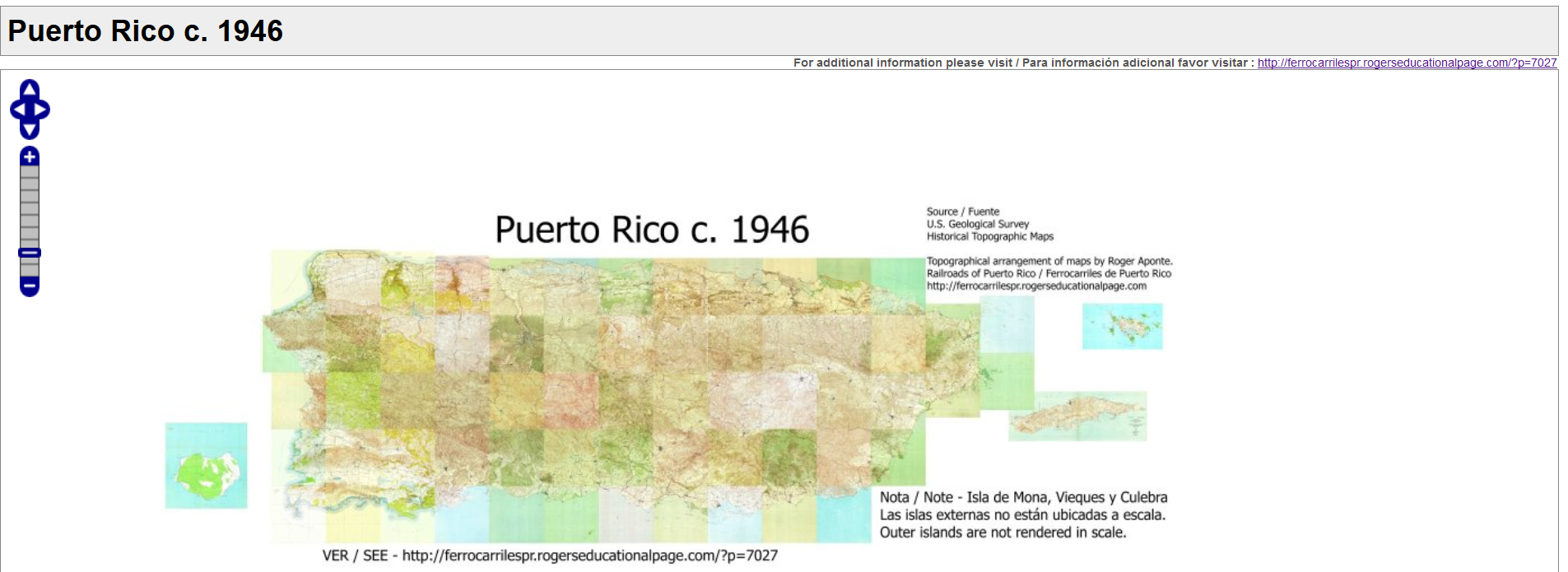
Puerto Rico c. 1946

Click la imagen / Click the image

English

Notas:

Este mapa es para complementar la página web – Railroads of Puerto Rico / Ferrocarriles de Puerto Rico, http://ferrocarrilespr.rogerseducationalpage.com/. Es para fines educativos.

La mayoría de los cuadrángulos son de alrededor del año 1946. No todos los ferrocarriles de Puerto Rico que existieron / existen se encuentran en el mapa. Unos no se mencionan en nuestra historia general. Otros no existían para la fecha del mapa como el Tren Urbano, el ferrocarril Chemex en Ponce, y los ferrocarriles de turismo, que fueron ferrocarriles posteriores. Otros ferrocarriles habían dejado de operar como los tranvías de Ponce y Mayagüez, Centrale Utuado, etc. Pero un gran número de ferrocarriles si se encuentran.

La Isla de Mona, Vieques y Culebra están localizadas en su posición aproximada.

En otra sección de esta página marcadores o punteros en mapas señalan a más información. Por ejemplo, desvíos ferroviarios, ramales, localización de estaciones, cambijas (toma de agua), centrales, fotos, puentes, comentarios, etc. Observarán que nuestra historia ferroviaria es bien rica e interesante.

– Fuentes:

U.S. Geological Survey – https://www.usgs.gov/

The National Map’s Historical Topographic Map Collection (HTMC) –
https://nationalmap.gov/historical/

https://viewer.nationalmap.gov/basic/?basemap=b1&category=histtopo,ustopo&title=Map%20View#startUp

——————–

Notes:

This map complements the web page – Railroads of Puerto Rico / Ferrocarriles de Puerto Rico, http://ferrocarrilespr.rogerseducationalpage.com/. It shows the railroad network of Puerto Rico c. to 1946. Not all railroads that existed or exist are on the map. Some are not mentioned in our general history. Others did not exist for the dates mentioned like Tren Urbano, Chemex RR of Ponce, tourist railways, Ponce and Mayagüez trolleys, Central (Sugar Mill) Utuado, etc. But a large number of our railroads are on the map.

Mona Island, Vieques, and Culebra are positioned approximately.

In another section or post of this page, pointers or markers on maps show additional information. For instance, railroad sidings, branchlines, railroad locations, water tanks, sugar mills, photos, bridges, comments, etc. You will see that we have a very rich and interesting railroad history.

– Sources:

U.S. Geological Survey – https://www.usgs.gov/

The National Map’s Historical Topographic Map Collection (HTMC) – https://nationalmap.gov/historical/

https://viewer.nationalmap.gov/basic/?basemap=b1&category=histtopo,ustopo&title=Map%20View#startUp


Posted in Uncategorized | Comments Off on Puerto Rico c. 1946

“Tren Urbano.” Headlights Jan.- June 1999


Russell, Bruce, J. William Vigrass, and Raymond R. Berger. “Tren Urbano.” Headlights Jan.- June 1999: Print. https://issuu.com/erausa/docs/1999-headlights-01/c/sc566l7

Link directo a página 9 / Direct link to page 9:

https://issuu.com/erausa/docs/1999-headlights-01/8

Revista completa (lea página 9) / Complete magazine (read page 9):


Posted in Uncategorized | Comments Off on “Tren Urbano.” Headlights Jan.- June 1999

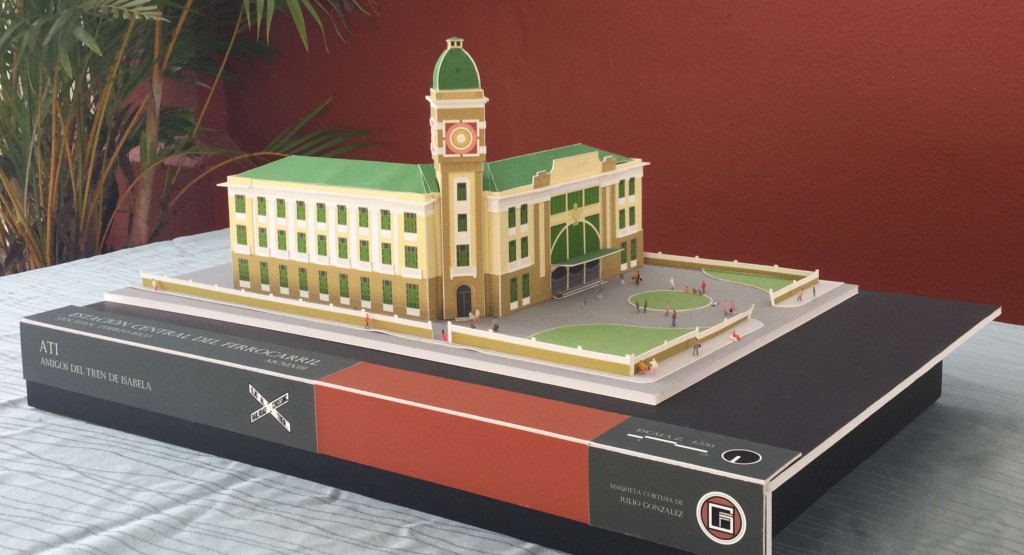
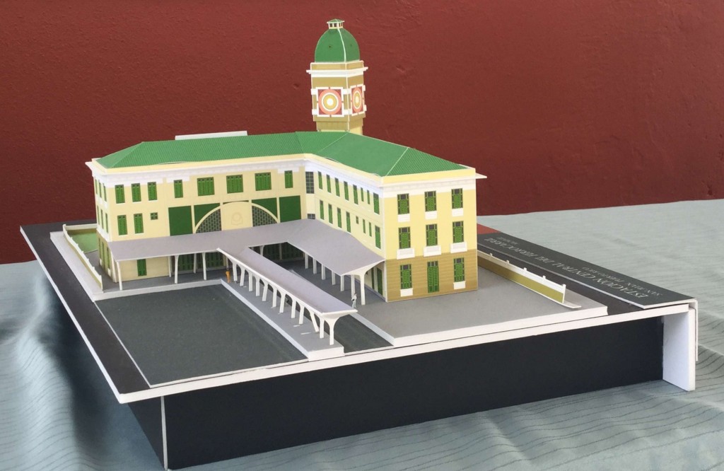
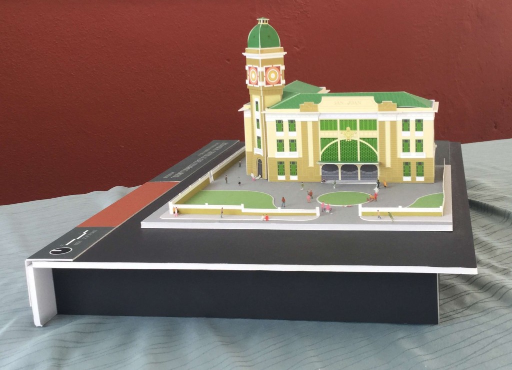
Estación de San Juan / San Juan Station / 1:220


Estación de San Juan / San Juan Station / 1:220
Modelo construído por el Arquitecto Julio González
Models built by Julio González, Architect
Colección Victor Díaz, fundador – Los Amigos del Tren Isabela http://www.atiisabela.com/


Posted in Uncategorized | Comments Off on Estación de San Juan / San Juan Station / 1:220