Dale un Click a la imagen / Click on the image.
Santurce ADNPR_20170602_182524 (1)
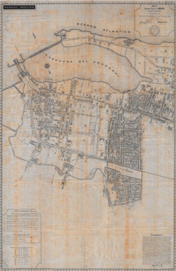
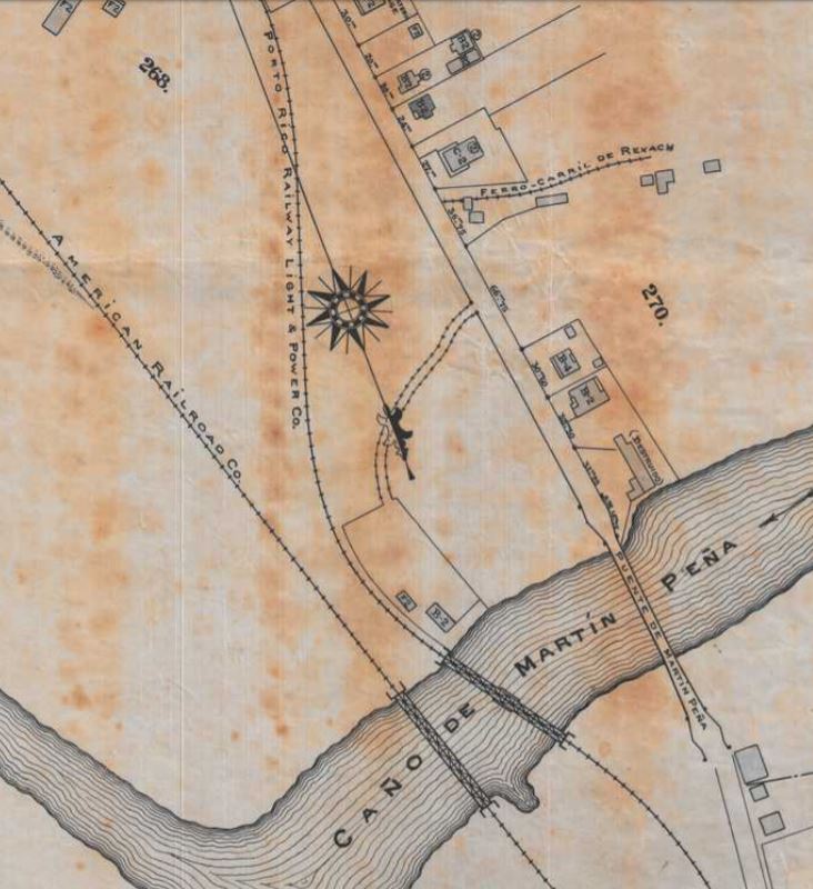
Este mapa de Santurce está compuesto de 3 partes. Se ve la red de vías de la American Railroad, Porto Rico Railway Light & Power Co., el trolley, y muy intersante la de el Ferrocarril de Rexach, una operación poca conocida. Ver siguiente mapa. Se ven las industrias servidas por la American Railroad, la localización de la planta eléctrica del trolley y el Parque Borinquen.
The above map of Santurce is divided in 3 parts. We can see the railroad tracks of the American Railroad, Porto Rico Railway Light & Power Co., the trolley, and a unfamiliar railroad, Ferrocarril de Rexach. See the following map. You can see the industries served by the American Railroad and the location of the power plant of the trolley and Borinquen Park.
—
—
Ver / See:
“General Plan of Santurce.” Mapa/Plano. 1917. Archivo General de Puerto Rico Mapoteca. https://archivonacional.com/PL/3/1/2795
Puerto Rico c. 1946 (Mapa/Map). Este mapa tiene la red de vías de la American Railroad. Tiene las vías del tranvía eléctrico, trolley, de San Juan a Santurce. This map shows the American Railroad track and trolley track between San Juan and Santurce.
El tranvía de San Juan a Rio Piedras. Redescubriendo a Puerto Rico, https://redescubriendoapuertorico.blogspot.com/. Estudio sobre el tranvía eléctrico de San Juan. This is a study of the electric trolley of San Juan.
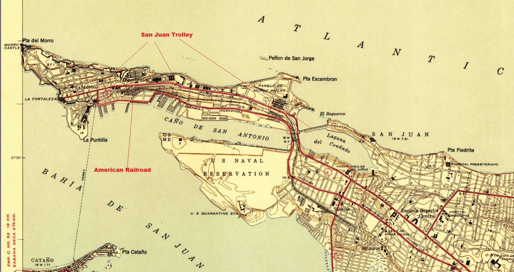
U.S. Geological Survey. San Juan quadrangle, Puerto Rico [map]. Surveyed in 1939-1940. 1;30000. 7.5 Minute Series. United States Department of the Interior, USGS, 1941. <http://nationalmap.gov/historical/> . Este mapa tiene identificado la ruta de la American Railroad y el trolley. The American Railroad and Trolley are identified in this map. (CLICK)
—
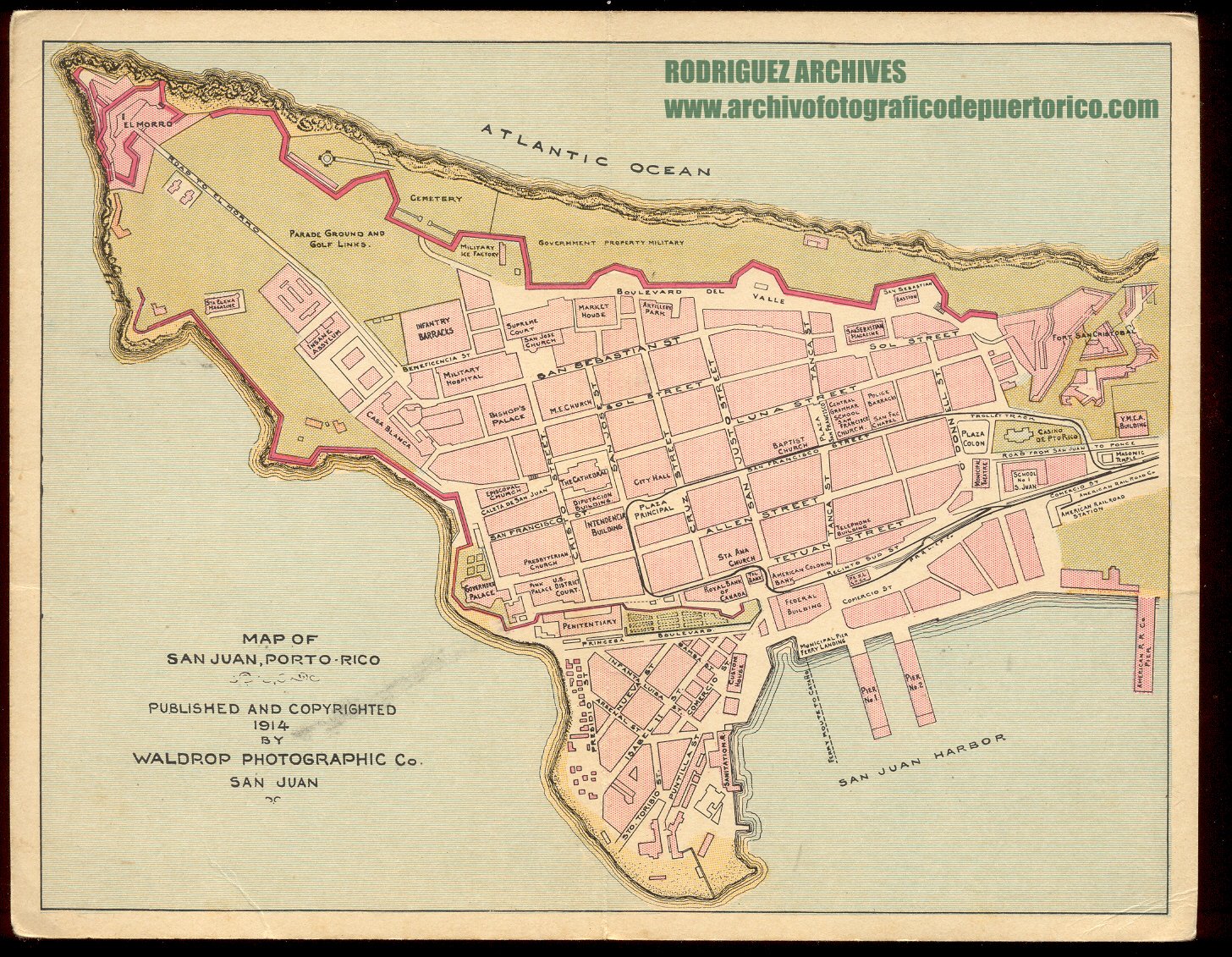
“Waldrop Photo Co. Set No. 10 MISC. ITEMS – Map of San Juan Published 1914.” ARCHIVO HISTORICO Y FOTOGRAFICO DE PUERTO RICO. https://www.flickr.com/photos/fredandrebecca/5393737595/. Rodríguez Archives (José Luis and José Alfredo Rodríguez). Ver: Archivo Histórico Y Fotográfico De Puerto Rico’s photostream. Photos used with permission / Fotos usadas con permiso. Este mapa tiene la ruta del trolley en el Viejo San Juan. This map has the trolley track plan in Old San Juan. (CLICK)
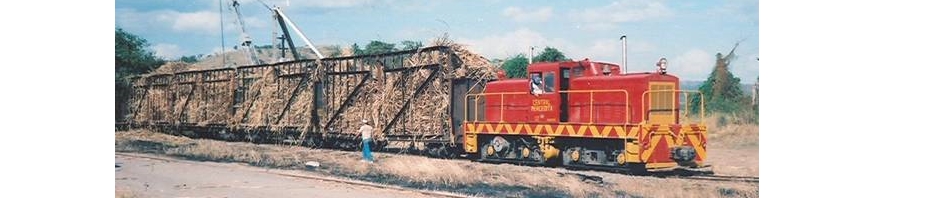
American Railroad Company of Porto Rico – Delaware Public Archives
Barriger III, John W. American Railroad Company of Puerto Rico
Rexach Railroad / El Ferrocarril de Rexach, Santurce, PR
Porto Rico Railway, Light and Power Co.
Parque Borinquen , Biblioteca Digital Puertorriqueña
Google “Parque Borinquen, Santurce”