Click la imagen / Click the image
Notas:
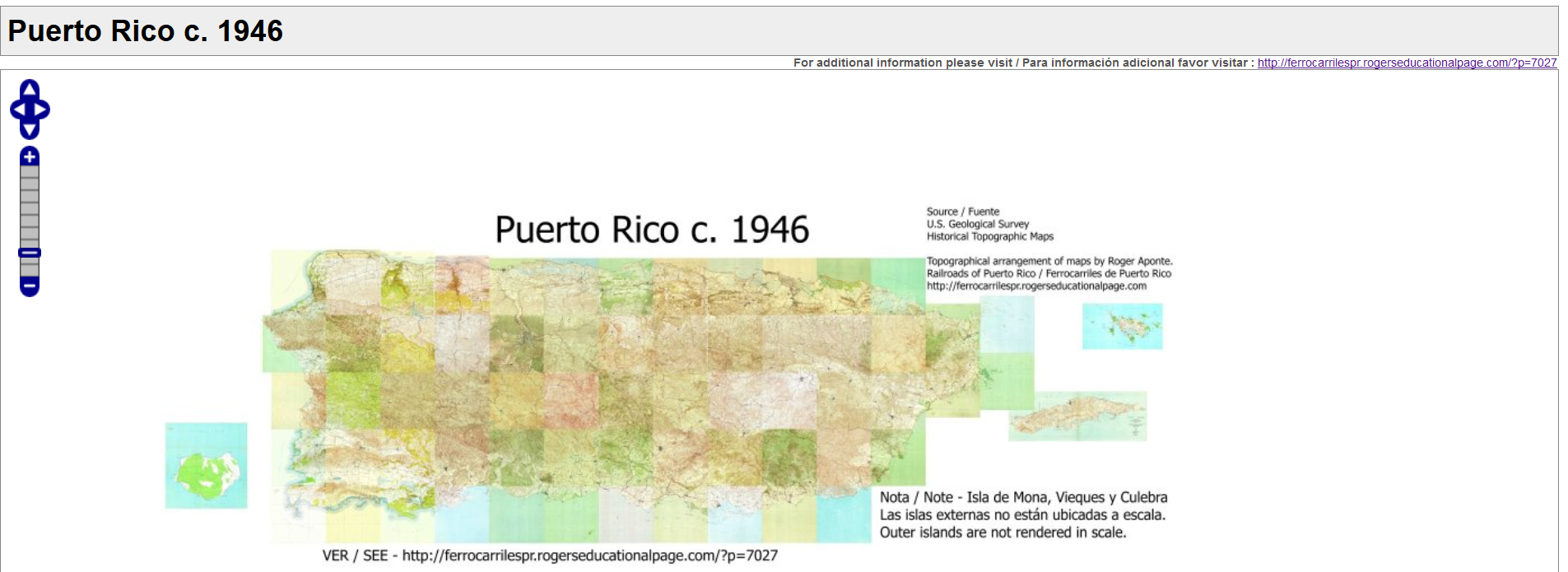
Este mapa es para complementar la página web – Railroads of Puerto Rico / Ferrocarriles de Puerto Rico, http://ferrocarrilespr.rogerseducationalpage.com/. Es para fines educativos.
La mayoría de los cuadrángulos son de alrededor del año 1946. No todos los ferrocarriles de Puerto Rico que existieron / existen se encuentran en el mapa. Unos no se mencionan en nuestra historia general. Otros no existían para la fecha del mapa como el Tren Urbano, el ferrocarril Chemex en Ponce, y los ferrocarriles de turismo, que fueron ferrocarriles posteriores. Otros ferrocarriles habían dejado de operar como los tranvías de Ponce y Mayagüez, Centrale Utuado, etc. Pero un gran número de ferrocarriles si se encuentran.
La Isla de Mona, Vieques y Culebra están localizadas en su posición aproximada.
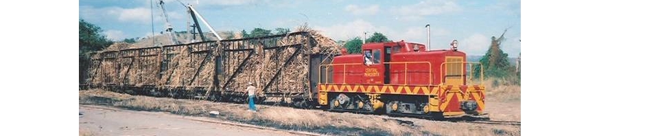
En otra sección de esta página marcadores o punteros en mapas señalan a más información. Por ejemplo, desvíos ferroviarios, ramales, localización de estaciones, cambijas (toma de agua), centrales, fotos, puentes, comentarios, etc. Observarán que nuestra historia ferroviaria es bien rica e interesante.
– Fuentes:
U.S. Geological Survey – https://www.usgs.gov/
The National Map’s Historical Topographic Map Collection (HTMC) –
https://nationalmap.gov/historical/
https://viewer.nationalmap.gov/basic/?basemap=b1&category=histtopo,ustopo&title=Map%20View#startUp
Notes:
This map complements the web page – Railroads of Puerto Rico / Ferrocarriles de Puerto Rico, http://ferrocarrilespr.rogerseducationalpage.com/. It shows the railroad network of Puerto Rico c. to 1946. Not all railroads that existed or exist are on the map. Some are not mentioned in our general history. Others did not exist for the dates mentioned like Tren Urbano, Chemex RR of Ponce, tourist railways, Ponce and Mayagüez trolleys, Central (Sugar Mill) Utuado, etc. But a large number of our railroads are on the map.
Mona Island, Vieques, and Culebra are positioned approximately.
In another section or post of this page, pointers or markers on maps show additional information. For instance, railroad sidings, branchlines, railroad locations, water tanks, sugar mills, photos, bridges, comments, etc. You will see that we have a very rich and interesting railroad history.
– Sources:
U.S. Geological Survey – https://www.usgs.gov/
The National Map’s Historical Topographic Map Collection (HTMC) – https://nationalmap.gov/historical/
https://viewer.nationalmap.gov/basic/?basemap=b1&category=histtopo,ustopo&title=Map%20View#startUp