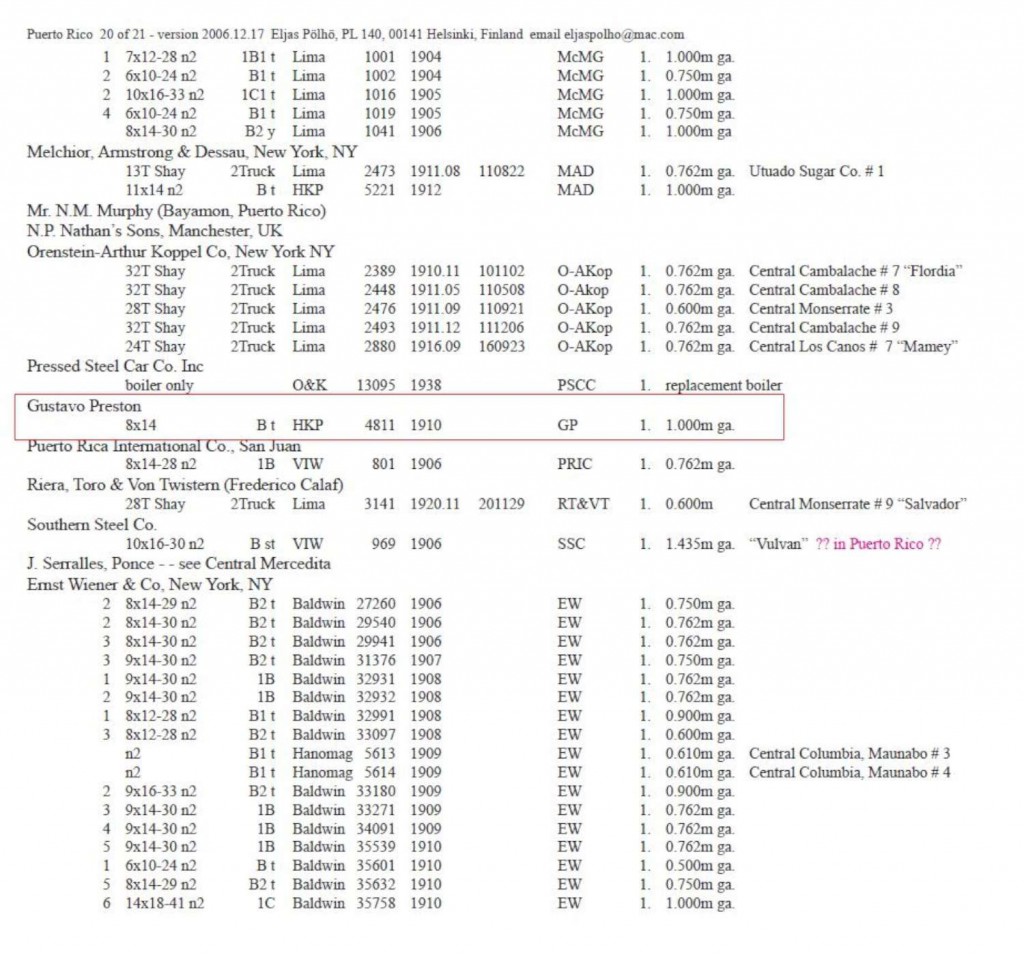
Central Mosquito, Vieques

Central Mosquito
Vieques
Gauge / Trocha (ancho de vía):

La Central Mosquito tenía una locomotora 2-4-0 Baldwin para c1900-10.

Copeland, P. Allen.  Locomotive Rosters – Railways of the West Indies, Part IV, Puerto Rico”.  48.  Railways of the West Indies, Puerto Rico

National Atlas of the United States

César Ayala. 2001. “ From Sugar Plantations to Military Bases: the U.S. Navy’s Expropriations in Vieques, Puerto Rico, 1940-45 .” Centro: Journal of the Center for Puerto Rican Studies 13(1) (Spring 2001): 22-44.

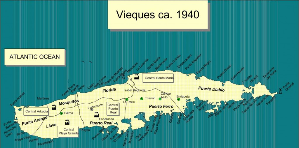
Map shows locations of other sugar mills.  En el mapa vemos la localización de las otras centrales en Vieques.

Permission: Prof. Xavier F. Totti, Editor, CENTRO: Journal of the Center for Puerto Rican Studies, Hunter College, 695 Park Avenue, E-1429, New York, NY 10065

http://centropr.hunter.cuny.edu

Field Operations, Bureau of Chemistry and Soils.  Soil Map, Western Sheet, Puerto Rico [map].  Agricultural Experiment Station, University of Puerto Rico, 1936. (Partial Map)

Para ver más mapas visite Mapas Topográficos Históricos del USGS (U.S. Geological Survey)USGS Historical Topographic Maps (Online) ( http://geonames.usgs.gov/pls/topomaps/). Busque los mapas de Vieques usando “Isla de Vieques”.

For more maps, visit Mapas Topográficos Históricos del USGS (U.S. Geological Survey)
USGS Historical Topographic Maps (Online)
( http://geonames.usgs.gov/pls/topomaps/). Search using the term “Isla de Vieques”

Posted in Uncategorized | Comments Off on Central Mosquito, Vieques

Central La Plata (Plata), San Sebastian, 60 cm / 24 in

Luis de, Casenave. “Central La Plata en San Sebastián.” Fotografía. Colección Periódico El Mundo, Universidad de Puerto Rico, Recinto de Río Piedras. N.p., 1952. Web. 13 Aug. 2014. <http://bibliotecadigital.uprrp.edu/cdm/singleitem/collection/fotoselmund/id/1917/rec/360>.

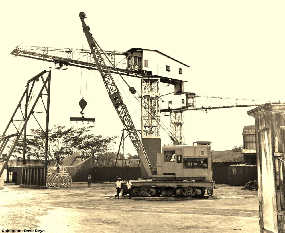
Locomotora Grúa / Locomotive Crane

….It was an ex-US Navy crane from Roosevelt Roads.  It was built by Ohio Crane, serial number 4264, 3/29/43.  It was meter gauge, and is a locomotive crane (self propelled), 30 tons, 75′ boom with a 5′ extension, diesel-electric.  It may have gone first to the American RR, per information from a veteran who was stationed at the base where the crane worked the docks and drydock.  But I have no proof of that.  According to workers at Plata, they got it in 1958.  I took the photo of it in early 1969.   Deyo, Dave. “Central La Plata.” Message to the author. 14 Sept. 2014. E-mail.


Mapa / Map –  San Sebastián


Posted in Uncategorized | Comments Off on Central La Plata (Plata), San Sebastian, 60 cm / 24 in

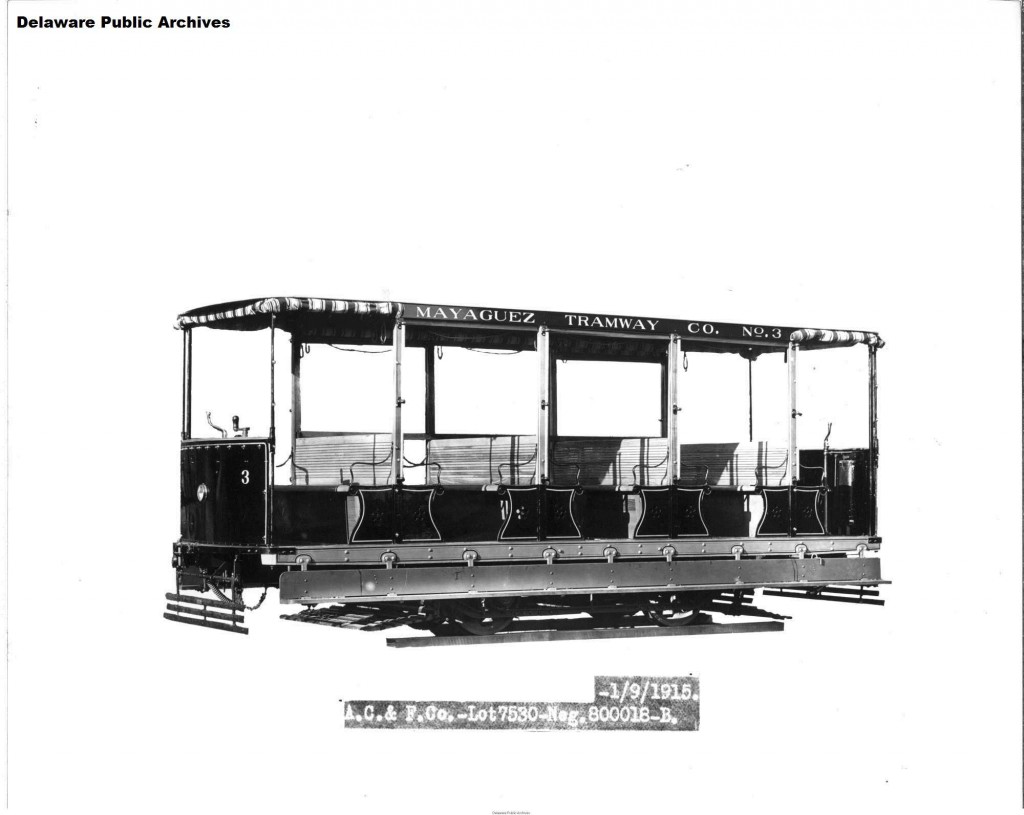
Mayaguez Tramway CO. (Tranvía de Mayagüez) – Delaware Public Archives


Street Car – Export (1).”  Jackson and Sharp Company (Wilmington, Del.). Jackson and Sharp Collection.  Delaware Public Archives. Web. 29 Sept. 2014.
<http://cdm15323.contentdm.oclc.org/cdm/singleitem/collection/p15323coll6/id/4893/rec/1> [Mayagüez Tramway Co. , Mayagüez, Puerto Rico]

Street Car – Export (3).”  Jackson and Sharp Company (Wilmington, Del.). Jackson and Sharp Collection.  Delaware Public Archives. Web. 29 Sept. 2014.
<http://cdm15323.contentdm.oclc.org/cdm/singleitem/collection/p15323coll6/id/4895/rec/3> [Mayagüez Tramway Co. , Mayagüez, Puerto Rico]

Street Car – Export (2).”  Jackson and Sharp Company (Wilmington, Del.). Jackson and Sharp Collection.  Delaware Public Archives. Web. 29 Sept. 2014.
<http://cdm15323.contentdm.oclc.org/cdm/singleitem/collection/p15323coll6/id/4894/rec/2> [Mayagüez Tramway Co. , Mayagüez, Puerto Rico]

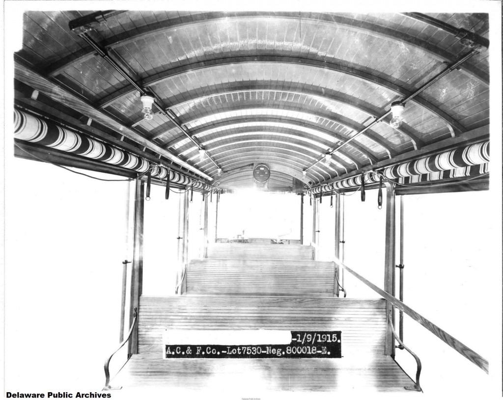
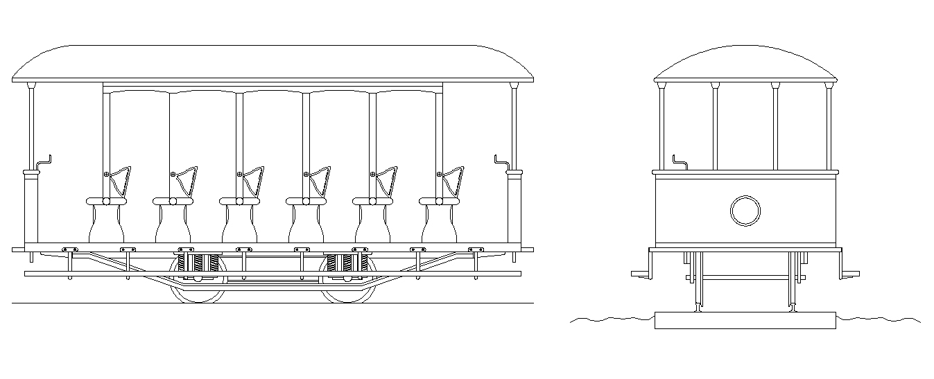
Three cars (#1-#3) built at the Jackson & Sharp Plant of American Car & Foundry, Lot #7530, 1/9/1915, 8 Bench, Single Truck, Gould Storage Battery for power. There was a car #4, but no records show who made it and it varies in design from these three cars. Most likely either purchased second hand from some other railroad, or even possibly home built in Mayaguez (I think it was second hand myself).  Dave Deyo.    Facebook, Historia del ferrocarril en Puerto Rico, 4 Oct. 2014.

Ver / See:

Manuel Durán (Architect)  Collection (1) Drawings, photos, etc., (Mayagüez) / Dibujos, fotos, etc., (Mayagüez) http://ferrocarrilespr.rogerseducationalpage.com/wp-content/uploads/2011/06/Tranvia-de-Mayaguez-2.jpg

Mayagüez 1910 Plan / Plano Mayagüez 1910 (JPG) Mayagüez 1910 Plan / Plano Mayagüez 1910 (PDF) Colección Efraín Martell

Primer tranvía de Mayagüez / First Mayagüez Tram Car


Posted in Uncategorized | Comments Off on Mayaguez Tramway CO. (Tranvía de Mayagüez) – Delaware Public Archives

Fuentes / Sources

Notas – Esta es una lista parcial.
Note – This is a parcial list.

Aponte Pargas, Roger.  Fotos de la Hacienda Las Llanadas y el Sistema Hidroeléctrico del Río Blanco.  Libro – Apuntes sobre el último ferrocarril de Puerto Rico : Ponce & Guayama Railroad, P & G, 1984.  La Chemex RR y Tren Urbano se construyeron después.  The Chemex RR and Tren Urbano came later.

Armstrong, William H. Manuscritos de William H. Armstrong. Biblioteca Digital Puertorriqueña, <http://bibliotecadigital.uprrp.edu/cdm/>.  UPR

Central Aguirre

Central Mercedita

Copeland, P. Allen.  Locomotive Rosters – Railways of the West Indies, Part IV, Puerto Rico”.  Pages 147 – 212.  See/Ver : Railways of the West Indies, Puerto Rico

Deyo, Dave – Well known researcher of the railroads of Puerto Rico.
Conocido investigador de los ferrocarriles de Puerto Rico.  Ver / See Facebook – Historia del ferrocarril en Puerto Rico and other posts in this page.

Dunn, Richard.  Baldwin and Vulcan Locomotives by Richard Dunn

Durán, Manuel.  Arquitecto de Mayagüez.

Escudero, Jaime. “Centrales Azucareras de Puerto Rico.” Recinto Universitario de Mayagüez, Universidad de Puerto Rico, Web. 24 Sept. 2014. <http://blogs.uprm.edu/canadeazucar/>.

Ferreras Pagán, Luis.  Biografía de la riqueza de Puerto Rico, Tomo I y II. San Juan, PR: Tipografía de Luis Ferreras, 1902. Print.


Gilmore Sugar Manuals – Publish under different names every two years from 1930.  Found in local libraries and / or  Historical Archives.  Publicado bajo diferentes nombres cada dos años desde 1930.  Se encuentran en bibliotecas y/o archivos históricos locales.

-The Gilmore Puerto Rico sugar manual,
Author:    International Society of Sugar Cane Technologists. Congress    San Juan, P.R., 1965.
-The Puerto Rico sugar manual, including data on Hispaniola and Virgin Islands’ mills, 1938.
Author:    A B GilmorePublisher:    New Orleans, La. : A.B. Gilmore, ©1938.
-The Puerto Rico sugar manual, including data on Dominican Republic and Haiti, 1948.
Publisher:    New Orleans, Gilmore Pub. Co. , 1948.
-The Puerto Rico-Dominican Republic sugar manual, including data on Haiti and Virgin Islands, 1962.
Publisher:    New Orleans, Hauser Press, 1962.
-The Puerto Rico sugar manual, including data on Dominican Republic and Haiti, 1954.
Author:    Fred I MeyersPublisher:    New Orleans, Gilmore Pub. Co., 1954
-The Puerto Rico sugar manual,: Including data on Santo Domingo, Haiti, and Virgin Island Mills, 1940-1941 Unknown Binding – January 1, 1941
by A. B Gilmore (Author)
-The Puerto Rico sugar manual, including data on Hispaniola mills
Author:    A B GilmorePublisher:    New Orleans, 1934.
-The Porto Rico sugar manual.
Publisher:    New Orleans, U.S.A. : A.B. Gilmore, ©1930-©1956.

Informe del Comisionado del Interior de al Honorable Gobernador de Puerto Rico, 1919

Instituto de Cultura Puertorriqueña / Archivo General De Puerto Rico.
Fondo De Obras Públicas…Ferrocarriles Y Tranvías
Very Extensive / Trabajo Extenso

Long, W. Rodney.   Porto RicoRailways of Central America and the West Indies . Washington: Government Printing Office, 1925. Pag. 336. Print.  (HATHI TRUST digital Library http://catalog.hathitrust.org/Record/000970279  (11 Oct. 2013))
Copyright: Public Domain, Google-digitized.

Locomotive Rosters of Puerto Rico / Catálogo de locomotoras de Puerto Rico

Maps, Plans, Other / Mapas, Planos, Otros

Map Railroads in Operation, 1916 / Mapa ferrocarriles en operación, 1916

Railroad Map of Porto Rico (1924) / Mapa Ferroviario de Puerto Rico (1924)
Railroad map of Porto Rico.   Map (39 x 89 cm,  Scale [ca. 1:255,000]).  United States. Dept. of Commerce. [S.l.], 1924.  American Memory Map Collection.   Library of Congress Geography and Map Division, Washington, D.C. 20540-4650.  May 17, 2011 < http://hdl.loc.gov/loc.gmd/g4971p.ct000303>

USGS Historical Topographic Maps (Online) / Mapas Topográficos Históricos del USGS (U.S. Geological Survey)
 

Posted in Uncategorized | Comments Off on Fuentes / Sources

Central Altagracia (Igualdad)

Central Altagracia (Igualdad), Mayagüez, (Pagan , Armstrong Report, Vol. 8, 1910)

National Atlas of the United States

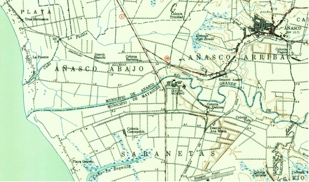
U.S. Geological Survey. Rincón, PR.  1949.  Historical Maps.

See / Ver:  Añasco – San Sebastián

Posted in Uncategorized | Comments Off on Central Altagracia (Igualdad)

Central Alianza, Camuy, 30 in

Alianza Arecibo & Camuy
30 inches
Closed c1923-1924

National Atlas of the United States

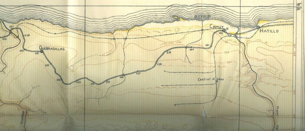
New York Academy of Sciences, Scientific Survey of Porto Rico and Virgin Islands, Vol. II, Part I

Colección Dave Deyo


Posted in Uncategorized | Comments Off on Central Alianza, Camuy, 30 in

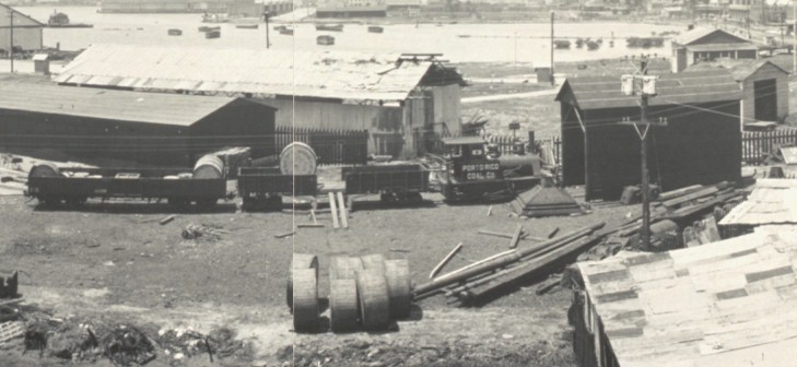
Puerto Rico Coal & Oil

Puerto Rico Coal & Oil
San Juan
Gauge / Trocha (ancho de vía):  Meter / Metro

Puerto Rico Coal & Oil, San Juan.  Coal and Oil, San Juan, Porto [sic] Rico, c1919, Library of Congress Prints and Photographs Division Washington, D.C. 20540 USA , (digital file from intermediary roll film copy) pan 6a24241 Library of Congress Prints and Photographs Division Washington, D.C. 20540 USA

See / Ver:  Port Series Maps by the US Army Engineering Corps / San Juan

Posted in Uncategorized | Comments Off on Puerto Rico Coal & Oil

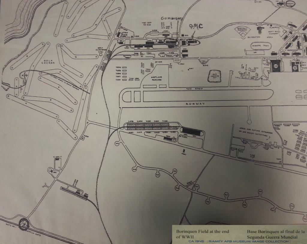
Ramey Air Force Base


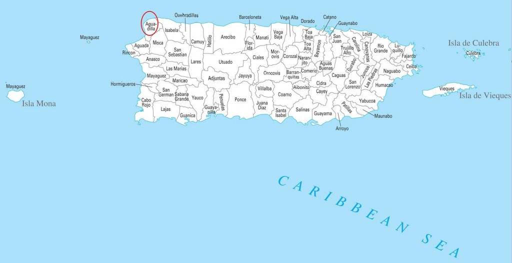
La Base Ramey estaba localizada en el pueblo de Aguadilla.
Ramey Air Force Base was located in the town of Aguadilla.

Source / Fuente: National Atlas of the United States,  http://nationalatlas.gov .  Last
modified:  Thursday, 27-Jan-2011 17:18:20 CST.

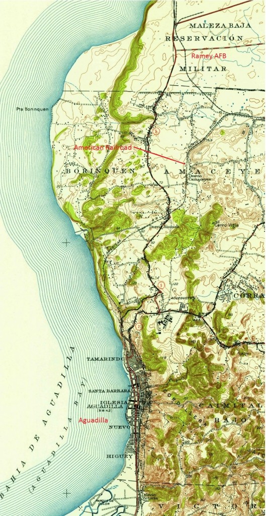
La base tenía una conexión con la American Railroad.
The base had a connection with the American Railroad.

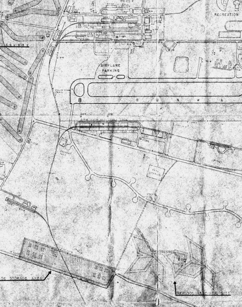
Ramey Air Force Base Track Plan (Plano de vías).  Date on photo – 12 Aug 1951.   Ramey AFB Museum.

U.S. Geological Survey.  Aguadilla [map], Puerto Rico.  1942.

Ramey AFB Museum

See / Ver:

RAMEY AFB MUSEUM IMAGE COLLECTION

Gracias a Ricardo Busquets, Director Ejecutivo del Borinquen Field / Ramey AFB Museum, por el uso de las fotos del museo.  Para más información, favor de comunicarse a las siguientes direcciones y teléfono:

Thanks to Ricardo Busquets, Executive Director of the Borinquen Field / Ramey AFB Museum, for the use of the museum photo collection.  For more information, call or write to the addresses or telephone:

Posted in Uncategorized | Comments Off on Ramey Air Force Base

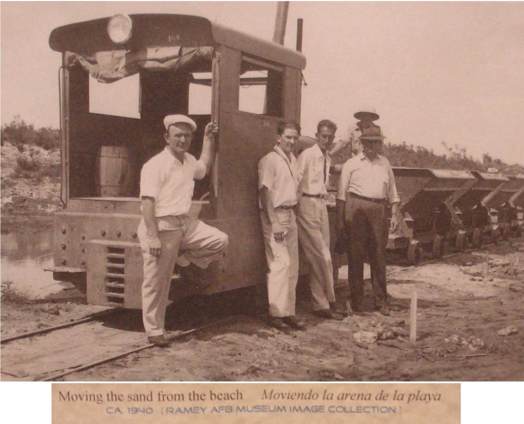
Ramey AFB, Aguadilla, PR – Ferrocarril industrial de arena / Industrial sand train


Ramey AFB (Borinquen Field) had a railroad connected to the American Railroad of Puerto Rico.  It also had an industrial railroad operation.  Most likely this was a private company. /  Ramey AFB (Borinquen Field) tuvo una conexión ferroviaria con la American Railroad.  Además tuvo un ferrocarril industrial.  Lo más probable era una compañía privada.

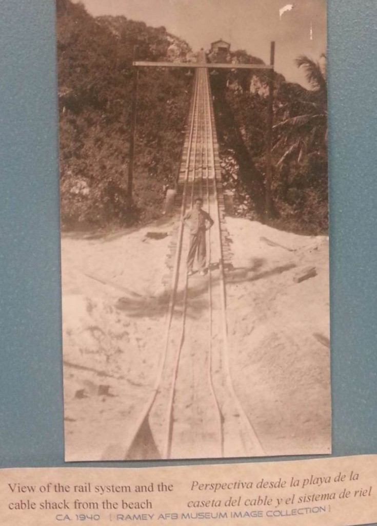
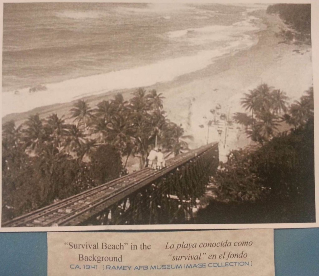
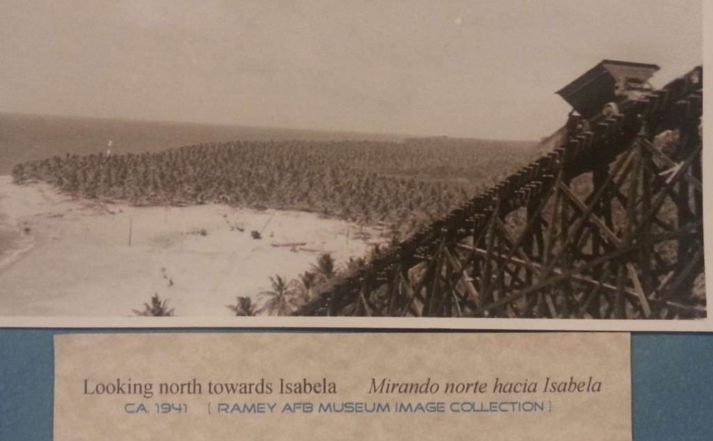
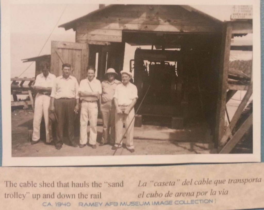
Sand used to make concrete for the hangars was extracted from Survival Beach.  A funicular and railroad was used to move the sand to the area of the construction site.

La arena para el concreto usado para la construcción de los hangares se obtuvo de la playa conocida como Survival Beach.  Se usó un funicular y un ferrocarril para llevar la arena al área de construcción.

The funicular is an inclined railway where cars are moved by a cable operated by a winch, a stationary engine.

El funicular es un ferrocarril que subía y bajaba una cuesta muy inclinada mediante el uso de cables operados por un malacate, un motor estacionario.

Casa de Máquinas (Malacate / “Winche”/ Torno) / Winch Station

Other funiculars on the Island / Otros funiculares en la Isla :
Ferrocarril del Sistema Hidroeléctrico del Río Blanco,  Naguabo / Railway of the Blanco River Hydroelectric System, Naguabo 

Mapas – Plano / Maps – Plans

Source / Fuente: National Atlas of the United States,  http://nationalatlas.gov .  Last
modified:  Thursday, 27-Jan-2011 17:18:20 CST.

U.S. Geological Survey.  Aguadilla [map], Puerto Rico.  1942.

Gracias a Ricardo Busquets, Director Ejecutivo del Borinquen Field / Ramey AFB Museum, por el uso de las fotos del museo.  Para más información, favor de comunicarse a las siguientes direcciones y teléfono:

Thanks to Ricardo Busquets, Executive Director of the Borinquen Field / Ramey AFB Museum, for the use of the museum photo collection.  For more information, call or write to the addresses or telephone:

Special thanks to Victor Díaz, Ramón Calero, and Elisaúl Vázquez for taking my son Juan Carlos Aponte and me to the Borinquen Field / Ramey AFB Museum and to see the Black Tunnel (largest tunnel) of Quebradillas.

Gracias especiales a Victor Díaz, Ramón Calero, y Elisaúl Vázquez por llevarnos, a mi hijo Juan Carlos Aponte y a este servidor Roger Aponte, al museo de Borinquen Field / Ramey AFB y a ver el Túnel Negro de Quebradillas.

Posted in Uncategorized | Comments Off on Ramey AFB, Aguadilla, PR – Ferrocarril industrial de arena / Industrial sand train

Hacienda Fe, Naguabo. (meter)

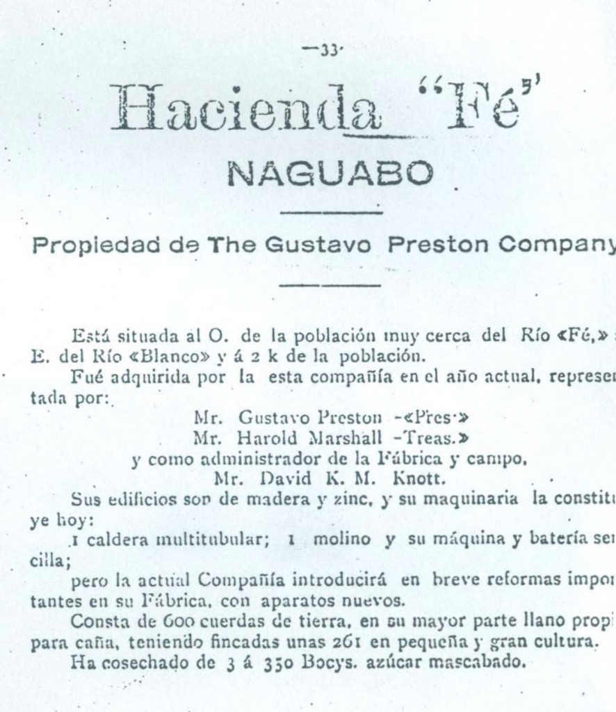
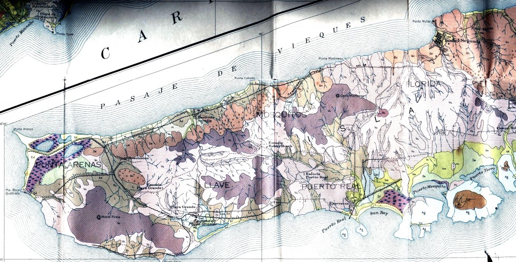
Hacienda Fe was the property of Gustavo Preston. He purchased a Porter #4811 in 1910, a small 0-4-0 saddletank locomotive, meter gauge. There is little information about the property which was located just northwest of Naguabo on the Rio Blanco. There was a very small mill, and the owner’s fields were the primary source of cane. For financial reasons, the mill closed by 1914. The locomotive would later be sold to Central Machete.  Dave Deyo.

La Hacienda Fe era propiedad de Gustavo Preston.   Para 1910 tenía una locomotora Porter, 0-4-0.  El ancho de vía era métrica.  La hacienda cerro en el 1914.  La locomotora fue vendida a la Central Machete.  Dave Deyo.

Ferreras Pagán, Luis. Biografía de las riqueza de Puerto Rico, tomo II. San Juan, PR: Tipografía de Luis Ferreras, 1902. P. 64. Print.  33.

Puerto Rico Railway and Locomotive Index by Eljas Pölhö, Helsinki, Findland.  20.

Source / Fuente:  Dave Deyo


Posted in Uncategorized | Comments Off on Hacienda Fe, Naguabo. (meter)