“Ferrocarril Nuevo” / “New Railroad”

Ancho de vía 24 in. No está en uso.
Este ferrocarril fue construido por la Porto Rico Railway, Light and Power Company durante los años 1929 y 1930. Esta era la misma compañía que operaba los trolleys de San Juan y también suplía electricidad.
El sistema incluía un ferrocarril funicular operado por un malacate (winch). Se usó para la construccíon y mantenimiento de un acueducto y represas en los ríos Cubuy, Sabana, Icacos, y Prieto localizados en El Yunque. Estos ríos forman el Río Blanco de Naguabo.
Material era llevado a una altura de 1400 pies aproximadamente usando el funicular y luego transferido al ferrocarril. Según entrevistas, el ferrocarril usó locomotoras de vapor y luego eléctricas.
Solamente observé tramos de vías al este de la represa del Río Icacos, pasando la represa del Río Prieto, hasta el área del funicular. Las vías corrían a lo largo del acueducto. Pero me dicen que la vía también se extendía al oeste de la represa del Río Icacos.
El sistema hidroeléctrico pertenece a la Autoridad de Energía Eléctrica de Puerto Rico.

Gauge: 24 in. Not in use.
This railway was constructed by the Porto Rico Railway, Light and Power Company during 1929 and 1930. This company also operated the San Juan trolleys and produced electricity.
The system included a funicular railway operated by a winch. It was used for the construction and maintenance of an aqueduct and dams on the Cubuy, Sabana, Icacos, y Prieto Rivers located in El Yunque. These rivers form the Río Blanco of Naguabo.
Material was taken up to a height of approximately 1400 ft on the funicular railway, where is was transferred to the railroad. According to interviews, the railroad used steam engines and later electric ones.
I only saw sections of tracks East of the Icacos River Dam, passing the Prieto River Dam and up to the funicular area. Tracks ran along the aqueduct. However, I was told that railway tracks also extended to the West of the Icacos River dam.
The hydroelectric system now belongs to the Autoridad de Energía Eléctrica of Puerto Rico.
————————

I walked from point A to Point B and back. The total distance was about 4.7 miles, approximately. Elevation at point A was at about 1627 ft elevation and at point B about 1342 ft., approximately. I saw segments of tracks East of the Icacos Dam. At point B was located the winch station, to operate the funicular; the Forebay, and the upper part of the funicular and penstock. See photos.
Caminé desde el punto A hasta el punto B. La distancia, ida y vuelta, fue de 4.7 millas, aproximadamente. La elevación era de 1627 pies en el punto A y 1342 pies en el punto B, aproximadamente. Vi segmentos de vía al este de la represa Icacos. En el punto B estaba el malacate, para operar el funicular, la Cámara de Carga, y la parte superior del funicular y tubería forzada. Ver fotos.
Tramos de vía / Track Segments


Área Represa Río Prieto / Río Prieto Dam Area


Funicular
 Krug, Frederick. “El proyecto de Río Blanco según fue constuido en 1929.” Revista de obras públicas, vol. 7, núm. 7; jul. 1930, page 173.
El funicular es un ferrocarril que subía y bajaba una cuesta muy inclinada mediante el uso de cables operados por un malacate, un motor estacionario. No se usaban locomotoras. / The funicular is an inclined railway where cars are moved by a cable operated by a winch, a stationary engine. No locomotives are used.
 Este funicular también fue construido por la Porto Rico Railway, Light and Power Company. (Represa Comerío II, Río La Plata) / This funicular was also constructed by the Porto Rico Railway, Light and Power Company (Comerío II Dam, La Plata River) (Foto / Photo: Lagos y Plantas Hidroeléctricas de Puerto Rico, Unidad de Inspección de Presas y Embalses de la AEE. Foto de José R. Bas García.)
Casa de Máquinas (Malacate / “Winche”/ Torno) / Winch Station
Aquí estaba colocado el malacate y era el área de la parte superior del funicular. / Here was the winch station and the upper part of the funicular.
 El malacate movía los vagones del funicular usando un cable de acero. / The winch moved the wagons on the funicular using a cable.
 Estamos al frente del malacate. Aquí empieza a descender el funicular y se encuentra la tubería forzada / We are in front of the winch. Here the funicular starts to descend and where the penstock starts.
-800-900") Malacate más pequeño, usado en una de las grúas de caña de Lajas. Observe el cable enroscado en el rolo metálico. / Winch used to operate a derrick at one of the loading stations in Lajas.
Malacate más pequeño, usado en una de las grúas de caña de Lajas. Observe el cable enroscado en el rolo metálico. / Winch used to operate a derrick at one of the loading stations in Lajas.

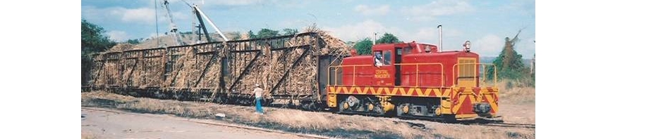
Malacate usado en la Central Aguirre para mover los vagones hacia el virador (área de vacío de vagones). Observe el cable colocado en el vagón. / Unloading facilities of sugar cane at Central Aguirre. Notice the use of the winch to move cars.
Cámara de Carga y Tubería Forzada / Forebay and Penstock
La Cámara de Carga y Tubería Forzada se encuentran al lado del malacate y el funicular. / The Forebay and Penstock are located next to the winch and funicular.


La parte superior del funicular y su trayectoria descendiente, cubierta en maleza, a lo largo de la tubería forzada / Upper part of the funicular and its downward path, covered with vegetation, along the penstock.
Por la tubería forzada el agua, recogida por el acueducto, pasa a presión hacia las turbinas de la planta hidroeléctrica. / Water from the aqueduct reaches the penstock moving under pressure towards the turbines at the hydroelectric plant.
 Embalse Río Blanco, Naguabo / Río Blanco Reservoir
——————
 Con mi hijo menor Juan Carlos Aponte Guadalupe. Gracias por su ayuda en esta aventura.
——————
Fuentes / Sources:
Bentz, Ray & Gwenn. Los Prieto Falls on El Yunque’s South Side. March 8, 2011 < http://www.puertoricodaytrips.com/los-prieto-falls >. Please see their GPS coordinates: Parking on Road 191: (18.265347, -65.800612), Rio Sabana Rec Area and Trail Head: (18.267365, -65.794704), Los Prieto Falls: (18.256903, -65.779173)
Deyo, Dave. E-mail on March, 1, 2011. Puerto Rican Railroad Historian and friend. Dave informed me of the existence of the railway. He found a photo taken by a tourist on Flickr of the railroad tracks. See his page on the railroads of Puerto Rico at flickr: http://www.flickr.com/photos/50893925@N04/
Krug, Frederick. “El proyecto de Río Blanco según fue constuido en 1929.” Revista de obras públicas, vol. 7, núm. 7; jul. 1930. http://www.conucopr.org/ViewRecord.do?id=11123513 . Favor de ver / Please see: Proyecto del Río Blanco
Latimer Torres, Eugenio. Historia de la Autoridad de Energía Eléctrica : implantación de los sistemas de luz y fuerza en Puerto Rico 1893-1993. San Juan, P.R.: First Book Pub. of P.R. 1997 (1999 printing)
Ortiz Zayas, Jorge, Ph.D., Ferdinand Quiñones, Silvana Palacios, Angeles Vélez, y Hernan Mas. Características y Condición de los Embalses Principales en Puerto Rico, 4 de marzo de 2004 (Borrador): Departamento de Recursos Naturales y Ambientales. April 15, 2011 < http://www.drna.gobierno.pr/oficinas/arn/agua/negociadoagua/planagua/estudios/INFORME_EMBALSES_2MAR04.pdf>. Ver página 145.
Phillips, Robin. El Yunque, Puerto Rico, Phillips Family Budget Cabin. http://www.rainforestfruitfarm.com/rainforesttours.html . April 15, 2011. I also found information at http://www.tripadvisor.com/Travel-g147324-s302/El-Yunque-National-Forest:Puerto-Rico:Getting.Around.html. Phillips young son, Jim, was my guide. Mr. Phillips was very nice and gave me a general idea of the railway’s history. His information is based on informal conversations he has had throughout the years.
Soler-López, L.R., 2007, Sedimentation survey of Lago Icacos, Puerto Rico, March 2004: U.S. Geological Survey Scientific Investigations Report 2007-5033, 19 p., 1 pl. See: http://pubs.usgs.gov/sir/2007/5033/
U.S Geological Survey, El Yunque and Humacao quadrangles, Puerto Rico [Topographic Maps]. 1:24,000. 7.5 Minute Series. Washington D.C.: USGS, 1967.