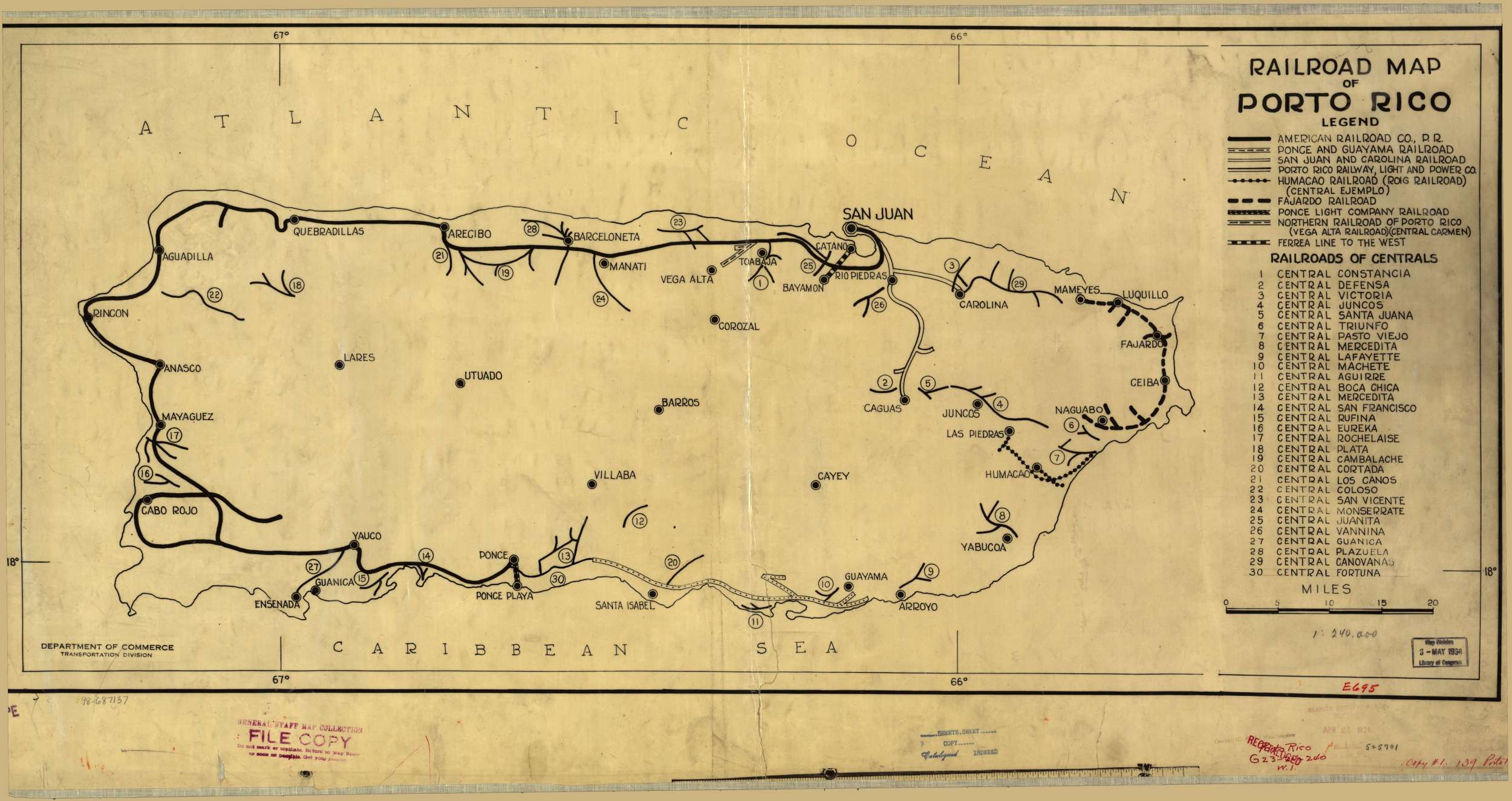
Railroad Map of Porto Rico (1924) / Mapa Ferroviario de Puerto Rico (1924)
Railroad map of Porto Rico. Map (39 x 89 cm, Scale [ca. 1:255,000]). United States. Dept. of Commerce. [S.l.], 1924. American Memory Map Collection. Library of Congress Geography and Map Division, Washington, D.C. 20540-4650. May 17, 2011 < http://hdl.loc.gov/loc.gmd/g4971p.ct000303>
Comentarios:
Faltan algunos ferrocarriles por diversas razones. Por ejemplo, el Tranvía de Mayagüez, Central Cayey y las centrales de Vieques. Otros ferrocarriles ya no existían o todavía no se habían formado. Por ejemplo, Central Utuado, Centrales Guamaní y Caribe.
Comments:
Some railways are not mentioned. For instance, the Mayagüez tram and the railroads of the island of Vieques. Other railroads no longer existed or had not been constructed. For instance, Central Utuado, Centrales Guamaní and Caribe.

