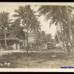
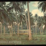
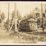
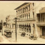
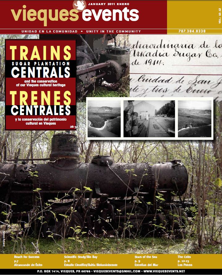
Rabin, Robert. “Trains Sugar Plantation Centrals…Trenes Centrales…

Rabin, Robert. “Trains Sugar Plantation Centrals and the conservation of our Vieques cultural heritage – Trenes Centrales y la conservación del patrimonio cultural en Vieques.” vieques events Jan. 2011: 28-31. Web. 17 Feb. 2013. <http://www.viequesevents.net/pdf/archives/VE0111.pdf>.  Used with permission / Usado con permiso

 See article / Ver artículo


Posted in Uncategorized | Comments Off on Rabin, Robert. “Trains Sugar Plantation Centrals…Trenes Centrales…

Mapas Topográficos Históricos del USGS (U.S. Geological Survey) / USGS Historical Topographic Maps (Online)

USGS Historical Topographic Maps (Online)
Mapas Topográficos Históricos del USGS (U.S. Geological Survey)

The U.S. Geological Survey has put online among others, the Puerto Rico historical topographic maps. The railroad routes of many of the companies that operated in Puerto Rico can be seen.  The maps can be seen and downloaded in PDF.

El U.S. Geological Survey ha puesto los mapas topográficos históricos de Puerto Rico en el Internet.   Se pueden ver y bajar los cuadrángulos en PDF, en algunos casos para diferentes años.   Se pueden observar las rutas de varios de los ferrocarriles de Puerto Rico.   Estos mapas son una gran ayuda para los maestros, estudiantes, y todas las personas que le interese la historia y geografía de Puerto Rico.

See / Ver:
The National Map: Historical Topographic Map Collection
(http://nationalmap.gov/historical/)

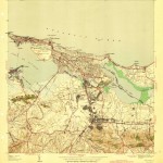
Ejemplo de mapa topográfico de Puerto Rico: San Juan

Dale un “click” a la foto / Click on the photo

Cuadrángulo de San Juan / Año 1941 / 1:30000 / 8 MB
Source / Fuente:
Maps- Courtesy of USGS – U. S. Geological Survey / http://www.usgs.gov. (Home Page) and The National Map: Historical Topographic Map Collection / http://nationalmap.gov/historical/)

See / Ver:
San Juan – Carolina and/y San Juan – Bayamón – Toa Baja

Se pueden observar las rutas del tren desde San Juan hasta parte de Bayamón y Carolina. Se puede ver la localización de la ruta del trolley de San Juan a Santurce (Compare con San Juan – Carolina and/y San Juan – Bayamón – Toa Baja), la Central San José, Terminal de San Juan, y la Universidad de Puerto Rico entre otros lugares.

Los lados del mapa identifican los mapas topográficos que le siguen al de San Juan.  Por ejemplo el cuadrángulo hacia el oeste es el de Bayamón y hacia el este es el de Carolina.

Dos formas para bajar los mapas:

Forma 1 –  Visite la página – The National Map: Historical Topographic Map Collection Dale un click al enlace – http://geonames.usgs.gov/pls/topomaps/
En el encasillado “State” dale un click a la flecha y escoge a Puerto Rico.
Dale un click a “Search”.

Aparece una lista extensa de todos los cuadrángulos de Puerto Rico.  Baje los cuadrángulos que le interesen dándole un click en la columna “Download GeoPDF”.  Personalmente, a mi me gustó esta forma y  bajé los mapas 1:30000.  Observe que los mapas son grandes.

Forma 2 –  En la página  The National Map: Historical Topographic Map Collection dale un click al enlace USGS Store: Map Locator and Downloader .
Sale un cuadro con parte del mapa de Estados Unidos y el Caribe.
Dale clicks al mapa de Puerto Rico para agrandarlo y cubrir el cuadro.
(Puedes centralizar la Isla con la “manito”)
Donde está “Mark Points”, dale un click.
Dale un click a los lugares del mapa que quieres ver.
Salen marcadores rojos en forma de globo.
Dale un click a los marcadores.  Salen los mapas topográficos correspondientes.
Dale un click  en la columna  “Download” para bajar el mapa correspondiente.
Observe que los mapas son grandes.

Posted in Uncategorized | Comments Off on Mapas Topográficos Históricos del USGS (U.S. Geological Survey) / USGS Historical Topographic Maps (Online)

AMIGOS DEL TREN DE ISABELA (ATI)


Modelo construído por el Arquitecto Julio González
Model built by Julio González, Architect
Scale / Escala : 1:87
Colección Victor Díaz, fundador – Los Amigos del Tren Isabela

El grupo AMIGOS DEL TREN DE ISABELA (ATI) fue fundado por Victor Díaz de Isabela. Se fomenta el interés en los ferrocarriles de Puerto Rico.  Algunas de las actividades programadas para el 2013:

Reuniones mensuales en Isabela (miembros son avisados antes de cada actividad).

Preparación de un libro sobre la Historia del tren en Isabela.

Excursiones a lugares donde había operaciones ferroviarias (Puentes, túneles, centrales, estaciones, etc.).

Visita a museos, parques, etc. y a la Convención de la Caña más un proyecto de restauración de un tren.

Para el verano hay un viaje para E.U. para dar un paseo en un tren de turismo con máquina de vapor.

Contacto:

Direccion postal: Amigos Del tren De Isabela, P.O. Box 531, Isabela P.R. 00662
Teléfono: 787-647-3173

Posted in Uncategorized | Comments Off on AMIGOS DEL TREN DE ISABELA (ATI)

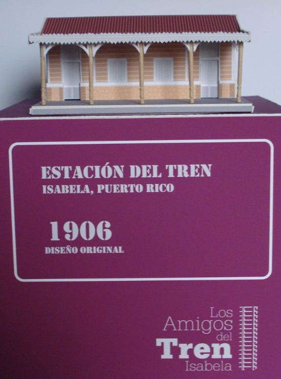
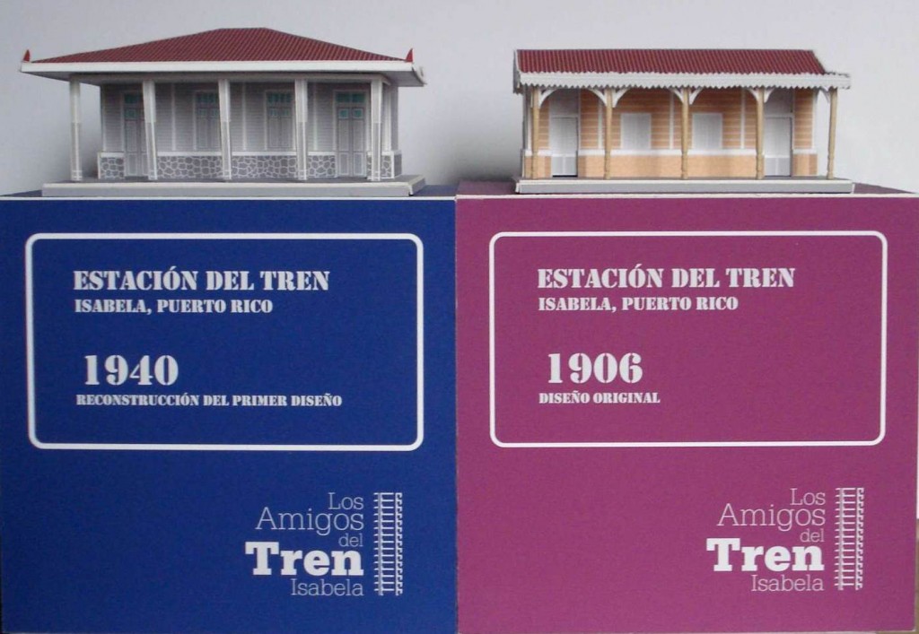
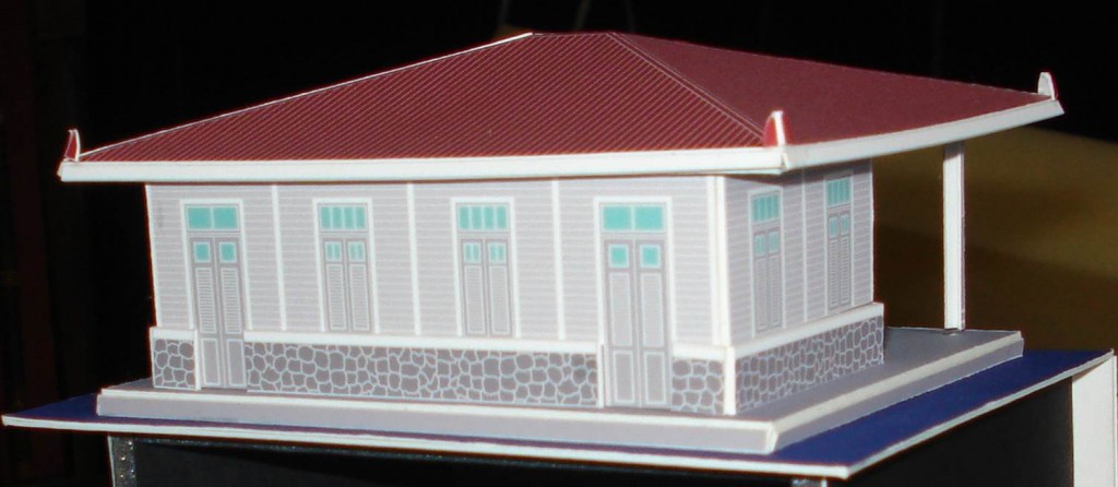
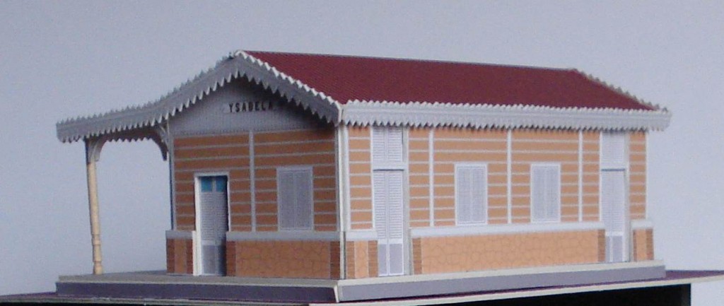
Modelo Estación de Isabela / Model Isabela Station


Estación c1940

Estación 1906

 —

Modelos construído por el Arquitecto Julio González
Models built by Julio González, Architect
Scale / Escala : 1:87
Colección Victor Díaz, fundador – Los Amigos del Tren Isabela

Source / Fuente: National Atlas of the United States,  http://nationalatlas.gov .  Last
modified:  Thursday, 27-Jan-2011 17:18:20 CST.

Ver otros modelos / See other Models – Models / Modelos

Posted in Uncategorized | Comments Off on Modelo Estación de Isabela / Model Isabela Station

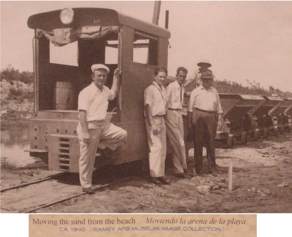
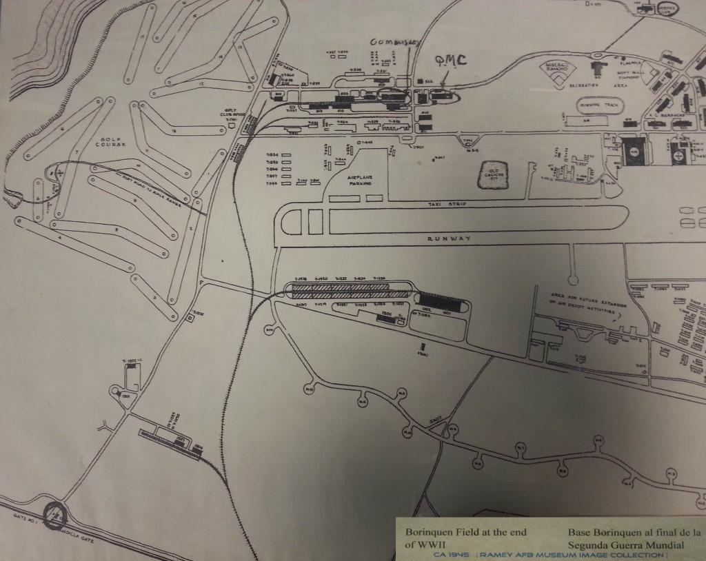
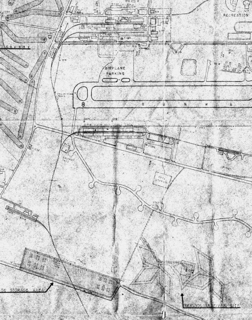
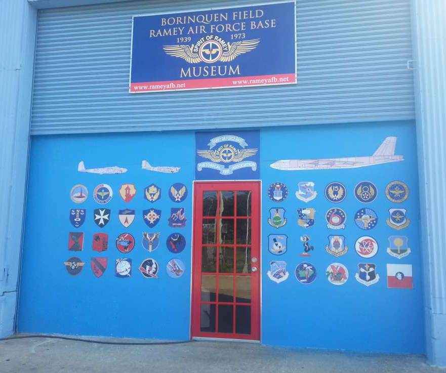
RAMEY AFB MUSEUM IMAGE COLLECTION


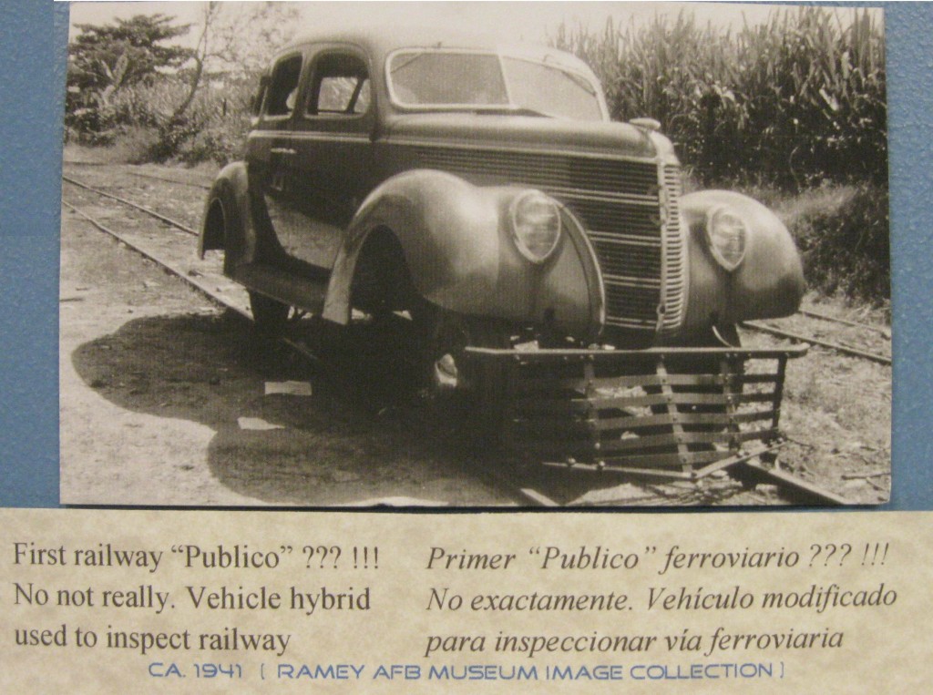
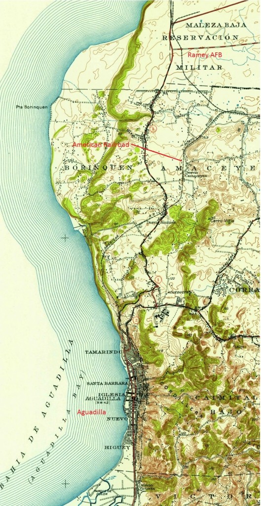
Ramey AFB (Borinquen Field) had a railroad connected to the American Railroad of Puerto Rico.  It also had an industrial railroad operation.  Most likely this was a private company. /  Ramey AFB (Borinquen Field) tuvo una conexión ferroviaria con la American Railroad.  Además tuvo un ferrocarril industrial.  Lo más probable era una compañía privada.

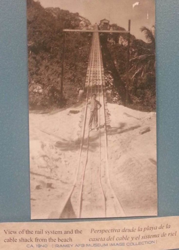
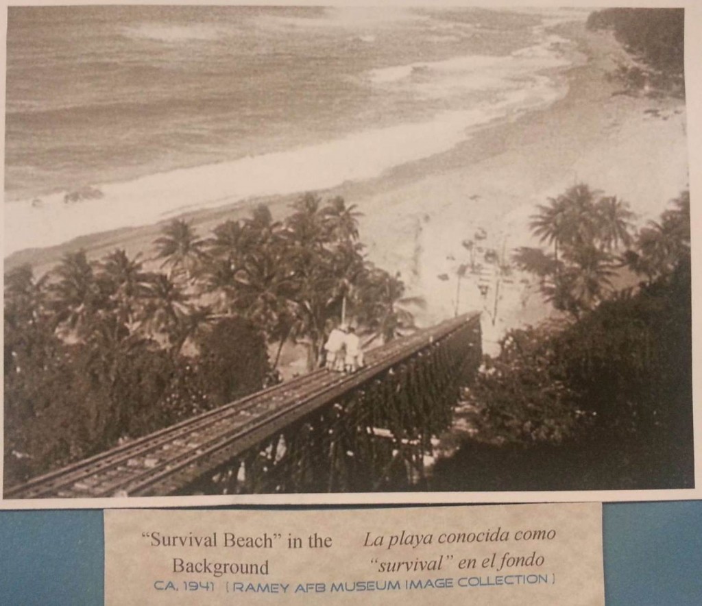
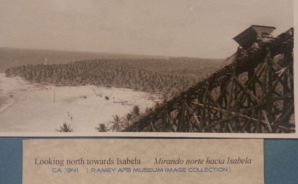
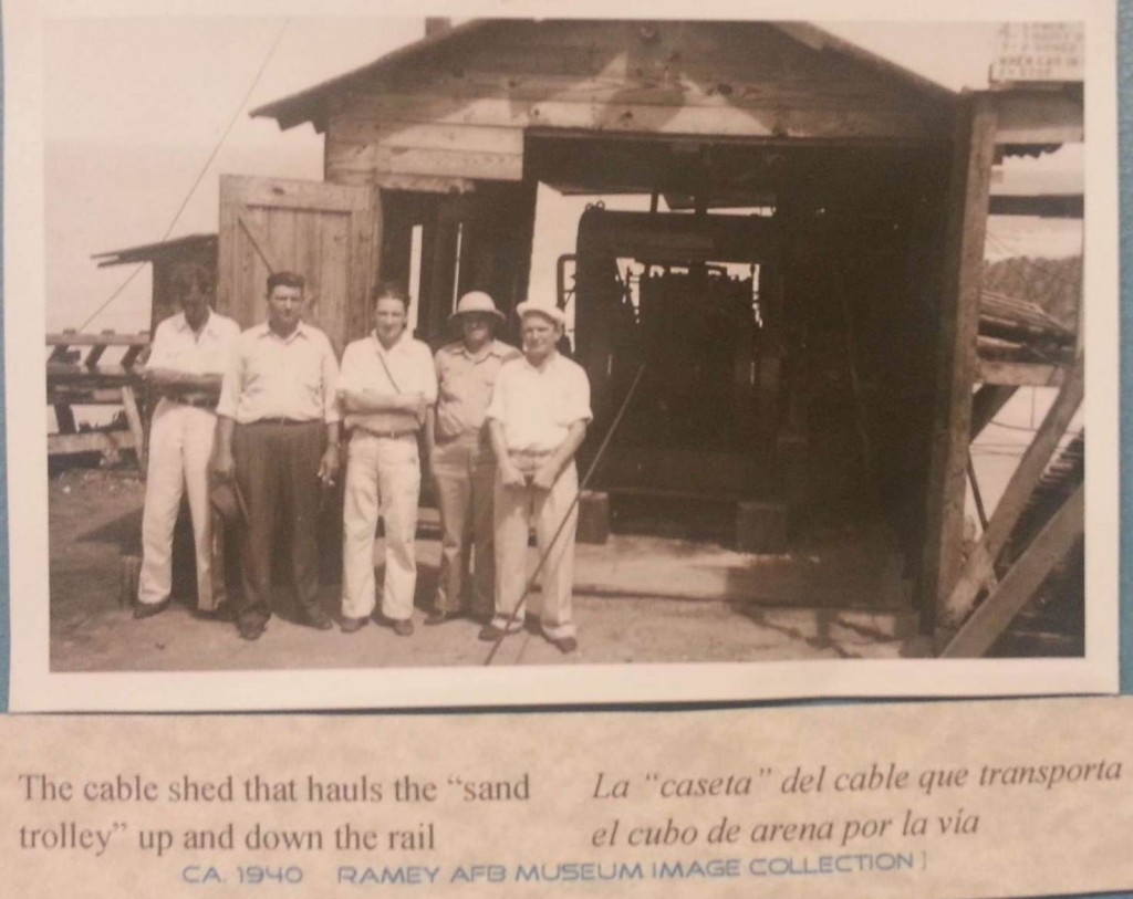
Sand used to make concrete for the hangars was extracted from Survival Beach.  A funicular and railroad was used to move the sand to the area of the construction site.

La arena para el concreto usado para la construcción de los hangares se obtuvo de la playa conocida como Survival Beach.  Se usó un funicular y un ferrocarril para llevar la arena al área de construcción.

The funicular is an inclined railway where cars are moved by a cable operated by a winch, a stationary engine.

El funicular es un ferrocarril que subía y bajaba una cuesta muy inclinada mediante el uso de cables operados por un malacate, un motor estacionario.

Casa de Máquinas (Malacate / “Winche”/ Torno) / Winch Station

Other funiculars on the Island / Otros funiculares en la Isla :
Ferrocarril del Sistema Hidroeléctrico del Río Blanco,  Naguabo / Railway of the Blanco River Hydroelectric System, Naguabo 

Mapas – Plano / Maps – Plans

Source / Fuente: National Atlas of the United States,  http://nationalatlas.gov .  Last
modified:  Thursday, 27-Jan-2011 17:18:20 CST.

La base tenía una conexión con la American Railroad.

The base had a connection with the American Railroad.

Ramey Air Force Base Track Plan (Plano de vías).  Date on photo – 12 Aug 1951.

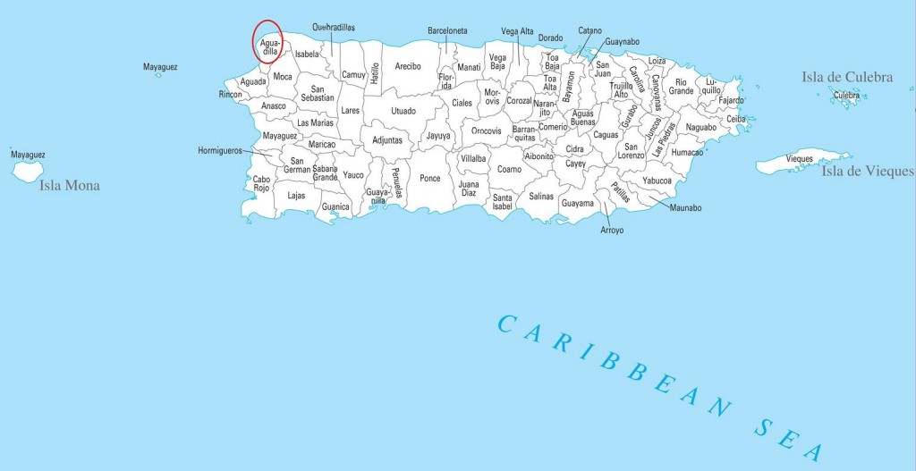
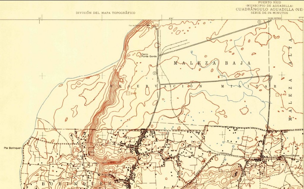
U.S. Geological Survey.  Aguadilla [map], Puerto Rico.  1942.

Source / Fuente:
Maps- Courtesy of USGS – U. S. Geological Survey / http://www.usgs.gov. (Home Page) and The National Map: Historical Topographic Map Collection / http://nationalmap.gov/historical/)

Gracias a Ricardo Busquets, Director Ejecutivo del Borinquen Field / Ramey AFB Museum, por el uso de las fotos del museo.  Para más información, favor de comunicarse a las siguientes direcciones y teléfono:

Thanks to Ricardo Busquets, Executive Director of the Borinquen Field / Ramey AFB Museum, for the use of the museum photo collection.  For more information, call or write to the addresses or telephone:

Special thanks to Victor Díaz, Ramón Calero, and Elisaúl Vázquez for taking my son Juan Carlos Aponte and me to the Borinquen Field / Ramey AFB Museum and to see the Black Tunnel (largest tunnel) of Quebradillas.

Gracias especiales a Victor Díaz, Ramón Calero, y Elisaúl Vázquez por llevarnos, a mi hijo Juan Carlos Aponte y a este servidor Roger Aponte, al museo de Borinquen Field / Ramey AFB y a ver el Túnel Negro de Quebradillas.


Posted in Uncategorized | Comments Off on RAMEY AFB MUSEUM IMAGE COLLECTION

Ponce – Trolleys / Tranvías

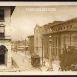
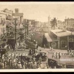
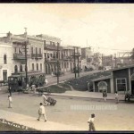
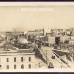
These photos are a selección from the Rodríguez Archives (José Luis and José Alfredo Rodríguez).  TROLLEYS. Please see Archivo Histórico Y Fotográfico De Puerto Rico’s photostream . Photos used with permission / Fotos usadas con permiso.

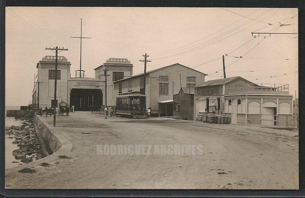
PONCE – Muelle de Ponce & Passenger Trolley – Real Photo Post Card unused c. 1910-1920’s.
Two businesses are on the right. One is named El Cosmopolita (appears to be a restaurant). Trolley Car No. 16 waiting on the track.

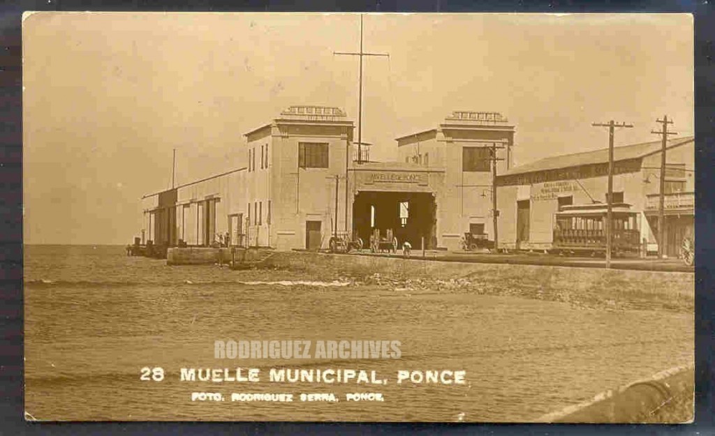
RS # 28 Type 4 – PONCE – Muelle Municipal. – Mailed from Ponce MAY 12, 1926

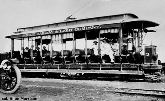
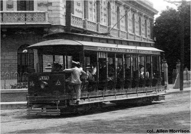
Complementary Photo.  Observe the name of the company:  Ponce Railway & Light Company.  Trolley was also named Ponce Electric at a different time.  El tranvía llegó a llamarse Ponce Electric.  Photo used with permission / Fotos usadas con permiso.  http://www.tramz.com/pr/pc.html

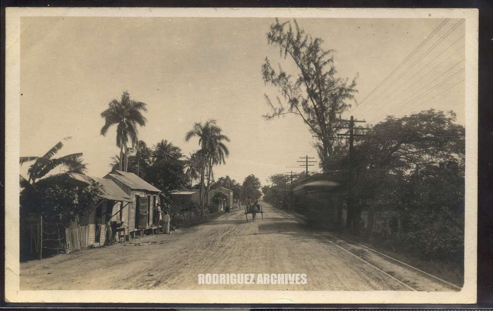
Phipps, Photo Group 2 – PONCE – Playa Road, Ponce, Porto Rico – Unused.
Trolley car in motion on the right. Thomas E. Phipps, Photographer, Ponce, P.R.
Comments and faves

PR RR Historian [deleted] (36 months ago):

From one of the maps I have showing railroads, the trolley line was
on the eastern side of the road most of the way to Playa Ponce from
the outskirts of the city of Ponce. It would be hard to deduce which
way the trolley is going, as we cannot see if the motorman is in the
end facing us and also we cannot see the trolley pole in the shot.
By the position of the poles, one on each end of the car, we could
determine its direction, as the pole that is up is on the rear of the car.
The motorman must drop one and raise the other in order to change
direction of movement. The poles were pulled down by a cord
which was tied to a circular hitch (generally) at each end of the trolley.
So a car going eastward would have the rear or westward pole up.
At this time in the history of photography, film speeds were extremely
slow and moving objects were often blurred, as is the case here.
Ponce’s trolleys were products of the Brill Co. of Philadelphia and
the company was long managed by a Boston firm, Stone & Webster.
The trolleys were numbered in the even numbers, starting with
#2. Odd numbers were assigned to at least one electrified freight
unit and additional freight cars. In one of the photos I have, there
is both a freight unit and a passenger trolley parked on the Ponce
Pier in the harbor, just beyond Playa Ponce. Some freight was taken
from ships at the pier and dropped mostly at businesses in the
old warehouse district at Playa Ponce. The Ponce trolleys shared
their access to the pier with the American railroad, and later when
the trolley was discontinued, the ARRCo. operated on some of
the trolley company’s Playa Ponce sidings as well as the rails to
the pier.

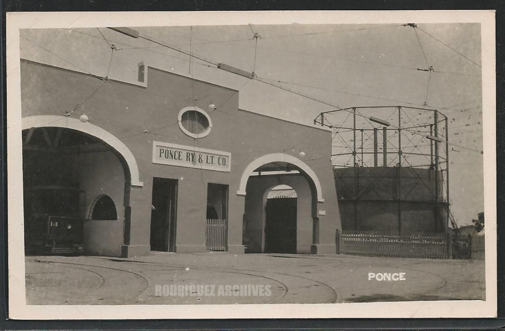
PONCE – Ponce Ry. & Lt. Co. Trolley Barn – Real Photo Post Card unused c. 1910’s) Car No. 14 is in the garage on the left. Ponce Railway & Light Company.

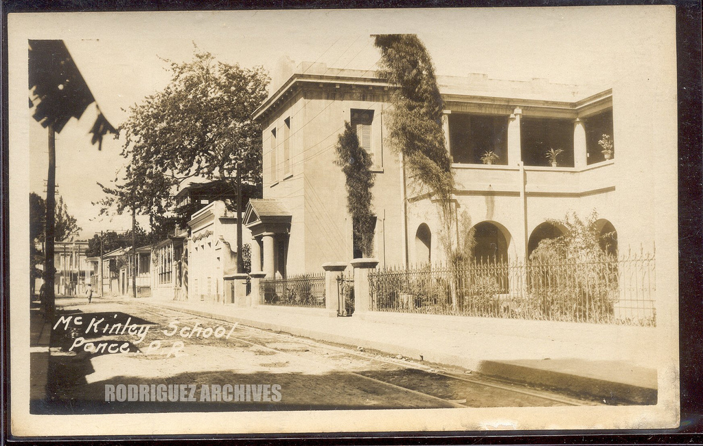
MOSCIONI RPPC (Attributed) ~ PONCE – McKinley School, Ponce, P. R. – Unused
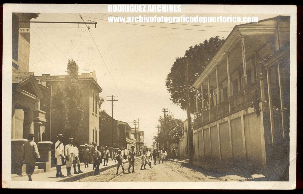
Calle Salud / Salud Street

PONCE RPPC – Untitled [Street Scene, School on Left] – Mailed from Ponce MAY 21, 1912
TAKE NOTE OF THE TROLLEY CABLE ABOVE WITH A STOP SIGN. TROLLEY TRACKS BELOW. WHICH SCHOOL COULD THIS BE?  (PONCE – McKinley School)

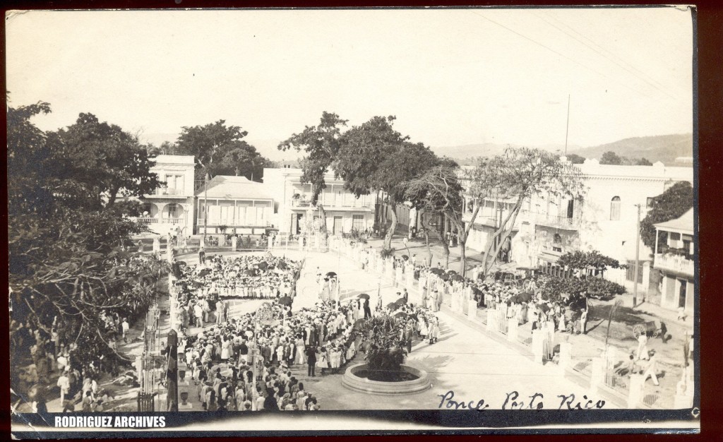
PONCE Real Photo Post Card – Untitled view of Crowds at Plaza Degetau Event – Mailed from Ponce FEB 23, 1912.
Plaza Degetau, Ponce, PR. Appears to be the unveiling of a statue or such. Possibly the statue of Juan Morel Campos which is located there. Many school children are in a line up near it.

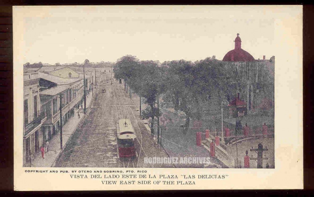
O&S Set 2 – PONCE – Lado Este de la Plaza ‘Las Delicias’ – Undivided Back Unused c. 1905 & Divided Back unused c. 1908.
Published by Otero & Sobrino, Ponce, PR (O&S)

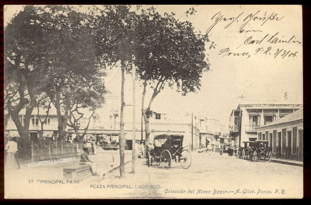
CNB-A. GILOT Set 1 No. 17 – PONCE – Plaza Principal Lado Sud. – Mailed Ponce MAR 3, 1906.
Published by Coleccion del Nuevo Bazar de A. Gilot (CNB)

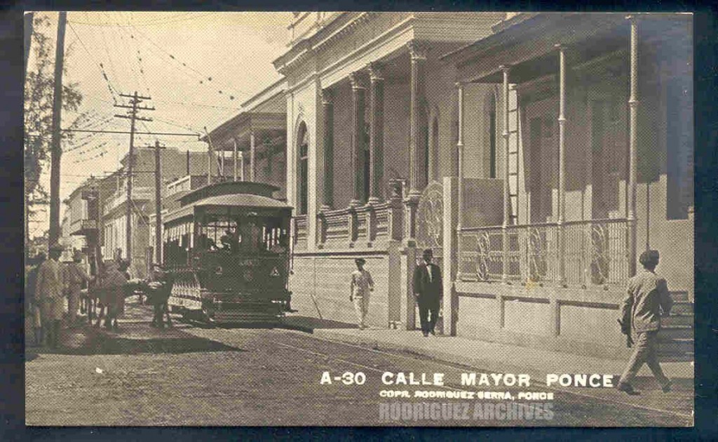
RS #A-30 – PONCE – Calle Mayor. – Unused c. 1920’s.  Trolley Car No. 2

Complementary Photo.  Trolley in front of the French Hotel.  Avenida Hostos and Marina St.  Photos used with permission / Fotos usadas con permiso.  http://www.tramz.com/pr/pc.html

Avenida Hostos y calle Marina, al lado de la estación de la American Railroad.  American Railroad was next to the hotel. PONCE – HOTELS.

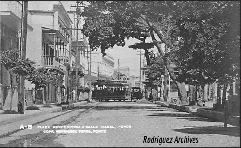
PONCE, P. R. – Plaza Muñoz Rivera & Calle Isabel – Real Photo PC # A-5 by Rodriguez Serra

See / Ver:

Ponce Electric Trolley
Tranvía Eléctrico de Ponce

The Tramways of Ponce, Puerto Rico
by Allan Morrison


Posted in Uncategorized | Comments Off on Ponce – Trolleys / Tranvías

Mayagüez – Trolleys / Tranvías

These photos are a selection from the Rodríguez Archives (José Luis and José Alfredo Rodríguez).   Please see:  Archivo Histórico y Fotográfico de Puerto Rico – Colección Rodríguez , and Archivo Histórico Y Fotográfico De Puerto Rico’s photostream .
Photos used with permission / Fotos usadas con permiso.
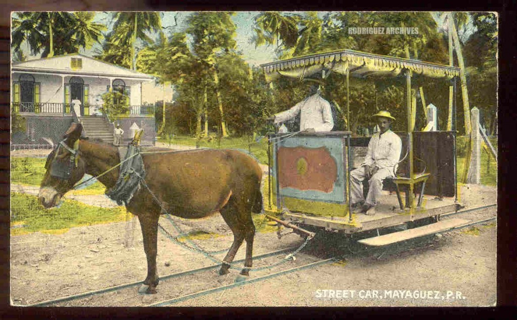
Liebig # 109 – Street Car, MAYAGUEZ, P. R. (Mule Drawn Trolley) – Unused & Mailed San Juan FEB 5, 1912.)

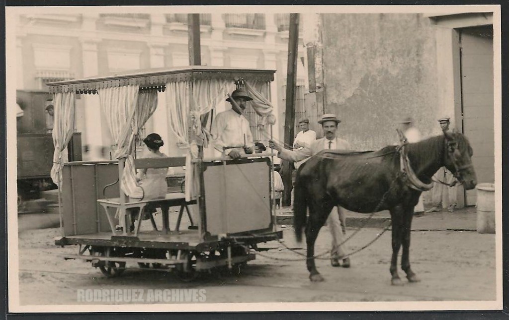
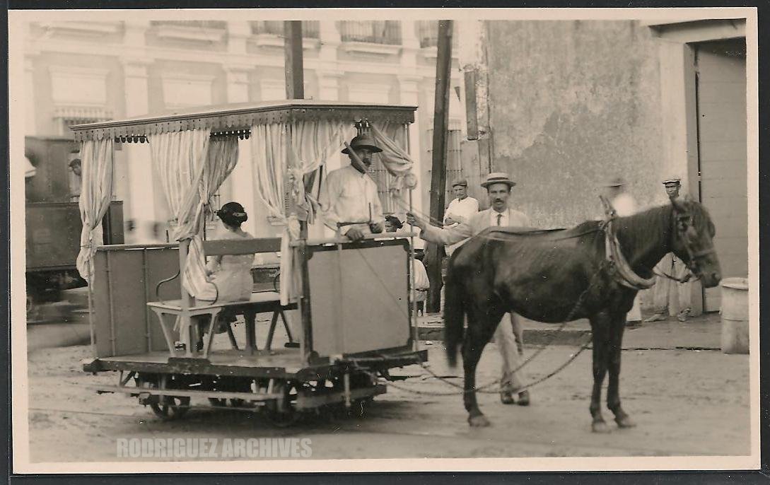
MAYAGUEZ – Horse Drawn Trolley – Untitled Real Photo Post Card unused & Mailed AUG 8, 1921)

Exceptional RPPC of an early horse drawn trolley.

PR RR Historian [deleted] (35 months ago)

Probably most people miss an important item in this photo. At the    left, behind the animal-drawn Mayaguez Tramway car is a French     Cail locomotive probably headed to piers to switch or pick up cars of freight. The tracks of the tramway crossed the Cia. Ferrocarriles de PR tracks here, so it was prudent for the driver of the tram to check out the tracks before poking across them with his rig.

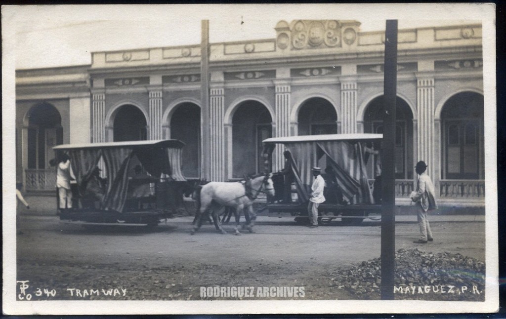
TP Co. 340 RP – MAYAGUEZ – Tramway, Mayaguez, P. R.)

TPCo. stands for Tourist Photographic Company, the name that Hayman gave his shop and studio in Mayaguez. This series is numbered and carries the TPCo logo.

Probably on Mendez Vigo Street. Nice architectural building.

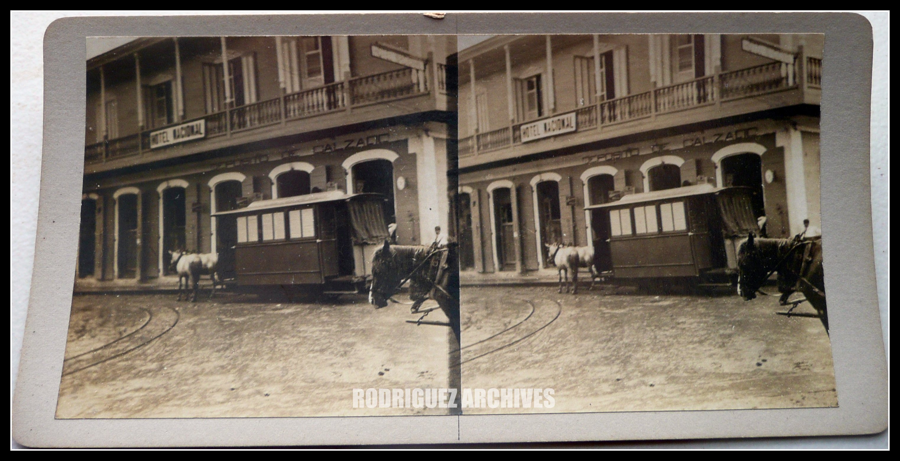
Phipps, Photo Group 2 – MAYAGUEZ – Horse Car Trolley at Mayaguez, P. R. – Unused.
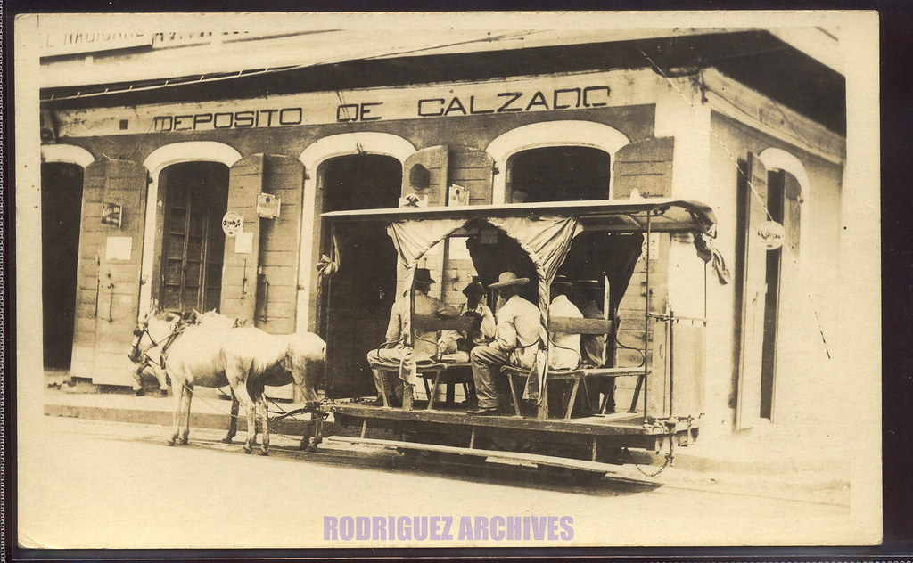
Horse-drawn trolley in front of Shoe store. Thomas E. Phipps, Photographer, Ponce, P.R.

Phipps, Photo Group 2 – MAYAGUEZ – Horse Car Trolley at Mayaguez, P. R. – Unused.)  Horse-drawn trolley in front of Shoe store. Thomas E. Phipps, Photographer, Ponce, P.R.

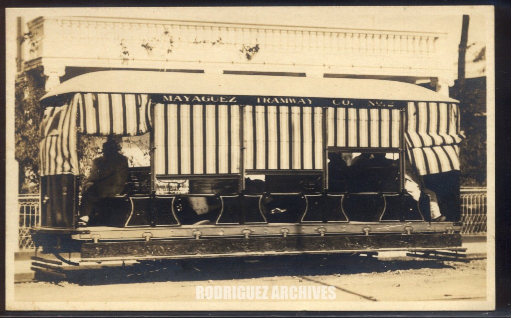
Hayman’s Tourist Shop RP Type 2 – MAYAGUEZ – Mayaguez Tramway Co. No. 2 [Battery Operated Trolley Car])

A full card close-up of the trolley with its curtains down used to protect passengers from rain, heavy sun, etc.

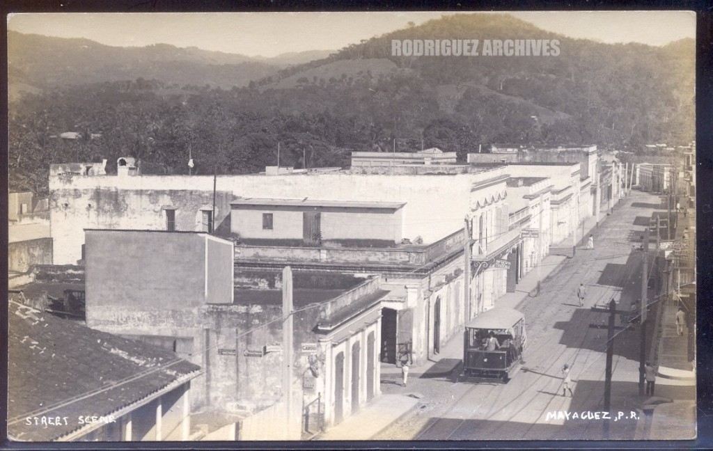
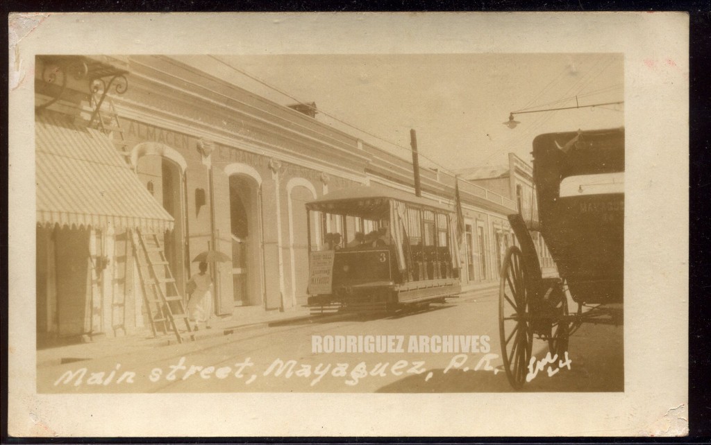
LM RP card 6 – Electric Trolley on Main Street, Mayaguez, P. R.)

The store where the trolley is has a sign that says Almacenes de Franco & Co. Sucesores de …” Trolley has a poster announcing a baseball game. The carriage on the right is a “publico” or taxi and has the Mayaguez sign on the back.

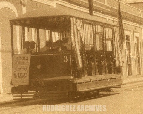
LM RP card 6a – Electric Trolley on Main Street, Mayaguez, P. R – Trolley closeup)

Real Photo Post Card views of the electric trolley is Mayaguez are rare. This is car No. 3. A poster hangs in front announcing a Base Ball Game to take place in Mayaguez.

PR RR Historian [deleted] (35 months ago)

Tranvia Electrico Mayaguez’s American Car & Foundry Co. battery-
electric trolley car is shown climbing up to the plaza on Calle
McKinley. This is one of four such cars purchased by the new
owner of the franchise formerly held by the animal-drawn tramway.
Built in 1915 at AC&F’s Jackson & Sharp plant and equipped with
Gould storage batteries, these 30″ gauge beauties attempted to
offer speedier transportation up from the waterfront area to the
plaza. But by later in the day, the batteries began to dwindle in
power, often stranding the car or forcing passengers to disembark
and push. The original “ferrocarril de sangre” used an uncommon
type of rail with crossties, in the form of a slitted tube and designated
the Pickett style. The electric trolley had to lay all new trolley-type
rail of 30″ size. Those nasty gasoline powered automobiles, publicos, clandestine taxis and bus companies drove this less-
efficient relic out of business. Cars were last seen as late as the
1940s stored next to the abandoned station and freighthouse of
the Linea Ferrea del Oeste in Bayamon.

Cars were charged at the ice and electric plant in Mayaguez.

Hayman’s Tourist Shop RP Type 1 – MAYAGUEZ – Street Scene, Mayaguez, P. R. [Battery Trolley Car No. 1])

See / Ver:

Tramways of Puerto Rico / Tranvías de Puerto Rico.  Copyright by Allen Morrison.  Mayagüez –  http://www.tramz.com/pr/my.html   –   The Tramways of Mayagüez

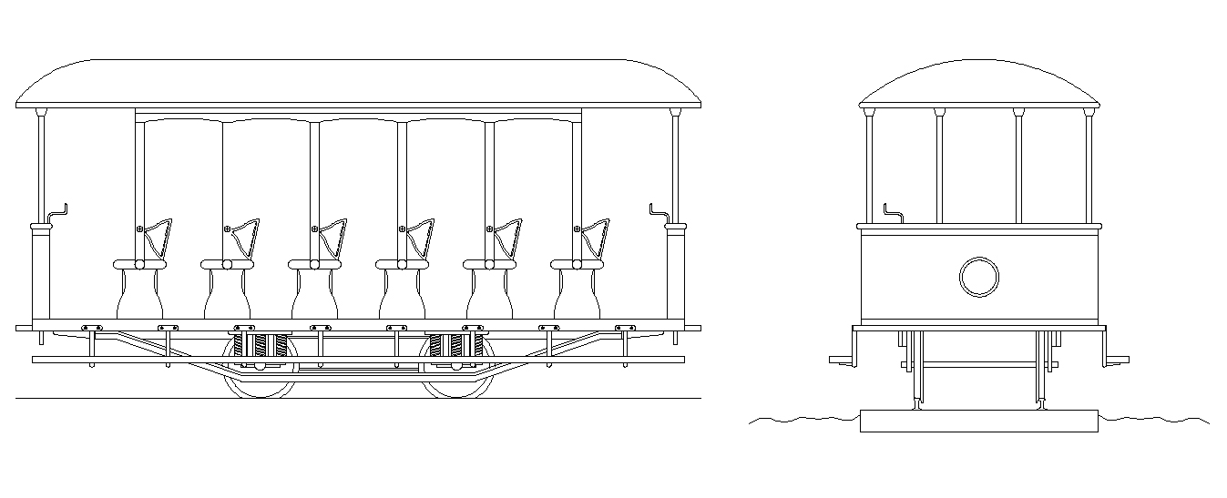
Manuel Durán (Architect)  Collection (1)
Drawings, photos, etc., (Mayagüez) / Dibujos, fotos, etc., (Mayagüez)

http://ferrocarrilespr.rogerseducationalpage.com/wp-content/uploads/2011/06/Tranvia-de-Mayaguez-2.jpg


Posted in Uncategorized | Comments Off on Mayagüez – Trolleys / Tranvías

San Juan – Trolleys / Tranvías

These photos are a selección from the Rodríguez Archives (José Luis and José Alfredo Rodríguez).   Please see:  Archivo Histórico y Fotográfico de Puerto Rico – Colección Rodríguez , and Archivo Histórico Y Fotográfico De Puerto Rico’s photostream .
Photos used with permission / Fotos usadas con permiso.

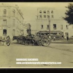
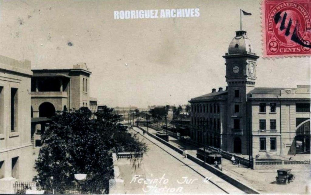
MOSCIONI (ATTRIBUTED) RPPC ~ SAN JUAN – Recinto Sur [showing Trolleys & R. R. Station] – Mailed from Aguadilla JUL 7, 1925.  https://www.flickr.com/photos/fredandrebecca/4570380522/in/photostream/.

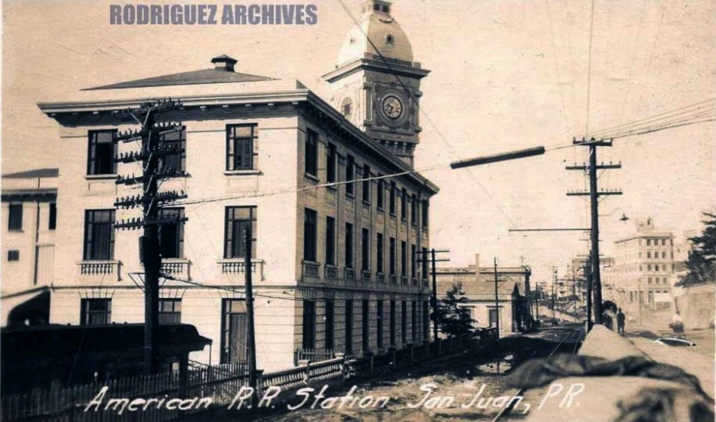
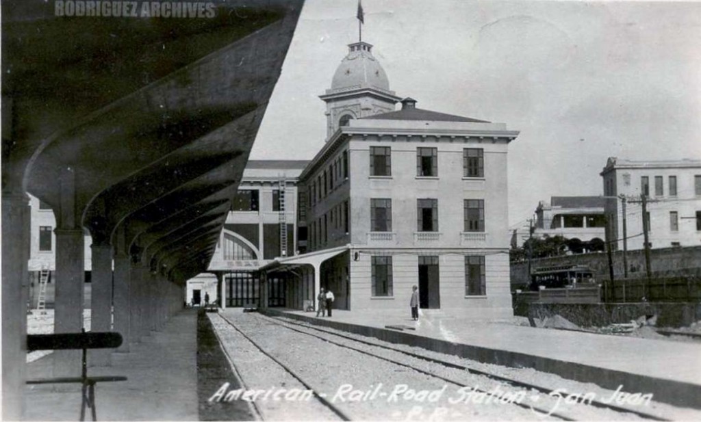
MOSCIONI (ATTRIBUTED) RPPC ~ SAN JUAN – American R. R. Station – Unused c. 1910’s-1920’s.  https://www.flickr.com/photos/fredandrebecca/4570380800/in/photostream/

MOSCIONI (ATTRIBUTED) RPPC ~ SAN JUAN – American Rail-Road Station – Mailed from San Juan APR 7, 1925.  https://www.flickr.com/photos/fredandrebecca/4569743437/in/photostream/
——
CPG #151 – Ayuntamiento, City Hall, San Juan, Puerto Rico. – Mailed from Ensenada JUL 26, 1910.

DPC #7414 – The Plaza, San Juan, Puerto Rico – Unused & Mailed San Juan NOV 30, 1904)

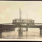
SAN JUAN – Untitled View of a Puerto Rico Railway Light & Power Co. Trolley crossing Trolley Bridge – RPPC unused c. 1910’s.)

PR RR Historian [deleted] (33 months ago) –
This is the trolley bridge over the Martin Pena Canal. Note a damaged part of a bridge to the rear. There was a derailment on this bridge when an American Railroad freight car left the track and smashed into the bridge side, shifting it on its pier and causing part of the bridge to collapse. It took quite a while to clear the mess, so  this shot was taken in the period where the wreckage had been cleared and repair was underway.

Sings-With-Spirits (19 months ago)-
This was the centermost of three bridges; one of the cart bridge’s pier can just barely be seen behind the trolley bridge.  The photograph was likely taken from the remaining bridge; a heavy iron truss rail bridge.

SANTURCE – Condado, P. R. Trolley Car. – RPPC unused c. 1910’s.)

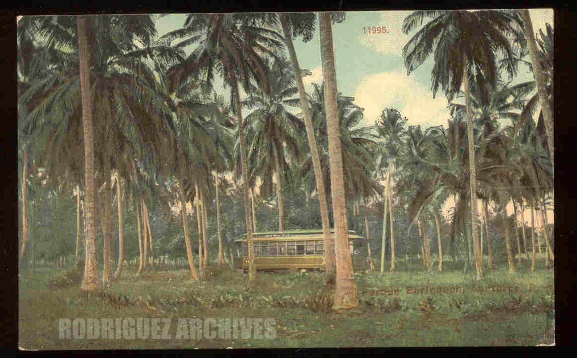
CB Set 3 # 11995 – SANTURCE – Parque Borinquen, Santurce, P. R. – Divided back unused c. 1910 Published by A. C. Bosselman & Co., NY (ACB). Note the electric trolley travelling through the park.

Moscioni RPPC (Attributed) – SANTURCE – Condado Town at San Juan, P. R. – Mailed SJ NOV 29, 1920.

Moscioni RPPC (Attributed) – SAN JUAN – American Colonial Bank, San Juan, P. R. [Trolley] – Unused c. 1910’s.)


MOSCIONI RPPC ~ SAN JUAN – Federal Building [Electric Trolley Car #15] – Unused)

pr gal 1942 (31 months ago)

Car #15 is a Stephenson product, part of an order dating to 1901 that included cars #11 to 17. These were my own personal favorites the line used. In the background, the old Ubarri terminal is seen, out of use by the railroad which was replaced by the trolley.

The trolley is outbound and would soon pass the new station  of the American Railroad as it headed towards Puerta Tierra.

Sings-With-Spirits (19 months ago)

Photograph taken from Banco Mercantil y Agricola.

OLD SAN JUAN – Crowds & Trolleys at Parade 18 DEC 1919. – RPPC unused.)

– PR RR Historian [deleted] (36 months ago)-
The building below the line of trolley was the terminal and
shop of Don Pablo Ubarri’s Tranvia de la Capital a Rio Piedras,
a steam powered 30″ gauge railroad whose route became
most of that used by the new trolley system, the San Juan Light
and Transit Co. (US Standard gauge). This site became the
original terminus of the new American Railroad until the new
station was built. One of the postcards in the Rodriguez Collection
shows a train ready to leave this spot, taken from the opposite
direction and at the lower level.
In this photo, you can see the tower on the San Juan American
RR railroad station, so this postdates the above mention of the
train leaving this spot. By this point in time, the San Juan Light
& Transit had become property a Canadian company and the
cars were lettered Porto Rico Railway, Light & Power Co..
?
– Sings-With-Spirits (19 months ago) –
The street where the trolleys are is Recinto Rur St.
The Ubarri building and yard is today the site of the Felisa Rincon de Gautier Parking Garage, colloquially known as “El Parkin de Doña Fela”.

FL (Liebig) RP – SAN JUAN – Paseo Covadonga, San Juan, P. R. – Unused.)
The white building on the left has a large sign across it that says: French Telegraph Cable Company. The trolley has a sign on the top indicating its destination: GARAGE. The conductor is on the front closest to you, the viewer.

PR RR Historian [deleted] (33 months ago)

The building that is set lower than the street where the trolley is
heading into Old San Juan was the shop and terminal of the Tranvia
de la Capital a Rio Piedras, the first commuter railroad into Old San
Juan from outside the city. The railroad was built by Don Pablo Ubarri, and later sold to the San Juan Light & Transit Co., that turned the railroad into an electric trolley system using the Ubarri right of way from San Juan out to Rio Piedras and later to the Condado. This
building later became a temporary station for the American Railroad while it build its new stone and cement building a few blocks further out of the city.

pr gal 1942 (29 months ago)

The trolley in the picture is one of the “jaulas”, named so because
of their safety wire mesh on the sides. These were the second
highest capacity cars on the Porto Rico Railway Light & Transit
Co. system surpassed only by the later Peter Witt style Perley-
Thomas trolley cars (which were the last ones to run on the San
Juan street railway system. Both of these larger cars had to be
careful turning the sharp curves in the top of Old San Juan, as
their overhang could strike a pedestrian not keeping back as they
executed these turns.

Sings-With-Spirits (19 months ago)

The Ubarri building is sitting in what is today the Doña Felisa Rincon de Gautier Parking Garage (“El Parking de Doña Fela”).
On the far right, peeking up from behind the trees is the clock tower of the ARR terminal.
The shot is actually showing Recinto Sur St.: it turns into PaseoCovadonga somewhere around the ARR terminal.

MOSCIONI RPPC ~ SAN JUAN – Panorama [Two Trolley Cars] – Unused.

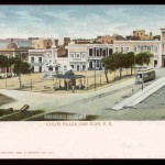
EF # 3632 (No. 120) – SAN JUAN – Colon Plaza (Trolley), San Juan, P. R. – Unused.)

SAN JUAN, P. R. RPPC – View of the C. O. Lord & Co. Building [una Ferreteria] on the Left and Trolley on the Right – Unused Velox PC c. 1910’s)

Sings-With-Spirits (19 months ago)

Looking north up Tanca St. from Comercio St.

TheUbarri line terminal building is visible on the right, where the Doña Fela Parking garage is located today.

 —

Trolley Route in San Juan
Ruta del tranvía en San Juan
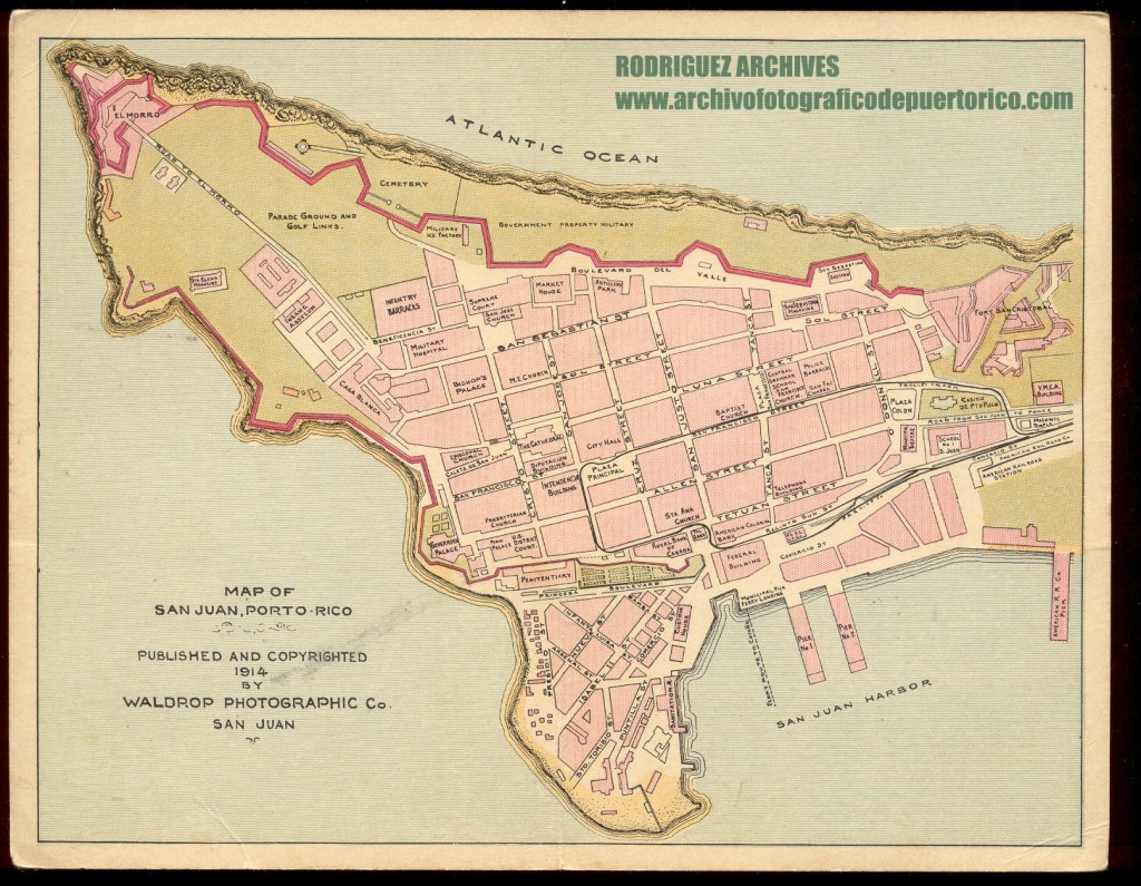

Waldrop Photo Co. Set No. 10 MISC. ITEMS – Map of San Juan Published 1914 – Unused

Double wide post card shows a map of Old San Juan. Published and Copyrighted 1914 by Waldrop Photographic Co., San Juan.

Sings-With-Spirits (22 months ago)

This map is worth GOLD. It took me years to piece together the trolley route through OSJ and here it is… on a silver platter!

See / Ver:

U.S. Geological Survey.  San Juan quadrangle, Puerto Rico [map]. Surveyed in 1939-1940.  1;30000.  7.5 Minute Series.  United States Department of the Interior, USGS, 1941. <http://nationalmap.gov/historical/>

Tramways of Puerto Rico / Tranvías de Puerto Rico.  Copyright by Allen Morrison.
San Juan – http://www.tramz.com/pr/sjs.html ,  http://www.tramz.com/pr/sj.html – This was put online on 1 November 2008.  Esto es una página sobre los tranvías de San Juan, Caguas y Cataño.  Photos used with permission / Fotos usadas con permiso.
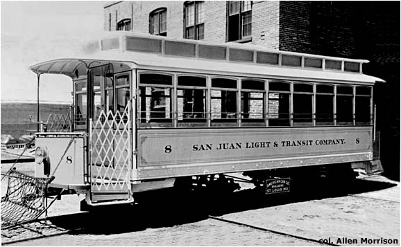


Originalment el tranvía eléctrico operaba entre  San Juan y Río Piedras.  La ruta tiene sus comienzos en el tranvía de vapor de Pablo Ubarri.

Originally the electric trolley operated between San Juan and Río Piedras.  The route has its beginnings with the steam tram of Pablo Ubarri.

Steam Tram of Pablo Ubarri, 76 cm / Tranvía de Rió Piedras a San Juan, 76 cm


Posted in Uncategorized | Comments Off on San Juan – Trolleys / Tranvías

Rodríguez Archives

These photos are a selección from the Rodríguez Archives (José Luis and José Alfredo Rodríguez).   Please see:  Archivo Histórico y Fotográfico de Puerto Rico – Colección Rodríguez , and Archivo Histórico Y Fotográfico De Puerto Rico’s photostream .
Photos used with permission / Fotos usadas con permiso.

San Juan – Trolleys / Tranvías

Mayagüez – Trolleys / Tranvías


Ponce – Trolleys / Tranvías


Posted in Uncategorized | Comments Off on Rodríguez Archives

Sepúlveda Rivera, Anibal. San Juan: Historia Ilustrada de su desarrollo urbano, 1508 – 1898 (Planos / Plans)

Photos used with permission /Fotos usada con permiso

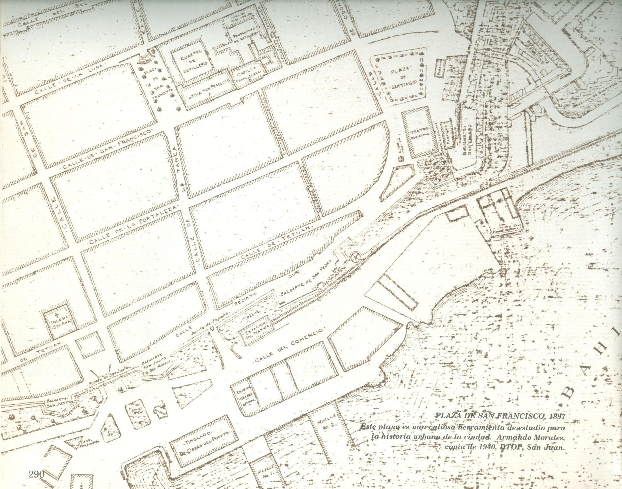
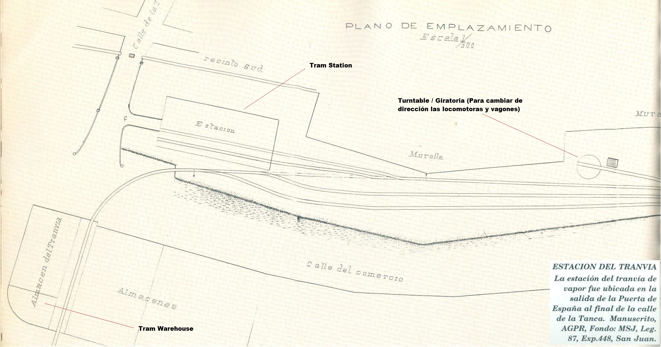
Source / Fuente:  Sepúlveda Rivera, Anibal. San Juan: Historia Ilustrada de su desarrollo urbano, 1508 – 1898. San Juan, PR: Centro de Investigaciones CARIMAR, 1989. Print.(Líneas y/o palabras rojas añadidas por R. Aponte / Red lines and/or words added by R. Aponte)


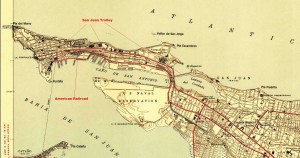
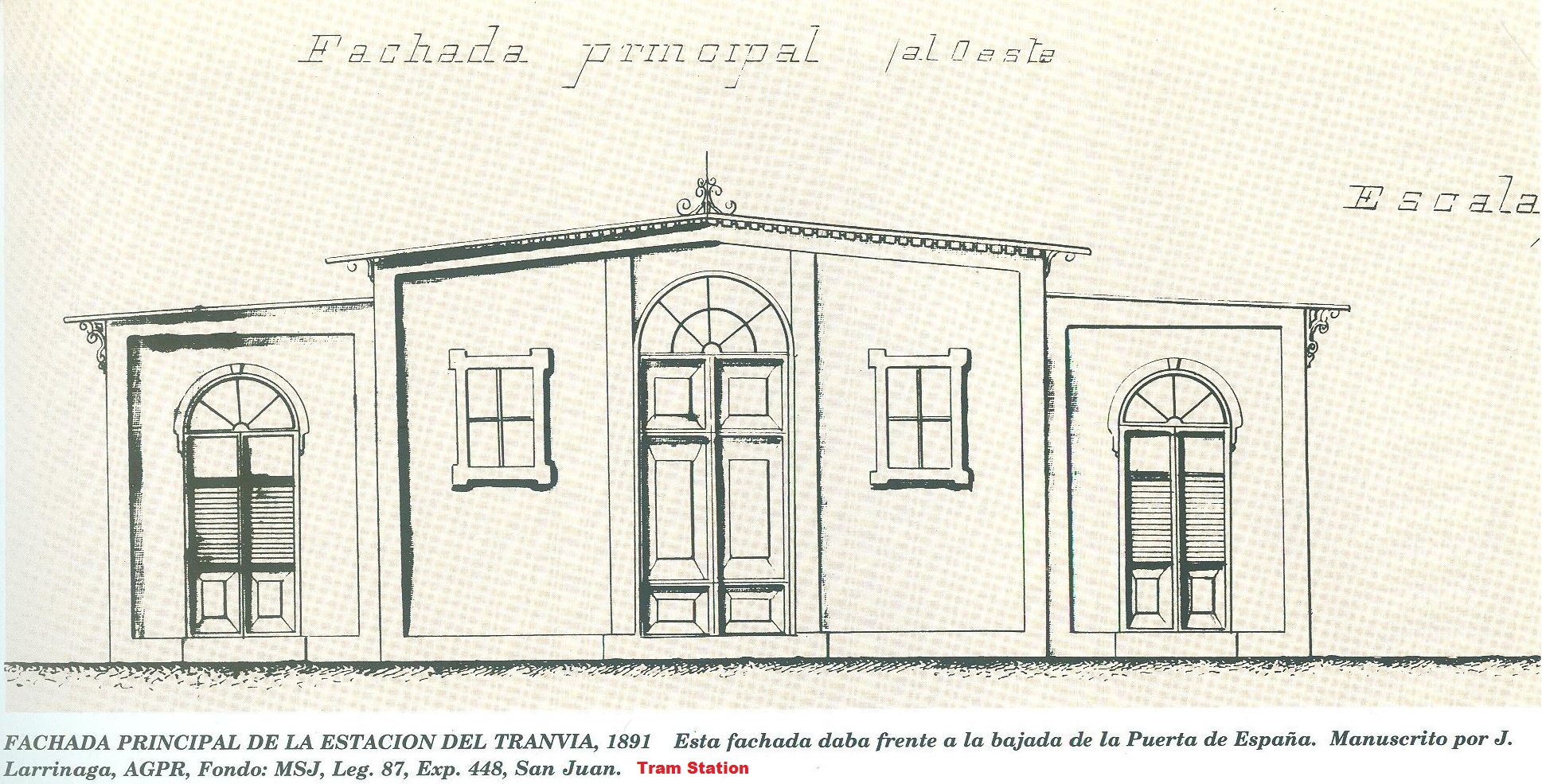
Plan showing tram and railroad in San Juan. /  Plano demostrando ruta del tranvía y ferrocarril en San Juan.

—–

(Page 335) Railroad and tram facilities in San Juan. /  Facilidades del tranvía y ferrocarril en San Juan.

—–

(Page 290)

—–

(Page 210)

—–

(Page 211)

—–

(Page 210)

—–

(Page 240-241)

See / Ver:

Steam Tram of Pablo Ubarri, 76 cm / Tranvía de Rió Piedras a San Juan, 76 cm
The Tramways of San Juan, Puerto Rico

Tren Urbano / San Juan Tren Urbano Light Rail System

San Juan tenía dos ferrocarriles:  Un tranvía de vapor, con vía de 76 cm (30 pulgadas) de ancho, y un ferrocarril con ancho de vía de un metro.  El tranvía operaba desde San Juan a Río Piedras.  Se conocía como el Tranvía  de Ubarri y Tranvía de la Capital a Río Piedras.  Inauguró sus operaciones en el 1880.  En el 1901 pasó a ser un tranvía eléctrico de vía estándar.
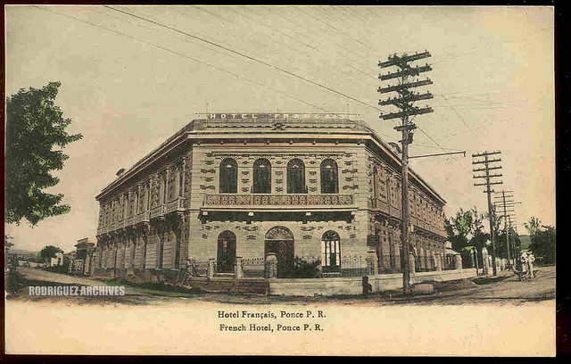
El ferrocarril se conocía como el Ferrocarril de Circunvalación, también conocido como el Ferrocarril Francés.  El ancho de vía era de un metro.  Las operaciones se iniciaron en 1891 y pasó a ser la American Railroad of Porto Rico.

Hoy día existe un ferrocarril moderno eléctrico de vía estándar conocido como el Tren Urbano que da servicio entre Río Piedras y Santurce.  En el futuro se espera extender las operaciones hasta San Juan.

San Juan had two railroads:  A steam 76 cm (30 in.) gauge tram and a meter gauge railway. The tram operated from San Juan to Río Piedras.  It was known as the Tranvía de Ubarri and Tranvía de la Capital a Río Piedras. It was inaugurated in 1880.  In 1901 it became a standard gauge (56.5 in) electric trolley operation.
The railroad was the Ferrocarril de Circunvalación, also known as the French Railroad.  It was meter gauge and began operating in 1891.  It became the American Railroad of Porto Rico.

Today there exist a standard gauge modern electric train (Tren Urbano) that connects Río
Piedras and Santurce.   In the future, operations will be extended to San Juan.

—–

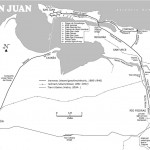
Observe: Trolley track (Vía del trolley), American R.R. of Porto Rico, Central San José (Sugar Mill), Universidad de Puerto Rico (University)

—–

Used with permission.  Copyright by Allen Morrison.  See / Ver: – San Juan  http://www.tramz.com/pr/sj.html

Other works of Dr. Aníbal Sepúlveda Rivera / Otros trabajos del Dr. Aníbal Sepúlveda Rivera:

– Puerto Rico Urbano : atlas histórico de la ciudad puertorriqueña

– San Juan extramuros : iconografía para sus estudio

– Cangrejos-Santurce : historia ilustrada de su desarrollo urbano (1519-1950)

– Hacia una metodología y políticas integrales para los programas de restauración en áreas históricas : caso-estudio de San Juan de Puerto Rico

– La Historia Urbana de Puerto Rico, Centro de Investigaciones Carimar, inc.  4 Tomos.

————–

En la Categoría Individual, el Dr. Aníbal Sepúlveda Rivera fue galardonado por salvaguardar la historia de las ciudades y pueblos de nuestro país a través de sus transformaciones urbanas y defender el Patrimonio Arquitectónico. Sepúlveda es doctor en planificación urbana, catedrático de la Escuela Graduada de Planificación de la Universidad de Puerto Rico, y miembro fundador del Centro de Investigaciones CARIMAR. Ha dedicado sobre veinte años a la investigación sobre la planificación y el desarrollo de nuestros espacios urbanos. Es autor o colaborador de varias publicaciones y otros documentos, incluyendo la ambiciosa antología Puerto Rico Urbano: Atlas Histórico de la Ciudad Puertorriqueña. Ha trabajado en diversos proyectos de investigación y exhibiciones relacionados con planificación urbana e historia urbana.

Fuente: http://www.caappr.org/index.php?node=831 (Colegio de Arquitectos y Arquitectos Paisajistas de Puerto rico) on 6 Oct 2012

Dr. Aníbal Sepúlveda Rivera is renowned for his extensive historical works.  He has a doctor’s degree in Urban Planning and is a professor at the University of Puerto Rico.

Posted in Uncategorized | Comments Off on Sepúlveda Rivera, Anibal. San Juan: Historia Ilustrada de su desarrollo urbano, 1508 – 1898 (Planos / Plans)