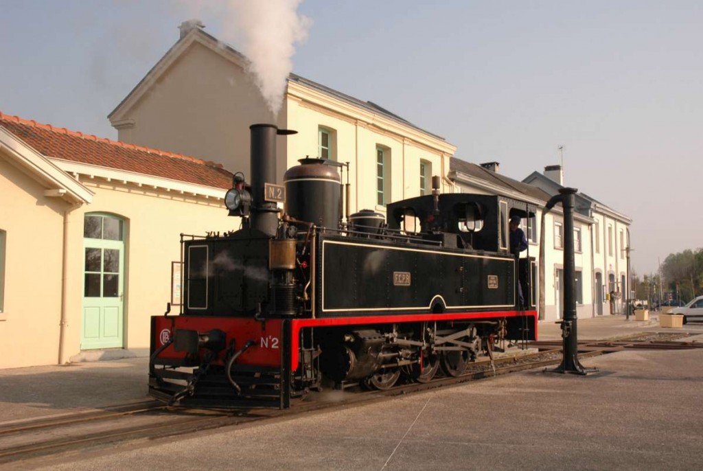
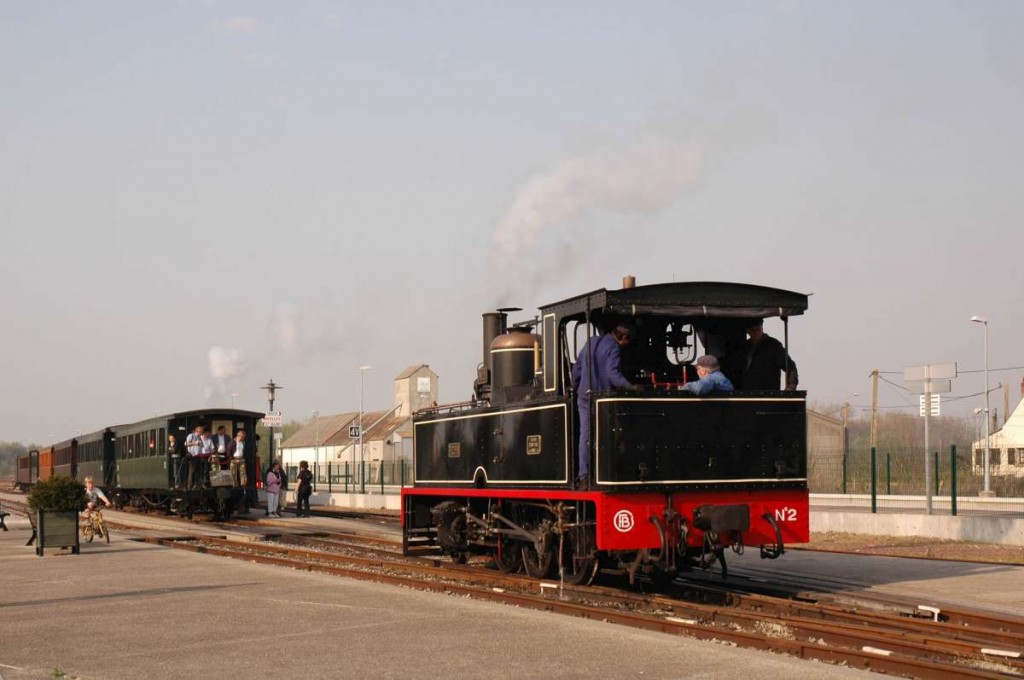
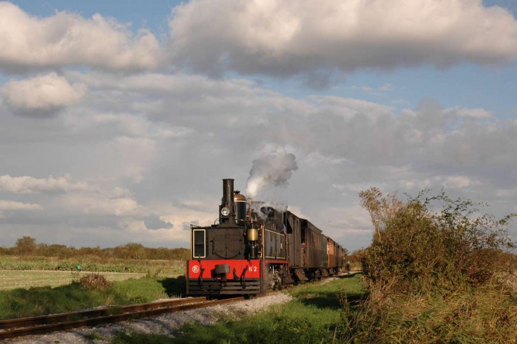
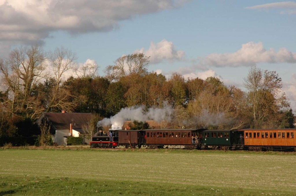
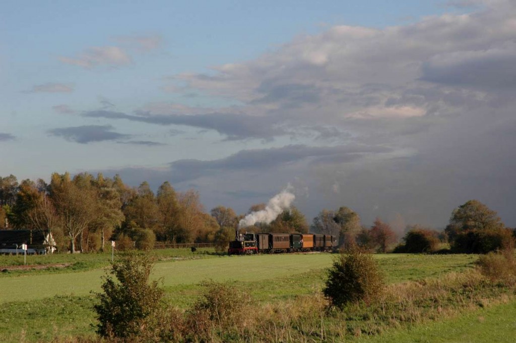
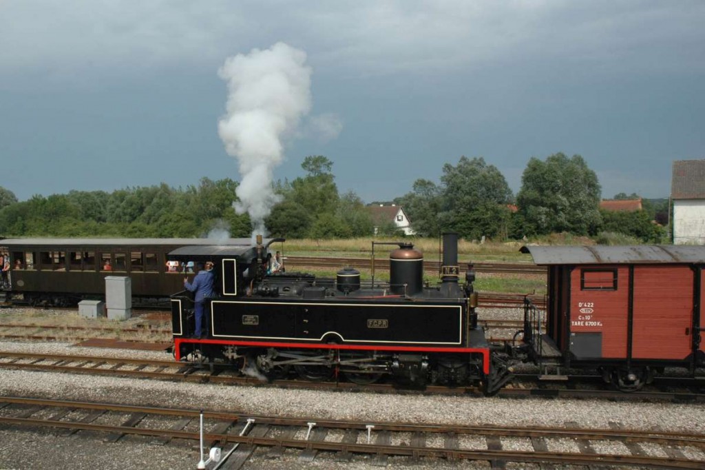
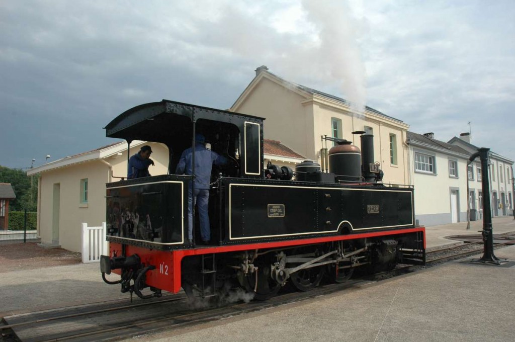
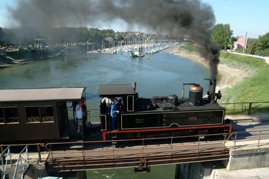
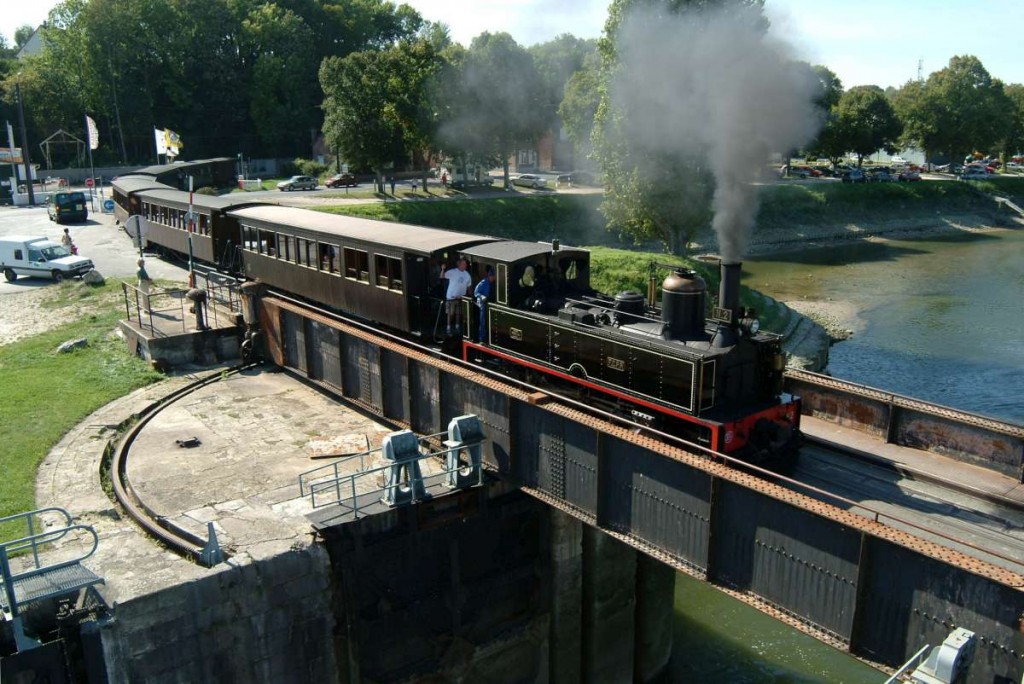
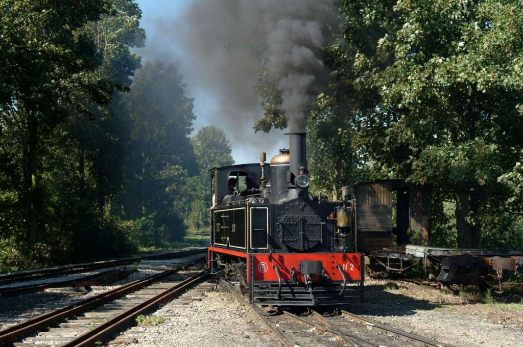
James Waite Collection: Cail N°2 (French Engine / Locomotora Francesa)


Noyelles

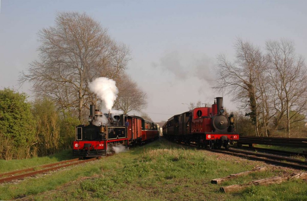
French engines were among the first locomotives that operated in Puerto Rico.  Cail N°2 was one of the engines.  This engine was sent to the United States from Puerto Rico.  It was later sent to France where it is part of a tourist operation.  Please see French Train / Ferrocarril Francés .

Locomotoras francesas fueron de las primeras que operaron en Puerto Rico.  Cail N°2 era una de esas locomotoras.  Esta locomotora fue trasladada a los Estados Unidos, y luego a Francia donde forma parte de una operación turística.  Favor de ver French Train / Ferrocarril Francés .

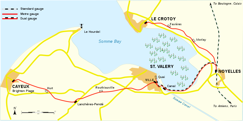
“File:Cfbs-en.svg.” Wikipedia, the free encyclopedia. Wikipedia. Web. 8 Aug. 2013.  http://en.wikipedia.org/wiki/File:Cfbs-en.svg

Description
English: Map of the en:Chemin de Fer de la Baie de Somme, a narrow-gauge light railway near the village of en:Le Crotoy, in the Somme department, France.
Français : Plan fr:Chemin de Fer de la Baie de Somme, une petite ligne à voie étroite dont le terminus est situé à Le Crotoy dans la Somme, en France.
Date     8 November 2009 / Source     Own work / Author     Hektor

This file is licensed under the Creative Commons Attribution-Share Alike 3.0 Unported, 2.5 Generic, 2.0 Generic and 1.0 Generic license.

Noyelles

Noyelles

Noyelles and Le Crotoy

Noyelles and Le Crotoy

Noyelles and Le Crotoy

Noyelles

Noyelles

St Valery

St Valery

St Valery

Noyelles

See / Ver: 

French Train / Ferrocarril Francés

Thomas Kautzor Collection
French train / Locomotora francesa

Sources / Fuentes:

Photo Collection from James Waite.  Used with permission.

From: James Waite
Sent: Thursday, February 07, 2013 1:53 PM
To: rwaponte…. ; Thomas Kautzor
Subject: FCPR no. 2

Dear Roger,

Thomas Kautzor is an old friend of mine and we’ve been in touch about the locos of Puerto Rico.

I think Thomas mentioned that my wife and are are going on a cruise from San Juan on 16th February for a week and will stay on for a few days on the island after the cruise is over.

Thomas suggested that you may welcome some photos of FCPR no. 2 at the CF de la Baie de Somme.  We visit the railway quite often.  Although we live in south eastern England it only takes about three hours to drive there thanks to the Channel Tunnel and so it’s a fairly easy day trip.  Here are a few photos and if they are of any use for your website you are most welcome to post them.

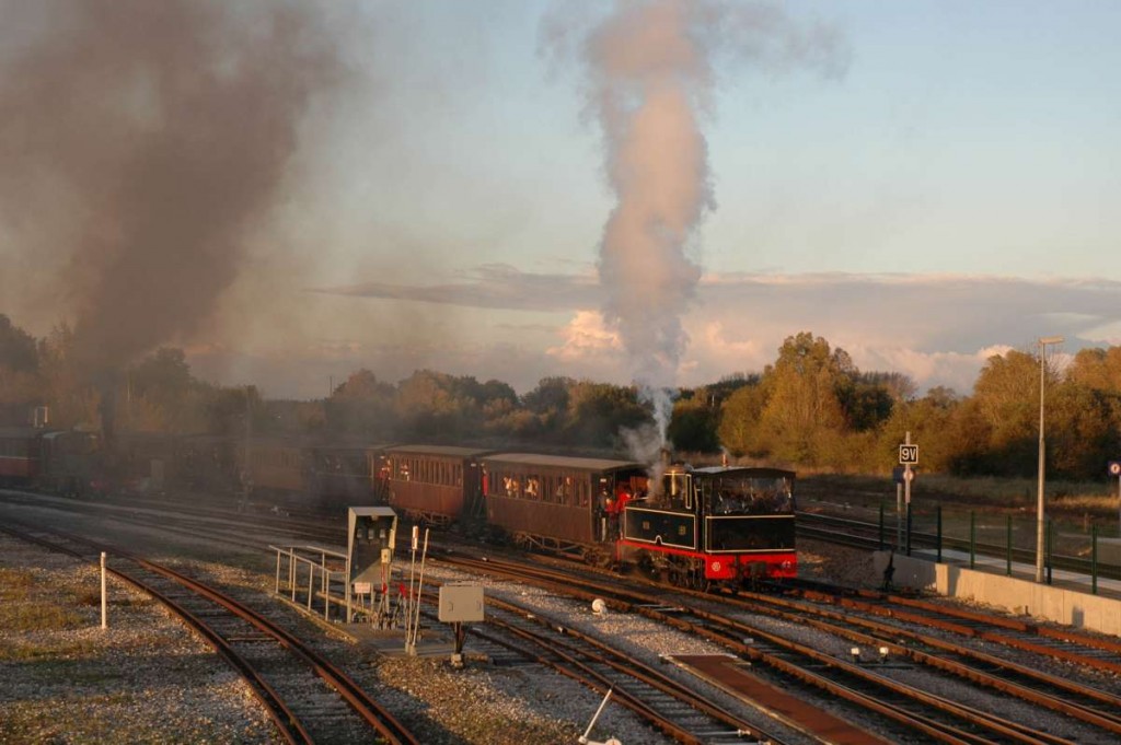
25, 33 and 52 are at Noyelles, the railway’s main line junction.  319, 332 and 339 are on the railway’s northern branch between Noyelles and Le Crotoy.  377, 459 and 462 are again at Noyelles.  483 is of the trains for the northern and southern branches near Noyelles at the point where the two lines diverge.  70 is at St Valery loco depot.  80 and 82 are of the train crossing the canal at St Valery and 149 is at Noyelles.  A very pretty loco – probably the most attractive one on the railway.

We’re looking forward to our visit to Puerto Rico.  We shall stay two nights in Old San Juan and two at the Cabanes del Rucio in the south of the island near Penuelas.  It should be fun!

Best wishes,

James Waite

See / Ver:

“Chemin de Fer de La Baie de Somme – Wikipedia, the Free Encyclopedia.” Web. 9 Aug. 2013.  http://en.wikipedia.org/wiki/Chemin_de_Fer_de_la_Baie_de_Somme

“Home – Chemin de Fer de La Baie de Somme.” Web. 9 Aug. 2013.  [Map /Mapa] http://www.cfbs.eu/en/

“File:CFBS Cail N°2.jpg.” Wikipedia, the free encyclopedia. Wikipedia. Web. 8 Aug. 2013.  http://en.wikipedia.org/wiki/File:CFBS_Cail_N%C2%B02.jpg

Posted in Uncategorized | Comments Off on James Waite Collection: Cail N°2 (French Engine / Locomotora Francesa)

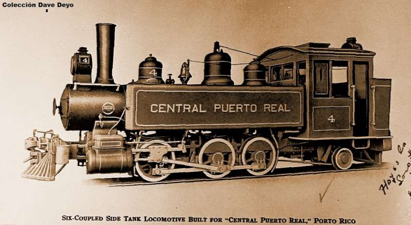
Central Puerto Real, Vieques, Puerto Rico

Central Puerto Real
Vieques
Gauge / Trocha (ancho de vía): 36 in

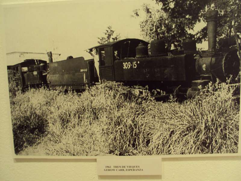
Central Puerto Real was located on the island of Vieques, a town east of Puerto Rico.
It was later referred to as “Central Esperanza”.  It had a 36″ gauge railway.

La Central Puerto Real se conocía como la Central Esperanza.  Tenía un ferrocarrils con ancho de vía de 36″.

Colección Gerrow Carr, Archivo Histórico de Vieques, R. Rabin, Director

Colección Gerrow Carr, Archivo Histórico de Vieques, R. Rabin, Director
Photos used with permission.

Las fotos fueron tomadas en el museo de Vieques por la hija del amigo Efraín Martell.

Map / Mapa:  National Atlas of the United States

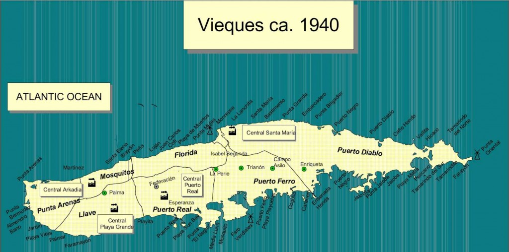
César Ayala. 2001. ” From Sugar Plantations to Military Bases: the U.S. Navy’s Expropriations in Vieques, Puerto Rico, 1940-45 .” Centro: Journal of the Center for Puerto Rican Studies 13(1) (Spring 2001): 22-44.

Map shows locations of other sugar mills.  En el mapa vemos la localización de las otras centrales en Vieques.

Permission: Prof. Xavier F. Totti, Editor, CENTRO: Journal of the Center for Puerto Rican Studies, Hunter College, 695 Park Avenue, E-1429, New York, NY 10065
http://centropr.hunter.cuny.edu

Versión en español: (Usado con permiso)

Dr. César Ayala Del latifundio azucarero al latifundio militar: las expropiaciones de la Marina de Guerra de los Estados Unidos en la década del 1940, en Vieques, Puerto Rico, de la Revista de Ciencias Sociales Núm. 10, 2001.

Revista de Ciencias Sociales

Centro de Investigaciones Sociales

Universidad de Puerto Rico

Recinto de Río Piedras

 Enlace del artículo: http://rcsdigital.homestead.com/files/Nueva_epoca-no-10/1-cesar_ayala__10.pdf

Central Puerto Real
Vieques Island, Puerto Rico
(later referred to as “Central Esperanza”)
Sociedad Mourraille y Martineau
Sucn. de Gustavo Mourraile
36″ Gauge
By
Dave Deyo

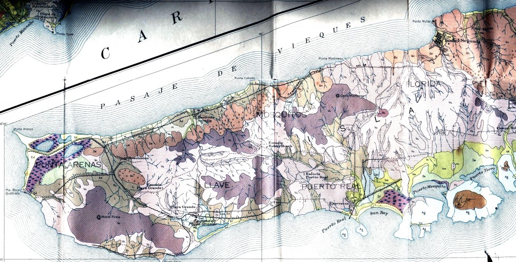
Field Operations, Bureau of Chemistry and Soils.  Soil Map, Western Sheet, Puerto Rico [map].  Agricultural Experiment Station, University of Puerto Rico, 1936. (Partial map)

Para ver más mapas visite Mapas Topográficos Históricos del USGS (U.S. Geological Survey)USGS Historical Topographic Maps (Online) ( http://geonames.usgs.gov/pls/topomaps/). Busque los mapas de Vieques usando “Isla de Vieques”.

For more maps, visit Mapas Topográficos Históricos del USGS (U.S. Geological Survey)
USGS Historical Topographic Maps (Online)
( http://geonames.usgs.gov/pls/topomaps/). Search using the term “Isla de Vieques”

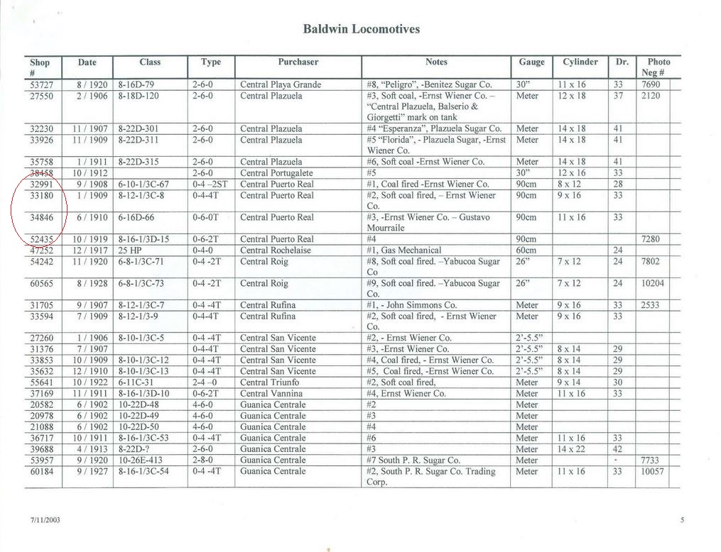
Baldwin Locomotives Data of Central Puerto Real by Richard Dunn

Please see:

Baldwin and Vulcan Locomotives by Richard Dunn

Central Puerto Real – Locomotive Rosters – Railways of the West Indies, Part IV, Puerto Rico” by P. Allen Copeland, pages 147 – 212

Locomotive Rosters of Puerto Rico / Catálogo de locomotoras de Puerto Rico

Baldwin Catalog Photo Of Central Puerto Real # 4.jpg
Ver / See:

Copeland, P. Allen.  Locomotive Rosters – Railways of the West Indies, Part IV, Puerto Rico”.  53.  Railways of the West Indies, Puerto Rico

Escudero, Jaime. “Centrales Azucareras de Puerto Rico.” Recinto Universitario de Mayagüez, Universidad de Puerto Rico, Web. 24 Sept. 2014. <http://blogs.uprm.edu/canadeazucar/>.


Posted in Uncategorized | Comments Off on Central Puerto Real, Vieques, Puerto Rico

Cartas de un conductor / Letters from a Conductor — American Railroad Co. of Puerto Rico


Cartas de un conductor / Letters from a Conductor
Colección Dave Deyo


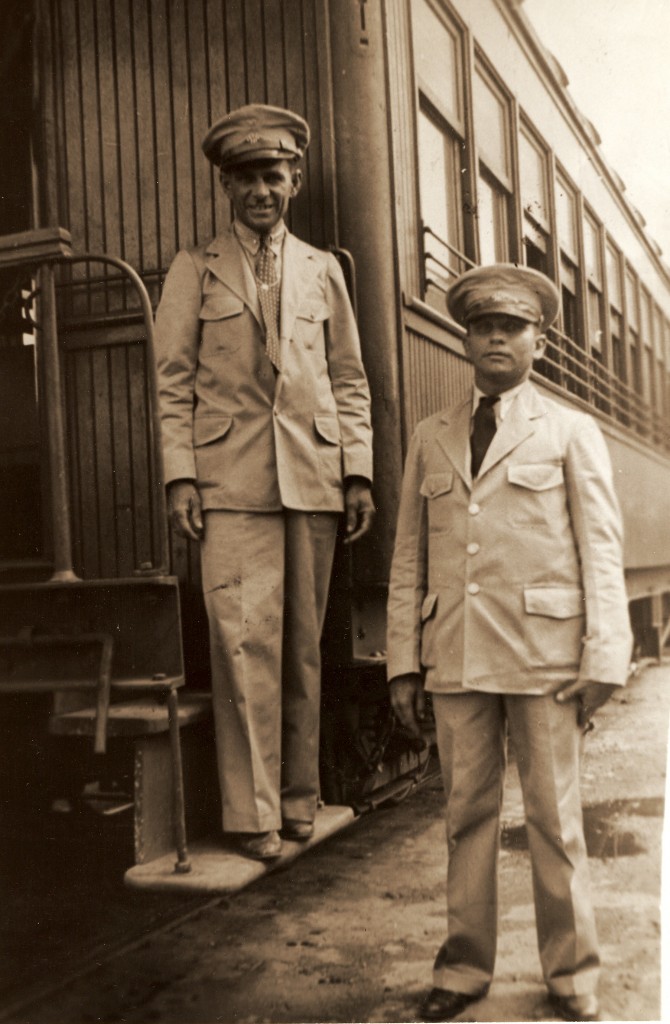
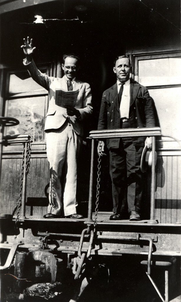
El Reverendo Ramírez Vélez era un conductor retirado en los trenes de pasajeros de la American Railroad. Le escribió varias cartas a Dave.  La carta incluida está incompleta pero tiene muchos datos interesantes.

….. I found part of one of the letters the Rev. Ramirez-Velez sent me while I was in Puerto Rico.  He was the retired ARR conductor who mailed me a half dozen long letters telling what he remembered from his years in passenger service.  I have not discovered the rest of the letters, but the attached pages represent most of one of the first ones he sent.  It appears there is a part of a page
missing as he abruptly starts talking about car attendants in the sleeping cars, and there is no earlier discussion about these cars.

Email from Dave Deyo, June 13, 2013.

Posted in Uncategorized | Comments Off on Cartas de un conductor / Letters from a Conductor — American Railroad Co. of Puerto Rico

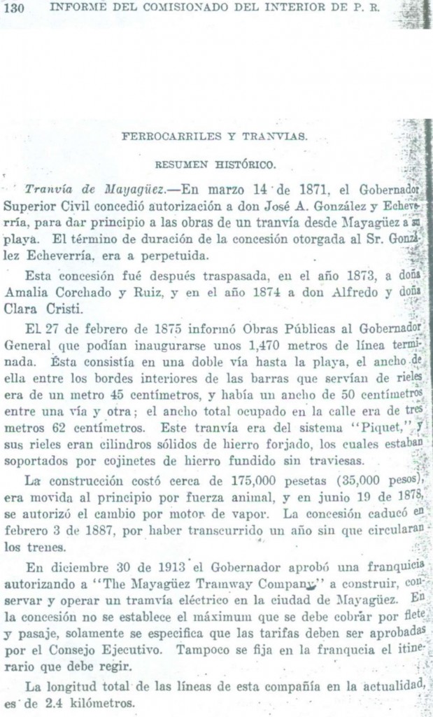
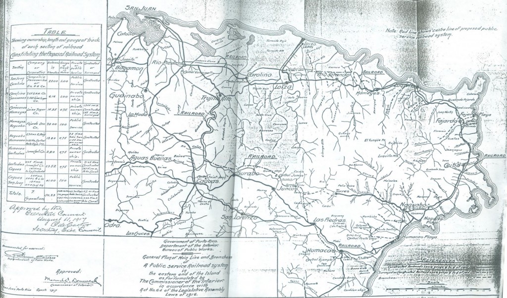
Informe del Comisionado del Interior de al Honorable Gobernador de Puerto Rico, 1919


Ferrocarriles y Tranvías, Resumen Histórico PDF

Dale un click al mapa

Source / Fuente: Informe del Comisionado del Interior de al Honorable Gobernador de Puerto Rico, 1919. San Juan.

Posted in Uncategorized | Comments Off on Informe del Comisionado del Interior de al Honorable Gobernador de Puerto Rico, 1919

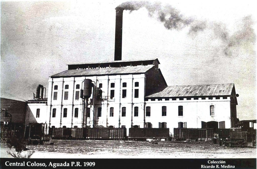
Central Coloso, Aguada, 20 inch (cerca de 500 mm) y metro


Colección Ricardo Medina

Copeland, P. Allen.  Locomotive Rosters – Railways of the West Indies, Part IV, Puerto Rico”.  Pages 147 – 212.  See/Ver : Railways of the West Indies, Puerto Rico , página 26.

Baldwin and Vulcan Locomotives by Richard Dunn.  Ver página 3.

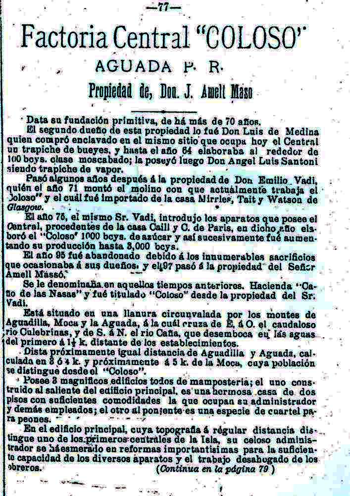
Ferreras Pagán, Luis.  Biografía de la riqueza de Puerto Rico, Tomo I. San Juan, PR: Tipografía de Luis Ferreras, 1902. Print. 77 – 81.

Para 1902, la Central Coloso tiene un tren de vía portátil tirado por bueyes y conexión con el Ferrocarril de Circunvalación (79).


Continuar


Posted in Uncategorized | Comments Off on Central Coloso, Aguada, 20 inch (cerca de 500 mm) y metro

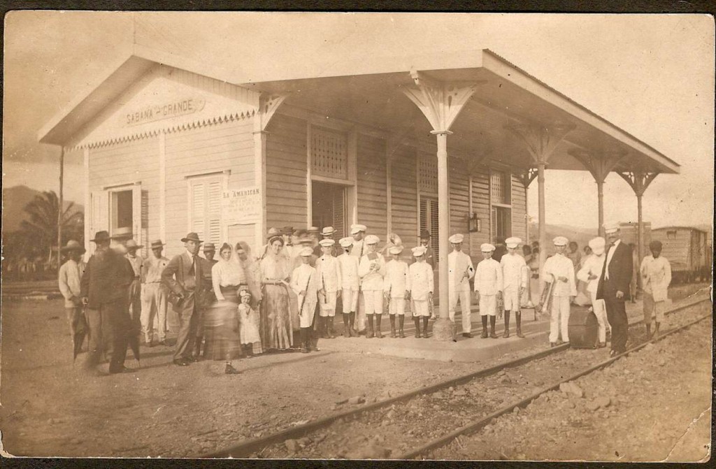
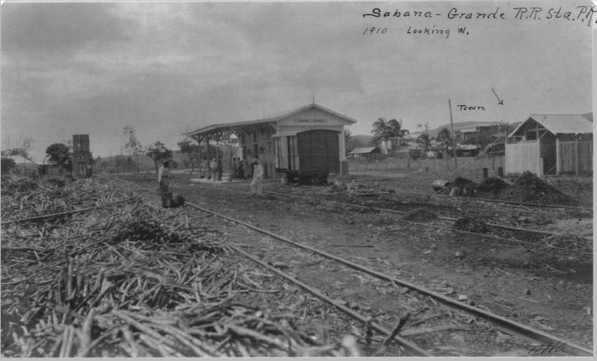
Estación Sabana Grande / Sabana Grande Station


Colección Belkis Munoz-Gelabert
http://www.flickr.com/photos/ladygelabert/7211831664/in/photostream/
http://www.flickr.com/photos/ladygelabert/7211931846/in/photostream/
Munoz-Gelabert, Belkis. American Railroad Company of Puerto Rico. 2009. Flickr. Web. 29 June 2013.

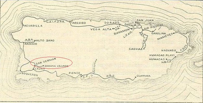
Al norte del pueblo de San Germán había un ramal operado por la American Railroad Co.  La estación de Sabana Grande estaba en el extremo este del tramo de vía.  El tren que operaba en este ramal se conocía como el Tren Batatero o el Tren Batata.

North of the town of San Germán was a branch line operated by the American Railroad Co. The Sabana Grande Station was on the Eastern end of the line. The train that operated on this branch line was known as Tren Batatero o el Tren Batata.


Manuscritos de William H. Armstrong, vol. 10, p. 78.
<http://bibliotecadigital.uprrp.edu/cdm/singleitem/collection/william/id/2>, accessed June 29, 2013.
Biblioteca Digital Puertorriqueña, <http://bibliotecadigital.uprrp.edu/cdm/>

Ver / See:  Estación Norte de San Germán / San Germán Station (North)

Source / Fuente:  Interstate Commerce Commission. No. 5701. In the matter of safety appliances of equipment in railroads of Porto Rico. Washington: Government printing office: 1916


Posted in Uncategorized | Comments Off on Estación Sabana Grande / Sabana Grande Station

Fábrica Ladrillos y Cal Manuel Díaz Caneja

Fábrica Ladrillos y Cal Manuel Díaz Caneja – Album

Fábrica Ladrillos (1917)
Pueblo Viejo, Caparra
Guaynabo, Puerto Rico

La foto muestra una fábrica de ladrillos con parte de su ferrocarril industrial de vía estrecha.  La materia prima utilizada para la producción de ladrillos es la arcilla.  Básicamente, se mezcal la arcilla con arena y agua.  Luego es endurecida por cocción.  También hay ladrillos producidos con cal y arena.

Los carritos (tipo volquete / dump truck) probablemente transportaban la material prima – arcilla, arena, y piedra caliza, desde los yacimientos a la fábrica para la manufactura de ladrillos y cal.

PRHBDS Colección: Aníbal Sepúlveda Rivera, Alberto del Toro, Fideicomiso de Conservación de Puerto Rico.

Puerto Rico Historic Buildings Drawings Society. “Fábrica Ladrillos y Cal Manuel Díaz Caneja.” Web. 10 June 2013

Photo used with permission. / Foto usada con permiso.


Posted in Uncategorized | Comments Off on Fábrica Ladrillos y Cal Manuel Díaz Caneja

ARRCO – Tabla de Distancias Exactas de Estaciones… / Table of Distances, Stations…


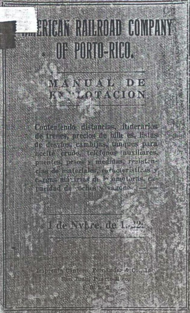
American Railroad Company of Porto Rico.  “Tabla de Distancias Exactas de Estaciones, Ramales y Desvíos.” Manual de Explotación. San Juan, PR: Imprenta Cantero, Fernández & Co., 1922. Print. (Table of Distances, Stations, Branchlines… – Pages / Páginas 16 -27)


Posted in Uncategorized | Comments Off on ARRCO – Tabla de Distancias Exactas de Estaciones… / Table of Distances, Stations…

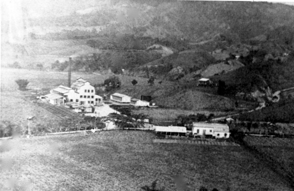
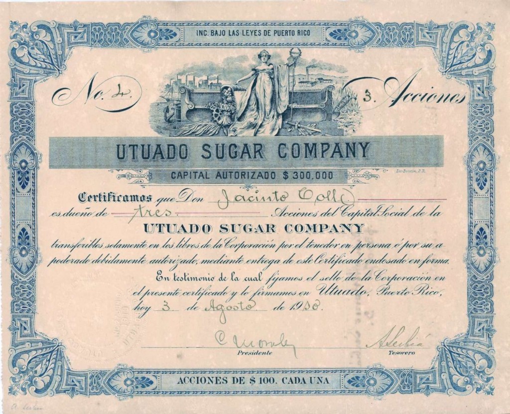
Central Utuado (Sugar Mill)


Colección César López Cabrera (Tolofish).  “Utuado Sugar Company.” Photo. Flickr. Web. 28 Feb.2013.

This sugar company was established by my great grandfather in 1910.


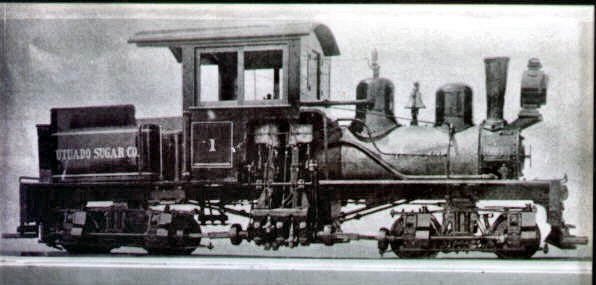
Shay locomotive, Utuado Sugar Co., Utuado, 30 inches (shaylocomotives.com).  Copyright 1958 Kalmbach Publishing Co. Used with permission of Model Railroader Magazine.

Colección César López Cabrera (Tolofish). “Utuado Sugar Company Stock Certificate Front Side.”  Photo. Flickr. Web. 28 Feb.2013.

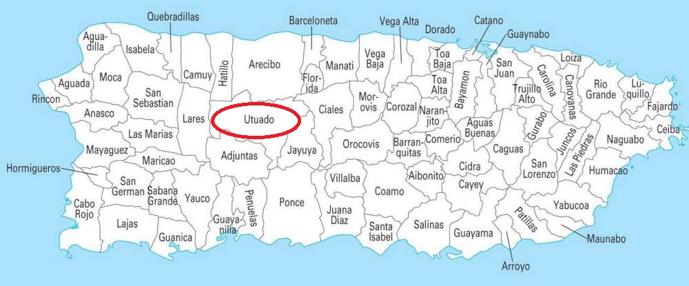
Source / Fuente: National Atlas of the United States (Map / Mapa)


Posted in Uncategorized | Comments Off on Central Utuado (Sugar Mill)

US Naval Air Station, San Juan, Puerto Rico


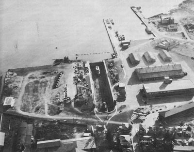
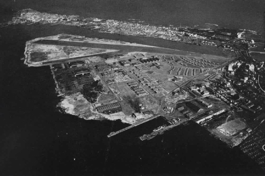
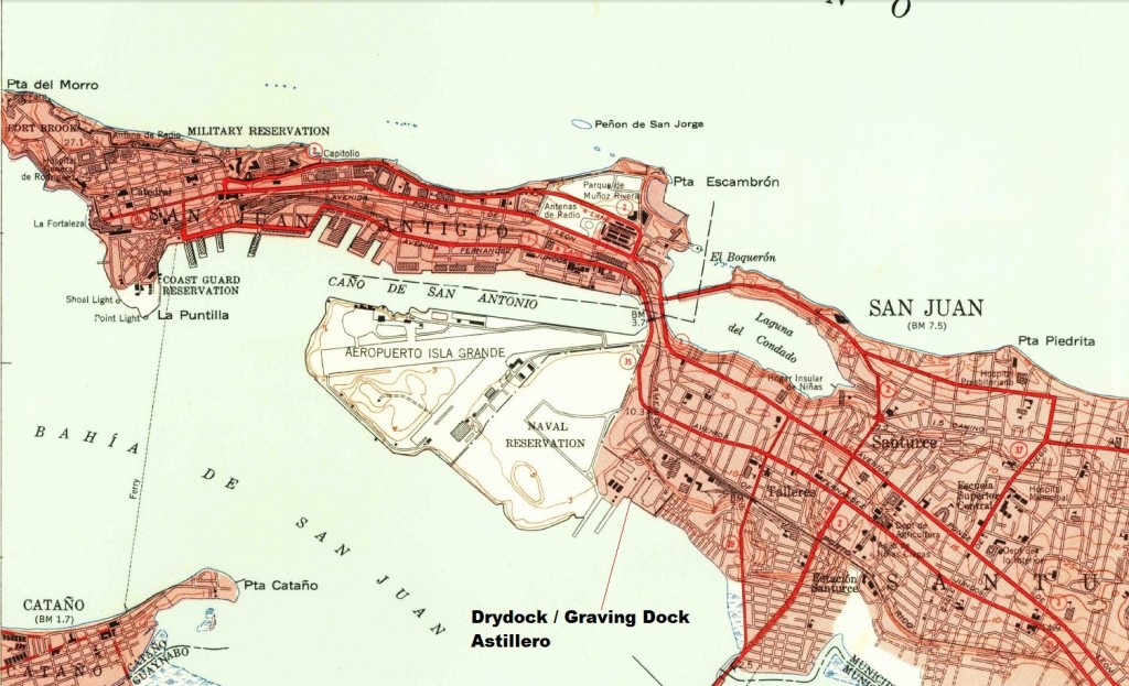
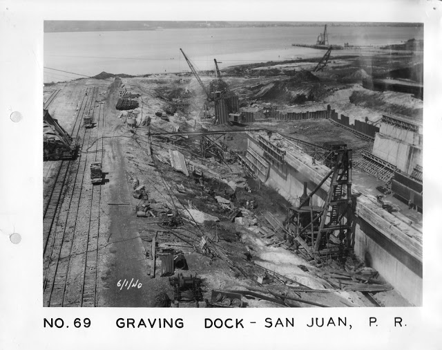
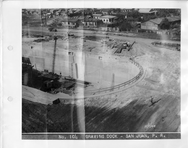
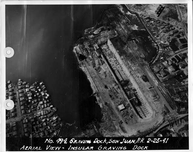
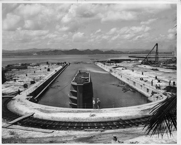
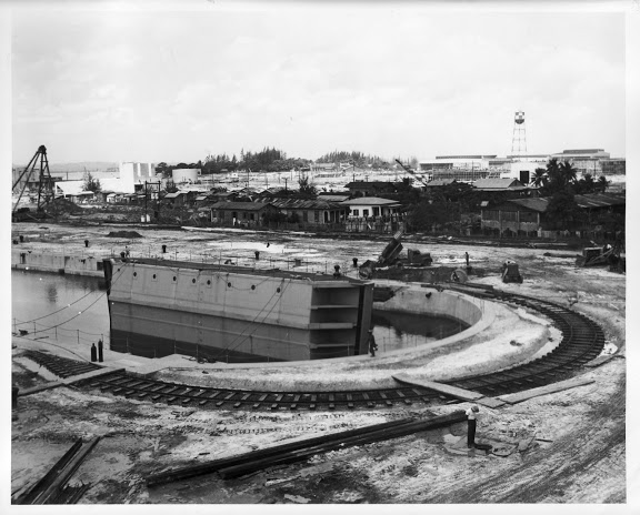
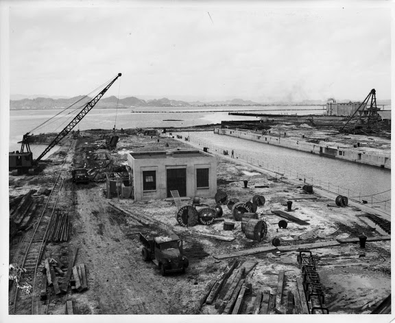
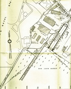
The US Naval Air Station in San Juan had a drydock, built at the beginning of the World War II.  Railroads were used to build the dock and in its operation.  Docks were used for the repair and maintenace of ships.  E.H. Latham Co., was the contractor.

La Marina de Estados Unidos construyó un astillero a principios de la Segunda Guerra Mundial.  Se usaron ferrocarriles para su construcción y operación.  El astillero era usado  para reparaciones y mantenimiento de barcos.  E.H. Latham Co., era el contratista.

Locomotora Grúa / Locomotive Crane.  Photo:  71-CA-408D SJNSY – ARP1757 – Picasa Web Albums N.d. https://picasaweb.google.com/ARP1757/71CA408DSJNSY, accessed April 26, 2013.

Drydock, US Navy
Colección Dave Deyo


Drydock Area, San Juan, Puerto Rico.  Administration building (with tower) at right; outfitting and tender piers, upper right. P. 7.
Building the Navy’s Bases in World War II N.d. http://www.history.navy.mil/library/online/buildbaseswwii/bbwwii2.htm, accessed April 25, 2013. P. 5-9.  (Navy Department Library)

United States Navy. [Photo] Aerial View of Naval Air Station San Juan, Puerto Rico, as It Appeared in the Jun 1947 Edition of the “US Navy Naval Aviation News”. World War II Database. Web. Accessed April 26, 2013.
<http://ww2db.com/image.php?image_id=9496>

Courtesy of the U.S. Geological Survey (San Juan, 1949, 1;30000)

Los mapas topográficos histórico del USGS se pueden ver en línea y bajar
US Historical Topographic Maps can be seen and downloaded
Ver / See

Search / Busque:  San Juan

Photos:  71-CA-408X SJNSY – ARP1757 – Picasa Web Albums N.d. https://picasaweb.google.com/ARP1757/71CA408XSJNSY, accessed April 26, 2013.

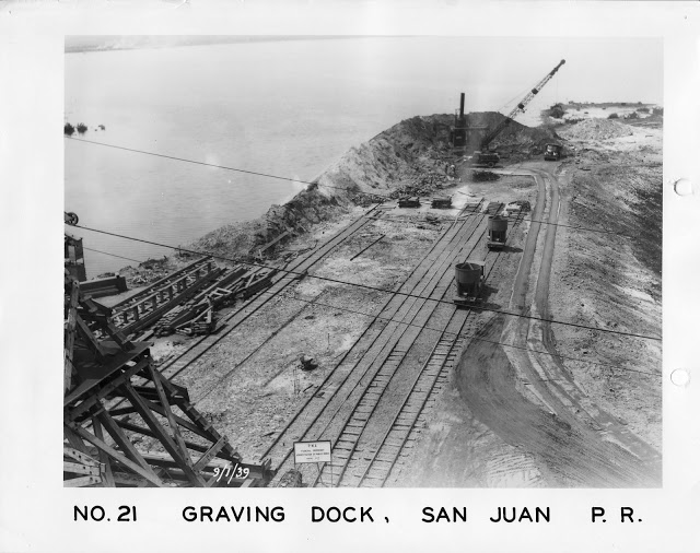
NO. 21 GRAVING DOCK, San Juan, P.R. 1 September 1939.  View of cofferdam fill looking south from top of concrete plant showing portion of head tower framework in extreme left foreground.  Concrete forms being assembled on left center, concrete buckets on cars in center and crane placing fill in cofferdam in background.  P.W.A. Project PR 1012-F  E.H. Latham Co., contractor.

NO. 69. GRAVING DOCK, San Juan, Puerto Rico, 1 June 1940.  General view of the south portion of the dock site showing in right foreground “A” frame rig pulling sheet piling on East side of completed dock wall approximately station 5-77.  In middle distance is the 16” discharge line from 15” pump over pump sump station 3-97.  In near background crane is setting and driving sheet piling for cut off wall station 2-31 and just beyond is crane excavating at pumpwell site.  PWA Docket PR 1012-F, E.H. Latham Co., Contractors.

NO. 71. GRAVING DOCK, San Juan, P. R. 1 June 1940.  View looking south on center line from above approximately station 7-50 showing part of bracing at head end, the completed walls and floor slab, the 15” pump and diesel engine in place 8 feet above the floor level at the far end of the slab.  P.W.A. Project PR 1012-F, E.H. Latham Co., Contractor.


NO. 104 GRAVING DOCK, San Juan, P. R. – 1 November 1940.  View of head end of the dock from top of concrete plant showing landfill almost complete.  P.W.A. Docket PR 1012-F.  E. H. Latham Co. contractor.


Photos:  71-CA-408D SJNSY – ARP1757 – Picasa Web Albums N.d. https://picasaweb.google.com/ARP1757/71CA408DSJNSY, accessed April 26, 2013.


Photo Collection:  Andrew P., Chesapeake, VA.  Picasa Web Albums – ARP1757 N.d. <https://picasaweb.google.com/ARP1757>, accessed April 25, 2013.
He obtained photos at NARA (National Archives and Records Administration) in College Park, MD.  Email March 19, 2013.
Photos used with permission. /  Fotos usadas con permiso.

There were two locomotive cranes, 20 ton Browning diesel-mechanical locomotives, 1941. They also had a Whitcomb engine. Tracks ran around the drydock and had connections to warehouse.

The cranes handled material for ship repairs as well as unloading supplies from ships at the other piers.  The locomotive moved a small number of cars of these supplies from the piers to the large warehouse.  One of the cranes went to Central Plata. The trackwork was
36″ gauge.

Operaban dos locomotoras grúas – 20 toneladas Browning diesel mecánicas, 1941. También tenían una locomotora diesel Whitcomb. Las vías estaban colocadas alrededor del muelle con conexión a los almacenes.

Las grúas se usaban para manejar material para la reparación de los barcos y en los muelles.  Una de las grúas pasó a la Central Plata.  El ancho de vía era de 36 pulgadas.

Email con Dave Deyo, Marzo 2013.

I thank John Taubeneck for letting me know of the website of Andrew P.
I thank Andrew P. for sharing these photos and allowing me to use them.

Posted in Uncategorized | Comments Off on US Naval Air Station, San Juan, Puerto Rico