Humacao & Humacao Playa Railroad
Humacao
Gauge / Trocha (ancho de vía): 75 cm
Map Railroads in Operation, 1916 / Mapa ferrocarriles en operación, 1916 (Data /Datos)
Humacao & Humacao Playa Railroad
Humacao
Gauge / Trocha (ancho de vía): 75 cm
Map Railroads in Operation, 1916 / Mapa ferrocarriles en operación, 1916 (Data /Datos)
This railroad was constructed to transport stone from a quarry located eastward from Santurce. It dates to 1917-1918 when materials were need to build the Bartolome de Las Casas military encampment, located northward of the end the Rexach railway, on land owned by the Rexach family. Rock from the quarry located in the area that is now referred to as Cantera, was previously hauled by barge on the Martin Pena canal. The quarry is said to have operated for nearly 50 years, utililizing trucks near the end of operations. The railroad followed what is now known as Calle Sofia Rexach, a straight tangent most of the distance from Santurce eastward to that quarry. One map in my collection shows the track splitting like a “Y” at the quarry end of the railway. The general area of the military encampment would later become the site of the Hipodromo Las Casas horse racing track.
The Rexach company operated a crusher in the area of Santurce called “Barrio Obrero”. Stone from this operation was also used for fill of some parts of Santurce that were low.
Two maps dated 1918 and 1926 show the tracks ending near Avenida Ponce de Leon, where there appears to be several buildings on the earliest map. One of the buildings extends over the track, possibly indicating this may have been an unloading point to a crusher owned by the Rexach company.
If the Rexach railway ever connected with either the Porto Rico Railway, Light & Power Co. trolley line or the mainline of the American Railroad, it is not shown on the currently-available maps in my possession. Yet there is evidence that Rexach had a large stone processing plant further south past the Martin Pena Canal, in Hato Rey.
Because there is no record of equipment sent to this railway, and the franchises for its
construction and operation have not yet been found, it is impossible to determine whether this was an isolated system, or a railway that had a connection onto or across one or both of the two nearby railroads. While the maps do not show any extension past the plant or crossing any of the Santurce roadways and the two railroads, mention is made in research by Fernando Silva Caraballo of a crusher located in the vicinity of the new Tren Urbano’s Sagrado Corazon station. His research also mentions another facility in Hato Rey, south, across the Martin Pena Canal.
A search of all the Public Service Commission of Puerto Rico franchise records up to 1931,
does not reveal the granting of franchises for the Rexach railway to cross any roadways,
or the trolley and or train tracks. Likewise, Annual Reports of the American Railroad Co.
Of Porto Rico do not show a switch or crossover in that part of Santurce, and no mention of any switches or sidings on the ARR in Hato Rey. The same would also apply to records of the Porto Rico Railway Light & Power Co. through that area.
There are no mentions of equipment or locomotives sent to this railway by any of the many manufacturers. Hence, equipment used on the railway may have been secondhand from on or off of the Island of Puerto Rico, or perhaps it may have been purchased through an agent, and the manufacturer failed to annotate the name of the customer for the company records, to indicate who was the actual recipient of that equipment.
Dave Deyo
June 25, 2013
Central Cayey, closed 1967, 30 inch gauge, (G32).
Cayey Map (U.S. Geological Survey. Cayey, PR.)
Observe que el ferrocarril está aislado de los otros ferrocarriles de la Isla.
Observe that this railway is isolated from other railroads on the Island.
Aguirre, Salinas, closed 1990, meter gauge, (30 in, G52).
Last sugar mill to operate a railroad. It received sugar cane by trucks and the Ponce & Guayama Railroad;
both companies were government owned.Última central en operar un ferrocarril. Recibía caña en camiones y en
el Ponce & Guayama Railroad; ambas compañías pertenecían al
gobierno.—
National Atlas of the United States
—
See / Ver:
More / Más Ponce & Guayama Railroad
—
La Central Aguirre incluía su fábrica, ferrocarril y comunidad.
Central Aguirre included the sugar mill, its railroad facilities and community.
Plano del “pueblo compañía” Central Aguirre
Plan of Central Aguirre Company Town ( 4.54 MB)
Sugarcane train – Puerto Rico, between 1952-55. Bill and Thelma Swartzendruber photo. #27,609.
Sugarcane Train | Flickr – Photo Sharing! N.d. <http://www.flickr.com/photos/tlehman/5694948934/>, accessed April 26, 2013. Photo belongs to t13hman’s photostream.
Great shot… This is one of two General Electric 47 ton diesel-electric locomotives
owned by Guanica Central. When enlarged, the initials GCRR are legible, but
the number is not. It would be either #101 or #102. Noteworthy is the different
color of the locomotive in this picture compared to the yellow scheme in another
photo you have in your photostream. I am glad this slide was discovered and shared,
as it is one of the very few photos I have seen to date of Guanica Centrale trains in
operation.
Right up until the last years of the P&G and Central Mercedita moving the cane by railcar,
the kids still did the same. Some even hitched rides on the train cars, and the crews
never seemed to bother chasing them away. I have movies I took of both kids hitching
rides and of kids pulling the stalks of cane that protruded from the cars and with their
pocket knives shaving the outside off of the cane. Sadly, one time when I was taking
photos near Gurabo on the Juncos railway, a young boy hitched a ride on the last
car of a long train of sugar cane headed back toward Juncos. As the cars crossed a
quite long and high trestle over the river, the young fellow lost his grip and fell, hitting his
head on the rail and falling about twenty five feet to the rocky river below. Between the
severe blow to his head and more trauma to his body on the rocks below, he died
shortly after arriving at the hospital in Caguas. I had to drive to a crossing ahead of
the train and get it to stop to tell them what happened, while another spectator went
down with some of his friends to try to rescue him. That was not such a great day
for me, as I couldn’t do any more photography. A very rude awakening to the fact
that railways can be very, very dangerous place to play.
—
Narrow gauge train, Feb. 1949, #993 – Robert Ebey photo
Narrow Gauge Train | Flickr – Photo Sharing! N.d. <http://www.flickr.com/photos/tlehman/383301574/>, accessed April 24, 2013. Photo belongs to t13hman’s photostream.
PR RR Historian:
This is a General Electric product. The mill owned two of these locomotives, 47 ton, split
frame, two trucked, diesel-electric locomotives identical to those owned in the last years by the American Railroad. They pretty much replaced the last few steam locomotives Guanica Centrale railroad, assisted by several smaller diesel-mechanical locomotives, as the decline
of sugar cane grown and harvested necessitated fewer trains, fewer cars and fewer locomotives. When the coastal railroad under the ownership of employees, formerly called the American Railroad and later called the Puerto Rico Railroad & Transport Co., was abandoned after years of bankruptcy and reorganization, the mill (and so many other mills) lost the connection to San Juan and Ponce and the many colonos along the PRR&TCo. that shipped their cane via the railroad. The end of the PRR&TCo. spelled the
end of many of Puerto Rico’s mill railways and changed the sugar economy of Puerto Rico quite drastically. In the picture, the locomotive is pulling what appears to be covered hopper cars used to transport sugars, probably to or from the connection at Santa Rita. The location of the stream on a map of the railroads would tell us which way the train is going, so I will have to dig out my USGS maps to see the direction of travel.
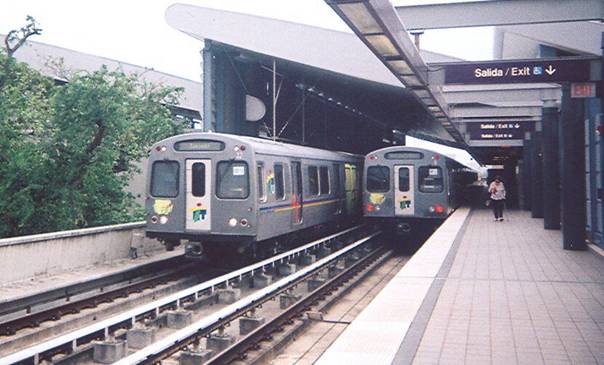
Tren Urbano (San Juan’s modern electric train)
San Juan
Gauge / Trocha (ancho de vía): 4 ft 8 ½ in
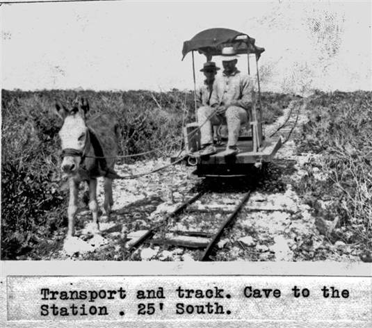
Tram was pulled by a donkey to the light house from the shore. There were two trams. One tram operated from the shore to a cave, where material was taken up a stairway and onto another tram, and from there to the lighthouse. Ferrocarril halado por un burrito para el transporte de materiales de la playa al faro. Materiales para el faro eran llevados en un vagón desde la orilla de la playa hasta una cueva en donde se subían por una escalera y luego se transportaban en otro vagón hasta el faro.
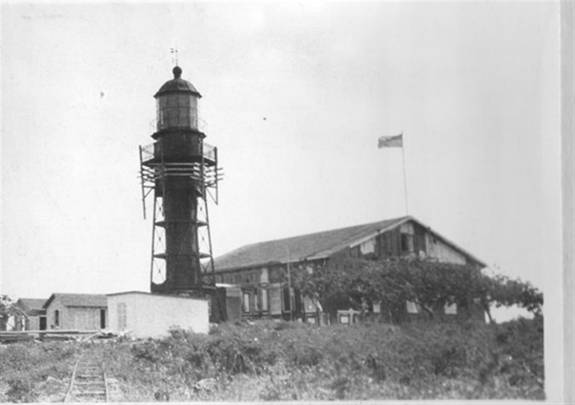
Fotos U.S. Coast Guard
Thanks to / Gracias a: Mrs. Sandra, http://www.thelighthousepeople.com/. They have published an e-book on the lighthouses of Puerto Rico which included the donkey tram. Ellos han publicado un e-book sobre los faros de Puerto Rico que incluía la foto del burrito.
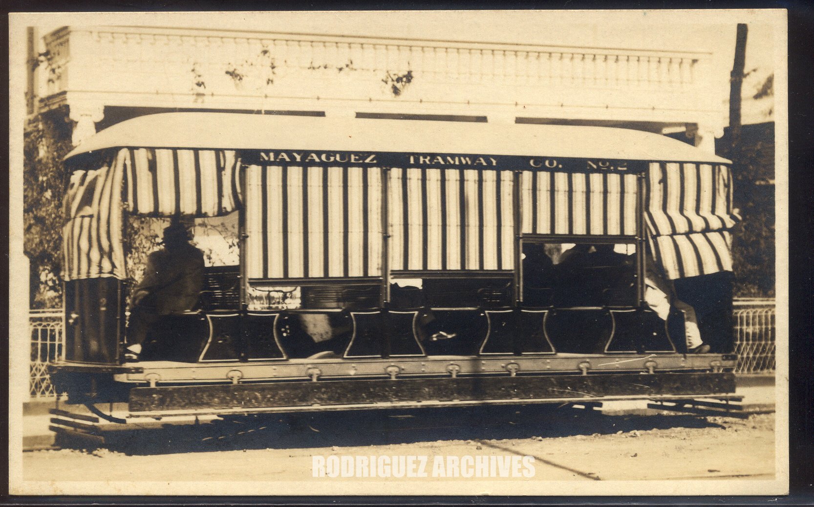
Hayman’s Tourist Shop RP Type 1 – MAYAGUEZ – Street Scene, Mayaguez, P. R. [Battery Trolley Car No. 1]). Rodríguez Archives (José Luis and José Alfredo Rodríguez). Please see: Archivo Histórico y Fotográfico de Puerto Rico – Colección Rodríguez , and Archivo Histórico Y Fotográfico De Puerto Rico’s photostream . Photos used with permission / Fotos usadas con permiso.
First public service railroad in Puerto Rico. Various companies and concessions existed. Tranvía de Mayagüez. Primer ferrocarril de servicio público. Varias compañías / concesiones existieron:
Don José A. González y Echevarría, (Durán; Informe del Comisionado del Interior, 1919)
Doña Amalia Corchado y Ruíz (Informe del Comisionado del Interior, 1919)
Don Alfredo y Doña Clara Cristi (Ibid)
Don Juan González inaugura el tranvía el 18 de marzo de 1872. Los vagones tenían inscrito por el lado – Ferrocarril UrbanoMayagüez , (Monclova, tomo II, pág. 245, 816. Ver María Asunción, pág. 375).
Sociedad Anónima Tranvía de Mayagüez (Duran, Comisionado 1919)
Mayagüez Tramway Co.
Existen unos tokens con el nombre de otras compañías:
KRAEMER&CA. (Catálogo Numismático de Puerto Rico; El Mundo, 18 de marzo de 1984)
SABATER & CO. (Catálogo Numismático)
Four types of trams / Cuatro tipos de tranvías:
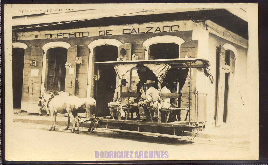
Two horse opened tram operated between town center and Playa (Port). Tranvía abierto de dos caballos que operaba entre el pueblo y la playa.
Phipps, Photo Group 2 – MAYAGUEZ – Horse Car Trolley at Mayaguez, P. R. – Unused.
Horse-drawn trolley in front of Shoe store. Thomas E. Phipps, Photographer, Ponce, P.R.
Rodríguez Archives (José Luis and José Alfredo Rodríguez). Please see: Archivo Histórico y Fotográfico de Puerto Rico – Colección Rodríguez , and Archivo Histórico Y Fotográfico De Puerto Rico’s photostream . Photos used with permission / Fotos usadas con permiso.
—
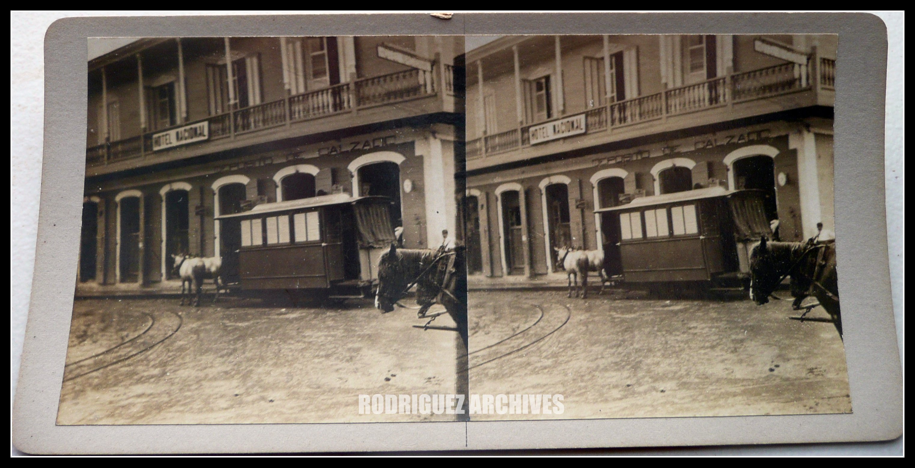
Two horse closed tram operated as above. Tranvía cerrado de dos caballos que operó entre el pueblo y la playa.
Phipps, Photo Group 2 – MAYAGUEZ – Horse Car Trolley at Mayaguez, P. R. – Unused.) Horse-drawn trolley in front of Shoe store. Thomas E. Phipps, Photographer, Ponce, P.R.
Rodríguez Archives (José Luis and José Alfredo Rodríguez). Please see: Archivo Histórico y Fotográfico de Puerto Rico – Colección Rodríguez , and Archivo Histórico Y Fotográfico De Puerto Rico’s photostream . Photos used with permission / Fotos usadas con permiso.
—
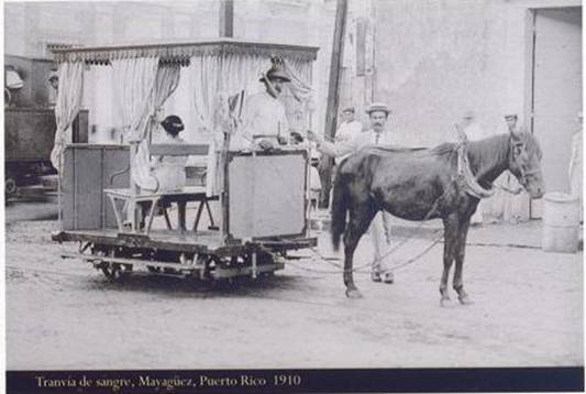
Playa tram. One horse tram that operated in the Playa section (Guanajibo). Tranvía de un caballo que operaba en la playa (Guanajibo)
Foto: Colección Ricardo Medina
—
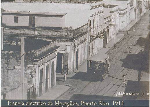
Battery operated tram. Operated between town center and Playa. Tranvía eléctrico de baterías que operaba entre el pueblo y la playa.
Foto: Colección Ricardo Medina
—
Ver / See:
Ver Folleto Tranvía de Mayagüez (Colección Arquitecto Manuel Durán). See Brochure Mayagüez Trams
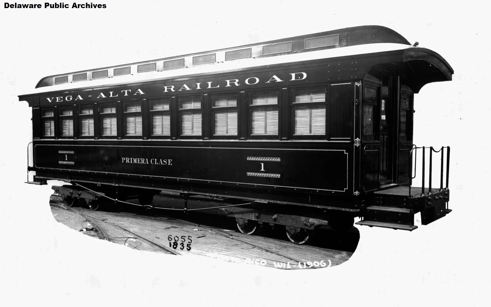 Vega-Alta Railroad Car. Jackson and Sharp Company (Wilmington, Del.). Jackson and Sharp Collection. Delaware Public Archives. Web. 25 Sept. 2014.
—
Northern Porto Rico Railroad Co. (Subsidiary of Central Carmen) (RD)
Vega Alta a Dorado
Gauge / Trocha (ancho de vía): Meter / Metro
Otros nombres / Other names: Vega Alta Railroad / F.C. Del Norte
Northern Porto Rico Railroad Co. is marked as Vega Alta Railroad in the following maps. / La Northern Porto Rico Railroad Co. está marcda como la Vega Alta Railroad en los siguientes mapas.
Map Railroads in Operation, 1916 / Mapa ferrocarriles en operación, 1916 (Data /Datos)
Ferrocarriles en operación, 1916
 National Atlas of the United States
—
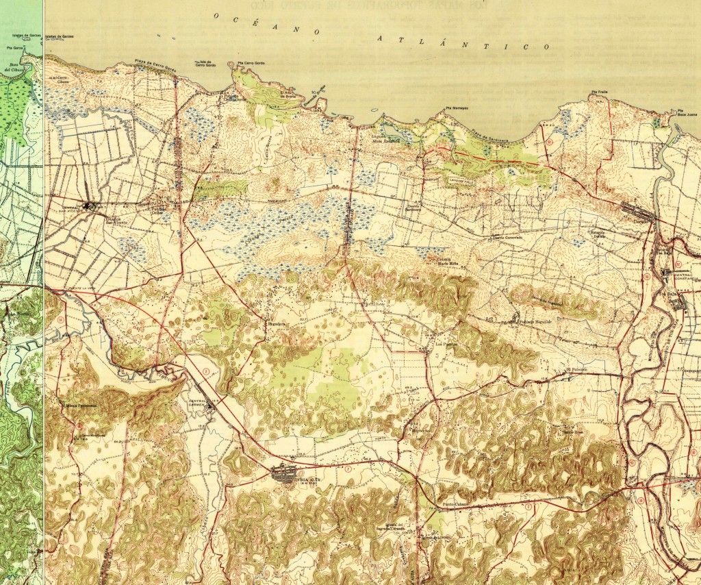 US Historical Topographic Maps (Partial Maps), Vega Alta, PR, 1946
Compare: Vega Baja – Toa Baja
Ver / See: