American Railroad Co. of Puerto Rico Photos
“American Railroad Co. of Puerto Rico – a Set on Flickr.” N. p., n.d. Web. 19 Feb. 2014.
<http://www.flickr.com/photos/barrigerlibrary/sets/72157640461367106/>
Nicholas Fry, John W. Barriger III National Railroad Library Curator. Photos used with permission.
—
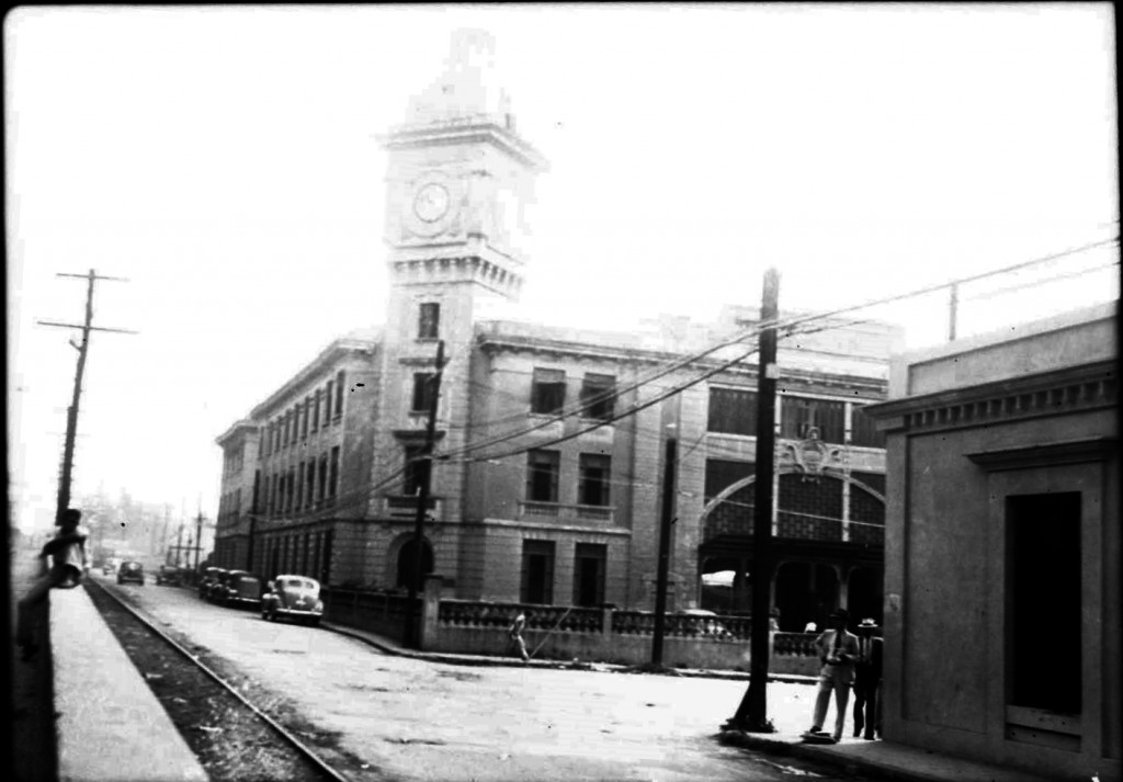 San Juan Station, San Juan. John W. Barriger III photo. Barriger Library, St. Louis Mercantile Library at the University of Missouri St. Louis. <http://www.flickr.com/photos/barrigerlibrary/12292335473/in/set-72157640461367106 > Tracks are from the trolley company. Maps / Mapas. See / Ver: Tramways of Puerto Rico / Tranvías de Puerto Rico. Copyright by Allen Morrison. – San Juan – http://www.tramz.com/pr/sj.html – This was put online on 1 November 2008. Esto es una página sobre los tranvías de San Juan, Caguas y Cataño. Las vías en la foto son del trolley. See / Ver: Port Series Maps by the US Army Engineering Corps / San Juan , Estación de San Juan / San Juan Station and San Juan – Trolleys / Tranvías.
—
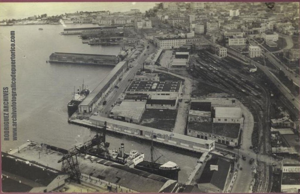 San Juan Station yard. MOSCIONI (ATTRIBUTED) RPPC ~ SAN JUAN – American Rail-Road Station – Mailed from San Juan APR 7, 1925. <https://www.flickr.com/photos/fredandrebecca/5415075816/>. Rodríguez Archives (José Luis and José Alfredo Rodríguez). Please see: Archivo Histórico y Fotográfico de Puerto Rico – Colección Rodríguez , and Archivo Histórico Y Fotográfico De Puerto Rico’s photostream. Photos used with permission / Fotos usadas con permiso.
—
 Source / Fuente: National Atlas of the United States.
Other maps / Otros mapas: Map Railroads in Operation, 1916 / Mapa ferrocarriles en operación, 1916
John W. Barriger III and his party made a trip on train from San Juan to Ponce on the American Railroad Co. of Puerto Rico. The photos they took are included in this page. See map. Two other persons recorded with photos and diagrams on the American Railroad: Jack Delano, a photographer of the Office of Information of the Government of Puerto Rico in 1946 and William Armstrong, 1909 – 1912, a United States military engineer.
John W. Barriger III y su grupo hicieron un viaje en tren desde San Juan a Ponce. Ver mapa. Existieron otras dos personas que reportaron con fotos y dibujos sobre la American Railroad Co. de Puerto Rico: Jack Delano en el 1946, un fotógrafo de la Oficina de de Información del Gobierno de Puerto Rico y William Armstrong, 1909 -1912, un ingeniero, oficial del ejercito de los Estados Unidos.
Ver / See:
Armstrong, William. [Manuscritos sobre algunos pueblos de Puerto Rico] . 1909 -1912. 9 Vol. Print. http://bibliotecadigital.uprrp.edu/cdm/landingpage/collection/william. Biblioteca Digital Puertorriqueña de la Universidad de Puerto Rico, http://bibliotecadigital.uprrp.edu/cdm/. It is a handwritten journal, 9 vol., with notes, photos, and diagrams.
Delano, Jack. De San Juan en el tren / From San Juan to Ponce on the Train. First Edition. Río Piedras, PR: Editorial de la Universidad de Puerto Rico, 1990. Print.
—
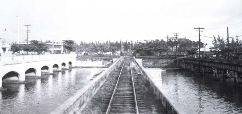 San Antonio Bridge, San Juan. John W. Barriger III photo. Barriger Library, St. Louis Mercantile Library at the University of Missouri St. Louis. <http://www.flickr.com/photos/barrigerlibrary/12292577794/in/set-72157640461367106>
—
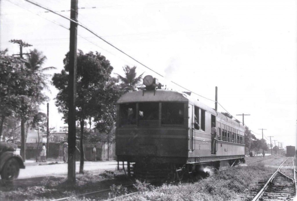 Motor Car / Automotor, Talleres, San Juan. John W. Barriger III photo. Barriger Library, St. Louis Mercantile Library at the University of Missouri St. Louis. <http://www.flickr.com/photos/barrigerlibrary/12292575326/in/set-72157640461367106>. Fuente / Source: Alfredo Vargas. See / Ver: The Steam Powered Passenger Car / El automotor de vapor
—
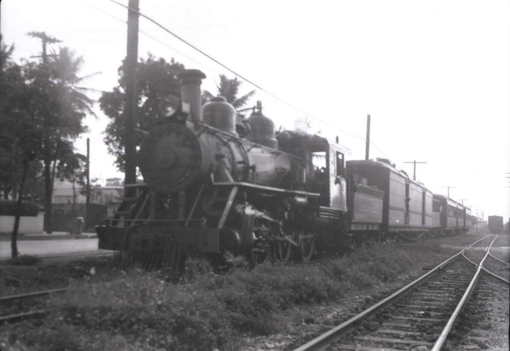 Passenger Train, Talleres, San Juan. John W. Barriger III photo. Barriger Library, St. Louis Mercantile Library at the University of Missouri St. Louis. <http://www.flickr.com/photos/barrigerlibrary/12292113463/in/set-72157640461367106>. Fuente / Source: Alfredo Vargas.
—
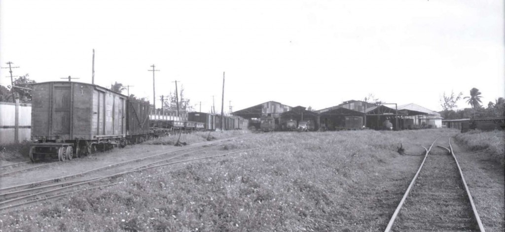 Talleres Station, San Juan. John W. Barriger III photo. Barriger Library, St. Louis Mercantile Library at the University of Missouri St. Louis. < http://www.flickr.com/photos/barrigerlibrary/12291967885/in/set-72157640461367106 > Fuente / Source: Alfredo Vargas. See his page / Ver su página – FreddyHonda . Photo collection of the remnants of the railroads of Puerto Rico / Colección de fotos de los remanentes de los ferrocarriles de Puerto Rico.
—
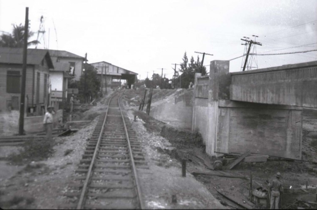 Bridge / Puente, Talleres, San juan. John W. Barriger III photo. Barriger Library, St. Louis Mercantile Library at the University of Missouri St. Louis. <https://www.flickr.com/photos/barrigerlibrary/12292645744/in/set-72157640461367106>. Source / Fuente: Víctor Díaz ( AMIGOS DEL TREN DE ISABELA (ATI) , Modelo Estación de Isabela / Model Isabela Station).
—
The above photos can be seen on the following photo below: “[Vista Aérea de Un Sector Arrabalero Del Caño de Martín Peña] / Caño Martín Peña (P.R.)–Aerial views :: Fotos El Mundo 40-68.” Las fotos anteriores se pueden localizar en la foto que sigue, de la colección El Mundo de la Universidad de Puerto Rico.
—
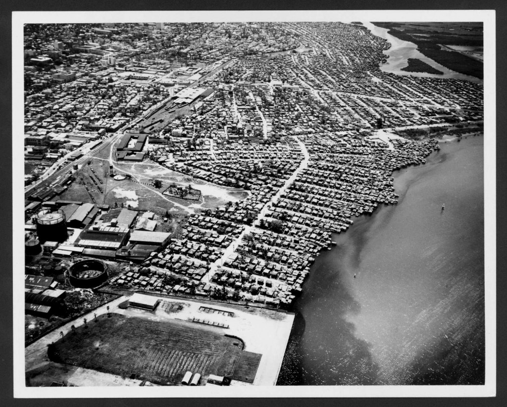 “[Vista Aérea de Un Sector Arrabalero Del Caño de Martín Peña] / Caño Martín Peña
(P.R.)–Aerial views :: Fotos El Mundo 40-68.” N. p., n.d. Web. 31 Mar. 2014.
Lugar y fecha del evento San Juan (P.R.), 1966. Publicador / Publisher (imagen
digital)- Universidad de Puerto Rico, Recinto de Río Piedras.
Identificador (Bib #) 1039698, Identificador (Unique ID) UI PRHDL
Identificador (PRDH) PRDH014PH01533
URL http://bibliotecadigital.uprrp.edu/cdm/ref/collection/ELM4068/id/1035
Biblioteca Digital Puertorriqueña – http://bibliotecadigital.uprrp.edu/cdm/
Derechos / Copyright – Todos los derechos reservados.
—
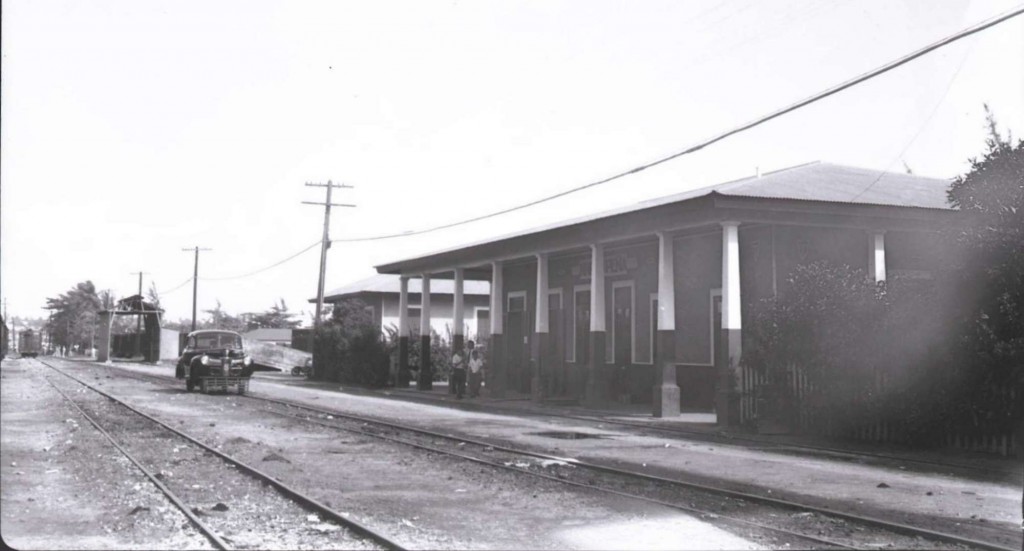 Martín Peña Station, San Juan. John W. Barriger III photo. Barriger Library, St. Louis Mercantile Library at the University of Missouri St. Louis. <http://www.flickr.com/photos/barrigerlibrary/12292120533/in/set-72157640461367106>
—
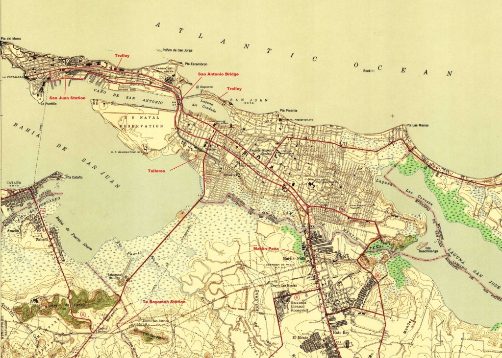 San Juan. Map – Cortesy of the USGS
—
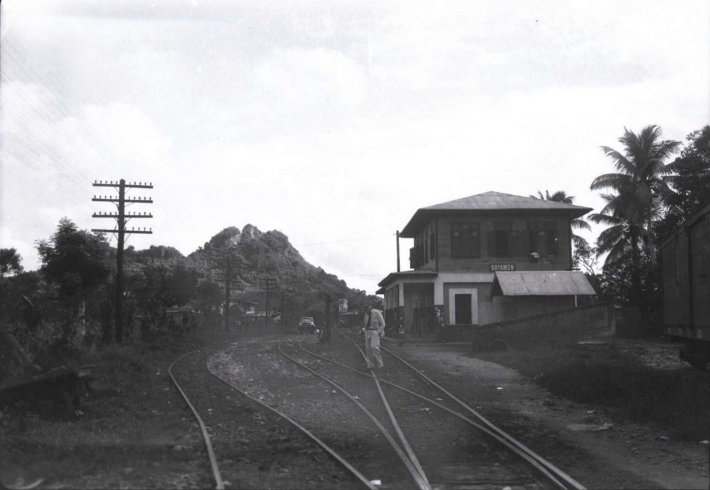 Bayamón Station / Estación de Bayamón, Bayamón. John W. Barriger III photo. Barriger Library, St. Louis Mercantile Library at the University of Missouri St. Louis. <http://www.flickr.com/photos/barrigerlibrary/12292099403/in/set-72157640461367106>. See / Ver: Estación de Bayamón / Bayamón Station
Puerto Rico Railroad & Transport Co., anteriormente la American Railroad Co.
—
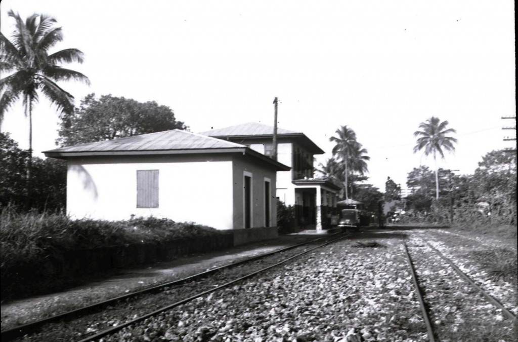 Bayamón Station 2. John W. Barriger III photo. Barriger Library, St. Louis Mercantile Library at the University of Missouri St. Louis. <http://www.flickr.com/photos/barrigerlibrary/12292404314/in/set-72157640461367106>
—
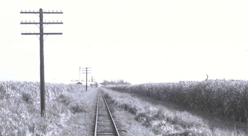 Central San Vicente (Sugar Mill), Vega Baja. John W. Barriger III photo. Barriger Library, St. Louis Mercantile Library at the University of Missouri St. Louis. <http://www.flickr.com/photos/barrigerlibrary/12292167125/in/set-72157640461367106> PR031 – Central San Vicente (Similar a la tomada por Jack Delano). Alfredo Vargas.
—
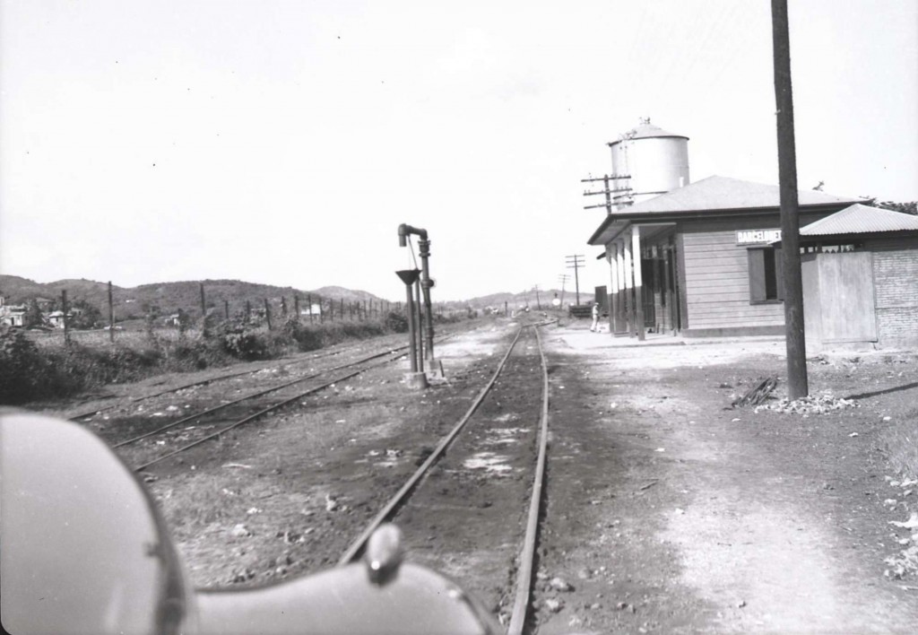 Barceloneta Station, Barceloneta. John W. Barriger III photo. Barriger Library, St. Louis Mercantile Library at the University of Missouri St. Louis. <http://www.flickr.com/photos/barrigerlibrary/12292585826/in/set-72157640461367106>
—
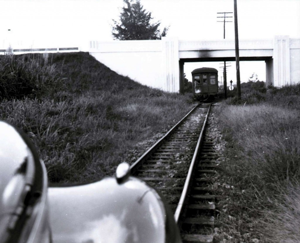
Central Cambalache Viaduct, Arecibo. John W. Barriger III photo. Barriger Library, St. Louis Mercantile Library at the University of Missouri St. Louis. <http://www.flickr.com/photos/barrigerlibrary/12292652576/in/set-72157640461367106>. There were two track gauges at Central Cambalache: 30 inches and meter gauge. The American Railroad was meter gauge.
Este viaducto era bastante ancho ya que por debajo pasaba la línea principal de la A.R.R.Co. paralela a un ramal del ferrocarril de la Central Cambalache. Justo antes de la entrada este del viaducto (km.81.340) había un desvío que conectaba las vías de la A.R.R.Co con el Ramal Cambalache que llegaba al batey de la central. Las vías de la A.R.R.Co. eran de 1 metro de ancho y las de Cambalache de 30 pulgadas, por lo que este ramal tuvo 3 rieles para tener los dos anchos de vía. Al oeste del viaducto al lado sur de la vía se encontraba la estación Cambalache. Quiero darle las gracias a Héctor Ruiz, por haber identificado la foto antígua del viaducto de Cambalache. Source / Fuente: Alfredo Vargas, Héctor Ruiz, Redescubriendo a Puerto Rico
—
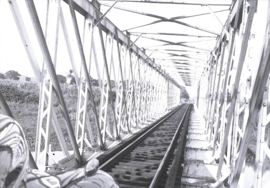
Río Grande de Arecibo Bridge (Cambalache Bridge / Puente). John W. Barriger III photo. Barriger Library, St. Louis Mercantile Library at the University of Missouri St. Louis. <http://www.flickr.com/photos/barrigerlibrary/12292087275/in/set-72157640461367106> See / Ver: Alfredo Vargas , Puente ferroviario sobre el Río Grande de Arecibo.
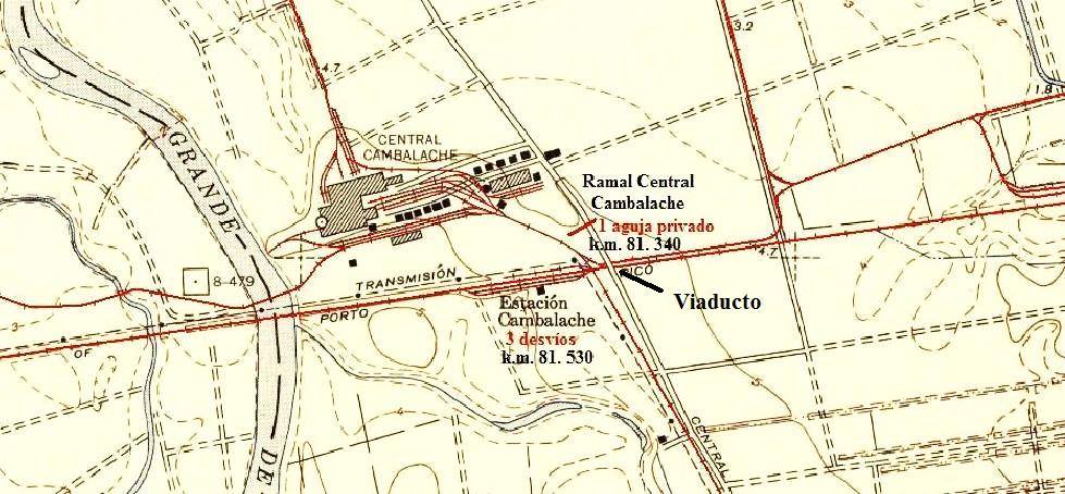 Map – Cortesy of the USGS. Comments by Alfredo Vargas.
—
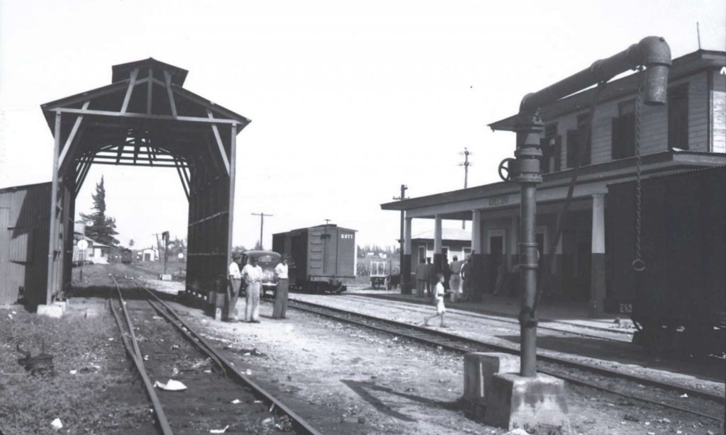 Arecibo Station 1. John W. Barriger III photo. Barriger Library, St. Louis Mercantile Library at the University of Missouri St. Louis. <http://www.flickr.com/photos/barrigerlibrary/12292508704/in/set-72157640461367106>
—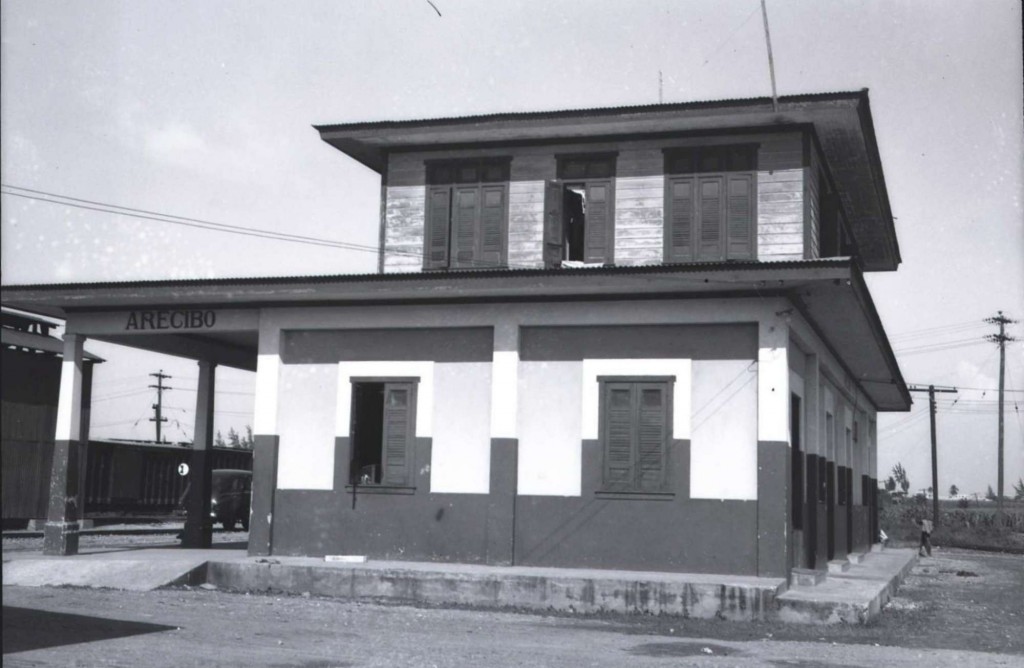 Arecibo Station 2. John W. Barriger III photo. Barriger Library, St. Louis Mercantile Library at the University of Missouri St. Louis. <http://www.flickr.com/photos/barrigerlibrary/12292457134/in/set-72157640461367106>
—
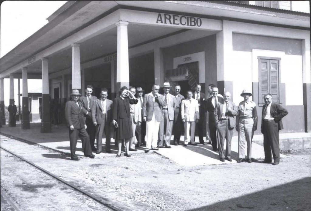 Arecibo Station 3. John W. Barriger III photo. Barriger Library, St. Louis Mercantile Library at the University of Missouri St. Louis. <http://www.flickr.com/photos/barrigerlibrary/12292338873/in/set-72157640461367106>
—
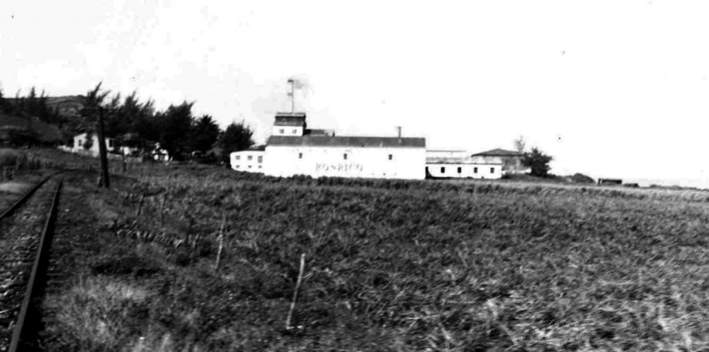 Destilería Ron Rico, Arecibo. John W. Barriger III photo. Barriger Library, St. Louis Mercantile Library at the University of Missouri St. Louis. <https://www.flickr.com/photos/barrigerlibrary/12292705866/in/set-72157640461367106>. Source / Fuente: Efraín Martell and Alfredo Vargas.
—
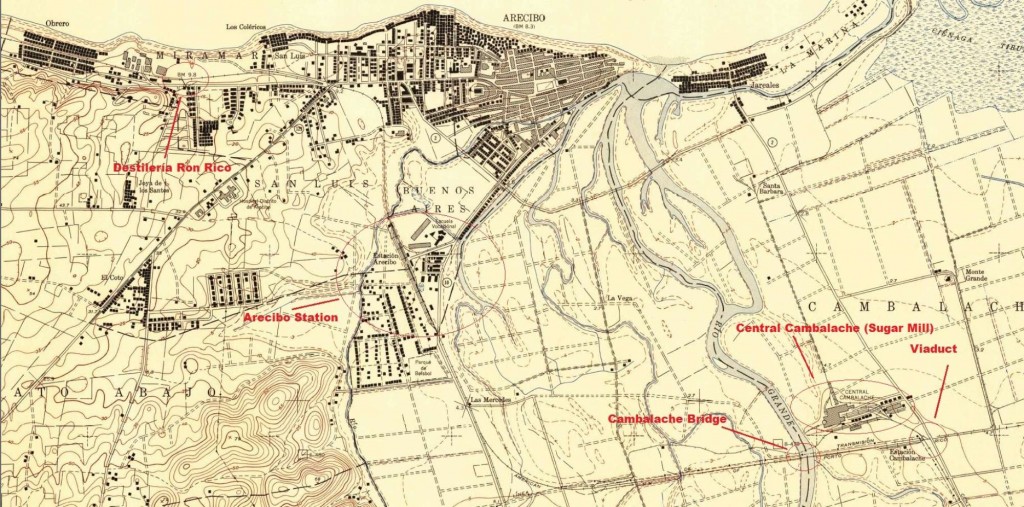 Map – Cortesy of the USGS. Arecibo 1950. Red comments added.
—
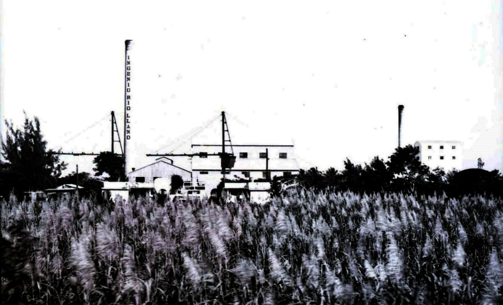 Central Río Llano, Camuy. John W. Barriger III photo. Barriger Library, St. Louis Mercantile Library at the University of Missouri St. Louis. <https://www.flickr.com/photos/barrigerlibrary/12292612116/in/set-72157640461367106>. “There are several shots both approaching and looking back at Rio Llano mill. They had a siding for
receiving molasses and coal or oil for burning, but did not receive any cane by rail. I believe from interviews I conducted around the mill, that they may have shipped some of their rum by rail in the earlier years of operation, but later went to trucks only. Cane arrived at the mill by truck.” Dave Deyo email, 27 Feb. 2014.
—
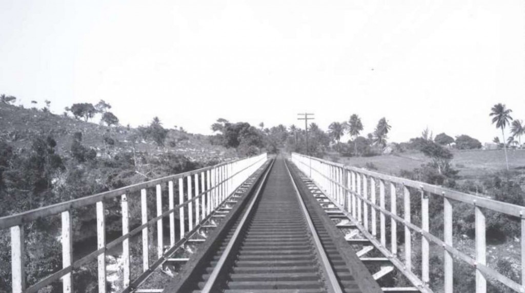 Quebrada Bellaca (Bridge), Camuy. John W. Barriger III photo. Barriger Library, St. Louis Mercantile Library at the University of Missouri St. Louis. <http://www.flickr.com/photos/barrigerlibrary/12292071675/in/set-72157640461367106> PR058 y PR059 – Puente sobre la Quebrada Bellaca (el terreno al lado del arrimo es muy accidentado y no concuerda con el de la Quebrada Los Cedros). Fuente / Source: Alfredo Vargas.
—
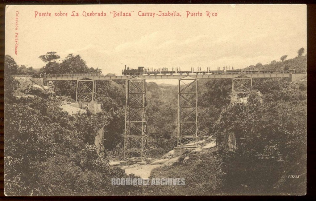 Puente sobre la quebrada Bellaca. CPB Set 3 Card #A50568 – Puente sobre la Quebrada ‘Bellaca’ CAMUY – ISABELA, Puerto Rico. Unused. eku San Juan 12-23-1908, Published by Coleccion Paris Bazar de Pedro Giusti (CPB). <https://www.flickr.com/photos/fredandrebecca/3574421217/in/photostream/>. Rodríguez Archives (José Luis and José Alfredo Rodríguez). Please see: Archivo Histórico y Fotográfico de Puerto Rico – Colección Rodríguez , and Archivo Histórico Y Fotográfico De Puerto Rico’s photostream .
Photos used with permission / Fotos usadas con permiso.
—
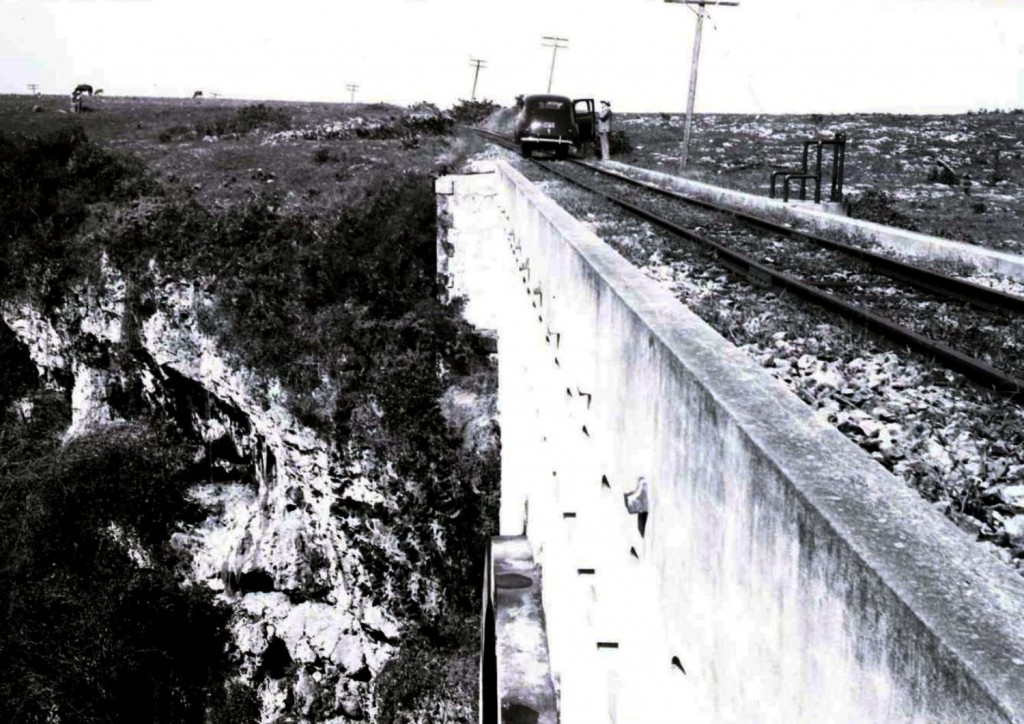 Puente Blanco (Bridge), Quebradilla. John W. Barriger III photo. Barriger Library, St. Louis Mercantile Library at the University of Missouri St. Louis. <http://www.flickr.com/photos/barrigerlibrary/12292063495/in/set-72157640461367106> PR006, PR034, PR043 y PR061- Puente Blanco (Quebrada Mala) Quebradillas.
—
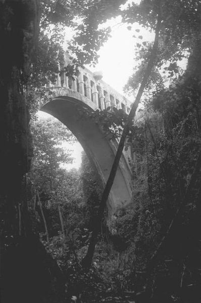
“Puente Blanco.” Wikipedia, the free encyclopedia 2 Apr. 2014. Wikipedia. Web. 7 Apr. 2014. <http://en.wikipedia.org/wiki/Puente_Blanco>. “File:Puente Blanco.jpg.” Wikipedia, the free encyclopedia. Wikipedia. Web. 7 Apr. 2014. <http://en.wikipedia.org/wiki/File:Puente_Blanco.jpg>. Author Víctor López Reyes, Old railway bridge near Quebradillas, Puerto Rico. Public Domain. Source: National Park Service.
—
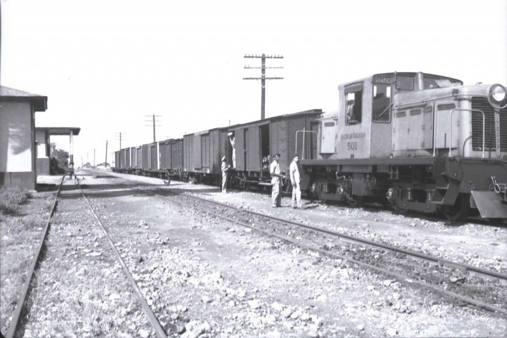 (Quebradilla Station? I need to verify. / ¿Estación de Quebradillas? Hay que verificar), Quebradillas. ARR 501. John W. Barriger III photo. Barriger Library, St. Louis Mercantile Library at the University of Missouri St. Louis. <http://www.flickr.com/photos/barrigerlibrary/12292554594/sizes/o/in/set-72157640461367106/> Locomotive: Whitcomb ARR 501, Serial #60048, built 11/1941, B-B Diesel-Electric, 44 tons, class 44DE-17, shipped as #401 but renumbered after arrival. Dave Deyo email, 27 Feb. 2014.
—
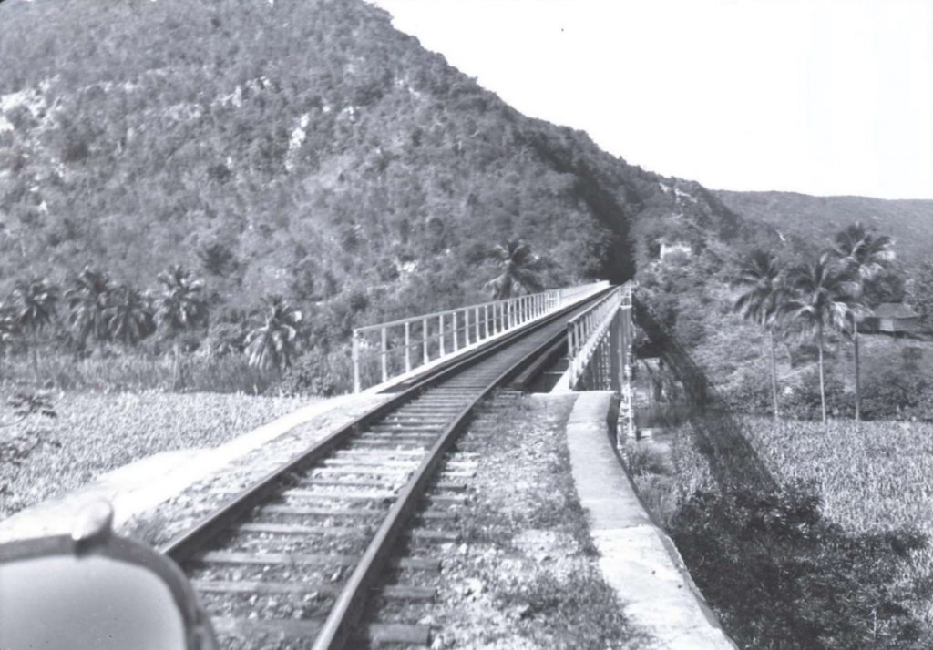 Guajataca Bridge / Puente. The Guajataca River divides the towns of Isabela and Quebradillas. Moving towards the West / Viajando hacia el oeste. John W. Barriger III photo. Barriger Library, St. Louis Mercantile Library at the University of Missouri St. Louis. < http://www.flickr.com/photos/barrigerlibrary/12292534706/in/set-72157640461367106>
—
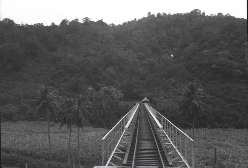
Guajataca Bridge / Puente. Looking back towards the East / Mirando hacia el este. John W. Barriger III photo. Barriger Library, St. Louis Mercantile Library at the University of Missouri St. Louis. < http://www.flickr.com/photos/barrigerlibrary/12292203685/in/set-72157640461367106>. In order to reach the Guajataca Bridge from the East, you would first passed the Guajataca Tunnel (East).
—
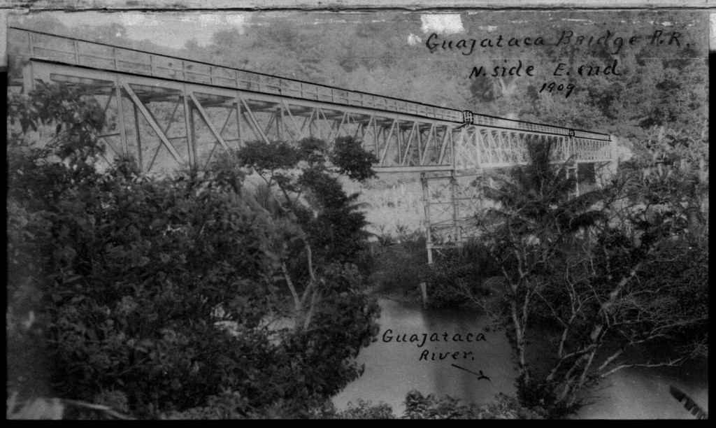 Guajataca Bridge. Manuscritos de William H. Armstrong, vol. 5. 10 abril 2014. Biblioteca Digital Puertorriqueña, <http://bibliotecadigital.uprrp.edu/cdm/>
—
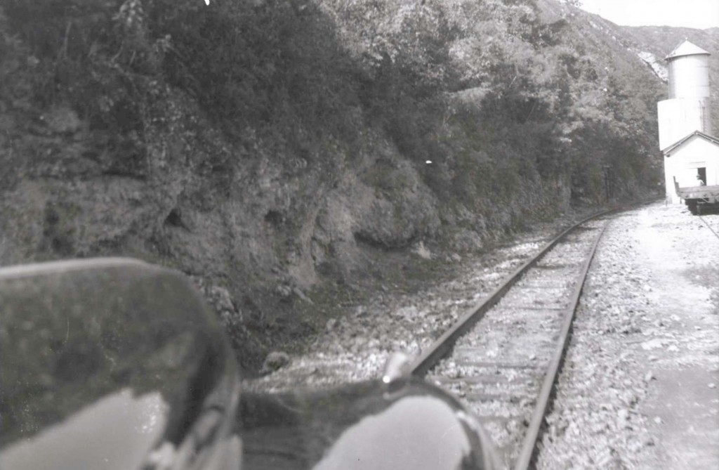 Guajataca Water Tower / Cambija de Guajataca, Isabela. John W. Barriger III photo. Barriger Library, St. Louis Mercantile Library at the University of Missouri St. Louis. <http://www.flickr.com/photos/barrigerlibrary/12292059875/in/set-72157640461367106> Source / Fuente: Víctor Díaz ( AMIGOS DEL TREN DE ISABELA (ATI) , Modelo Estación de Isabela / Model Isabela Station).
—
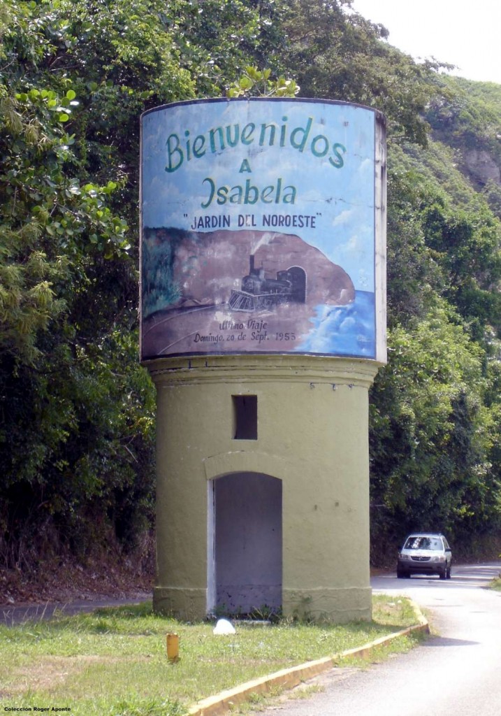 —
—
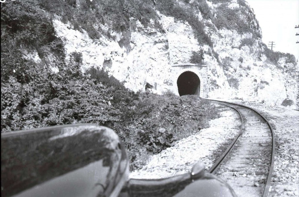 Guajataca Tunnel (West) / Túnel de Guajataca (oeste), Isabela. John W. Barriger III photo. Barriger Library, St. Louis Mercantile Library at the University of Missouri St. Louis. < http://www.flickr.com/photos/barrigerlibrary/12292530516/in/set-72157640461367106>
—
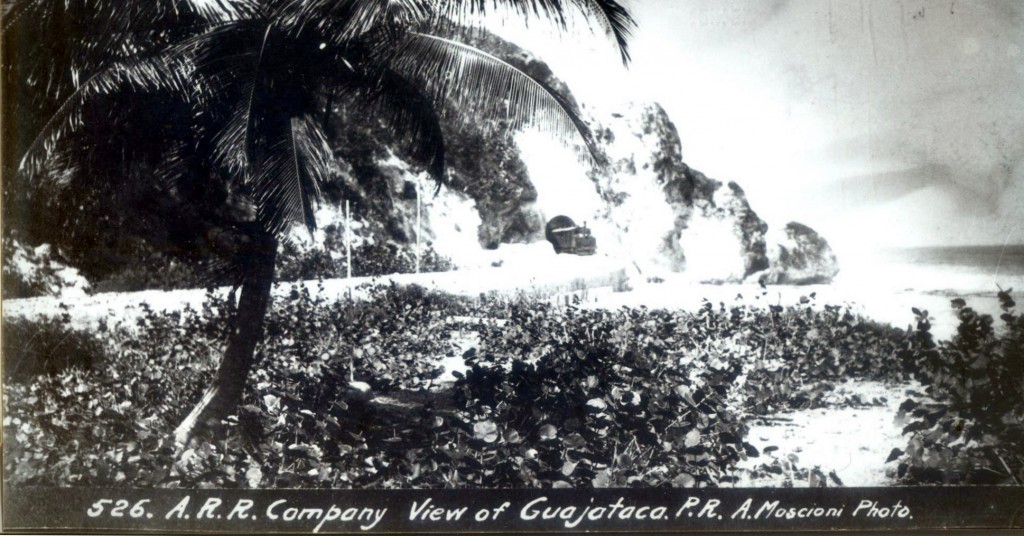 Colección Dave Deyo. Photo by Attilio Moscioni. Train with a French engine. Tren con locomotora francesa.
—
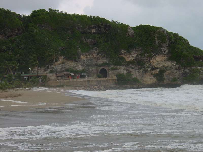 Guajataca Tunnel (West). Bill Goodman Collection, Greenville, TX. Used with permission.
—
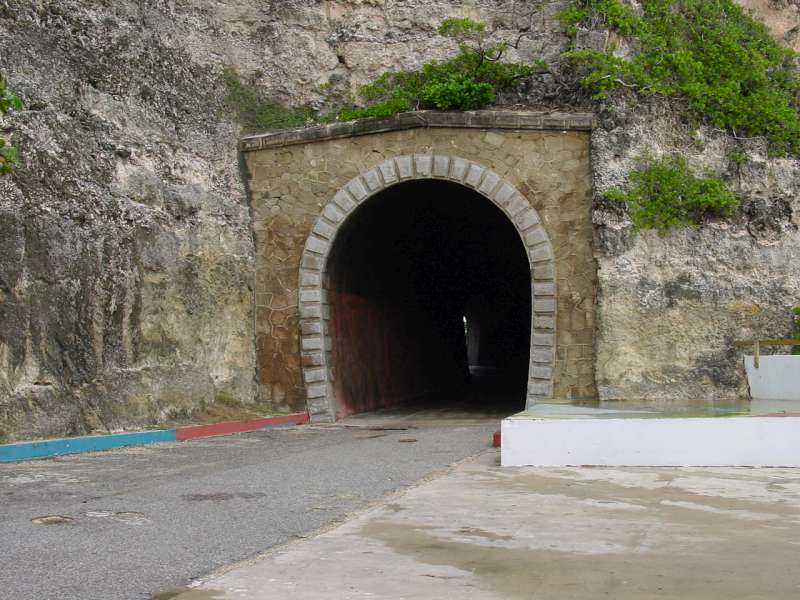 Guajataca Tunnel (West). Bill Goodman Collection, Greenville, TX. Used with permission.
—
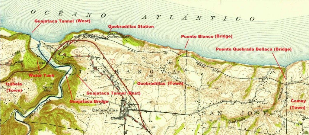 Map – Cortesy of the USGS
—
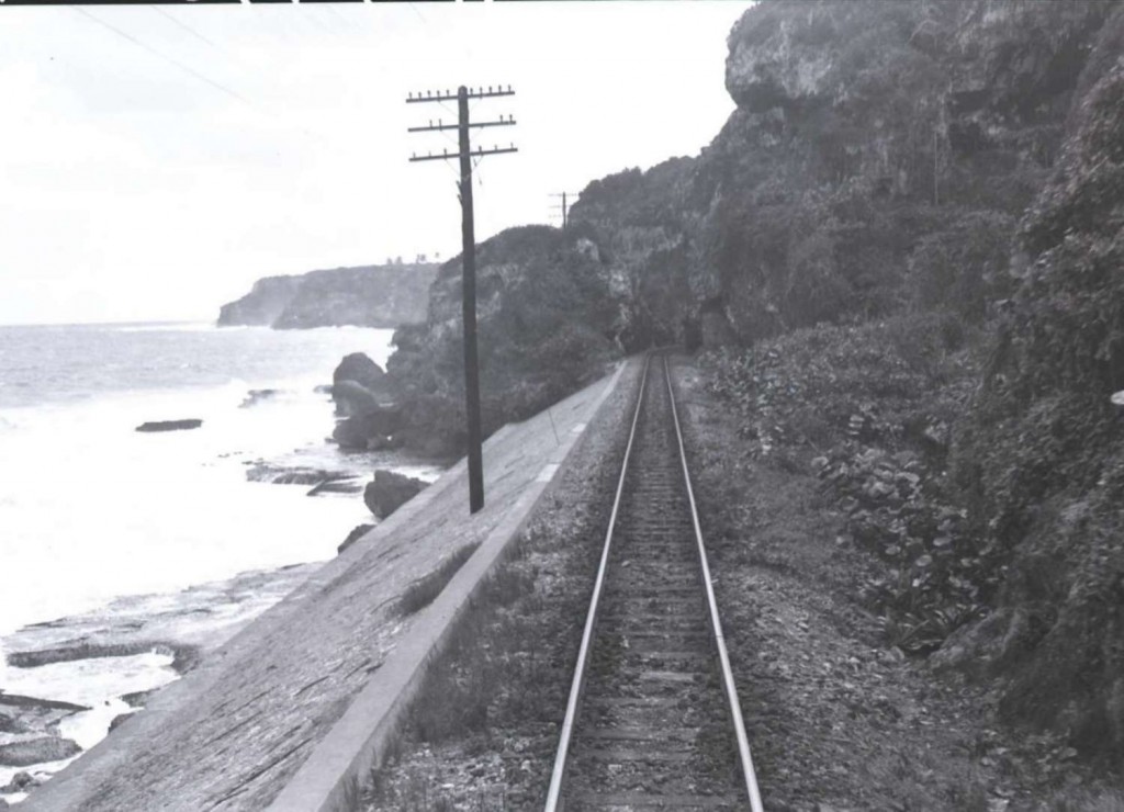 Guajataca Tunnel / Túnel de Guajataca (Leaving the tunnel). John W. Barriger III photo. Barriger Library, St. Louis Mercantile Library at the University of Missouri St. Louis. <http://www.flickr.com/photos/barrigerlibrary/12292343213/in/set-72157640461367106> See / Ver: Tunnels / Túneles
—
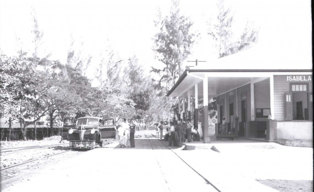 Isabela Station, Isabela. John W. Barriger III photo. Barriger Library, St. Louis Mercantile Library at the University of Missouri St. Louis. <http://www.flickr.com/photos/barrigerlibrary/12292534824/in/set-72157640461367106> See / Ver: Víctor Díaz – AMIGOS DEL TREN DE ISABELA (ATI) , Modelo Estación de Isabela / Model Isabela Station.
—
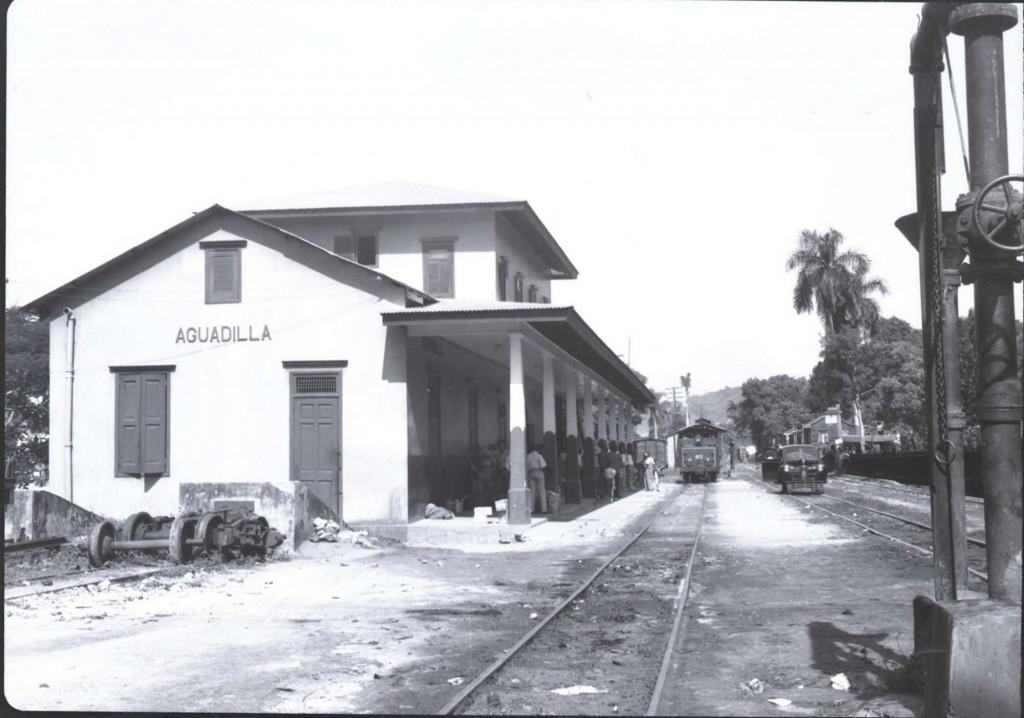 Aguadilla Station, Aguadilla. John W. Barriger III photo. Barriger Library, St. Louis Mercantile Library at the University of Missouri St. Louis. <http://www.flickr.com/photos/barrigerlibrary/12292554594/in/set-72157640461367106>. See / Ver: Platt, Robert S. (Robert Swanton), 1891-1964 / American Geographical Society Library, University of Wisconsin-Milwaukee Libraries. Photos used with permission.
—
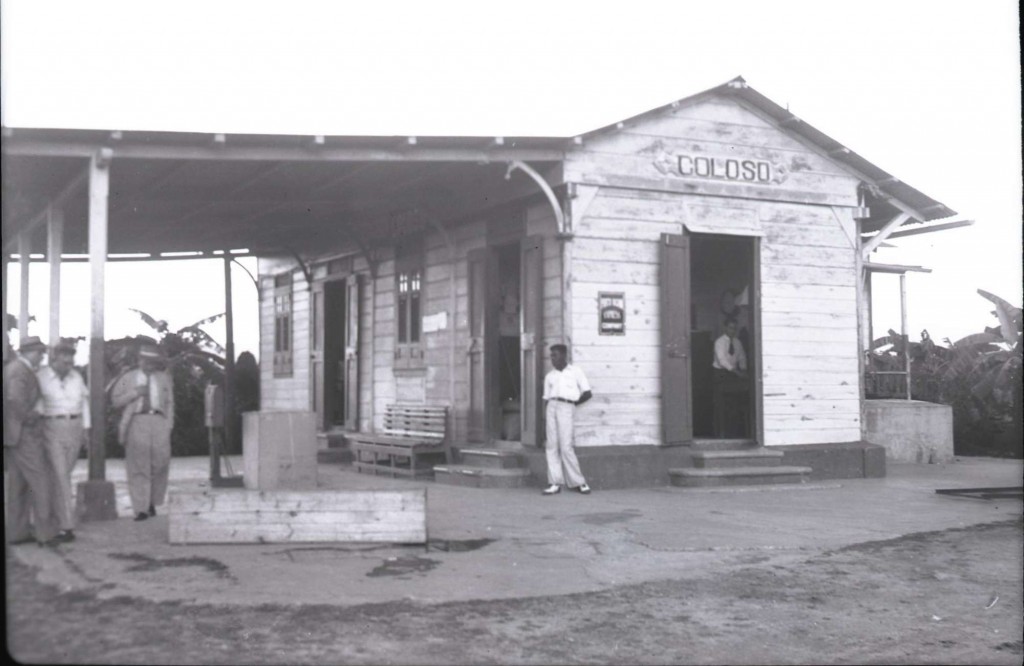
Coloso Station, Aguada. John W. Barriger III photo. Barriger Library, St. Louis Mercantile Library at the University of Missouri St. Louis. <http://www.flickr.com/photos/barrigerlibrary/12292257913/in/set-72157640461367106>
—
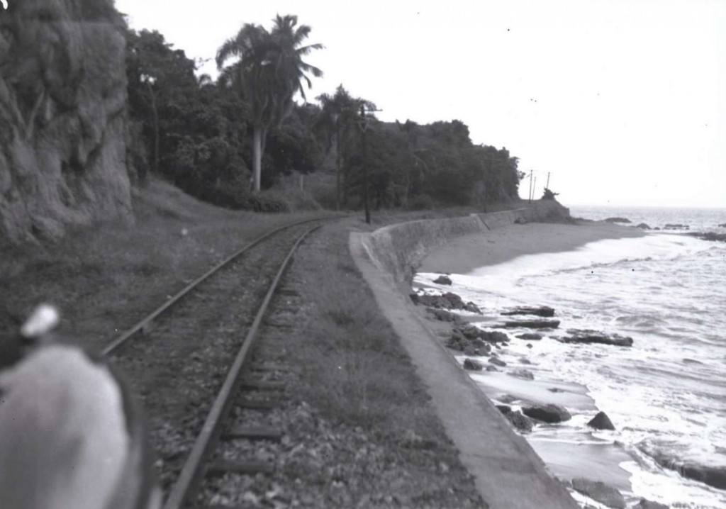 Barrio Barrero, Rincón. John W. Barriger III photo. Barriger Library, St. Louis Mercantile Library at the University of Missouri St. Louis. <http://www.flickr.com/photos/barrigerlibrary/12292582916/in/set-72157640461367106> Area identified by Alfredo Vargas. PR010 y PR073 – Muros de contención del barrio Barrero de Rincón (las pude identificar por la curvatura y la alcantarilla que todavía existe).
—
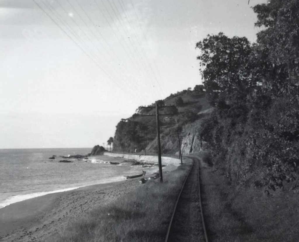 Barrio Barrero, Rincón. John W. Barriger III photo. Barriger Library, St. Louis Mercantile Library at the University of Missouri St. Louis. <http://www.flickr.com/photos/barrigerlibrary/12292197095/in/set-72157640461367106> Area identified by Alfredo Vargas. PR010 y PR073 – Muros de contención del barrio Barrero de Rincón (las pude identificar por la curvatura y la alcantarilla que todavía existe).
—
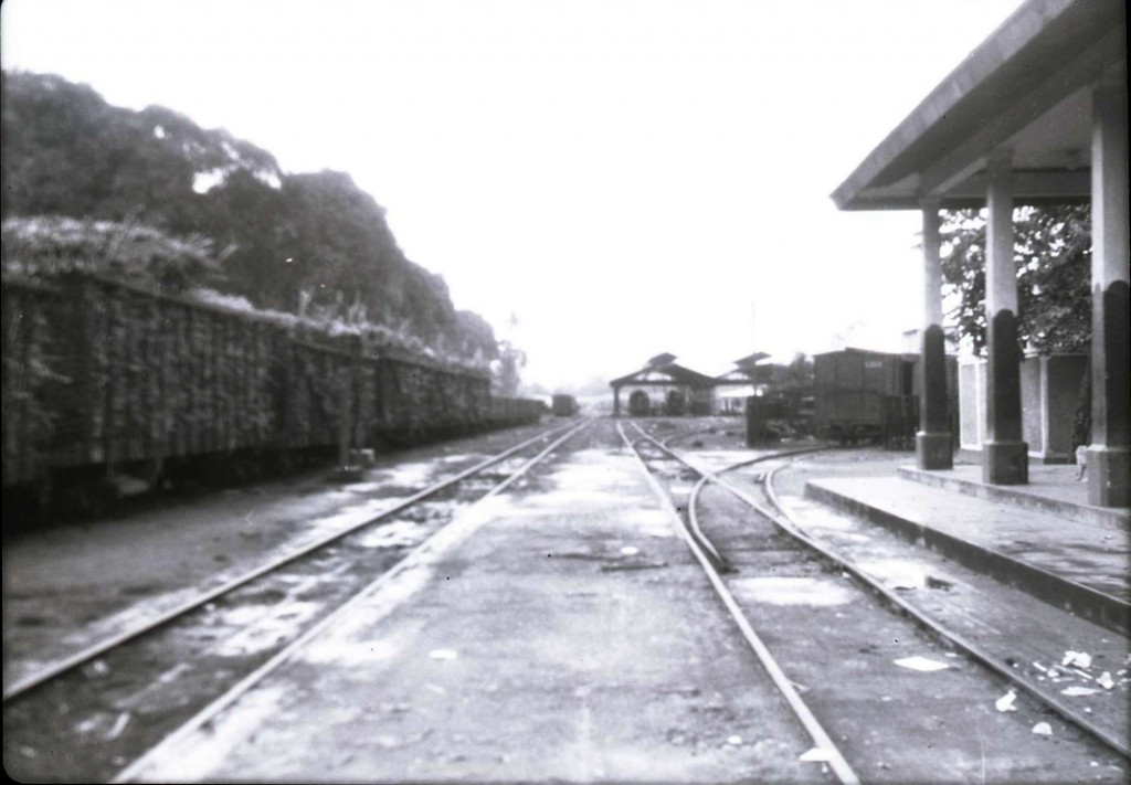 Mayagüez Station (Playa), Mayagüez. John W. Barriger III photo. Barriger Library, St. Louis Mercantile Library at the University of Missouri St. Louis. <http://www.flickr.com/photos/barrigerlibrary/12292461494/in/set-72157640461367106 >
—
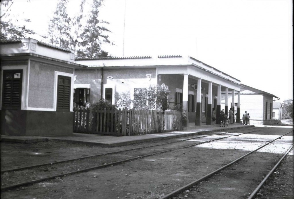 Manatí Station, Manatí. John W. Barriger III photo. Barriger Library, St. Louis Mercantile Library at the University of Missouri St. Louis. <http://www.flickr.com/photos/barrigerlibrary/12292633516/in/set-72157640461367106 > Source / Fuente: Efraín Martell and Alfredo Vargas. Ver / See: Delano, Jack. De San Juan a Ponce en el Tren / From San Juan to Ponce on the Train. Río Piedras, Puerto Rico : Editorial de la Universidad de Puerto Rico, 1990. Print. 49.
—
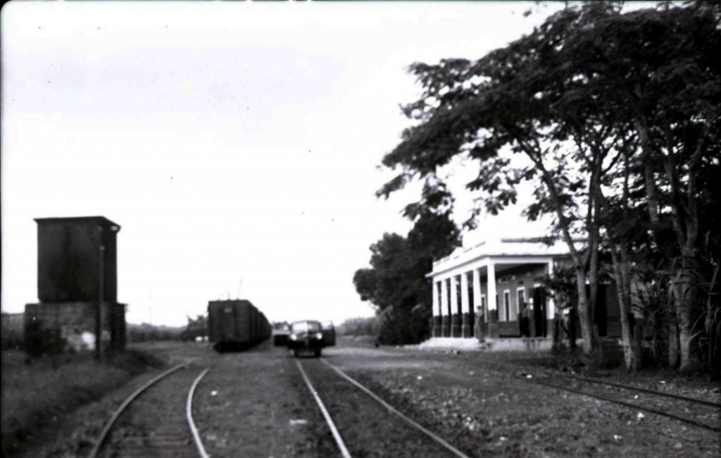 Hormigueros Station, Hormigueros. John W. Barriger III photo. Barriger Library, St. Louis Mercantile Library at the University of Missouri St. Louis. <http://www.flickr.com/photos/barrigerlibrary/12292276073/in/set-72157640461367106> Source / Fuente: Efraín Martell.
—
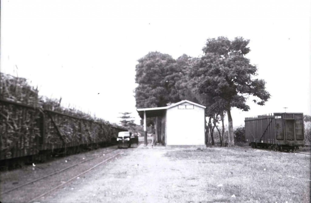 Filial Amor Station, San Germán. John W. Barriger III photo. Barriger Library, St. Louis Mercantile Library at the University of Missouri St. Louis. <http://www.flickr.com/photos/barrigerlibrary/12292558286/in/set-72157640461367106 > Fuente / Source: Efraín Martell and Alfredo Vargas.
—
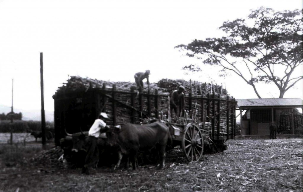 Filial Amor Station 2. John W. Barriger III photo. Barriger Library, St. Louis Mercantile Library at the University of Missouri St. Louis. <http://www.flickr.com/photos/barrigerlibrary/12292152363/in/set-72157640461367106> Fuente / Source: Efraín Martell and Alfredo Vargas.
—
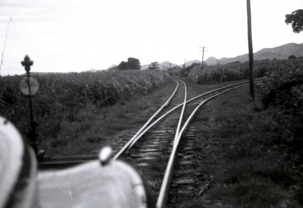 Filial Amor Station 3. John W. Barriger III photo. Barriger Library, St. Louis Mercantile Library at the University of Missouri St. Louis. <http://www.flickr.com/photos/barrigerlibrary/12292238763/in/set-72157640461367106> Fuente / Source: Efraín Martell and Alfredo Vargas.
—
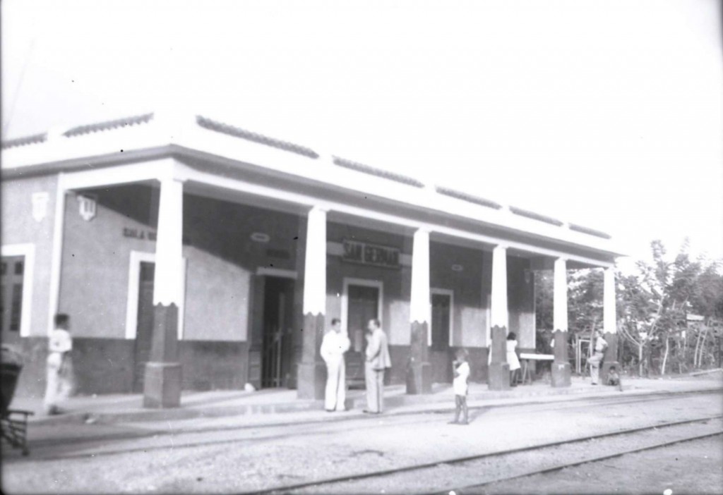
San Germán Station, San Germán. John W. Barriger III photo. Barriger Library, St. Louis Mercantile Library at the University of Missouri St. Louis. <http://www.flickr.com/photos/barrigerlibrary/12292702306/in/set-72157640461367106>
—
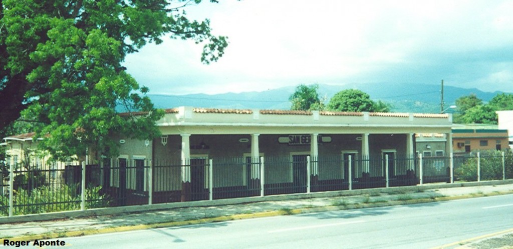
—
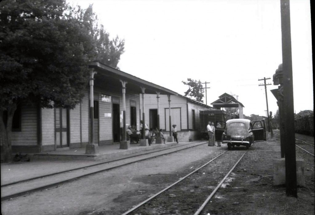 Lajas Station (Country / Campo), Lajas. John W. Barriger III photo. Barriger Library, St. Louis Mercantile Library at the University of Missouri St. Louis. <http://www.flickr.com/photos/barrigerlibrary/12292682046/in/set-72157640461367106> Fuente / Source: Efraín Martell and Alfredo Vargas.
—
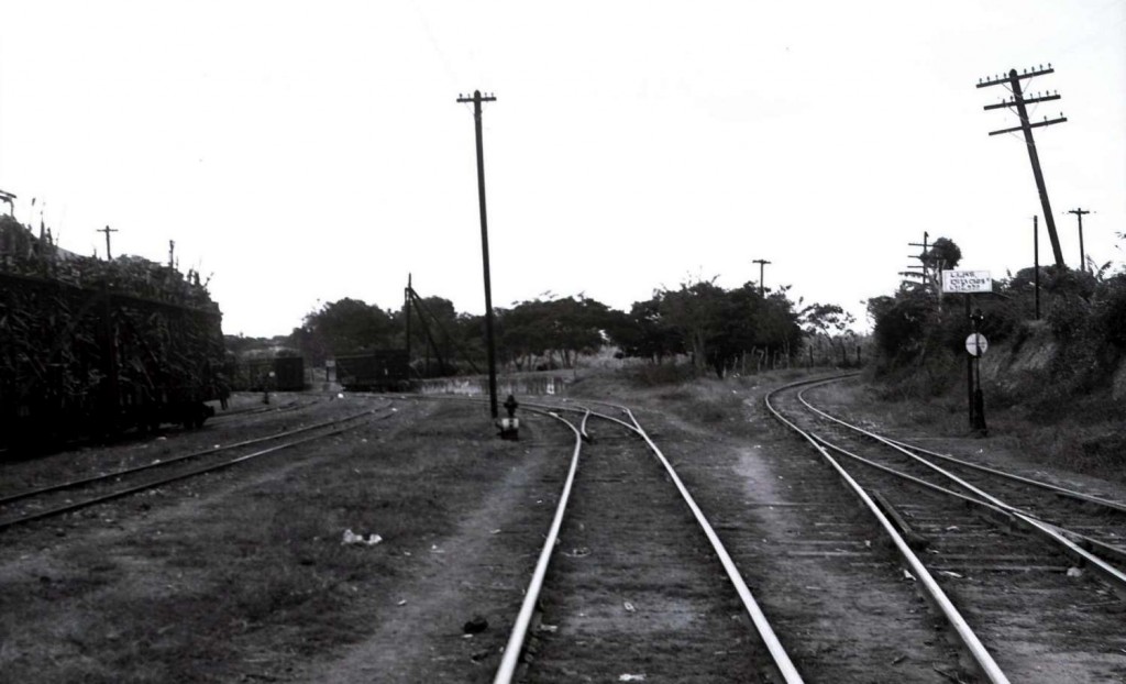 Lajas Station 2 (Country / Campo). John W. Barriger III photo. Barriger Library, St. Louis Mercantile Library at the University of Missouri St. Louis. <http://www.flickr.com/photos/barrigerlibrary/12292561114/in/set-72157640461367106> Fuente / Source: Efraín Martell and Alfredo Vargas.
—
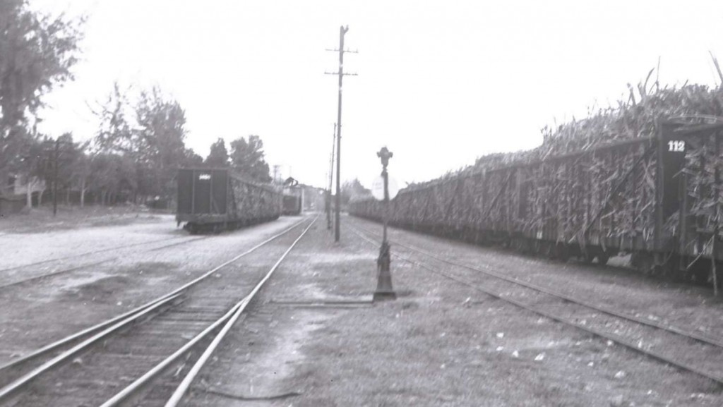 Lajas Station 3 (Country / Campo). John W. Barriger III photo. Barriger Library, St. Louis Mercantile Library at the University of Missouri St. Louis. <http://www.flickr.com/photos/barrigerlibrary/12292133045/in/set-72157640461367106> Fuente / Source: Efraín Martell and Alfredo Vargas. See / Ver Estaciones de Lajas / Lajas Stations
—

Source / Fuente: National Atlas of the United States. The trip passed the towns of Mayagüez, Hormigueros, San Germán, and Lajas and then onto Guánica, Yauco, and Ponce. El viaje pasó por los pueblos mencionados.
—
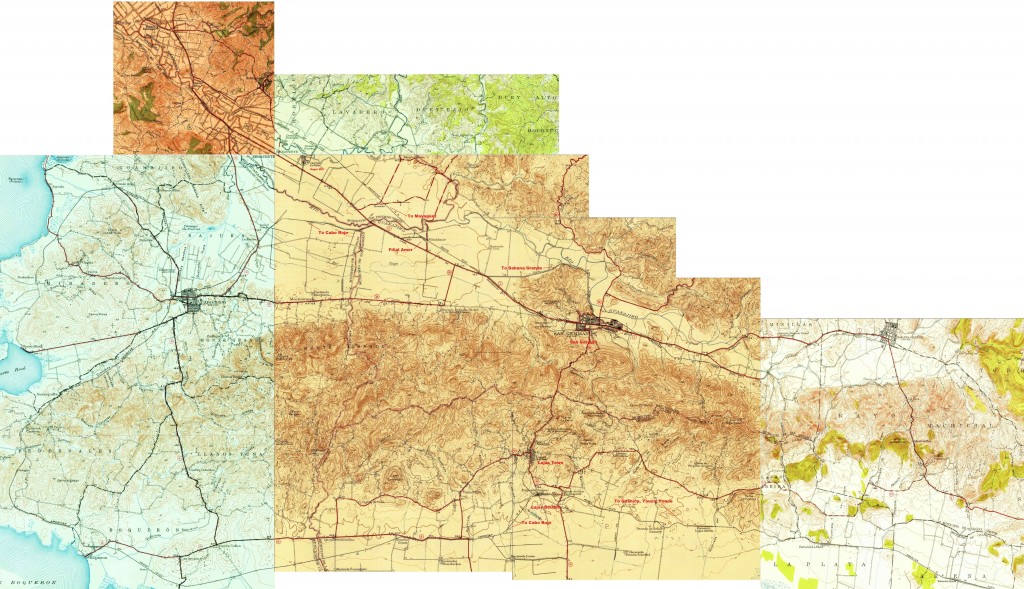 Courtesy of the U.S. Geological Survey.
—
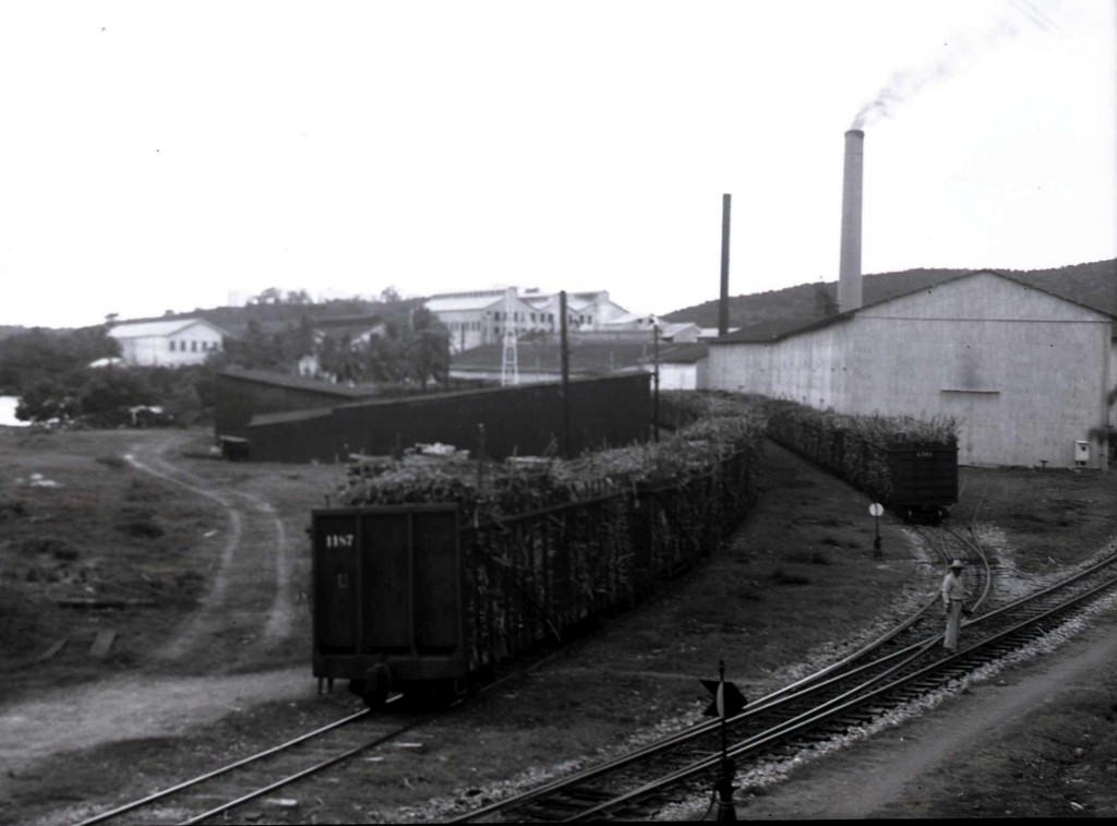 Central Guánica (Sugar Mill), Guánica. John W. Barriger III photo. Barriger Library, St. Louis Mercantile Library at the University of Missouri St. Louis. <http://www.flickr.com/photos/barrigerlibrary/12292751066/in/set-72157640461367106 > Fuente / Source: Efraín Martel.
—
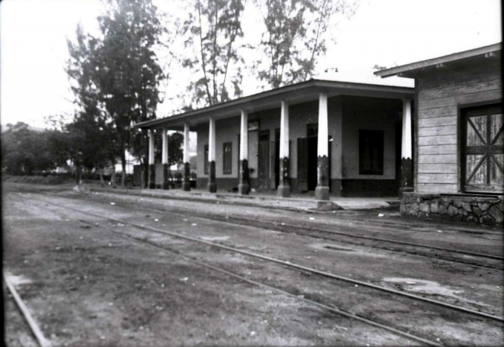
Yauco Station, Yauco. John W. Barriger III photo. Barriger Library, St. Louis Mercantile Library at the University of Missouri St. Louis. <http://www.flickr.com/photos/barrigerlibrary/12292586044/in/set-72157640461367106> Fuente / Source: Efraín Martel.
—
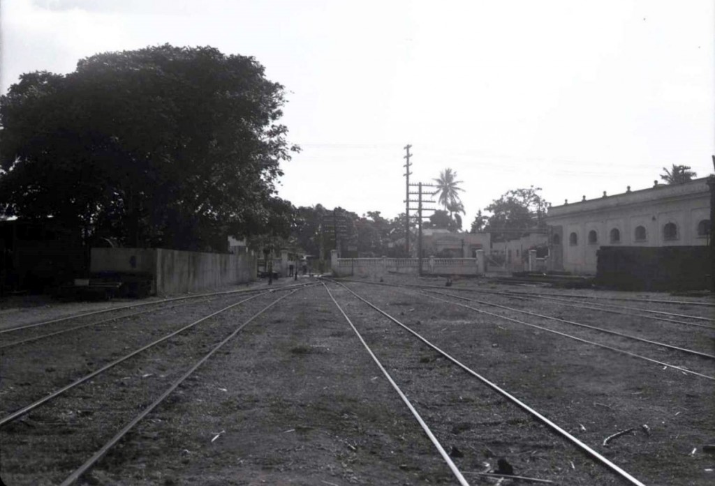 Ponce Station, Ponce. John W. Barriger III photo. Barriger Library, St. Louis Mercantile Library at the University of Missouri St. Louis. <https://www.flickr.com/photos/barrigerlibrary/12292747736/in/set-72157640461367106 >. Fuente / Source: Alfredo Vargas. See photo of Ponce Station from RODRIGUEZ ARCHIVES (JOSE LUIS AND JOSE ALFREDO RODRIGUEZ) , http://www.archivofotograficodepuertorico.com/ and Models / Modelos.
—
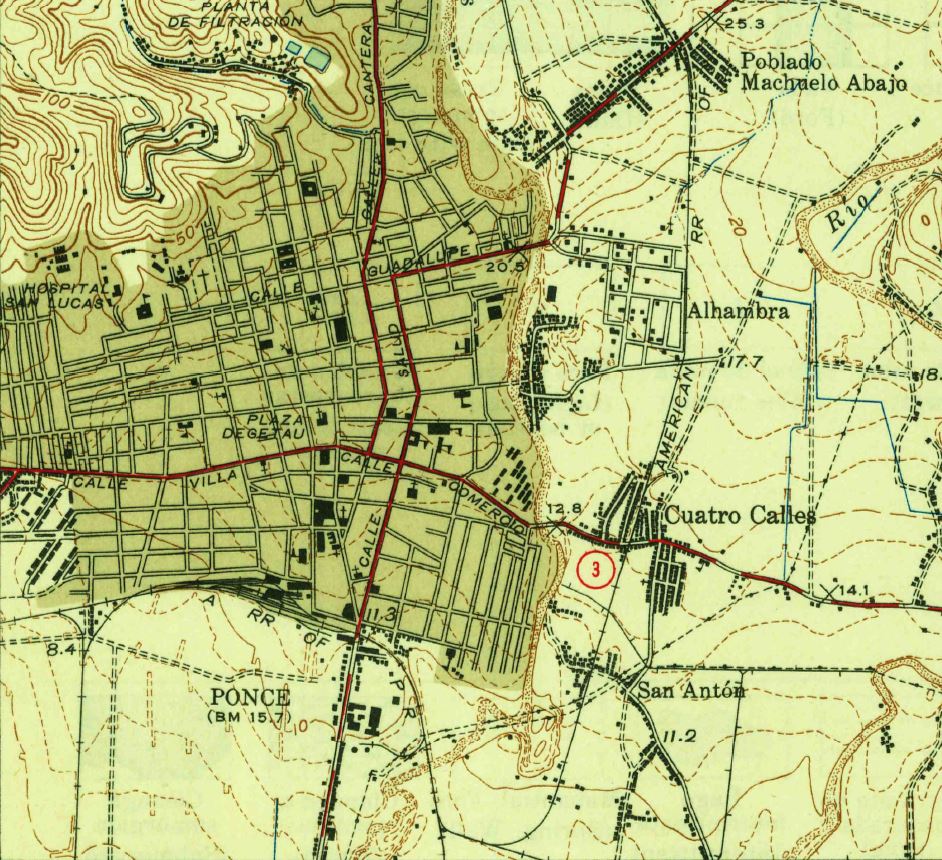 Courtesy USGS. Ponce 1945.
—
Ponce Station Plan. Source / Fuente: Archivo Histórico de Puerto Rico
—
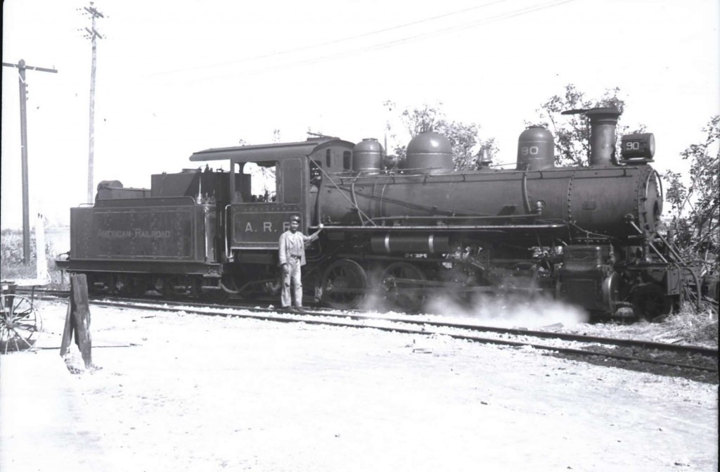 ARR 90. John W. Barriger III photo. Barriger Library, St. Louis Mercantile Library at the University of Missouri St. Louis. <http://www.flickr.com/photos/barrigerlibrary/12292331443/in/set-72157640461367106>. Unknown location.
—
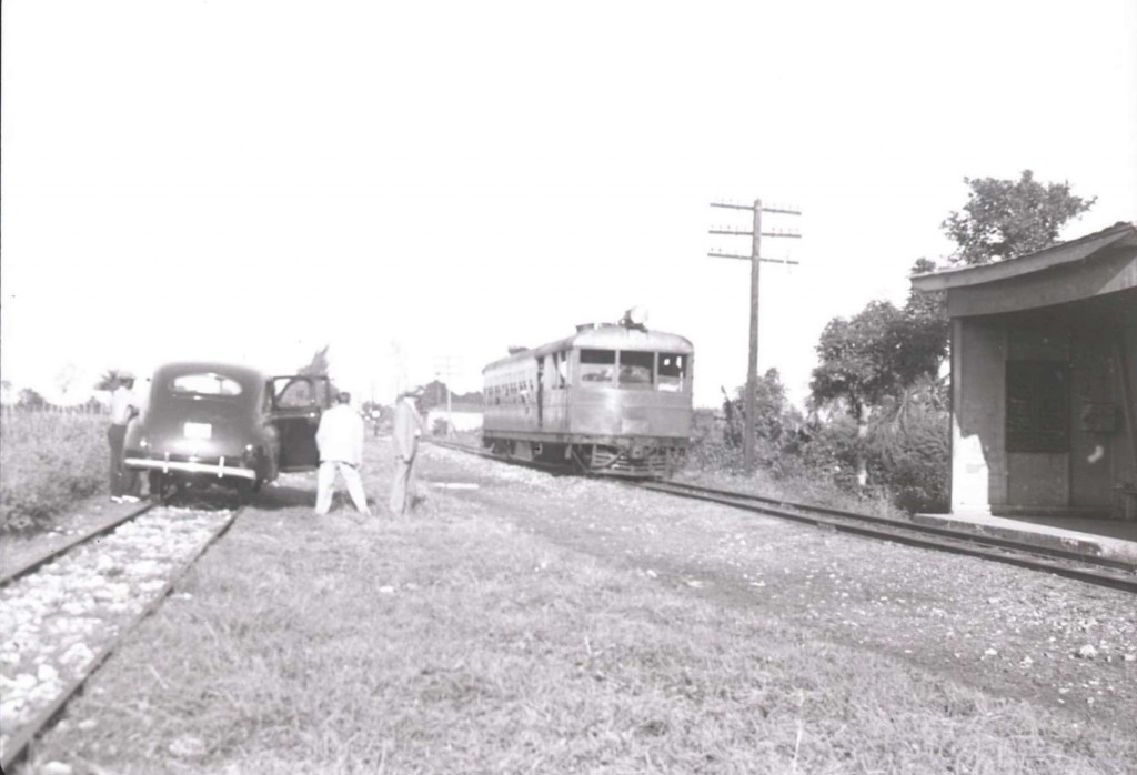
Motor Car / Automotor. John W. Barriger III photo. Barriger Library, St. Louis Mercantile Library at the University of Missouri St. Louis. <http://www.flickr.com/photos/barrigerlibrary/12291954025/in/set-72157640461367106>. Unknown location.
—
—–
Sources / Fuentes:
Alfredo Vargas. See his page / Ver su página – FreddyHonda . Extensive photo collection of the remnants of the railroads of Puerto Rico / Extensa colección de fotos de los remanentes de los ferrocarriles de Puerto Rico.
—
Héctor Ruiz. Redescubriendo a Puerto Rico.
—
Efraín Martell, Mayagüez.
—
Ramón Calero, Aguadilla
—
Víctor Díaz, Isabela. AMIGOS DEL TREN DE ISABELA (ATI) , Modelo Estación de Isabela / Model Isabela Station
—-
I thank Mr. Nicholas Fry, John W. Barriger III National Railroad Library Curator, for allowing the use of the photos. I am grateful to Bruce Pryor – Narrowmind.railfan.net , for sharing this very important link. The photos included are extremely interesting and valuable. Most have not been published in Puerto Rico and / or are unknown.
Le doy gracias a el Sr. Nicholas Fry, John W. Barriger III National Railroad Library Curator, por permitir el uso de la fotos. Estoy muy agradecido a Bruce Pryor por compartir el enlace de la colección de fotos de la American Railroad Co. of Puerto Rico de la colección de la John W. Barriger III National Railroad Library.
