Central Fajardo / Fajardo Development Co. Railroad by Dave Deyo

National Atlas of the United States


Fajardo Development Co. Railroad
Central Fajardo
Fajardo Sugar Co.
Fajardo, Puerto Rico
Meter gauge

The Fajardo Sugar Company was incorporated in Connecticutt in March of 1905.  By power of Franchise #63 enacted by the Executive Council of Puerto Rico on 10/27/1905, the Fajardo Development Co. was granted the right to construct, maintain and operate a public service railway between the towns of Mameyes and Naguabo, for the conveyance of passengers and freight for hire.  The Fajardo Sugar Co. of Porto Rico was reincorporated on 2/28/1919 in Puerto Rico.  The company owned Central Fajardo (located at the southeastern limits of the city of Fajardo on the east coast, the Loiza Sugar Co. and its affiliated mill Central Canovanas, the Fajardo Development Co. Railroad, and the Fajardo Sugar Growers Association which owned 26,410 acres and leases another 4,670.  Loiza Sugar Co. had been acquired in October of 1925.  The original owners were Lorenzo Armstront, James Bliss Coombs and Henry Couger.  At  some point, Jorge Bird Arias is shown as the owner or manager, which is not yet clear.

Under ordinance # 176, an extension for one year was granted to the FDC to complete the railroad from Mameyes to Naguabo in 1909.  In December of 1909, the Executive Council issued Franchise #184 granting the FDC the right to extend its railway to Playa Fajardo, and to operate a pier at such location for shipment of sugar and molasses.  This would not be a deep water terminal, and products would be conveyed by lighters to larger vessels achored at deep water.

Formerly, a franchise had been given to the American Railroad to extend its tracks eastward from Carolina to Mameyes, to connect with the Fajardo Development Co. railway, but this was not carried out.  On 2/25/1927, the Executive Council issued Franchise # 581 permitting the FDC to extend its railway westward from Mameyes to Carolina to connect with the American Railroad. One of the principal obstructions to building this extension was the replacement of the wooden bridge built by the Loiza Sugar Company over the Rio Grande de Loiza river just west of the Canovanas mill.  American Bridge Co. built this bridge for the railroad at a cost of $59,473, and made it dual-gauge (meter and 30″ gauge) to facilitate access by the Canovanas railway to its fields on the west shore of the river.

An additional franchise granted the FDC permission to extend its trackage from Naguabo to a nearby connection with the Ferrocarriles del Este, making the combined railroad system complete from San Juan to Humacao.

Under Fajardo-Eastern Sugar Associates, the railway was also granted additional extensions to reach Playa Humacao and Central Pasto Viejo.

At the beginning, Central Fajardo had a daily grinding capacity of 2000 tons of cane.  The factory underwent many improvements over the years.  By the 1930’s capacity had been increased to 3800 tons daily.  In its final state, the mill was capable of grinding 5400 tons of cane daily.  In 1970,  Central Fajardo and the former FDC were purchased by the Land Authority of Puerto Rico (ATdePR), which operated the mill until it ground its last harvest in 1977.  Some locomotives were sold off of the Island, while many were transferred southward to the Ponce & Guayama and Central Mercedita railroads under the new government agency Corporacion Azucarera de Puerto Rico (CAdePR).

The Fajardo Development Co. railway was one of the best maintained systems on the island.  It was the only mill to buy a full-size steam weedburner to keep the right-of-way free of vegetation.  Its locomotive fleet was second only to the American Railroad in terms of the power of its engines.  The FDC remained loyal to the proven-reliability of locomotives built by American Locomotive, but turned to Baldwin Locomotive Works for its large weedburner.

Locomotive #3, a tank engine when delivered, was purchased to pull the passenger train that the Executive Council obligated the railroad to operate.  The daily train between Naguabo and Mameyes also carried mail.  At both ends of the line, bus service was provided.  A bus connected passengers with the American Railroad train to Carolina, while a similar service made connection between the Naguabo terminus and downtown Humacao.

When the line was complete from Carolina to Humacao, American Railroad locomotives and coaches operated by agreement over the FDC and the Ferrocarriles del Este, giving service from San Juan to Humacao on a daily basis.  From all accounts so far, freight, however, was transported by the locomotives of the FDC.  It was picked up at Carolina and and any cars not destined for customers on the FDC, were  taken to the connection with the Ferrocarriles del Este near Naguabo for exchange.

The FDC operated a number of branchlines, some very short and some quite lengthy.  The mainline from Carolina to Naguabo area was 65 kms. in length.  Following are the branchlines the railroad operated:

Carmelita Branch – .54 miles
Monserrate Branch – 1.90 miles
Union Branch – 1.90 miles
Juan Martin Branch – 1.00 miles
Rio Arriba Branch – 8.60 miles
Playa Fajardo Branch – 1.00 miles
Carolina Branch – 1.60 miles
Saco Branch – .78 miles
Aurora Branch – .54 miles
Oriente Branch – 1.60 miles
Mariana Branch – 2.10 miles
Corco Branch – .78 miles
Duque Branch – .78 miles
San Cristobal Branch – 5.90 miles
Paraiso Branch – 7.95 miles

The FDC acquired ex-Central San Cristobal Porter #1, which it renumbered # 7.  This locomotive ran low on water and blew up on the Duque Branch, about 1934 or 1935, killing both the engineer and the fireman and injuring several workers nearby.

American Locomotive Co. #3 was rebuilt twice.  First reports from the 1930s indicate it was a 2-6-0 with a homemade tender, but later reports indicate it was rebuilt to a 2-8-0, with a desired weight increase for traction to better facilitate reassignment  to hauling sugar cane trains.

Locomotive # 9 has two distinctions to its honor.  It is the last steam locomotive purchased new for Puerto Rico, and it was the largest locomotive ordered by a sugar railroad.  It was also one of the last steam locomotives to run in Puerto Rico, working through the ownership of C. Brewer Puerto Rico until 1966.  It was stored in Central Pasto Viejo’s enginehouse for a number of years before going to Central Fajardo, where it was to become a display at the Ferrocarril Historico.

Molasses produced at the mill was transported in company tank cars 3/4 of a mile to the company pier at Playa Fajardo.  There, the Fajardo Sugar Co. had storage tanks and also a warehouse for sugar storage.  Molasses was piped into lighters for transport out to deepwater vessels.  Central Fajardo also produced a raw sugar in fairly large quantity.

The FDC traversed some of the island’s most lush scenery, due to its high annual rainfall and its proximity on all sides to the rain forest, El Yunque.  Some of the largest cane grown on the island came from this coastal area, and irrigation was not needed in most colonias.

On 3/15/1932, delegates to the 4th  annual International Sugar Congress got their third railroad ride of the day, travelling over portions of the FDC.  Two trains were provided, using company coaches.  The first train supposedly went westward to Luquillo and then to the company pier at Playa Fajardo, while the second train went south, climbing the Paraiso Branch.  Since I personally rode this line while it was being used by the steam-powered Ferrocarril Historico, I can say the passengers that took the latter tour got the best ride.  With the Fajardo River coming close to the line several times, the incredible vegetation trackside and the view of El Yunque, it would be hard to surpass this experience.  This line also had the steepest of grades on the FDC system.

When the FDC began to replace its aging steam fleet, it went to another proven builder of
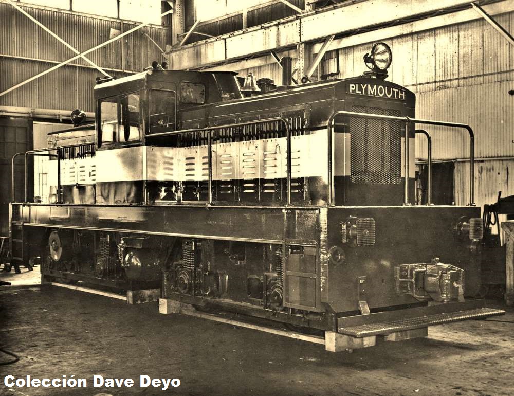
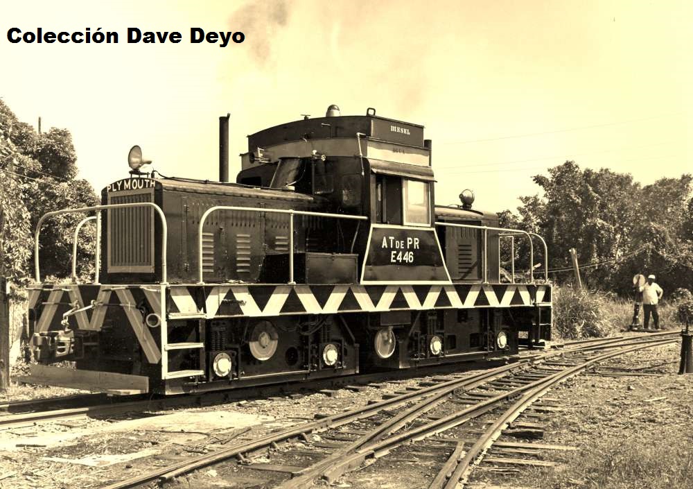
locomotives, Plymouth.  Eventually, after purchasing a number of 30 and 40 ton, 3-axle units, it replaced its largest steamers with two-truck, B-B type diesel-electric locomotives.  These occasionally were used in pairs for the long runs to Naguabo and Canovanas areas.

When the FDC was purchased by C. Brewer PR, the head of the railroad, Jorge Zampierrollo, converted sets of two locomotives as multiple-unit pairs, connected electrically so that the engineer of one unit could control both locomotives.  They were paired as follows: E-442+E-443, E-444+E-445, and E-446+E-447.  While they could be disconnected and used independently, they were most often seen paired, especially during the peak of the harvest.  This capability was unique to this railroad and was not copied by any other on the island.

When the American Railroad abandoned its service in 1957, the FDC (Fajardo-ESA at the time) acquired one of their 47 ton General Electric diesel-electric locomotives.  This locomotive was a frequent favorite of crews for the Paraiso branch.  This locomotive along with two more at Guanica Centrale and its sister locomotives on the ARRCo., were of a different design than the Plymouths.  The Plymouths had B-B wheel arrangements, by which the trucks are mounted underneath each end of the locomotive frame.  The GE B+B wheel arrangement differed in that the frame of each truck was integral with two separate portions of the frame, which were joined in the center of the locomotive body by a pivot, allowing each to move more freely around sharper curves.  While the pilot on a Plymouth is built into the one-piece frame, the pilot of the B+B locomotive is mounted on the end of each of these two frame sections, coordinating with the movement of the trucks themselves while taking a curve or passing through a switch.

90+ percent of traffic on the FDC was sugar cane, the balance made up of chemical fertilizers, lime, firewood, lumber, sand & stone, coal, oil and provisions plus production products of the mills.

The railroad had a maximum grade of 3% (on the Paraiso Branch), and a maximum curve of 16 degrees.

Ties were made of cypress and bayaonda woods from the Dominican Republic, measuring
6×8″, 6 and 7 feet in length.  Shale was used as ballast on most of the railroad.

During passenger service years, stations were at Mameyes, Rio Grande, Luquillo, Fajardo, Ceiba, Naguabo-Daguao and Naguabo.

The FDC had some interesting “carros de brigada”, which, according to shop personnel, were built on the frames of some of the ex-Fajardo Sugar Growers Association locomotives used on the colonias.  These cars differed from each other, and from best count totalled  five in number.  They were used to transport track gangs to work sites.  They bore the names of Greek gods.  Several survived into the Autoridad de Tierras ownership, and one was actually transferred by them to Central Aguirre for use on the Ponce & Guayama when Central Fajardo stopped grinding and the railroad was torn up.

Most of the roster of locomotives were transferred to the Ponce & Guayama and Central Mercedita railroads, but several were sold off of the island, including the GE 47 ton and four of the six Plymouth B-Bs.


Locomotive Roster:

In construction / En construcción

Other

606 sugar cane cars, all-steel, 15 ton capacity
22 sugar cane cars, all-steel, 20 ton capacity
16 flatcars, 15 ton capacity
10 flatcars, 20 ton capacity

14 gondolas, 15 ton capacity
45 boxcars, all-steel, 25 ton capacity
4 boxcars, wood, 20 ton capacity

1 combination car, 35′, American Car & Foundry, 3/23/1907 via L.W.&P. Armstrong, Agent

1 passenger coach, 40 seats, 35′, 1st class, Brill order #17350, built 6/9/1910, shipped 9/30/1910, Brill MCB 1st class trucks, mahogany sides, 33,590 lbs. weight, car # 1, named “Nicolasa Arias de Bird”

1 passenger coach, 40 seats, 35′, lst class, Brill order #48912, built 4/22/1912, shipped 7/22/1912,

#60-D 1st class MCB trucks, mahogany sides, 33,590 lbs. weight, car # 2, named “Louise”
(Both coaches sold to the American Railroad Co. in the 1930s)

8 tank cars
6 handcars
2 automobile inspection cars
1 Dependable Hardie Weed Sprayer, model SCDA

132 kms. fixed meter gauge railway, laid with 60 lb. rail on mainlines, 45 lb. on branches and sidings

152 kms. of fixed and portable 30″ gauge railway, including 4900 15′ sections of portable track to bring harvest from field to loading stations.  These are operated by the wholly-owned subsidiary, the Fajardo Sugar Growers Association, on the various colonias.

Ver / See:

Fajardo Development Co.

Mapas / Maps

San Juan – Luquillo 

Eastern Puerto Rico / Este de Puerto Rico

(Photo copies of U.S. Geological Survey maps / Fotocopias de mapas del U.S. Geological Survey)

Más Información / More Information

Posted in Uncategorized | Comments Off on Central Fajardo / Fajardo Development Co. Railroad by Dave Deyo

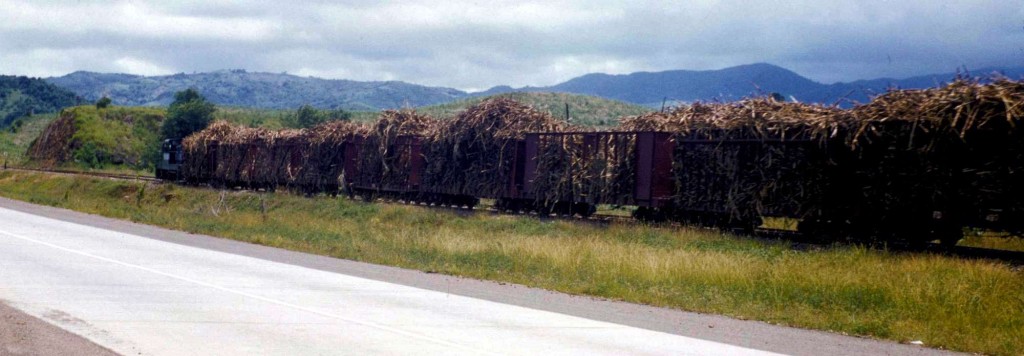
Tren de caña / Sugar Cane Trane – Fajardo Development Co.


Tren de caña con locomotora Plymouth de 50 toneladas, área de Fajardo Development Co.  Sugar cane train with 50 ton Plymouth locomotive, area of Fajardo Development Co.

Wilson, Gerald / Tom Lehman photostream. “13,247–Trainload of sugarcane=58.jpg | Flickr – Photo Sharing!”. Photo. Web. 29 Sept. 2014.
<https://www.flickr.com/photos/telehman/2411511593/in/set-72157604526393015/>.  Copyright.  All rights reserved.

Mapa / Map Fajardo Development Co.

Eastern Puerto Rico / Este de Puerto Rico


Email 27 Sept 2014 from Dave Deyo:

Hello Roger:

I note the letters FD on several of the cane car frames, but cannot see a “C” to make it FDC.  The locomotive pulling the train is a Plymouth centercab in the original FDC paint scheme.  #E446 and E447 on the ATdePR roster have a flare on either side of the cab, so this would have been one of the first four locomotives FDC purchase where the cab met the frame at a 90 degree angle.  The number of support stanchions on each section of handrail along both hoods matches the four first centercab Plymouths.  I am not sure the third and fourth units going to the FDC came in the original paint scheme, so my first response is to say it is either E442 or E443.  The automobile coming at us is a 1957 or 1958 Ford, I think, so it might give some clue as to the date of the photo.  See the attached photos on which I made my evaluation.

Looking at my Plymouth records, only FDC Plymouth 50 ton #2 (later E442) was purchased by FDC, and the next three were purchased by and shipped to Fajardo-Eastern Sugar Associates, most likely supporting my theory that the locomotive in the picture was #2 (E442) and may have been the only one painted as seen here.  This was built in 1957, while the others were in 1958 and later.  The final two big Plymouths were ex-US and Canadian military engines, and the flare at the bottom of the cab where it meets the frame may have been part of the new batches of 50 tonner built.

Dave


Posted in Uncategorized | Comments Off on Tren de caña / Sugar Cane Trane – Fajardo Development Co.

Maquetas pequeñas de trenes en miniatura / Small Model Train Layouts

Modelismo Ferroviario / Model RailroadingPasatiempo (hobby) de trenes en miniatura ( tren maqueta)

El pasatiempo consta de reproducir en miniatura, usando modelos y/o juguetes las operaciones de los trenes verdaderos.  Por ejemplo, se puede reproducir las operaciones de una parte del Tren Urbano, una central, estación de pasajeros, o inventarse un escenario. Uno construye o compra las estructuras o crea estructuras nuevas usando y juntando partes de modelos (kits) ya existentes, árboles, vías, vagones, locomotoras, figuras de personas y animales, carros, etc.

¡Las maquetas no tienen que ser grande!  No hace falta mucho material ni espacio como podrán ver en las fotos y videos más adelante.  Ver  Micro / Small Layouts For Model Railroads y ALL GAUGE PAGE Fun with Model Railroading (http://www.thortrains.com/ ).  Más información en Modelismo Ferroviario / Model Railroading .


Ver:

Below Photos are from Fairlightworks Photo Collection of Micro Layouts at flickr.com
Fairlightworks – Photos Sets ,  Photos.  Photos used with permission.  They also have a creative commons license.  See below.

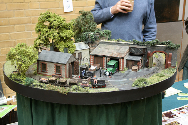
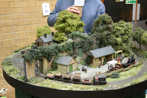
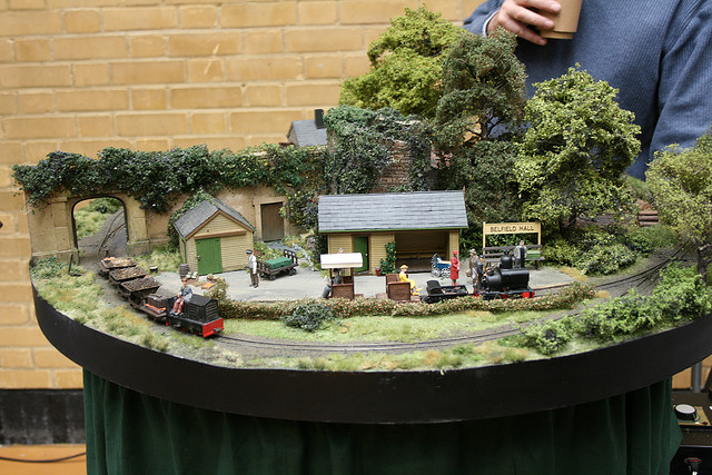
Belfield Hall – 09
Layout originally constructed by Stephen Brown, now owned by Tony Hill.

Belfield Hall – 09
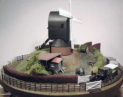
Layout originally constructed by Stephen Brown, now owned by Tony Hill. Using 9mm gauge track in 7mm scale to represent a 15″ gauge estate railway, this layout caught my eye in Railway Modeller about 15 years ago and it’s great to see it’s still around. The new owner has remodelled the scenery but it definitely keeps the spirit of the original. The whole layout can rotate to keep a moving train continously in view as the scenery passes by.

License| Some rights reserved by fairlightworks
http://creativecommons.org/licenses/by/2.0/

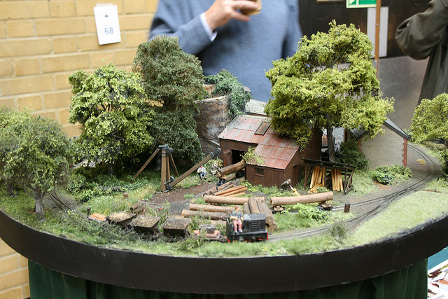
Loxley Barton Falls – 009
Layout by Simon Cox

License| Some rights reserved by fairlightworks
http://creativecommons.org/licenses/by/2.0/

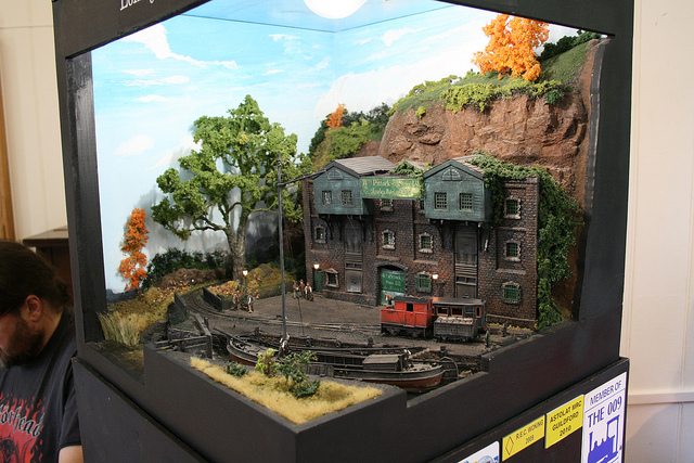
Grossbierdorf – O14
Layout by Escadrille St Michel

Photo 1

Photo 2

Photo 3

Grossbierdorf – O14
Layout by Escadrille St Michel

License| Some rights reserved by fairlightworks
http://creativecommons.org/licenses/by/2.0/

The Sewage Works
009 layout by Stephen Sullivan

License| Some rights reserved by fairlightworks
http://creativecommons.org/licenses/by/2.0/

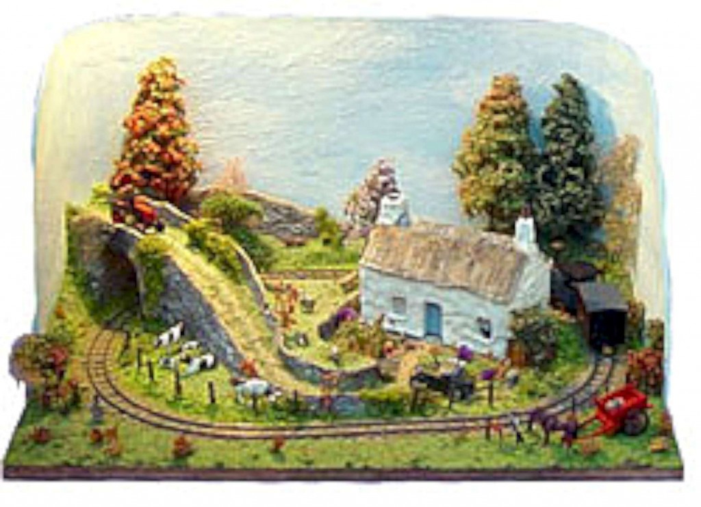
Lazy Cottage.  Annie Winters delightful micro layout in 009 centered around a cottage. Has won Annie Best Junior Modeller at Amberley for 2 consecutive years.

Black Dyke Mill. Chris O’Donoghue’s pizza based around a windmill.
Above photos: The Greenwich and District Narrow Gauge Railway Society – Members Layouts  (Used with permission).  Visit Expo Narrow Gauge


Más fotos / More Photos:

http://www.flickr.com/photos/fairlightworks/sets/72157602746375838/
http://www.flickr.com/photos/fairlightworks/sets/72157622588263769/
http://www.flickr.com/photos/fairlightworks/sets/72157619821321619/
http://www.flickr.com/photos/fairlightworks/sets/72157608375426362/
http://www.flickr.com/photos/fairlightworks/sets/72157636195124255/
http://www.flickr.com/photos/fairlightworks/sets/72157624775756382/
http://www.flickr.com/photos/fairlightworks/sets/72157623832181784/

License| Some rights reserved by fairlightworks
http://creativecommons.org/licenses/by/2.0/

All above photos and links are from fairlightworks at flickr.com.

Ver /See:

Models / Modelos

———-

Maquetas de trenes en Youtube / Youtube Micro Layouts

110706ForestR.R.Coalpit Micro Layout
yutaatelier1

130526 On30&18 Mine Micro Layout
yutaatelier1

Train Shoppe Customers Micro Layout in HOn30!
Train Shoppe
http://youtu.be/VLHwF2r7q9k

On30 Mini Layout – Revisited May 2013 – Spruce Coal & Timber RR
Joey Ricard

On30 mini layout
beaka50

1/87 HOe Small Layout 090812A
yutaatelier1

Small On30 Layout
grits3d


Nn3 mini layout 3
Schmuck804

Revistas digitales:

Model Railroad Hobbyist magazine

O Scale Trains Magazine Online
Dale un click a  “Downloads”

TrainLife (http://www.trainlife.com/magazines)

Visitar / Visit:

Modelismo Ferroviario / Model Railroading

Models / Modelos


Posted in Uncategorized | Comments Off on Maquetas pequeñas de trenes en miniatura / Small Model Train Layouts

More Information

For more information on many of the railroads like ownership, type and number of engines and cars, miles of track, etc., visit and consult:

Copeland, P. Allen.  Locomotive Rosters – Railways of the West Indies, Part IV, Puerto Rico”.  Pages 147 – 212.  See/Ver : Railways of the West Indies, Puerto Rico

Deyo, Dave – Well known researcher of the railroads of Puerto Rico.
Conocido investigador de los ferrocarriles de Puerto Rico.  Ver / See Facebook – Historia del ferrocarril en Puerto Rico and other posts in this page.

Dunn, Richard.  Baldwin and Vulcan Locomotives by Richard Dunn

Escudero, Jaime. “Centrales Azucareras de Puerto Rico.” Recinto Universitario de Mayagüez, Universidad de Puerto Rico, Web. 24 Sept. 2014. <http://blogs.uprm.edu/canadeazucar/>.

Informe del Comisionado del Interior de al Honorable Gobernador de Puerto Rico, 1919

Instituto de Cultura Puertorriqueña / Archivo General De Puerto Rico.
Fondo De Obras Públicas…Ferrocarriles Y Tranvías
Very Extensive / Trabajo Extenso

Long, W. Rodney.   Porto RicoRailways of Central America and the West Indies . Washington: Government Printing Office, 1925. Pag. 336. Print.  (HATHI TRUST digital Library http://catalog.hathitrust.org/Record/000970279  (11 Oct. 2013))
Copyright: Public Domain, Google-digitized.

Locomotive Rosters of Puerto Rico / Catálogo de locomotoras de Puerto Rico

Maps, Plans, Other / Mapas, Planos, Otros

Map Railroads in Operation, 1916 / Mapa ferrocarriles en operación, 1916

Railroad Map of Porto Rico (1924) / Mapa Ferroviario de Puerto Rico (1924)
Railroad map of Porto Rico.   Map (39 x 89 cm,  Scale [ca. 1:255,000]).  United States. Dept. of Commerce. [S.l.], 1924.  American Memory Map Collection.   Library of Congress Geography and Map Division, Washington, D.C. 20540-4650.  May 17, 2011 < http://hdl.loc.gov/loc.gmd/g4971p.ct000303>

USGS Historical Topographic Maps (Online) / Mapas Topográficos Históricos del USGS (U.S. Geological Survey)

With respect to the sugar mills, I only show in the maps the location of the factory.  In various cases, the railroads of the mills extended to other towns.

All studies are subject to corrections and updates.  There are differences because of various reasons. For instance, date of the research and resources available.


Posted in Uncategorized | Comments Off on More Information

Más Información

Para más datos sobre varios de los ferrocarriles como propietario, tipo y número de locomotoras y vagones, red de vías, etc., visite y consulte:

Copeland, P. Allen.  Locomotive Rosters – Railways of the West Indies, Part IV, Puerto Rico”.  Pages 147 – 212.  See/Ver : Railways of the West Indies, Puerto Rico

Deyo, Dave – Well known researcher of the railroads of Puerto Rico.
Conocido investigador de los ferrocarriles de Puerto Rico.  Ver / See Facebook – Historia del ferrocarril en Puerto Rico and other posts in this page.

Dunn, Richard.  Baldwin and Vulcan Locomotives by Richard Dunn

Escudero, Jaime. “Centrales Azucareras de Puerto Rico.” Recinto Universitario de Mayagüez, Universidad de Puerto Rico, Web. 24 Sept. 2014. <http://blogs.uprm.edu/canadeazucar/>.

Informe del Comisionado del Interior de al Honorable Gobernador de Puerto Rico, 1919

Instituto de Cultura Puertorriqueña / Archivo General De Puerto Rico.
Fondo De Obras Públicas…Ferrocarriles Y Tranvías
Very Extensive / Trabajo Extenso

Long, W. Rodney.   Porto RicoRailways of Central America and the West Indies . Washington: Government Printing Office, 1925. Pag. 336. Print.  (HATHI TRUST digital Library http://catalog.hathitrust.org/Record/000970279  (11 Oct. 2013))
Copyright: Public Domain, Google-digitized.

Locomotive Rosters of Puerto Rico / Catálogo de locomotoras de Puerto Rico

Maps, Plans, Other / Mapas, Planos, Otros

Map Railroads in Operation, 1916 / Mapa ferrocarriles en operación, 1916

Railroad Map of Porto Rico (1924) / Mapa Ferroviario de Puerto Rico (1924)
Railroad map of Porto Rico.   Map (39 x 89 cm,  Scale [ca. 1:255,000]).  United States. Dept. of Commerce. [S.l.], 1924.  American Memory Map Collection.   Library of Congress Geography and Map Division, Washington, D.C. 20540-4650.  May 17, 2011 < http://hdl.loc.gov/loc.gmd/g4971p.ct000303>

USGS Historical Topographic Maps (Online) / Mapas Topográficos Históricos del USGS (U.S. Geological Survey)

En cuanto a las centrales azucareras, solo ilustro en los mapas la localización de la fábrica. En varios casos, la red de vías de sus ferrocarriles se extendían a otros pueblos.

Los estudios están sujetos a correcciones y a ser actualizados. Hay  diferencias por varias razones. Por ejemplo, la fecha del estudio y material disponible.

Posted in Uncategorized | Comments Off on Más Información

Hacienda Mallorquina, Ponce, PR

Hacienda Mallorquina
Ponce
Gauge / Trocha (ancho de vía):

National Atlas of the United States

Según una entrevista a Pedro Reyes Santos, existió un ferrocarril por lo menos hasta el 1912 (34). La Sucessión Serrallés (Central Mercedita), compró la finca en el 1923 (33).  El informe incluye una foto de clavos usados en las vías ferroviarias (Foto Num. 26, colección Roberto Ramos).

According to an interview, there was a railroad up to c1912.  The Sucesion J. Serrallés (Central Mercedita), bought the land in 1923.

Source / Fuente:

Alemán Crespo Harry E., Eduardo Questell Rodríguez , and Edgar J. Maíz López. Sibanacan – Investigaciones Arqueológicas e Históricas. Informe DE Evaluación Cultural (Fases 1A-1B) – Proyecto Reidencial Hacienda Mallorquina, Bo. Cerillos, Ponce, P.R. Ponce, Puerto Rico, 1985.  Exigido por el Instituto de cultura Puertorriqueña, División de Preservación Histórica y la Oficina Estatal de Preservación Histórica S.H.P.O. #3-28-85-02 JPU #84-63-1201.

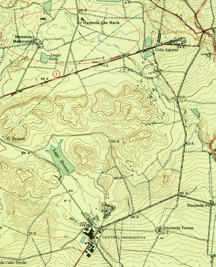
USGS, Ponce, PR, 1945.  Location of Hacienda Ana María and Hacienda Mallorquina.

Ver / See:

Biblioteca Universidad de Puerto Rico:
Catálogo UPRIB, http://wwwbib.upr.edu/, [Proposed station and bridge at the Mallorquina – Ana María railroad] [graphic]by [Central Guánica], 1915.  [Note: I have not seen this file.  It could have more information.]

Posted in Uncategorized | Comments Off on Hacienda Mallorquina, Ponce, PR

Hacienda Ana María, Ponce, PR

Hacienda Ana María
Ponce
Gauge / Trocha (ancho de vía):

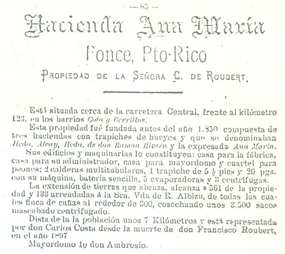
Para 1905, la Hacienda Ana María tenía un ferrocarril.  Sus dueños eran Francisco Costa y Palmieri and Carlos Costa y Guevara.  Ellos le compraron la hacienda a la viuda de Francisco Roubert y Castaing, la Sra. Etelvina Costa y Guevara.  La Sucesión J. Serrallés (Central Mercedita) era la dueña de la propiedad para 1916.

When Hacienda Ana María was sold to Francisco Costa y Palmieri and Carlos Costa y Guevara, in 1905, it included a railroad system.  They bought the hacienda from the widow of Francisco Roubert y Castaing, Mrs. Etelvina Costa y Guevara.  By 1916, Sucesion J. Serrallés (Central Mercedita) was the owner of the Hacienda (26, 27, 30).

Fuente / Source:

New World Research Inc., NWR Report of Investigations 86-10 / Swanson Mark T., and Thomas Prentice Jr. M. Archaeological Excavationas at Hacienda Ana María, (P033), Ponce, Puerto Rico, DACW17-86-Q-0080. Ponce, Puerto Rico, 1986. Prepared for The United states Army Engineer District, Jacksonville Corps of Engineers, Jacksonville, Florida.


National Atlas of the United States

USGS, Ponce, PR, 1945.  Location of Hacienda Ana María and Hacienda Mallorquina.

Ver / See:

Biblioteca Universidad de Puerto Rico:
Catálogo UPRIB, http://wwwbib.upr.edu/, [Proposed station and bridge at the Mallorquina – Ana María railroad] [graphic]by [Central Guánica], 1915.  [Note: I have not seen this file.  It could have more information.]

Ferreras Pagán, Luis.  Biografía de la riqueza de Puerto Rico, Tomo II. San Juan, PR: Tipografía de Luis Ferreras, 1902. Print.  85.


Posted in Uncategorized | Comments Off on Hacienda Ana María, Ponce, PR

Central Arcadia, Vieques, 30 inches


National Atlas of the United States

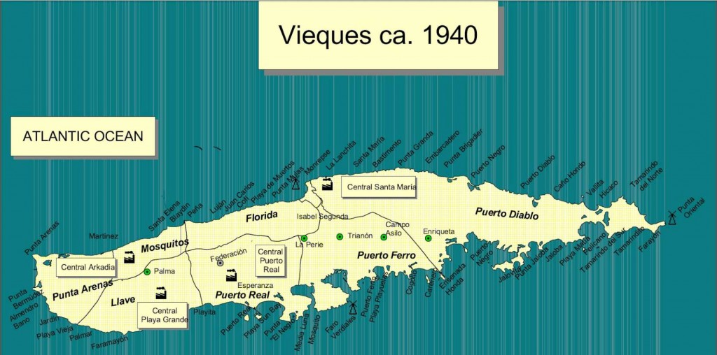
César Ayala. 2001. “ From Sugar Plantations to Military Bases: the U.S. Navy’s Expropriations in Vieques, Puerto Rico, 1940-45 .” Centro: Journal of the Center for Puerto Rican Studies 13(1) (Spring 2001): 22-44.

Map shows locations of other sugar mills.  En el mapa vemos la localización de las otras centrales en Vieques.

Permission: Prof. Xavier F. Totti, Editor, CENTRO: Journal of the Center for Puerto Rican Studies, Hunter College, 695 Park Avenue, E-1429, New York, NY 10065

http://centropr.hunter.cuny.edu

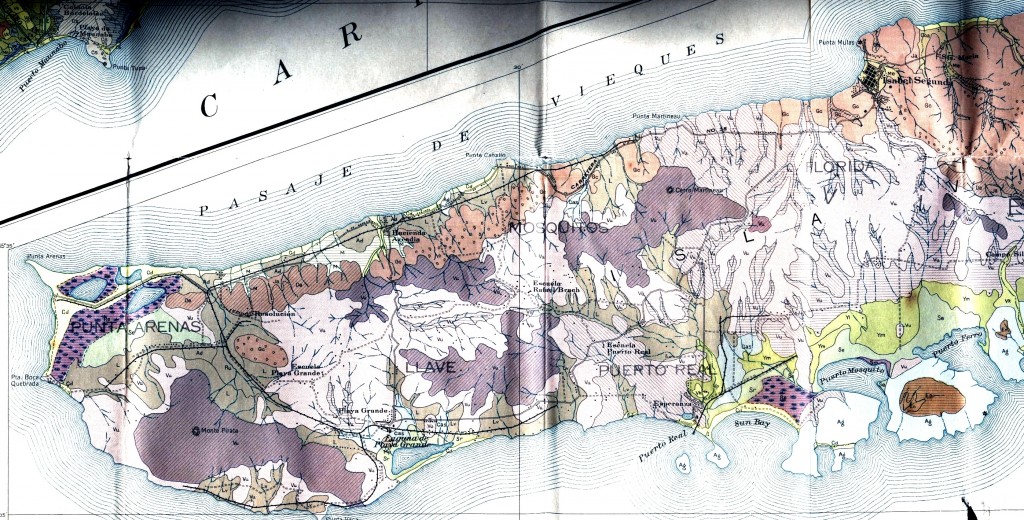
Field Operations, Bureau of Chemistry and Soils.  Soil Map, Western Sheet, Puerto Rico [map].  Agricultural Experiment Station, University of Puerto Rico, 1936. (Partial Map)

Para ver más mapas visite Mapas Topográficos Históricos del USGS (U.S. Geological Survey)USGS Historical Topographic Maps (Online) ( http://geonames.usgs.gov/pls/topomaps/). Busque los mapas de Vieques usando “Isla de Vieques”.

For more maps, visit Mapas Topográficos Históricos del USGS (U.S. Geological Survey)
USGS Historical Topographic Maps (Online)
( http://geonames.usgs.gov/pls/topomaps/). Search using the term “Isla de Vieques”

Posted in Uncategorized | Comments Off on Central Arcadia, Vieques, 30 inches

Central Resolución, Vieques

Central Resolución
Vieques
Gauge / Trocha (ancho de vía): 24 in

—Don Manual Eusebio Benítez es el dueño de la Hacienda Resolución según el inventario del 1872 – Protocolos de Vieques No 0075123, pp 204-210.  Entre otras cosas el inventario incluye 19 vagones ferroviarios más rieles, y 31 yuntas de bueyes (38). No menciona locomotoras. Por lo tanto se asume que era un ferrocarril de sangre, o sea, los vagones eran halados por bueyes.

La Hacienda Resolución se une a la Central Playa Grande (40, 43).  Para los años 1920s, Playa Grande tenía 28 km de vías, 7 locomotoras, más vagones para llevar caña (53).

[In 1892 Hacienda Resolución had a railway of 19 railroad cars.  No mention of locomotives.  Most likely railroad cars were pulled by oxen.  Eventually, Hacienda Resolución merged with Central Playa Grande.  In the 1920s, Playa Grande had 28 km of tracks, 7 locomotives, and cane cars.]

Langhorne Elizabeth. Vieques, History of a Small Island. Vieques, Puerto Rico: The Vieques Conservation and Historical Trust, 1987.

National Atlas of the United States

César Ayala. 2001. “ From Sugar Plantations to Military Bases: the U.S. Navy’s Expropriations in Vieques, Puerto Rico, 1940-45 .” Centro: Journal of the Center for Puerto Rican Studies 13(1) (Spring 2001): 22-44.

Map shows locations of other sugar mills.  En el mapa vemos la localización de las otras centrales en Vieques.

Permission: Prof. Xavier F. Totti, Editor, CENTRO: Journal of the Center for Puerto Rican Studies, Hunter College, 695 Park Avenue, E-1429, New York, NY 10065

http://centropr.hunter.cuny.edu

Field Operations, Bureau of Chemistry and Soils.  Soil Map, Western Sheet, Puerto Rico [map].  Agricultural Experiment Station, University of Puerto Rico, 1936. (Partial Map)

Para ver más mapas visite Mapas Topográficos Históricos del USGS (U.S. Geological Survey)USGS Historical Topographic Maps (Online) ( http://geonames.usgs.gov/pls/topomaps/). Busque los mapas de Vieques usando “Isla de Vieques”.

For more maps, visit Mapas Topográficos Históricos del USGS (U.S. Geological Survey)
USGS Historical Topographic Maps (Online)
( http://geonames.usgs.gov/pls/topomaps/). Search using the term “Isla de Vieques”

Ver / See:

Langhorne Elizabeth. Vieques, History of a Small Island. Vieques, Puerto Rico: The Vieques Conservation and Historical Trust, 1987.

—–. Vieques 1889-1939 the sweet spoils of sugar. Sunday San Juan Star Magazine [San Juan, Puerto Rico], (1983, March 20), pp. 1-4.

—–. Don José benítez and his Wife Ana Rieckehoff When sugar was king in Vieques, he was the power behind the throne. Sunday San Juan Star Magazine [San Juan, Puerto Rico], (1982, November 14), pp. 1-4.

Posted in Uncategorized | Comments Off on Central Resolución, Vieques

Central Playa Grande, Vieques, 30 in

Central Playa Grande
Vieques
Gauge / Trocha (ancho de vía): 30 in


Don Manual Eusebio Benítez es el dueño de la Hacienda Resolución según el inventario del 1872 – Protocolos de Vieques No 0075123, pp 204-210.  Entre otras cosas el inventario incluye 19 vagones ferroviarios más rieles, y 31 yuntas de bueyes (38). No menciona locomotoras. Por lo tanto se asume que era un ferrocarril de sangre, o sea, los vagones eran halados por bueyes.

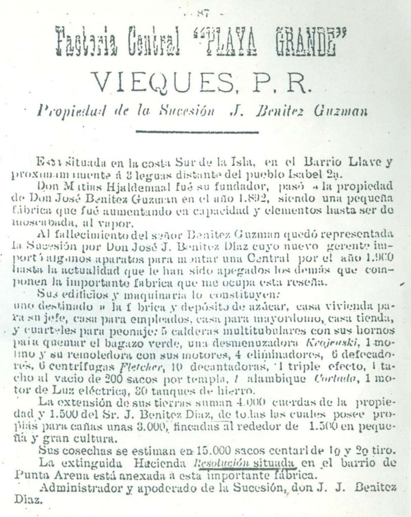
La Hacienda Resolución se une a la Central Playa Grande (40, 43).  Para los años 1920s, Playa Grande tenía 28 km de vías, 7 locomotoras, más vagones para llevar caña (53).

[In 1892 Hacienda Resolución had a railway of 19 railroad cars.  No mention of locomotives.  Most likely railroad cars were pulled by oxen.  Eventually, Hacienda Resolución merged with Central Playa Grande.  In the 1920s, Playa Grande had 28 km of tracks, 7 locomotives, and cane cars.]

Langhorne Elizabeth. Vieques, History of a Small Island. Vieques, Puerto Rico: The Vieques Conservation and Historical Trust, 1987.

National Atlas of the United States

César Ayala. 2001. “ From Sugar Plantations to Military Bases: the U.S. Navy’s Expropriations in Vieques, Puerto Rico, 1940-45 .” Centro: Journal of the Center for Puerto Rican Studies 13(1) (Spring 2001): 22-44.

Map shows locations of other sugar mills.  En el mapa vemos la localización de las otras centrales en Vieques.

Permission: Prof. Xavier F. Totti, Editor, CENTRO: Journal of the Center for Puerto Rican Studies, Hunter College, 695 Park Avenue, E-1429, New York, NY 10065

http://centropr.hunter.cuny.edu

Field Operations, Bureau of Chemistry and Soils.  Soil Map, Western Sheet, Puerto Rico [map].  Agricultural Experiment Station, University of Puerto Rico, 1936. (Partial Map)

Para ver más mapas visite Mapas Topográficos Históricos del USGS (U.S. Geological Survey)USGS Historical Topographic Maps (Online) ( http://geonames.usgs.gov/pls/topomaps/). Busque los mapas de Vieques usando “Isla de Vieques”.

For more maps, visit Mapas Topográficos Históricos del USGS (U.S. Geological Survey)
USGS Historical Topographic Maps (Online)
( http://geonames.usgs.gov/pls/topomaps/). Search using the term “Isla de Vieques”

Ferreras Pagán, Luis.  Biografía de la riqueza de Puerto Rico, Tomo II. San Juan, PR: Tipografía de Luis Ferreras, 1902. Print.  87.

Ver / See:

Copeland, P. Allen.  Locomotive Rosters – Railways of the West Indies, Part IV, Puerto Rico”.  51.  Railways of the West Indies, Puerto Rico

Baldwin and Vulcan Locomotives by Richard Dunn.  Ver páginas 4 y 5, Baldwin Locomotives

Escudero, Jaime. “Centrales Azucareras de Puerto Rico.” Recinto Universitario de Mayagüez, Universidad de Puerto Rico, Web. 24 Sept. 2014. <http://blogs.uprm.edu/canadeazucar/>.

Langhorne Elizabeth. Vieques, History of a Small Island. Vieques, Puerto Rico: The Vieques Conservation and Historical Trust, 1987.

—–. Vieques 1889-1939 the sweet spoils of sugar. Sunday San Juan Star Magazine [San Juan, Puerto Rico], (1983, March 20), pp. 1-4.

—–. Don José benítez and his Wife Ana Rieckehoff When sugar was king in Vieques, he was the power behind the throne. Sunday San Juan Star Magazine [San Juan, Puerto Rico], (1982, November 14), pp. 1-4.


Posted in Uncategorized | Comments Off on Central Playa Grande, Vieques, 30 in