Central Resolución
Vieques
Gauge / Trocha (ancho de vía): 24 in
—Don Manual Eusebio Benítez es el dueño de la Hacienda Resolución según el inventario del 1872 – Protocolos de Vieques No 0075123, pp 204-210. Entre otras cosas el inventario incluye 19 vagones ferroviarios más rieles, y 31 yuntas de bueyes (38). No menciona locomotoras. Por lo tanto se asume que era un ferrocarril de sangre, o sea, los vagones eran halados por bueyes.
La Hacienda Resolución se une a la Central Playa Grande (40, 43). Para los años 1920s, Playa Grande tenía 28 km de vías, 7 locomotoras, más vagones para llevar caña (53).
[In 1892 Hacienda Resolución had a railway of 19 railroad cars. No mention of locomotives. Most likely railroad cars were pulled by oxen. Eventually, Hacienda Resolución merged with Central Playa Grande. In the 1920s, Playa Grande had 28 km of tracks, 7 locomotives, and cane cars.]
Langhorne Elizabeth. Vieques, History of a Small Island. Vieques, Puerto Rico: The Vieques Conservation and Historical Trust, 1987.
—
National Atlas of the United States
—
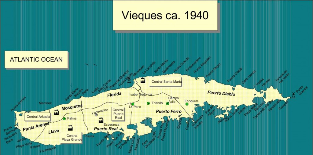
César Ayala. 2001. “ From Sugar Plantations to Military Bases: the U.S. Navy’s Expropriations in Vieques, Puerto Rico, 1940-45 .” Centro: Journal of the Center for Puerto Rican Studies 13(1) (Spring 2001): 22-44.
Map shows locations of other sugar mills. En el mapa vemos la localización de las otras centrales en Vieques.
Permission: Prof. Xavier F. Totti, Editor, CENTRO: Journal of the Center for Puerto Rican Studies, Hunter College, 695 Park Avenue, E-1429, New York, NY 10065
http://centropr.hunter.cuny.edu
—
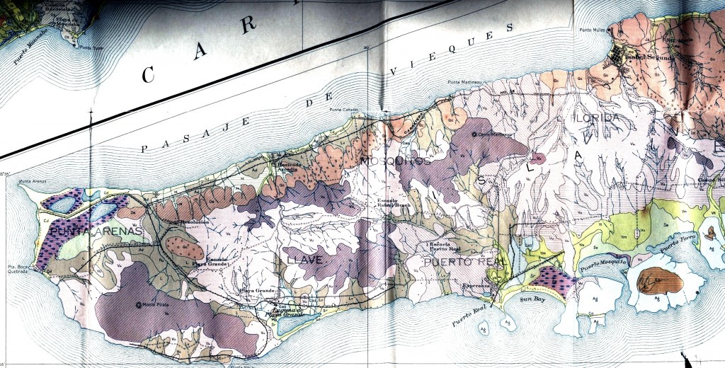
 Field Operations, Bureau of Chemistry and Soils. Soil Map, Western Sheet, Puerto Rico [map]. Agricultural Experiment Station, University of Puerto Rico, 1936. (Partial Map)
—
Para ver más mapas visite Mapas Topográficos Históricos del USGS (U.S. Geological Survey)USGS Historical Topographic Maps (Online) ( http://geonames.usgs.gov/pls/topomaps/). Busque los mapas de Vieques usando “Isla de Vieques”.
For more maps, visit Mapas Topográficos Históricos del USGS (U.S. Geological Survey)
USGS Historical Topographic Maps (Online) ( http://geonames.usgs.gov/pls/topomaps/). Search using the term “Isla de Vieques”
—
Ver / See:
Langhorne Elizabeth. Vieques, History of a Small Island. Vieques, Puerto Rico: The Vieques Conservation and Historical Trust, 1987.
—–. Vieques 1889-1939 the sweet spoils of sugar. Sunday San Juan Star Magazine [San Juan, Puerto Rico], (1983, March 20), pp. 1-4.
—–. Don José benítez and his Wife Ana Rieckehoff When sugar was king in Vieques, he was the power behind the throne. Sunday San Juan Star Magazine [San Juan, Puerto Rico], (1982, November 14), pp. 1-4.


