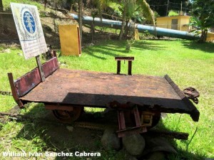
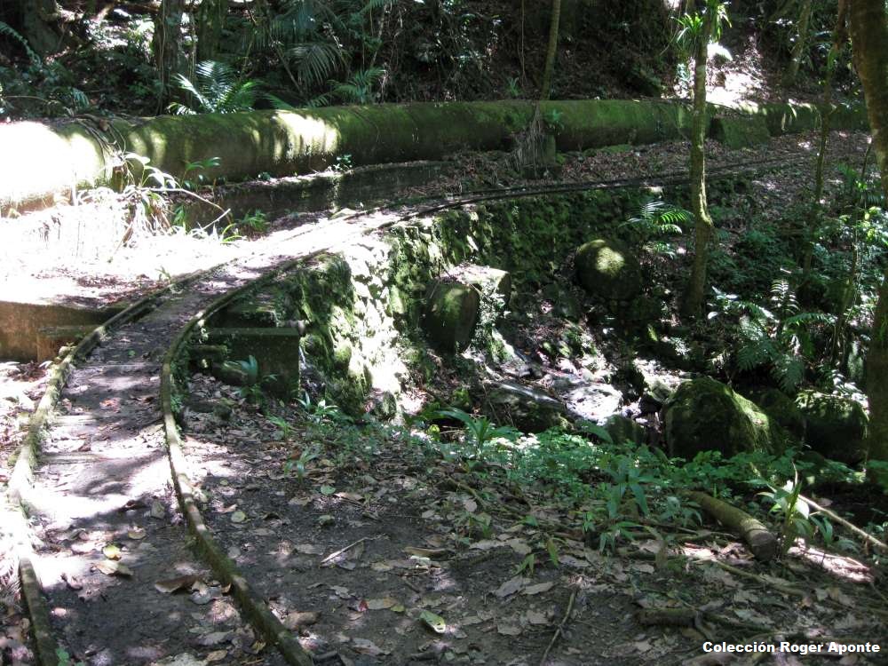
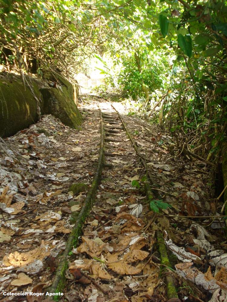
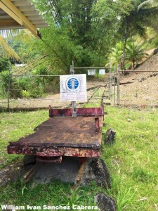
Vagón – Ferrocarril del Sistema Hidroeléctrico del Río Blanco, Naguabo / Wagon – Railway of the Blanco River Hydroelectric System, Naguabo


William Ivan Sanchez Cabrera
Facebook
Historia del ferrocarril en Puerto Rico, 24 de abril de 2015


Fotos usadas con permiso

Fotos muy interesantes. La vía debe tener una conexión con la vía del funicular (Proyecto del Río Blanco).  Tengo entendido que el vagón era usado para el mantenimiento del acueducto y las varias represas del mismo. Favor de ver:

Ferrocarril del Sistema Hidroeléctrico del Río Blanco, Naguabo / Railway of the Blanco River Hydroelectric System, Naguabo
http://ferrocarrilespr.rogerseducationalpage.com/?p=116

—-

Ferrocarril del Sistema Hidroeléctrico del Río Blanco,  Naguabo / Railway of the Blanco River Hydroelectric System, Naguabo ,
http://ferrocarrilespr.rogerseducationalpage.co

http://ferrocarrilespr.rogerseducationalpage.com/wp-content/uploads/2011/04/6IMG_0452-1000.jpg

“El sistema incluía un ferrocarril funicular operado por un malacate (winch). Se

usó para la construccíon y mantenimiento de un acueducto y represas en los ríos

Cubuy, Sabana, Icacos, y Prieto localizados en El Yunque. Estos ríos forman el

Río Blanco de Naguabo.

Material era llevado a una altura de 1400 pies aproximadamente usando el funicular

y luego transferido al ferrocarril. Según entrevistas, el ferrocarril usó

locomotoras de vapor y luego eléctricas.”

No tengo datos de personas que vieron el sistema en operación . Tampoco he

encontrado datos del equipo usado. Una persona mencionó que se llegó a usar

bueyes. En los libros sobre el Yunque solamente se menciona el funicular y no el

ferrocarril. Llamé a las oficinas del parque de El Yunque, pero no pudieron

ayudar.

Sería interesante ver si el registro de la propiedad tiene alguna información.

Otra opción es ver si las oficinas principales tienen más información.

Creemos que el carrito / vagoneta fue usado en el ferrocarril del acueducto y no

en el funicular. Tengo entendido que los trabajadores subían hasta el área del

acueducto usando el funicular. Por lo tanto el vehículo usado tenía que ser de

otra forma.
http://ferrocarrilespr.rogerseducationalpage.com/wp-content/uploads/2011/04/2DSC03874-1000.jpg

Ver:

Where Dwarfs Reign: A Tropical Rain Forest in Puerto Rico
https://books.google.com.pr/books?isbn=0847702553 , Kathryn Robinson – 1997.
“a narrow gauge railroad ascends a valley along the penstock pipe to the Río Blanco power plant…”. p 191. [Se refiere al funicular que corre paralelo a la tubería forzada (penstock). Ver http://ferrocarrilespr.rogerseducationalpage.com/…/Cami…]

“Waterline Trail to Los Prieto Falls in El Yunque | Puerto Rico Day Trips Travel Guide.” N.p., n.d. Web. 28 Apr. 2015.
http://www.puertoricodaytrips.com/waterline-trail/ – “This rail system was

apparently used in the construction and maintenance of the pipeline, to get

materials and workers up and down the mountainside. Here we found (newly cleared

of vines by the maintenance guys — what luck!) was a “Lidgerwood” winch and cable

system that raised and lowered the rail cars. It is a pretty steep hill, and it

must have been a scarey ride.
We’ve been told that, during the pipeline construction, there was a tragic

accident. While a rail car filled with workers was being pulled up the

mountainside, the cable broke … and the workers plummeted to their deaths. I am

unable to find documentation about this incident, so I don’t know how much of the

story is true.”

Ferrocarril del Sistema Hidroeléctrico del Río Blanco, Naguabo / Railway of the Blanco River Hydroelectric System, Naguabo
http://ferrocarrilespr.rogerseducationalpage.com/?p=116

Krug, Frederick. “El proyecto de Río Blanco según fue constuido en 1929.” Revista de obras públicas, vol. 7, núm. 7; jul. 1930. http://www.conucopr.org/ViewRecord.do?id=11123513 . Favor de ver / Please see: Proyecto del Río Blanco

 

Posted in Uncategorized | Comments Off on Vagón – Ferrocarril del Sistema Hidroeléctrico del Río Blanco, Naguabo / Wagon – Railway of the Blanco River Hydroelectric System, Naguabo
Introducción y desarrollo del léxico del ferrocarril en la lengua española por Frances Rodríguez Ortíz, Tesis Doctoral
Trabajo muy interesante –

En Puerto Rico se puede hacer un estudio sobre el vernáculo (folclórico) usado por los trabajadores de los ferrocarriles. Ver – Actividades e investigaciones que se pueden realizar sobre los ferrocarriles de Puerto Rico
http://ferrocarrilespr.rogerseducationalpage.com/?p=1468

Ver:

Introducción y desarrollo del léxico del ferrocarril en la …
www.tdx.cat/bitstream/handle/…/01.FRO_1de4.pdf?… – Translate this page by F Rodríguez Ortíz – 1996 – Cited by 8 – Related articles
Introducción y desarrollo del léxico del ferrocarril en la lengua española. Francesc Rodríguez Ortíz. ADVERTIMENT. La consulta d’aquesta tesi queda …
http://goo.gl/gpbTQv

Title: Introducción y desarrollo del léxico del ferrocarril en la lengua española
Authors: Rodríguez Ortíz, Francesc
Director: Gutiérrez Cuadrado, J.

http://diposit.ub.edu/dspace/handle/2445/35048

—-

Title: Introducción y desarrollo del léxico del ferrocarril en la lengua española
Author: Rodríguez Ortíz, Francesc

http://www.tesisenred.net/handle/10803/1715

Actividades e investigaciones que se pueden
realizar sobre los ferrocarriles de Puerto Rico
http://ferrocarrilespr.rogerseducationalpage.com/?p=1468

Posted in Uncategorized | Comments Off on Introducción y desarrollo del léxico del ferrocarril en la lengua española por Frances Rodríguez Ortíz, Tesis Doctoral

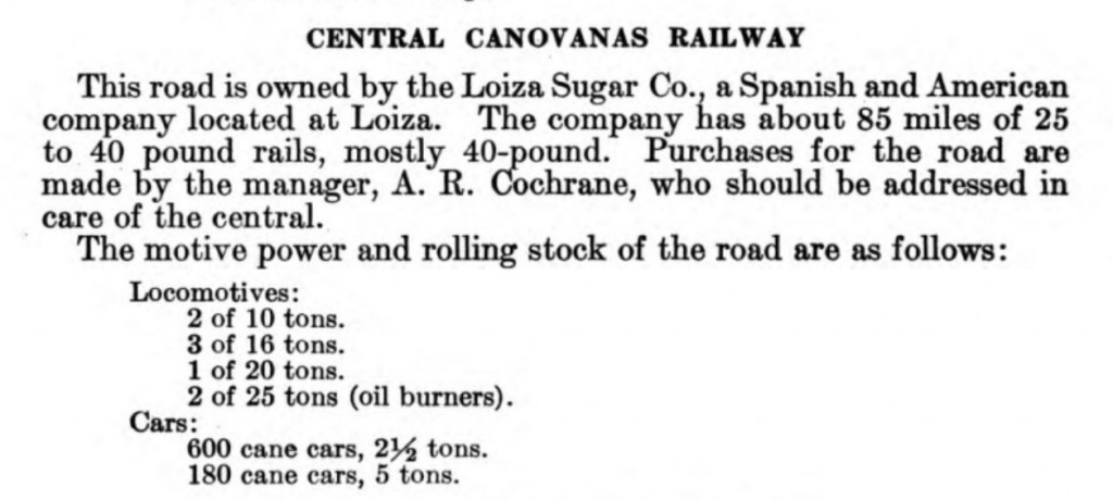
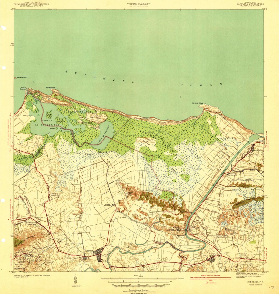
Central Canóvanas, Canóvanas [Loiza], closed 1965, (30 inch, meter gauge G 1930)


Copeland, P. Allen.  Locomotive Rosters – Railways of the West Indies, Part IV, Puerto Rico”.  Pages 147 – 212.  See/Ver : Railways of the West Indies, Puerto Rico.  Pag. 23

Long, W. Rodney.   Porto RicoRailways of Central America and the West Indies . Washington: Government Printing Office, 1925. Pag. 336. Print.  (HATHI TRUST digital Library http://catalog.hathitrust.org/Record/000970279  (11 Oct. 2013))
Copyright: Public Domain, Google-digitized.  [See / Ver Pag. 354]

Source / Fuente: Carolina, P.R., 1940 Edition, USGS

Los mapas topográficos histórico del USGS se pueden ver en línea y bajar
US Historical Topographic Maps can be seen and downloaded
Ver / See:

Mapas Topográficos Históricos del USGS (U.S. Geological Survey)
USGS Historical Topographic Maps (Online)

Favor de ver el mapa de vías entre San Juan y Luquillo.

Please see following map which has the railroad route from part of San Juan to Luquillo.

San Juan – Luquillo (Photo copy of USGS maps)

Source / Fuente: National Atlas of the United States


Posted in Uncategorized | Comments Off on Central Canóvanas, Canóvanas [Loiza], closed 1965, (30 inch, meter gauge G 1930)

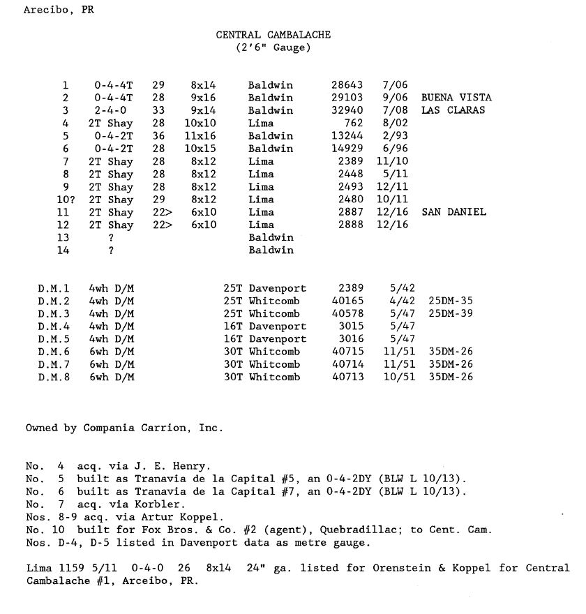
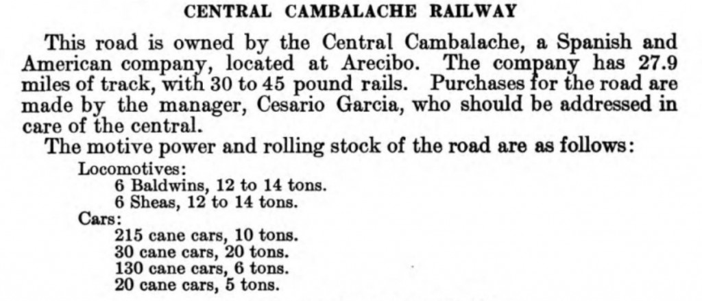
Central Cambalache, Arecibo, closed 1981, (30 inch and meter gauge, G 1930)


Copeland, P. Allen.  Locomotive Rosters – Railways of the West Indies, Part IV, Puerto Rico”.  Pages 147 – 212.  See/Ver : Railways of the West Indies, Puerto Rico.  Pag. 22

Long, W. Rodney.   Porto RicoRailways of Central America and the West Indies . Washington: Government Printing Office, 1925. Pag. 336. Print.  (HATHI TRUST digital Library http://catalog.hathitrust.org/Record/000970279  (11 Oct. 2013))
Copyright: Public Domain, Google-digitized.  [See / Ver Pag. 353]

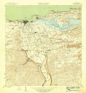
Source / Fuente: Arecibo, P.R., 1946 Edition, USGS

Los mapas topográficos histórico del USGS se pueden ver en línea y bajar
US Historical Topographic Maps can be seen and downloaded
Ver / See:

Mapas Topográficos Históricos del USGS (U.S. Geological Survey)
USGS Historical Topographic Maps (Online)

Source / Fuente: National Atlas of the United States

Posted in Uncategorized | Comments Off on Central Cambalache, Arecibo, closed 1981, (30 inch and meter gauge, G 1930)

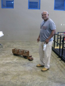
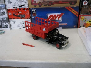
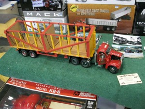
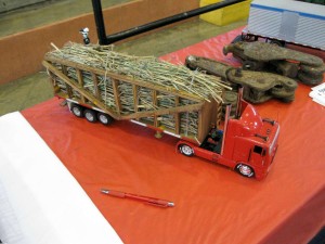
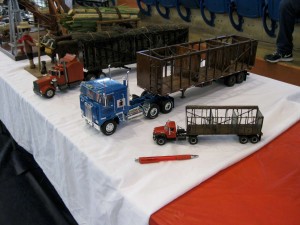
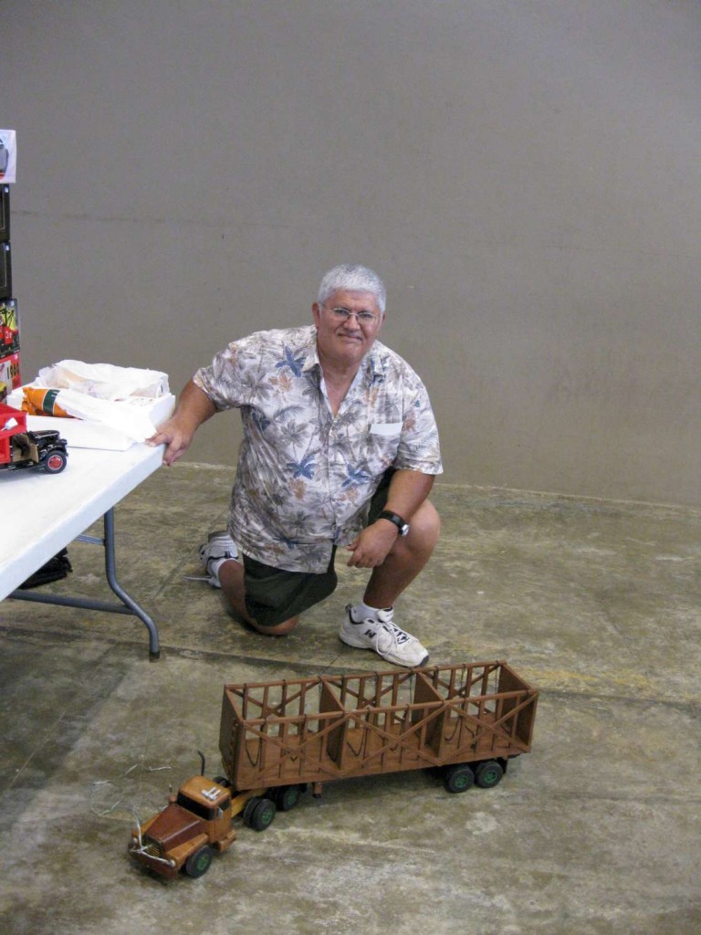
Segundo Día Nacional del Carro a Escala, Cabo Rojo, PR

Segundo Día Nacional del Carro a Escala
Transformando el Hobby
Domingo 22 de marzo 2015
Coliseo Rebeca Colberg
Cabo Rojo, PR
Organizado por Gabriel Ramos

Colección 1
Mother Trucker


Colección 2
Porta Coeli Classic Bikes


Colección 3


Gracias a los amigos por compartir sus modelos

Posted in Uncategorized | Comments Off on Segundo Día Nacional del Carro a Escala, Cabo Rojo, PR

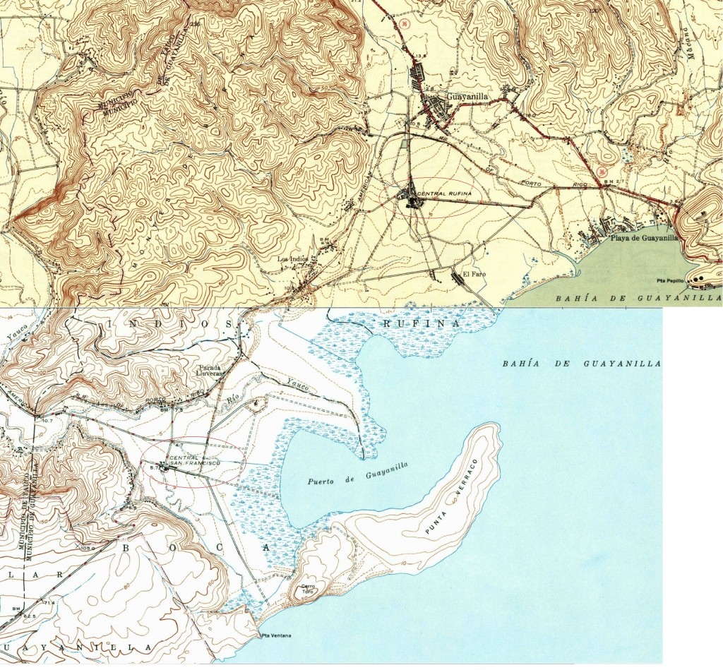
Central San Francisco, Guayanilla, closed 1977


Dale un click a los mapas.


Centrales Rufinas y San Francisco

Yauco a Peñuelas

Ver los mapas:

Lajas – Guayanilla

Guayanilla – Ponce

Los mapas topográficos histórico del USGS se pueden ver en línea y bajar
US Historical Topographic Maps can be seen and downloaded
Ver / See:

Mapas Topográficos Históricos del USGS (U.S. Geological Survey)
USGS Historical Topographic Maps (Online)


Posted in Uncategorized | Comments Off on Central San Francisco, Guayanilla, closed 1977

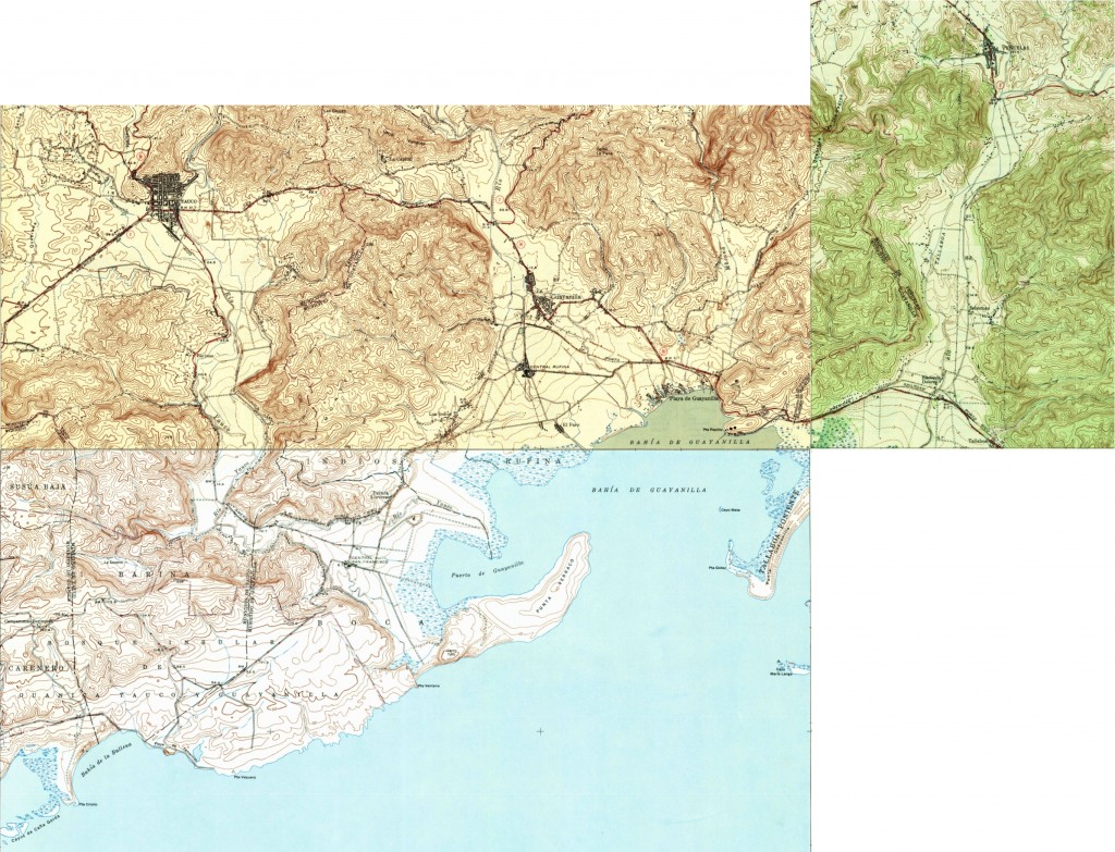
Central Rufina, Guayanilla, closed 1967, meter gauge


Dale un click a los mapas.


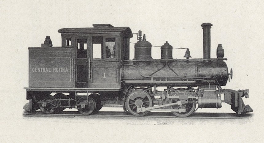
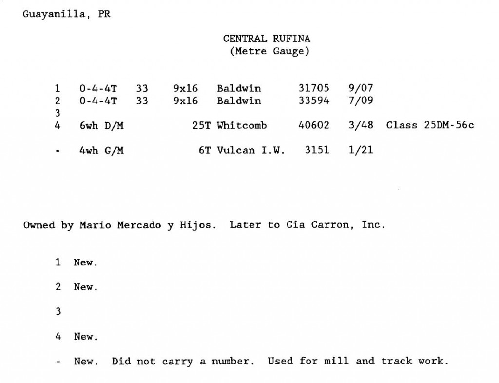
Central Rufina, Guayanilla.  Locomotora tanque – 044T
Baldwin Locomotives in Puerto Rico – Pryor, Bruce


Copeland, P. Allen.  Locomotive Rosters – Railways of the West Indies, Part IV, Puerto Rico”.  Pages 147 – 212.  See/Ver : Railways of the West Indies, Puerto Rico , página 56.

Ver Central Rufina en Baldwin and Vulcan Locomotives by Richard Dunn


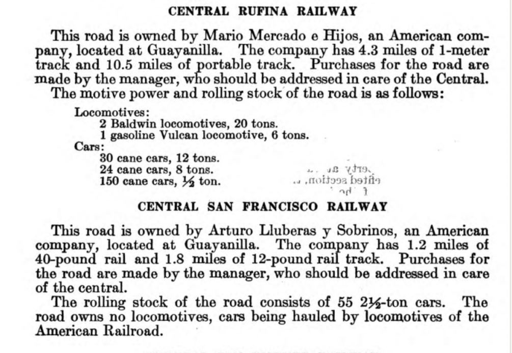
Long, W. Rodney.   Porto RicoRailways of Central America and the West Indies . Washington: Government Printing Office, 1925. Pag. 336. Print.  (HATHI TRUST digital Library http://catalog.hathitrust.org/Record/000970279  (11 Oct. 2013))
Copyright: Public Domain, Google-digitized.

Centrales Rufinas y San Francisco

Yauco a Peñuelas

Ver los mapas:

Lajas – Guayanilla

Guayanilla – Ponce

Los mapas topográficos histórico del USGS se pueden ver en línea y bajar
US Historical Topographic Maps can be seen and downloaded
Ver / See:

Mapas Topográficos Históricos del USGS (U.S. Geological Survey)
USGS Historical Topographic Maps (Online)


Posted in Uncategorized | Comments Off on Central Rufina, Guayanilla, closed 1967, meter gauge

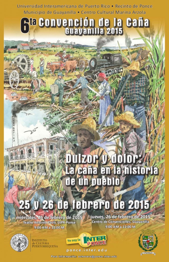
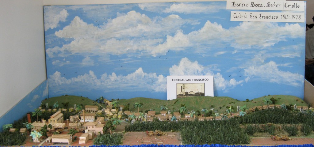
6ta Convención de la caña, Guayanilla 2015 – 25 y 26 de febrero de 2015

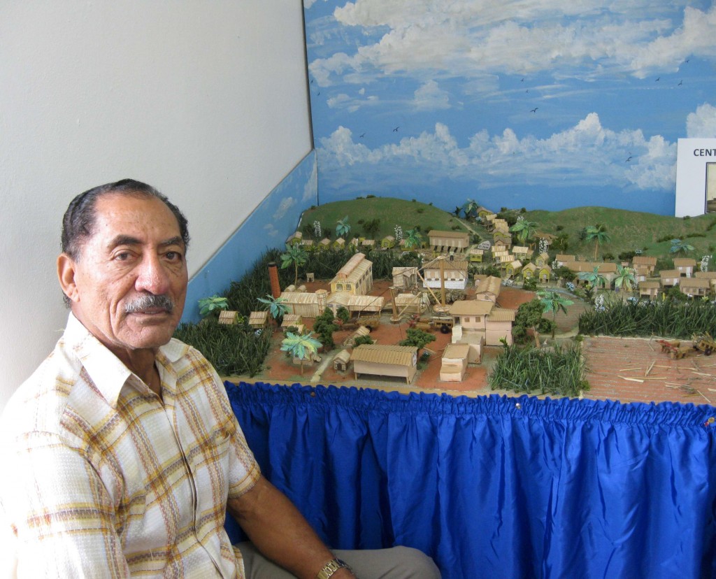
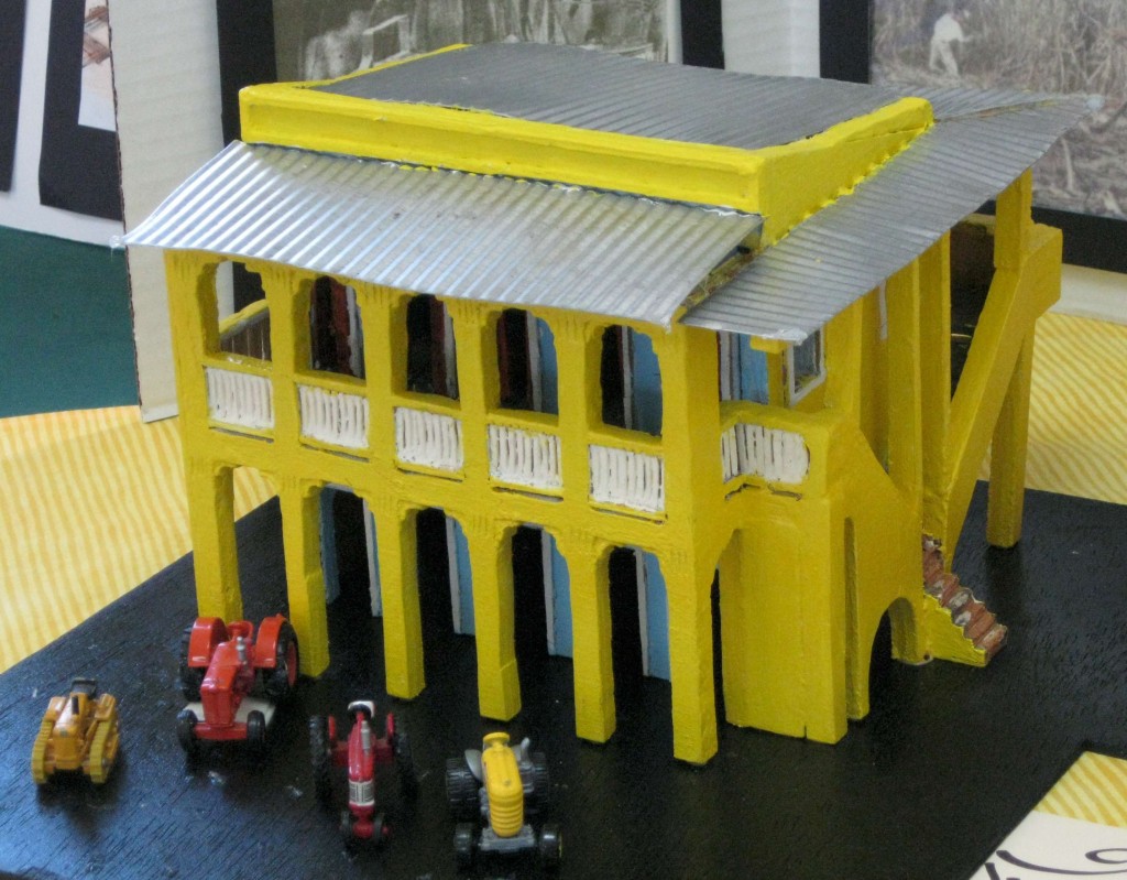
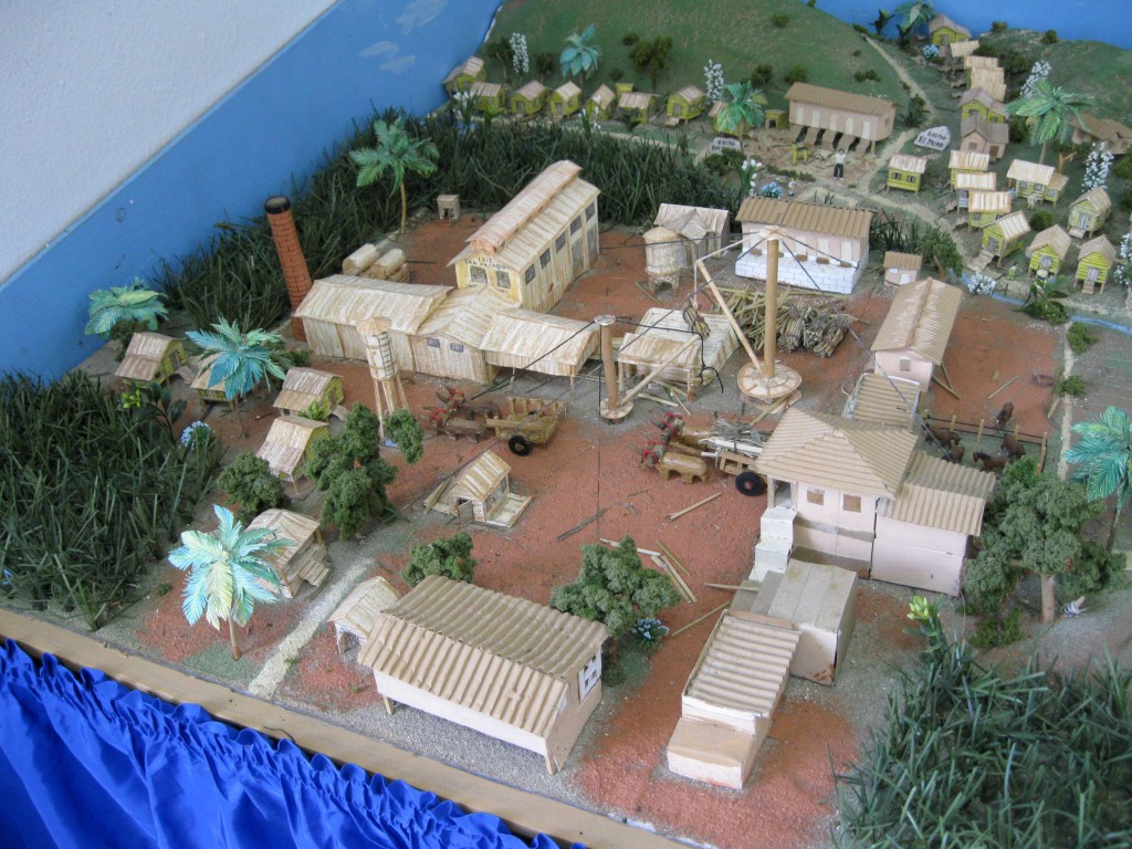
Maqueta de la Central San Francisco, Guayanilla.

Don Wilfredo Ramírez López con su prim José María López, creadores de la maqueta


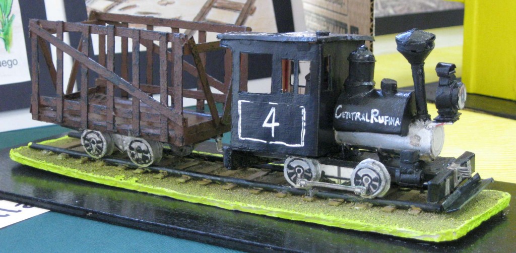
Maqueta locomotora Central Rufina, Guayanilla.
Agradeceré me ayuden identificar el autor de esta obra.

Ver otras maquetas en Models / Modelos

Ver Baldwin Locomotives in Puerto Rico – Pryor, Bruce

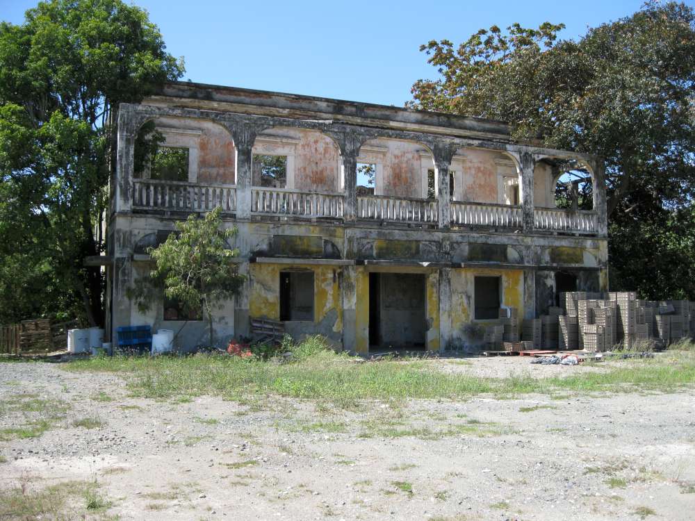
Remanente oficinas, Central Rufina.

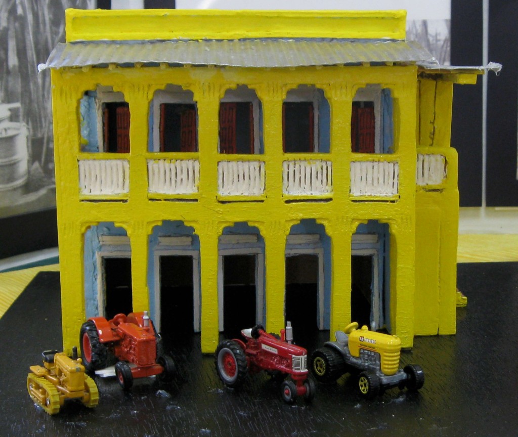
Maqueta oficinas de la Central Rufina, Guayanilla.
Agradeceré me ayuden identificar el autor de esta obra.

Ver otras maquetas en Models / Modelos

Posted in Uncategorized | Comments Off on 6ta Convención de la caña, Guayanilla 2015 – 25 y 26 de febrero de 2015

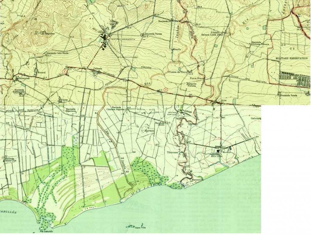
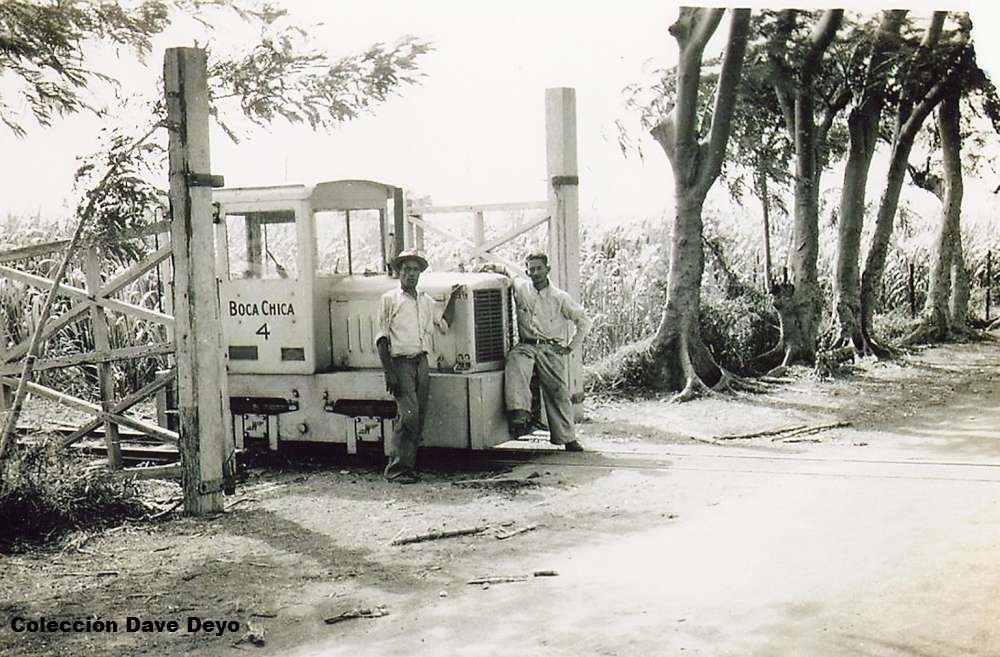
Central Boca Chica, Juana Díaz, meter / 26 in gauge

Whitcomb 4 wheel diesel-mechanical unit, serial #40110, December of 1940, 6 tons, model # 6DM-35, 26″ gauge

Dale un click a los mapas.

“Central Boca Chica has always been a mill for which little railroad information or photographs were found over the years of my research. In recent years I was able to buy a photograph of their #4 on Ebay at a modest price. But the picture has appeared in many places since that time, as the seller used a decent resolution picture for his listing. The photograph was taken by a US serviceman, who also took pictures of a large steam tractor working near the locomotive, as well as some photos of workers cutting cane. A year or so later I was able to find a builder’s photo of #4. Oddly, this was the only locomotive ever factory-lettered for Boca Chica. Boca Chica had a very extensive railroad system, and from the Wirshing family I was able to get the blue print of the mill yard and all the surrounding fields owned at the time of that blueprint. All of those fields were connected to this rail system. … I visited what few traces were left of this mill site in 1968 and found several small sections of rail in concrete near road crossings. The gauge was 60cm. This narrow gauged system was powered by teams of oxen.

There was an old meter gauge section just north of the mill site, again embedded in concrete at a roadway. The mill had a meter gauge connection with the ARR near its junction with the Fortuna RR. According to Marco Amaro at Aguirre, the original #1 from the P&G (Baldwin 0-6-0 tender locomotive) first worked the mill connection when acquired in 1912. When the Serralles interests became principal owners, they extended a 26″ gauge line to Boca Chica and around 1935 assigned two Plymouth locomotives to the mill. These were relettered for Boca Chica and assigned #2 & #3. The #4 locomotive we seen in the photo, was the first one ordered by Serralles for the mill and was shipped lettered for the mill. It was a Whitcomb 4 wheel diesel-mechanical unit, serial #40110 built December of 1940, rated at 6 tons and model # 6DM-35, and was 26″ gauge…. ”

Dave Deyo, 13 August 2014.


Posted in Uncategorized | Comments Off on Central Boca Chica, Juana Díaz, meter / 26 in gauge

Plantación de Piñas, Manatí / Edward Bailey’s Pineapple Plantation

“En 1910 los siguientes extranjeros eran agricultures de piña en el barrio de Coto Sur: Robert Day, William Hill, Nathaniel Tyler y Edward Bailey……
Bailey era un propietario adyacente al Pueblito, no muy lejos de Palo Alto, de acuerdo a los mayores del lugar. Su casa estaba en un monte cercano a Las Papayas, una urbanización nueva. Subía al monte por medio de un carro eléctrico que corría por una vía férrea, especialmente construida con ese propósito. Con el tiempo, los agricultores extranjeros se retiraron a sus estados de origen. Entró a la escena un agricultor local, Francisco Vázquez, empresario menor que gradualmente compró todas las fincas que pudo, hasta formar un emporio que a lo último se extendía desde Pugnado Afuera de Vega Baja hasta las vegas de Matrullas, no muy lejanas del pueblo de Manatí…..”

Source / Fuente –
“Pineapple, Sunday, October 01, 2006.” N.p., n.d. Web. 27 Feb. 2015.
http://agro-pineapple.blogspot.com/2006/10/los-nombres-aborgenes-de-la-pia-eran.html  (“Cultivo de piñas.” 26 Dec. 2006)

—-

PR RR Historian (Dave Deyo):
This is the pineapple plantation of Mr. William Hill, who with four other investors from England, owned the largest such a farm on the Island. Mr. Hill had a stately home atop one of the hills in the background area, and had a unique railroad powered by electricity
to reach this home from the flatlands below. There is no record of what kind of equipment was owned, and if the railroad played any part in the operation of the properties. The land was later sold to Sr. Francisco Vasquez and Mr. Hill returned to his native country.
Apparently he was the only one residing in Puerto Rico and the other four partners were absentee owners. This vast expanse of land was located between Manati and Vega Baja along PR Route #2, and the area may have been called Barrio Coto Laurel according
to one source. (https://www.flickr.com/photos/fredandrebecca/3842389497/. 27 Feb 2015).


Posted in Uncategorized | Comments Off on Plantación de Piñas, Manatí / Edward Bailey’s Pineapple Plantation