These photos are a selección from the Rodríguez Archives (José Luis and José Alfredo Rodríguez). Please see: Archivo Histórico y Fotográfico de Puerto Rico – Colección Rodríguez , and Archivo Histórico Y Fotográfico De Puerto Rico’s photostream .
Photos used with permission / Fotos usadas con permiso.

—
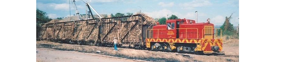
La Central Aguirre era un Pueblo Compañía. La compañía era dueña de la central, el ferrocarril, hotel, teatro, tiendas, casas, etc. La central con su pueblo estaba localizada en el municipio de Salinas. El área entre Ponce y Patillas fue impactada económicamente por la Central Aguirre. Su ferrocarril era el Ponce & Guayama Railroad.
Central Aguirre was a company town. The company owned the sugar mill, railroad, hotel, hospital, theater, stores, homes, etc. The mill and its town was located in the municipality of Salinas. The area from Ponce to Patillas was impacted economically by Central Aguirre. Its railroad was the Ponce & Guayama Railroad.
—

Map / Mapa: National Atlas of the United States, http://nationalatlas.gov (http://nationalatlas.gov/printable/printableViewer.htm?imgF=images/preview/counties3/pagecnty_pr3.gif&imgW=588&imgH=450)
—
 CENTRAL AGUIRRE – Bird’s Eye View of Central Aguirre. – Real Photo Post Card Mailed Central Aguirre FEB 11, 1935
—

Map / Mapa: Interstate Commerce Commission. No. 5701. In the matter of safety appliances of equipment in railroads of Porto Rico. Washington: Government printing office: 1916 (I added the connection Carolina – Mameyes and Naguabo – Humacao Playa. / Anadí las conexiones Carolina – Mameyes and Naguabo – Humacao Playa.)
—

—

—

—

CENTRAL AGUIRRE – #8 Central Aguirre, P. R. , Theatre. – Real Photo Post Card unused c. 1930 – 1940’s
—

—

—

—
 —
—

AP 1910 – Sugar Cane Car, Central Aguirre, Jobos, Salinas, Porto Rico
Amateur Photographer May 1910.
—
Ver / See:
Plano del “Pueblo Compañía” Central Aguirre
Plan of Central Aguirre Company Town ( 4.54 MB)
Ponce & Guayama RR – Prepared and published by the Defense Mapping Agency, Topographic Center, Washington, D. C., Map information as of 1977, Scale 1:50,000
Plano de vía Ponce & Guayama RR (Sketch Ponce & Guayama Railroad) Compare con los dos mapas anteriores. Los nombres identifican los desvíos. / Compare with the previous maps. Names refer to sidings. (Colección Privada)
Daniel R. Sepúlveda Collection – Central Aguirre