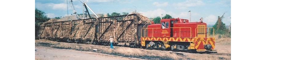
Plano de vías de la Ponce & Guayama Railroad, vía principal y desvíos. Los desviós eran usados para que un tren pudiera pasarle a otro, como estaciones para recoger caña, y colocar vagones . Para llegar a la estación de Ponce, la vía de la Ponce & Guayama se unía al oeste con la vía de la Fortuna Railroad y esta a la American Railroad. Para llegar hasta Arroyo, al este, la Ponce & Guayama se unía a la Luce & Co. donde está señalado la Central Machete. La Ponce & Guayama RR, Luce & Co., Central Aguirre, Central Cortada, y Central Machete eran compañías afiliadas.
Ponce & Guayama Railroad, main track and sidings. Sidings were used for trains to meet and pass each other, as loading sugar cane stations, and for storing railroad cars. To reach the Ponce station to the West, the P&G tracks made a connection with the Fortuna Railroad tracks which in turn made a connection with the American Railroad. To reach the town of Arroyo, East of Guayama, the P&G tracks connected to the Luce & Co. in the area marked Central Machete. The P&GRR., Luce & Co., Central Aguirre, Central Cortada, and Central Machete were affiliated companies.

(United States Geological Survey, different years, 1940s and 1950s)
Ponce & Guayama RR – Prepared and published by the Defense Mapping Agency, Topographic Center, Washington, D. C., Map information as of 1977, Scale 1:50,000
Plano de vía Ponce & Guayama RR (Sketch Ponce & Guayama Railroad) Compare con los dos mapas anteriores. Los nombres identifican los desvíos. / Compare with the previous maps. Names refer to sidings.
Plano del “pueblo compañía” Central Aguirre
Plan of Central Aguirre Company Town ( 4.54 MB)
.